
St Catherine's Hill
Good walks are even better shared.
Overview
St Catherine’s Hill, Isle of Wight
Above Chale and Blackgang, this is the Isle of Wight hill, DoBIH 5440. It reaches 239 m with a 127 m drop and is a HuMP. DoBIH places the high point on a tumulus at SZ 49389 77274. The nearby trig is about 35 m north and 1.8 m lower. Neither the Pepperpot tower nor the Hoy Monument is the recorded summit.
A complete circular route
The National Trust’s Monk and Merchant walk starts and finishes at Blackgang Viewpoint car park, SZ490767. The full circuit is 7.36 km, with a published duration of 2 to 2½ hours. The Trust gives 250 m of ascent; its parenthetical “800m” is an inconsistent unit label, so that figure is not used here.
Cross the A3055 to the steps and climb towards the Oratory. The outward route turns away from it, continues along the down to the Hoy Monument, then descends past the Hermitage into Wydcombe. The return crosses the valley and climbs Head Down before reaching the trig-side gate and the Oratory, then follows the outward approach downhill to the same car park. Follow the Trust’s detailed directions and an OS map, especially where the Head Down path is faint.
The published circuit visits the trig and Oratory area but does not expressly identify the exact DoBIH tumulus point. A separate summit diversion or other extension is not covered by these totals. English Heritage’s 400 m approach describes a one-way walk to the Oratory, not this whole circuit or a certified return-distance summit walk.
Landscape and landmarks
The hill beneath the Oratory is chalk; the lower ridge towards the Hoy Monument is greensand. This is the southern Isle of Wight landscape. The old name Chale Down is associated with the hill now named for St Catherine’s Oratory.
The Pepperpot is the surviving tower of a medieval chapel completed in 1328 and thought to have served as a lighthouse. A Bronze Age burial mound lies nearby. The separate Hoy Monument dates from 1814. Views extend over Chale Bay and, from the wider ridge in clear conditions, towards Tennyson Down and Culver Down.
Planning and conditions
Use the public viewpoint car park off the A3055 near PO38 2JB; it is outside National Trust and English Heritage management. The Trust currently lists free parking. Check the signs and take care crossing the road. Southern Vectis service 6 serves the Chale, Blackgang and Niton area between Newport and Ventnor; confirm the actual stop and return timetable before travel.
The full route has steep steps, stiles, gates, muddy field and woodland paths, and a climb back from the valley. Wind and low cloud can make the exposed down less straightforward than its height suggests. There are no toilets on the circuit; car-park refreshments are seasonal. Bring supplies, keep dogs on leads around livestock and at the Oratory, and respect the archaeological remains.
Explore routes near St Catherine's Hill
Walks starting near this hill. Open a route to check its map, distance and full itinerary.
Ventnor Downs Dakota Crash Memorial Circuit
View route
Port Solent Walk with Men Walking & Talking
View route
Wilverley Inclosure Walk, New Forest
View route
Havant Walk with Men Walking & Talking
View route
Route planning notes
These notes describe possible approaches. Check a route's map and access information when planning your walk.
Monk and Merchant circuit from Blackgang Viewpoint
Start and finish at Blackgang Viewpoint car park, SZ490767. Cross the A3055 and climb towards the Oratory; turn onto the ridge to the Hoy Monument, descend by the Hermitage into Wydcombe, and return over Head Down to the trig-side gate and Oratory. Descend the original approach to the same car park. National Trust totals are 7.36 km, 250 m ascent and 2–2½ hours for this complete loop. The exact DoBIH tumulus, 35 m south of the trig, is not explicitly identified in its instructions; an added summit diversion is outside these totals. Carry a map for the faint final path. https://www.nationaltrust.org.uk/visit/isle-of-wight/st-catherines-down-and-knowles-farm/the-monk-and-the-merchant-walk
Make a day of it, together
Find someone to share the walk with, or organise a day out along a route you like.
Hill facts and local notes
Classifications
Elevation
239m
784 ft
Prominence
127m
Coordinates
50.5930, -1.3036
SZ493772
OS Map
196
Explorer: OL29E OL29W
At the Summit
DoBIH records the 239 m high point on a tumulus at SZ 49389 77274, about 35 m south of the trig point. The trig at SZ 49386 77305 is about 1.8 m lower. The Pepperpot tower and the Hoy Monument are separate landmarks, not the recorded high point.
Terrain & Geology
St Catherine’s Hill is a chalk hill in the southern Isle of Wight. The National Trust distinguishes the chalk beneath the Oratory from the greensand of the lower ridge towards the Hoy Monument. It is separate from Hampshire’s South Downs.
Views & Scenery
Coastal views overlook Chale Bay and the southern Isle of Wight. The wider ridge walk offers views towards Tennyson Down and Culver Down in clear weather. Low cloud can obscure the panorama.
History & Heritage
Name Origin
The modern hill name is associated with St Catherine’s Oratory, the medieval chapel and beacon on the hilltop. The National Trust records the earlier name Chale Down.
Historical Significance
St Catherine’s Oratory, known as the Pepperpot, is the surviving tower of a medieval chapel completed in 1328 and thought to have served as a lighthouse. A Bronze Age burial mound lies nearby. The Hoy Monument farther north was erected in 1814; it is a separate site.
Getting There & Facilities
Parking
Blackgang Viewpoint car park off the A3055, near PO38 2JB, is the start of the described circuit (National Trust route grid SZ490767). It is a public car park outside National Trust and English Heritage management. The Trust lists it as free; check signs on arrival. Cross the road carefully to reach the steps.
Public Transport
Southern Vectis service 6 connects Newport and Ventnor via Chale, Blackgang Chine and Niton. The National Trust identifies a stop by the viewpoint car park; English Heritage also describes an approach from Blackgang Chine. Check current stop locations, outward and return times with the operator. Bus approaches add to the published car-park circuit.
Nearby Facilities
There are no toilets along the National Trust’s Monk and Merchant circuit. English Heritage lists refreshments at the viewpoint car park during summer only. Bring water and food and do not rely on hilltop facilities; check seasonal availability before travelling.
Safety Information
Known Hazards
- Cross the A3055 carefully between the viewpoint car park and the hillside steps.
- Paths, steep steps and stiles may be slippery in rain; the exposed down can be windy or hidden in low cloud. The final approach from Head Down includes a faint path, so carry a map.
- Livestock may be present. Keep dogs on leads around livestock and follow the Oratory’s dogs-on-leads rule.
- Respect the burial mound and historic structures; do not climb the tower. English Heritage prohibits smoking, vaping, barbecues and naked flames at the site.
General Safety Tips
- Check weather conditions before setting out
- Carry appropriate clothing and equipment
- Let someone know your planned route
- Take a map, compass, and GPS device
- Carry emergency supplies: food, water, first aid kit, torch
Hills
Some common questions about the hills answered
Are there group walks up St Catherine's Hill?
Many walkers use Walkmates to join or organise walks with others. You can check for group walks around St Catherine's Hill through the maps
Are there other walkers around St Catherine's Hill?
Activity varies by location and time, but Walkmates lets you see whether others have shared walks or shown interest in this area. Find other people through the walking friends search walking friends for St Catherine's Hill search or of course create your own walk for St Catherine's Hill
Can I organise a walk to St Catherine's Hill?
Yes. If there aren’t any walks listed already, you can create a walk and make it available for others to join.
If you're signed up to Walkmates, you can create a walk to St Catherine's Hill.
How do I find a walk up this hill?
There are often multiple ways to walk this hill, depending on experience and route preference. Walkmates helps you explore walks and routes that others have shared.
Can I suggest a new route up St Catherine's Hill?
Yes. You can suggest or create routes to share with others. Walkmates focuses on the social side of walking, so routes are used to help people organise walks and explore areas together, rather than as detailed navigation tools or route libraries.
Other uses really appreciate knowledgeable walkers sharing their routes. Share your favourite route to St Catherine's Hill here
The is an error or something incorrect about this hill. How do I let you know?
We always strive to keep the information on Walkmates as accurate as possible. If you find an error, please let us know through the contact form and we'll aim to correct it as quickly as possible
Community Discussion
Comments
Location
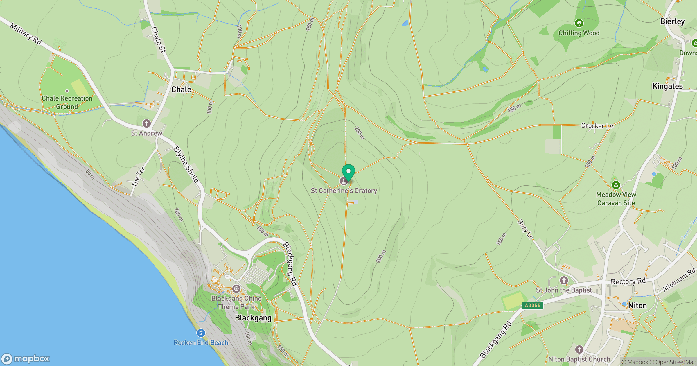
Grid reference: SZ493772
View on OpenStreetMapOpens a map in a new tab, centred on the hill.
Nearby Hills
Leith Hill
294m
Ditchling Beacon
248m
Glastonbury Tor
158m
Worcestershire Beacon
425m
Titterstone Clee Hill
533m
No comments yet. Be the first.