

Sugar Loaf
Good walks are even better shared.
SO0471 : Woodland on Sugar Loaf
Nigel Brown Photo source
Overview
Sugar Loaf: A Gem in the Black Mountains
Introduction
Nestled in the picturesque Black Mountains, Sugar Loaf stands at an elevation of 596 meters, challenging hikers with its moderately steep slopes yet rewarding them with riveting views. It’s a favourite among locals and visitors alike, beckoning adventurers to tread its well-worn paths.
Geology
Sugar Loaf is composed mainly of volcanic rock, a remnant of ancient geological upheaval that shaped this vibrant landscape. Its conical shape, accentuated by centuries of erosion, presents a striking silhouette visible from afar, making it a beacon for those who seek the outdoors.
Routes
There are several routes to tackle this peak, catering to a variety of skills and hiking preferences. The Sugar Loaf Circular Route is a well-marked path offering a moderate trek for families and casual hikers, while the Llangenny Red Route is aimed at the more adventurous spirits, promising a steeper climb.
Sugar Loaf Circular Route
- Distance: 6.0 km
- Time: 2.5 hours
- Difficulty: Moderate
Just the ticket for a family day out!
Llangenny Red Route
- Distance: 4.5 km
- Time: 2.0 hours
- Difficulty: Challenging
Bring your A-game for this one!
Summit Features
Upon reaching the summit, hikers are greeted with a delightful stone cairn and a trig point. These features not only serve as excellent photo ops but also mark the highest point, where you can catch your breath and soak in the stunning vistas.
Terrain
The terrain varies between grassy meadows, rocky outcrops, and some uneven surfaces, so good footwear is a must! The good news is that it’s generally manageable, though a trip or two is not out of the question.
Views
As for the views, prepare to be dazzled! From the summit, the rolling hills of the Black Mountains stretch out before you, complemented by the awe-inspiring Brecon Beacons. Both sunset and sunrise hikes promise a colourful spectacle that you won’t soon forget.
Hazards
While Sugar Loaf doesn’t pose significant dangers, it’s important to watch your step on loose rocks and be cautious during wet conditions to avoid slipping. As always, a little common sense goes a long way!
Access
Nearest Parking
The nearest parking is conveniently located at SO 050 200, with enough space to accommodate most vehicles. Be sure to arrive early on weekends to beat the crowds.
Public Transport
For those relying on public transport, regular bus services connect Abergavenny with surrounding areas. It’s a great way to avoid the hassle of parking.
Nearest Town
Abergavenny, the closest town, is not just a jumping-off point but also a charming locale with plenty to offer, from coffee shops to quaint boutiques!
Facilities
Although Sugar Loaf itself lacks amenities, the nearby town of Abergavenny boasts several cafes and public toilets, making it easy to refuel after your hike.
History
The name 'Sugar Loaf' aptly describes the mountain’s iconic shape, reminiscent of sugar loaves of old. This peak plays a significant role in the local ecology and history, weaving itself into the rich tapestry of the Brecon Beacons National Park.
Conclusion
Whether you’re a casual walker or a seasoned hiker, Sugar Loaf is well worth a visit. With its stunning views, engaging routes, and a dollop of Welsh charm, it’s sure to leave you with memories that’ll make you smile every time you think of it. So lace up those boots, grab your walking stick, and hit the trail!
Stay safe and happy hiking!
Explore routes near Sugar Loaf
Walks starting near this hill. Open a route to check its map, distance and full itinerary.
Elan Valley: Reservoir Trail to Pen y Garreg Dam
View route
Welshpool to Sweeps Bridge: Montgomery Canal and Belan Locks
View route
Croft Castle: Fishpool Valley and the Gothic pumphouse
View route
Brecon Basin to Brynich Aqueduct: Canal Towpath Walk
View route
Make a day of it, together
Find someone to share the walk with, or organise a day out along a route you like.
Photo Gallery
View all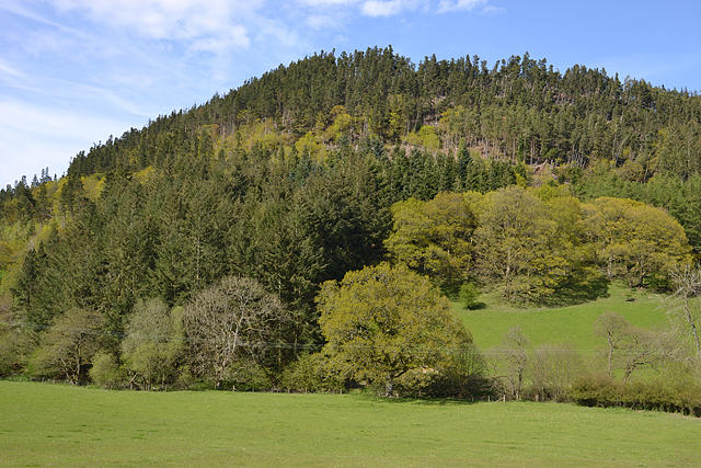 Photo could not load
SO0471 : Woodland on Sugar Loaf
Nigel Brown
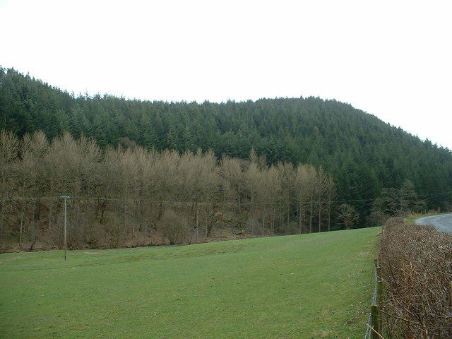 Photo could not load
SO0471 : Sugar loaf
David Medcalf
Hill facts and local notes
Classifications
Elevation
388m
1,273 ft
Prominence
60m
Coordinates
52.3320, -3.3980
SO048713
OS Map
136 147
Explorer: 200E 214E
At the Summit
The summit features a stone cairn and a trig point, perfect for a bit of a chinwag with fellow hikers while resting those weary legs.
Terrain & Geology
Sugar Loaf is primarily composed of volcanic rock, formed from ancient volcanic activity. Its distinctive conical shape is a product of erosion over thousands of years, creating steep slopes and a striking profile against the landscape.
Views & Scenery
From the summit, you can enjoy panoramic views of the Black Mountains, the Brecon Beacons, and on a clear day, even the distant hills of Shropshire.
History & Heritage
Name Origin
The name 'Sugar Loaf' is derived from its characteristic pyramid shape, reminiscent of sugar loaves used in the past.
Historical Significance
Known for its beautiful scenery and as part of the Brecon Beacons National Park, Sugar Loaf holds both ecological and historical importance in the region.
Getting There & Facilities
Parking
The main car park is located at SO 050 200, offering ample space for vehicles and a conveniently marked trailhead.
Public Transport
Regular bus services run from Abergavenny to nearby villages, connecting with walking routes leading to Sugar Loaf.
Nearby Facilities
There are no formal facilities on the mountain itself, but Abergavenny boasts cafes and public toilets, perfect for a post-hike treat or a quick pit stop.
Safety Information
Known Hazards
- Loose rocks on steeper sections. Wet conditions can make paths slippery, so a bit of caution is advised while navigating the ascent and descent.
General Safety Tips
- Check weather conditions before setting out
- Carry appropriate clothing and equipment
- Let someone know your planned route
- Take a map, compass, and GPS device
- Carry emergency supplies: food, water, first aid kit, torch
Hills
Some common questions about the hills answered
Are there group walks up Sugar Loaf?
Many walkers use Walkmates to join or organise walks with others. You can check for group walks around Sugar Loaf through the maps
Are there other walkers around Sugar Loaf?
Activity varies by location and time, but Walkmates lets you see whether others have shared walks or shown interest in this area. Find other people through the walking friends search walking friends for Sugar Loaf search or of course create your own walk for Sugar Loaf
Can I organise a walk to Sugar Loaf?
Yes. If there aren’t any walks listed already, you can create a walk and make it available for others to join.
If you're signed up to Walkmates, you can create a walk to Sugar Loaf.
How do I find a walk up this hill?
There are often multiple ways to walk this hill, depending on experience and route preference. Walkmates helps you explore walks and routes that others have shared.
Can I suggest a new route up Sugar Loaf?
Yes. You can suggest or create routes to share with others. Walkmates focuses on the social side of walking, so routes are used to help people organise walks and explore areas together, rather than as detailed navigation tools or route libraries.
Other uses really appreciate knowledgeable walkers sharing their routes. Share your favourite route to Sugar Loaf here
The is an error or something incorrect about this hill. How do I let you know?
We always strive to keep the information on Walkmates as accurate as possible. If you find an error, please let us know through the contact form and we'll aim to correct it as quickly as possible
Community Discussion
Comments
Location
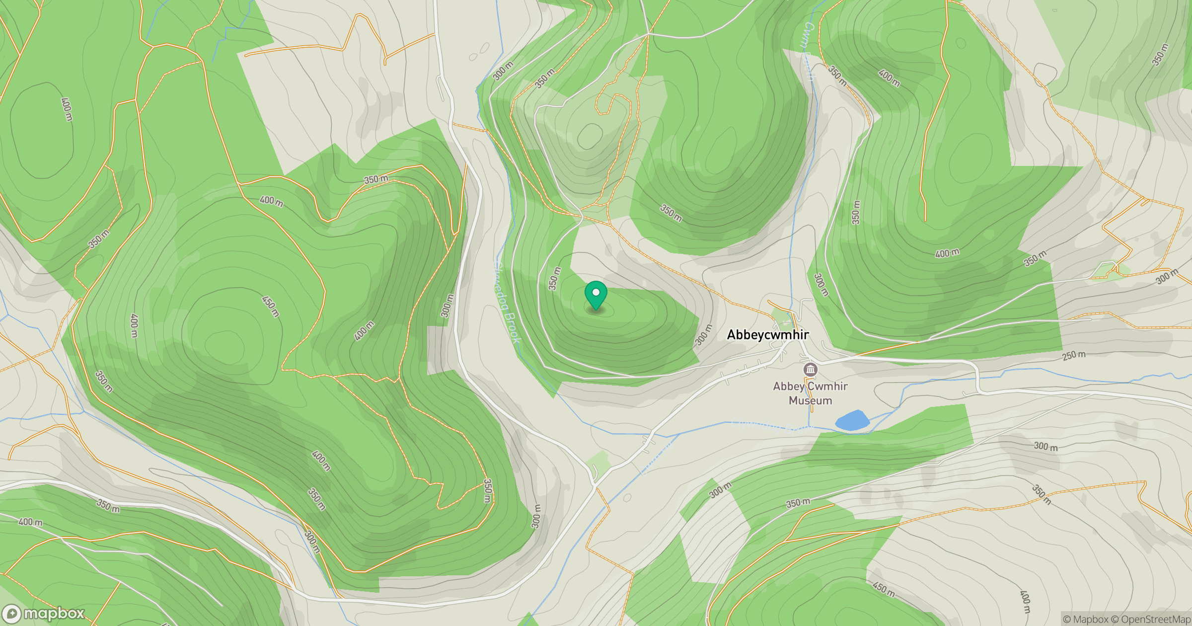
Grid reference: SO048713
View on OpenStreetMapOpens a map in a new tab, centred on the hill.

No comments yet. Be the first.