

Strathfinella Hill
Good walks are even better shared.
NO6978 : Young Trees Alongside Track in Drumtochty Forest
Dominic Dawn Harry and Jacob Paterson Photo source
Explore routes near Strathfinella Hill
Walks starting near this hill. Open a route to check its map, distance and full itinerary.
Banchory to Milton of Crathes: Deeside Way return
View route
Milton of Crathes to Drumoak: Deeside Way return
View route
Potarch to Shooting Greens: Deeside Way return
View route
Loch Kinord: Muir of Dinnet Woodland Circuit
View route
Route planning notes
These notes describe possible approaches. Check a route's map and access information when planning your walk.
Strathfinella Farm Trail
A scenic route starting from Strathfinella Farm, weaving through lush farmland and up to the summit of the hill.
Make a day of it, together
Find someone to share the walk with, or organise a day out along a route you like.
Photo Gallery
View all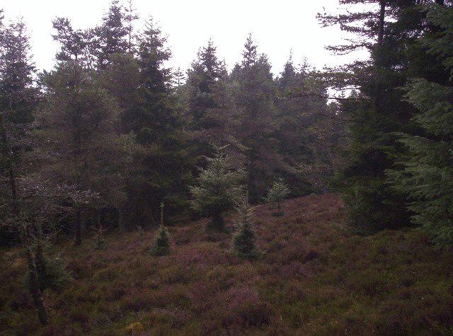 Photo could not load
NO6978 : Young Trees Alongside Track in Drumtochty Forest
Dominic Dawn Harry and Jacob Paterson
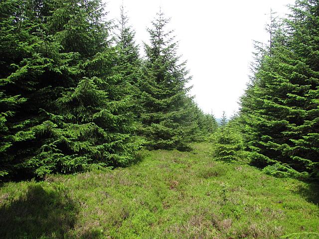 Photo could not load
NO6978 : Ride, Strathfinella Hill
Richard Webb
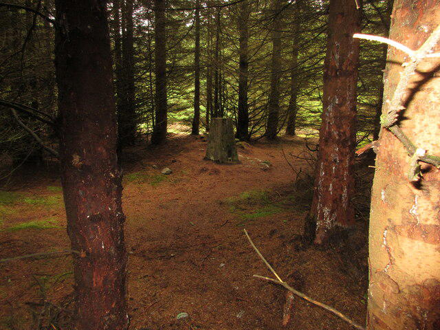 Photo could not load
NO6978 : Strathfinella Hill Trig Pillar
Scott Cormie
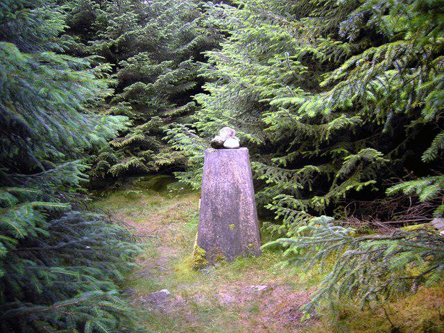 Photo could not load
NO6978 : Strathfinella Trig
Colin Kinnear
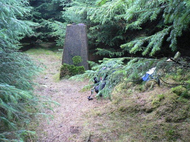 Photo could not load
NO6978 : Triangulation Pillar
Liz Gray
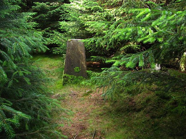 Photo could not load
NO6978 : Summit, Strathfinella Hill
Richard Webb
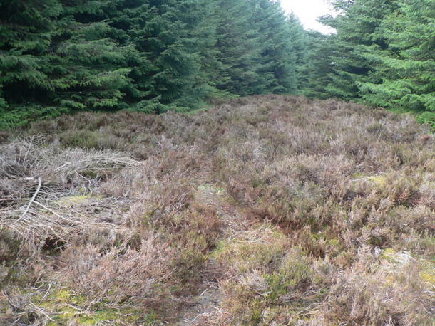 Photo could not load
NO6978 : Track through the heather
Liz Gray
Hill facts and local notes
Classifications
Elevation
414m
1,358 ft
Prominence
239m
Coordinates
56.8990, -2.5055
NO693787
OS Map
45
Explorer: 396
At the Summit
The summit features a modest cairn, perfect for a photo op and a few moments to catch your breath. On a clear day, you might just fancy a wee dance with the clouds!
Terrain & Geology
Strathfinella Hill is primarily composed of Old Red Sandstone, featuring fascinating sedimentary rock formations that tell a tale of ancient river systems and landscapes from hundreds of millions of years ago.
Views & Scenery
Spectacular views of the surrounding hills, including glimpses of the distant Grampians and the lush valleys below.
History & Heritage
Name Origin
The name 'Strathfinella' is derived from Scottish Gaelic, meaning 'the valley of the white waterfall', hinting at the natural beauty of the area.
Historical Significance
Historically, the area was used for farming and grazing, and it holds cultural significance to the local clans.
Getting There & Facilities
Parking
There is a small layby near Strathfinella Farm, approximately 500 meters from the trailhead.
Public Transport
The nearest bus stop is in the village of Balquhidder, though services may be infrequent.
Nearby Facilities
Facilities are limited in the immediate vicinity, but Callander has cafés, shops, and public toilets.
Safety Information
Known Hazards
- Watch out for sudden weather changes, typical of the Highlands, and be wary of muddy patches after rainfall.
General Safety Tips
- Check weather conditions before setting out
- Carry appropriate clothing and equipment
- Let someone know your planned route
- Take a map, compass, and GPS device
- Carry emergency supplies: food, water, first aid kit, torch
Hills
Some common questions about the hills answered
Are there group walks up Strathfinella Hill?
Many walkers use Walkmates to join or organise walks with others. You can check for group walks around Strathfinella Hill through the maps
Are there other walkers around Strathfinella Hill?
Activity varies by location and time, but Walkmates lets you see whether others have shared walks or shown interest in this area. Find other people through the walking friends search walking friends for Strathfinella Hill search or of course create your own walk for Strathfinella Hill
Can I organise a walk to Strathfinella Hill?
Yes. If there aren’t any walks listed already, you can create a walk and make it available for others to join.
If you're signed up to Walkmates, you can create a walk to Strathfinella Hill.
How do I find a walk up this hill?
There are often multiple ways to walk this hill, depending on experience and route preference. Walkmates helps you explore walks and routes that others have shared.
Can I suggest a new route up Strathfinella Hill?
Yes. You can suggest or create routes to share with others. Walkmates focuses on the social side of walking, so routes are used to help people organise walks and explore areas together, rather than as detailed navigation tools or route libraries.
Other uses really appreciate knowledgeable walkers sharing their routes. Share your favourite route to Strathfinella Hill here
The is an error or something incorrect about this hill. How do I let you know?
We always strive to keep the information on Walkmates as accurate as possible. If you find an error, please let us know through the contact form and we'll aim to correct it as quickly as possible
Community Discussion
Comments
Location
View the hill's mapped position and surrounding paths.
Grid reference: NO693787
View on OpenStreetMapOpens a map in a new tab, centred on the hill.

No comments yet. Be the first.