

Hill of Garvock
Good walks are even better shared.
NO7269 : Tower of Johnston
Scott Cormie Photo source
Overview
Hill of Garvock
Introduction
The Hill of Garvock, sitting at an elevation of 280 meters, is a charming Marilyn nestled in the Grampian Mountains of Scotland. Perfect for a leisurely hike, it provides a fantastic escape into the great outdoors.
Geology
This little gem is primarily made of metamorphic rocks, intricately shaped by glacial activity. Keep your eyes peeled for those captivating folded rock formations; it's nature's artwork at its finest!
The Routes
The Garvock Trail is the most popular route, starting from the village of Laurencekirk. It covers 5.5 kilometers and takes approximately 1.5 hours to ascend. Rated as easy, it's suitable for all hikers—even those who might need a little extra motivation like a promised cake at the end!
Summit Features
Reaching the summit unveils a simple stone cairn and a wooden post, both excellent for that much-needed photo. Don’t forget: selfies are the true evidence of your climb!
Terrain Type
The terrain consists of lush grassy patches—ideal for picnicking. However, watch out for slippery areas, especially after rain when the soil turns into a muddy surprise!
Views
From the summit, enjoy sweeping vistas of the Grampian landscape, with sights stretching toward the North Sea on clear days. The best times for these spectacles are during spring and early autumn when the views are clearer, and the weather's on your side.
Hazards
While hiking, be mindful of any muddy spots, and perhaps keep a safe distance from sheep—you wouldn't want to end up in an unexpected staring contest with a woolly beast!
Nearby Summits
The Hill of Garvock is in good company. Nearby, you'll find Bennachie and Clachnaben, both of which are worthwhile additions to your hiking itinerary if you're feeling adventurous!
Access
Parking is available at a small lot on the outskirts of Laurencekirk. Public transport connects this charming village to Aberdeen and Dundee, facilitating access for all outdoorsy types.
Facilities
After your hike, pop into one of the local cafes in Laurencekirk for a well-deserved treat; whether that’s a warm cuppa or a sweet scone, you’ve earned it!
History
As for the name, 'Garvock' derives from the Scots Gaelic 'Garbh', meaning rough—a fitting label for such a beautiful yet rugged location. Historically, it has served as a guiding landmark for travels in the region.
Enjoy your adventure on Hill of Garvock, where stunning views and your hiking prowess await!
Explore routes near Hill of Garvock
Walks starting near this hill. Open a route to check its map, distance and full itinerary.
Banchory to Milton of Crathes: Deeside Way return
View route
Milton of Crathes to Drumoak: Deeside Way return
View route
Arbroath: St Vigeans and Waulkmills Railway Trail to Letham Grange
View route
Potarch to Shooting Greens: Deeside Way return
View route
Route planning notes
These notes describe possible approaches. Check a route's map and access information when planning your walk.
The Garvock Trail
A pleasant and straightforward trail leading from the village of Laurencekirk up to the summit, ideal for all skill levels.
Make a day of it, together
Find someone to share the walk with, or organise a day out along a route you like.
Photo Gallery
View all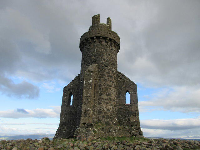 Photo could not load
NO7269 : Tower of Johnston
Scott Cormie
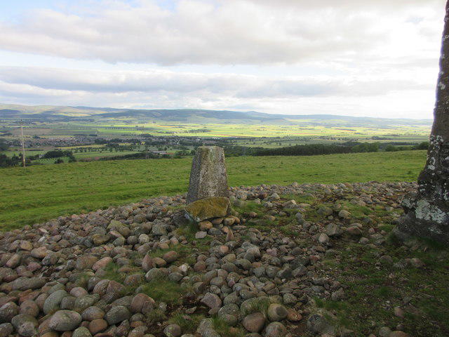 Photo could not load
NO7269 : Trig Pillar, Tower of Johnston
Scott Cormie
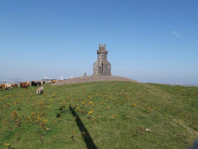 Photo could not load
NO7269 : Tower of Johnston
David Brown
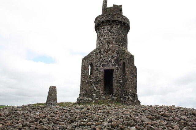 Photo could not load
NO7269 : Tower of Johnston
Michael Pullan
Hill facts and local notes
Classifications
Elevation
277m
909 ft
Prominence
219m
Coordinates
56.8134, -2.4493
NO726691
OS Map
45
Explorer: 382N
At the Summit
At the summit, you will find a modest stone cairn and a wooden post, which, although it won’t offer tea, can be the perfect backdrop for your victory selfie.
Terrain & Geology
The Hill of Garvock is predominantly composed of metamorphic rocks, with an intriguing history of glacial erosion that gives the hill its distinctive rounded shape. You might even spot some interesting folded rock formations if you look closely!
Views & Scenery
You can enjoy panoramic views of the surrounding farmland, the distant Grampian mountains, and on a clear day, even the North Sea coastline peeking through the undulating hills.
History & Heritage
Name Origin
The name 'Garvock' is thought to derive from the Scots Gaelic 'Garbh', meaning rough, reflecting its rugged terrain.
Historical Significance
Historically, the hill is considered a landmark for navigation, guiding travelers through the surrounding landscape for centuries.
Getting There & Facilities
Parking
There's a small car park at the edge of Laurencekirk village, just a short walk from the trailhead.
Public Transport
Laurencekirk can be accessed via regular bus services from Aberdeen and Dundee. A textile bus service operates near the hill as well.
Nearby Facilities
Cafes and local shops can be found in Laurencekirk, where you can replenish your energy with a slice of homemade cake or a bacon roll—fuel for the hike ahead!
Safety Information
Known Hazards
- Occasional muddy sections can be slippery, particularly in wet weather. Also, keep an eye out for the odd sheep—everyone loves a picturesque landscape, but they can be surprisingly territorial!
General Safety Tips
- Check weather conditions before setting out
- Carry appropriate clothing and equipment
- Let someone know your planned route
- Take a map, compass, and GPS device
- Carry emergency supplies: food, water, first aid kit, torch
Hills
Some common questions about the hills answered
Are there group walks up Hill of Garvock?
Many walkers use Walkmates to join or organise walks with others. You can check for group walks around Hill of Garvock through the maps
Are there other walkers around Hill of Garvock?
Activity varies by location and time, but Walkmates lets you see whether others have shared walks or shown interest in this area. Find other people through the walking friends search walking friends for Hill of Garvock search or of course create your own walk for Hill of Garvock
Can I organise a walk to Hill of Garvock?
Yes. If there aren’t any walks listed already, you can create a walk and make it available for others to join.
If you're signed up to Walkmates, you can create a walk to Hill of Garvock.
How do I find a walk up this hill?
There are often multiple ways to walk this hill, depending on experience and route preference. Walkmates helps you explore walks and routes that others have shared.
Can I suggest a new route up Hill of Garvock?
Yes. You can suggest or create routes to share with others. Walkmates focuses on the social side of walking, so routes are used to help people organise walks and explore areas together, rather than as detailed navigation tools or route libraries.
Other uses really appreciate knowledgeable walkers sharing their routes. Share your favourite route to Hill of Garvock here
The is an error or something incorrect about this hill. How do I let you know?
We always strive to keep the information on Walkmates as accurate as possible. If you find an error, please let us know through the contact form and we'll aim to correct it as quickly as possible
Community Discussion
Comments
Location
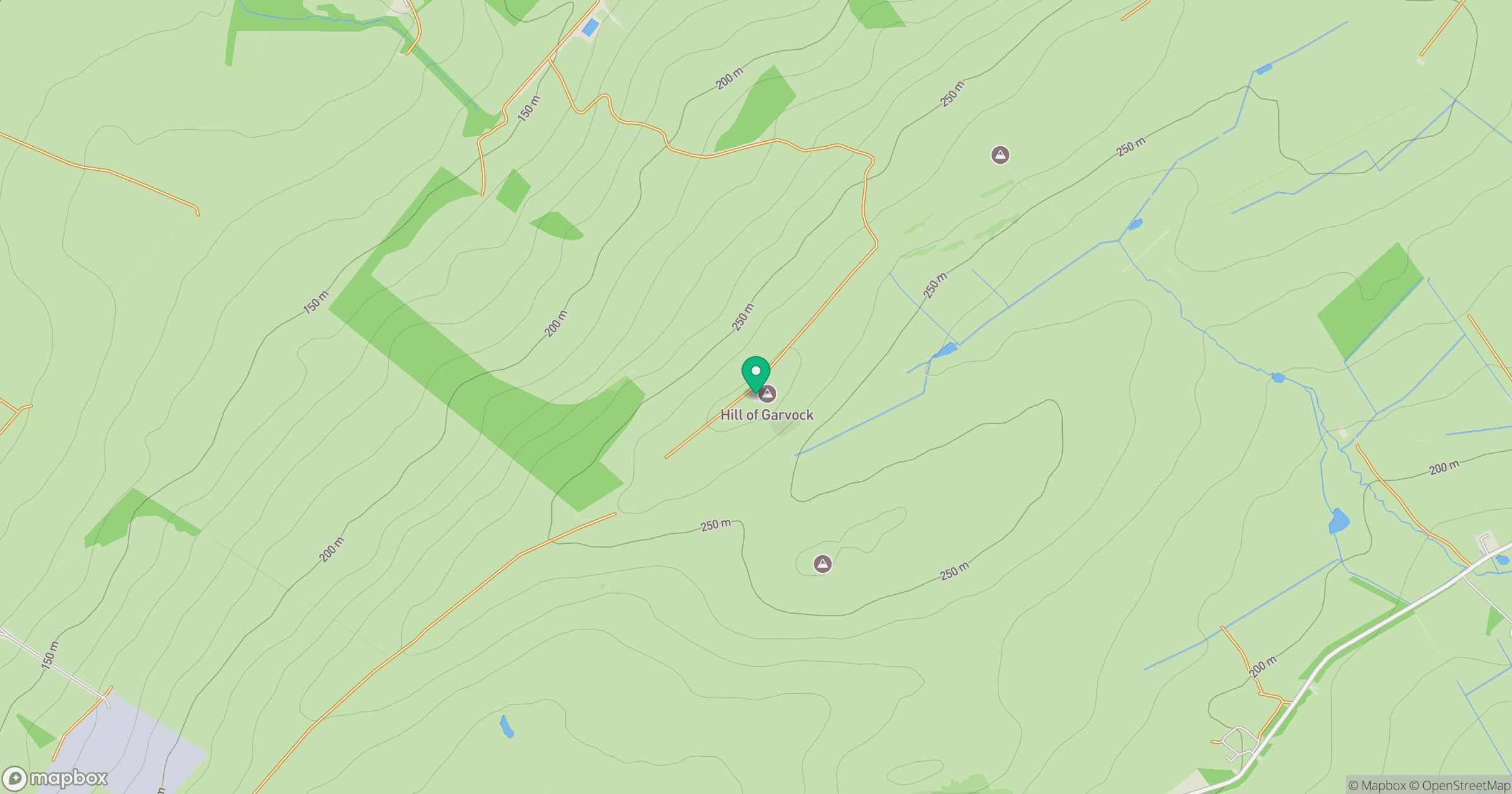
Grid reference: NO726691
View on OpenStreetMapOpens a map in a new tab, centred on the hill.


No comments yet. Be the first.