

Hill of Goauch
Good walks are even better shared.
Overview
Hill of Goauch
Overview
Located in the enchanting Grampian Mountains, Hill of Goauch stands at an elevation of 557 meters, making it a prominent Marilyn. This hike is a perfect experience for those looking to escape into nature and enjoy some panoramic views.
Geology
The hill is predominantly composed of granite, a rock type that is as reliable as it is sturdy, forged over millions of years. The landscape reflects its glacial past, and it's not just the views that are breathtaking—it's the very ground beneath your feet!
Routes
Standard Route from Glenkindie
- Distance: 6.2 km
- Time: Approximately 2.5 hours
- Difficulty: Moderate
This popular route begins at Glenkindie, leading you through delightful woodlands and across rolling hills.
Summit Features
The summit boasts a delightful stone cairn where many hikers stop to celebrate their accomplishment with a snack—or a cheeky selfie!
Terrain Type
Expect a blend of grassy areas and rocky outcrops, interspersed with heather and occasional boggy bits that can surprise even the most experienced hikers!
Views
From the top, you will be rewarded with sweeping views of the Grampians, including striking vistas of the Dee Valley below. The best time to enjoy these views is undoubtedly during the spring and early autumn when visibility is at its peak.
Hazards
Do keep an eye on the weather; it can change faster than a squirrel on a sugar rush! Also, watch that you don't find yourself shoe-deep in a bog—nobody likes squelchy socks!
Nearby Summits
Several noteworthy peaks accompany Hill of Goauch in its stunning surroundings:
- Mounth of Leny (605 meters)
- Clachnaben (599 meters)
Access
- Nearest Parking: A small car park at Glenkindie, where you may encounter a few friendly sheep.
- Public Transport: Hop onto a bus to Aboyne, but remember that this isn't exactly a bus hotspot, so planning is key.
- Nearest Town: The charming village of Aboyne, about 12 miles away, has your essential amenities.
Facilities
If you need to refuel, Aboyne has you covered with several cafes and restaurants, plus public toilets for your convenience.
History
The name 'Goauch' comes from the Gaelic word ‘Gabhail’, highlighting its agricultural roots. A landmark for centuries, Hill of Goauch has inspired both folklore and adventurers alike.
Happy hiking, and remember—leave no trace but fill your soul with the wonder of nature!
Explore routes near Hill of Goauch
Public walks starting within 80 km of this hill. Nearby does not mean a route reaches the summit; check its map and access before setting out.
Banchory to Milton of Crathes: Deeside Way return
View route
Potarch to Shooting Greens: Deeside Way return
View route
Milton of Crathes to Drumoak: Deeside Way return
View route
Pitfichie: Cairn William Trail
View route
Route planning notes
These notes describe possible approaches, not verified navigable routes or permission to cross land. Check current paths, local access rules and conditions before setting out.
Standard Route from Glenkindie
This well-trodden route starts from the car park at Glenkindie, leading you through scenic woodland and across grassy slopes to the summit.
Make a day of it, together
Find someone to share the walk with, or organise a day out along a route you like.
Photo Gallery
View all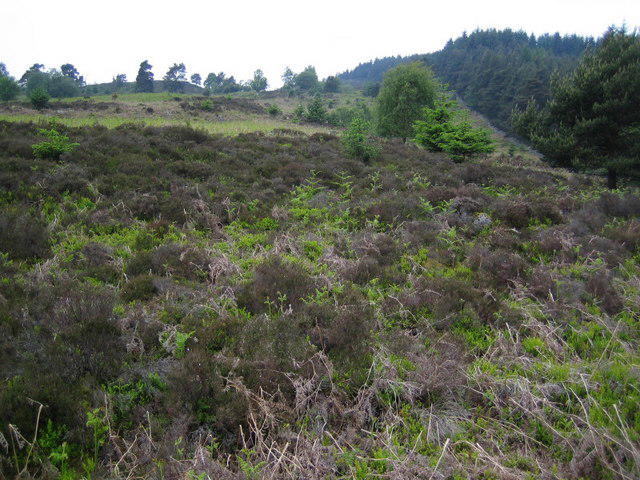 Photo could not load
NO6694 : Edge of Blackhall Forest looking towards Hill of Goauch
Nigel Corby
Hill facts and local notes
Classifications
Elevation
337m
1,106 ft
Prominence
149m
Coordinates
57.0375, -2.5568
NO663941
OS Map
38 45
Explorer: 406W
At the Summit
The summit is adorned with a well-built stone cairn, offering a perfect spot for a breather and some stunning views.
Terrain & Geology
Composed mainly of granite, Hill of Goauch offers intriguing geological features typical of the Scottish Highlands. Its rugged terrain has been shaped by glacial activity, resulting in a unique landscape.
Views & Scenery
On a clear day, you'll be treated to impressive views of the surrounding Grampian peaks and the expansive Dee Valley below.
History & Heritage
Name Origin
The name 'Goauch' is derived from the Gaelic term ‘Gabhail’ meaning ‘to take’, referencing the area's historical agricultural practices.
Historical Significance
The hill has been a landmark for centuries, being part of local folklore and offering hunters and shepherds a vantage point.
Getting There & Facilities
Check current local access restrictions, parking rules and transport timetables before travelling. These notes do not confirm public access to the summit.
Parking
There’s a small car park located at Glenkindie, which can accommodate about 10 vehicles. Be mindful of park rules as it's a popular area.
Public Transport
Limited public transport options are available, so a vehicle is preferred. The nearest bus service can be found in Aboyne, approximately 12 miles away.
Nearby Facilities
For a cuppa or a bite to eat, head back to Aboyne where you'll find several cafes and restaurants. Public toilets are also available in town.
Safety Information
Known Hazards
- Be on the lookout for sudden weather changes; the mountains have a knack for turning grey and moody. Also, watch out for slippery stones and muddy patches.
General Safety Tips
- Check weather conditions before setting out
- Carry appropriate clothing and equipment
- Let someone know your planned route
- Take a map, compass, and GPS device
- Carry emergency supplies: food, water, first aid kit, torch
Hills
Some common questions about the hills answered
Are there group walks up Hill of Goauch?
Many walkers use Walkmates to join or organise walks with others. You can check for group walks around Hill of Goauch through the maps
Are there other walkers around Hill of Goauch?
Activity varies by location and time, but Walkmates lets you see whether others have shared walks or shown interest in this area. Find other people through the walking friends search walking friends for Hill of Goauch search or of course create your own walk for Hill of Goauch
Can I organise a walk to Hill of Goauch?
Yes. If there aren’t any walks listed already, you can create a walk and make it available for others to join.
If you're signed up to Walkmates, you can create a walk to Hill of Goauch.
How do I find a walk up this hill?
There are often multiple ways to walk this hill, depending on experience and route preference. Walkmates helps you explore walks and routes that others have shared.
Can I suggest a new route up Hill of Goauch?
Yes. You can suggest or create routes to share with others. Walkmates focuses on the social side of walking, so routes are used to help people organise walks and explore areas together, rather than as detailed navigation tools or route libraries.
Other uses really appreciate knowledgeable walkers sharing their routes. Share your favourite route to Hill of Goauch here
The is an error or something incorrect about this hill. How do I let you know?
We always strive to keep the information on Walkmates as accurate as possible. If you find an error, please let us know through the contact form and we'll aim to correct it as quickly as possible
Community Discussion
Comments
Location
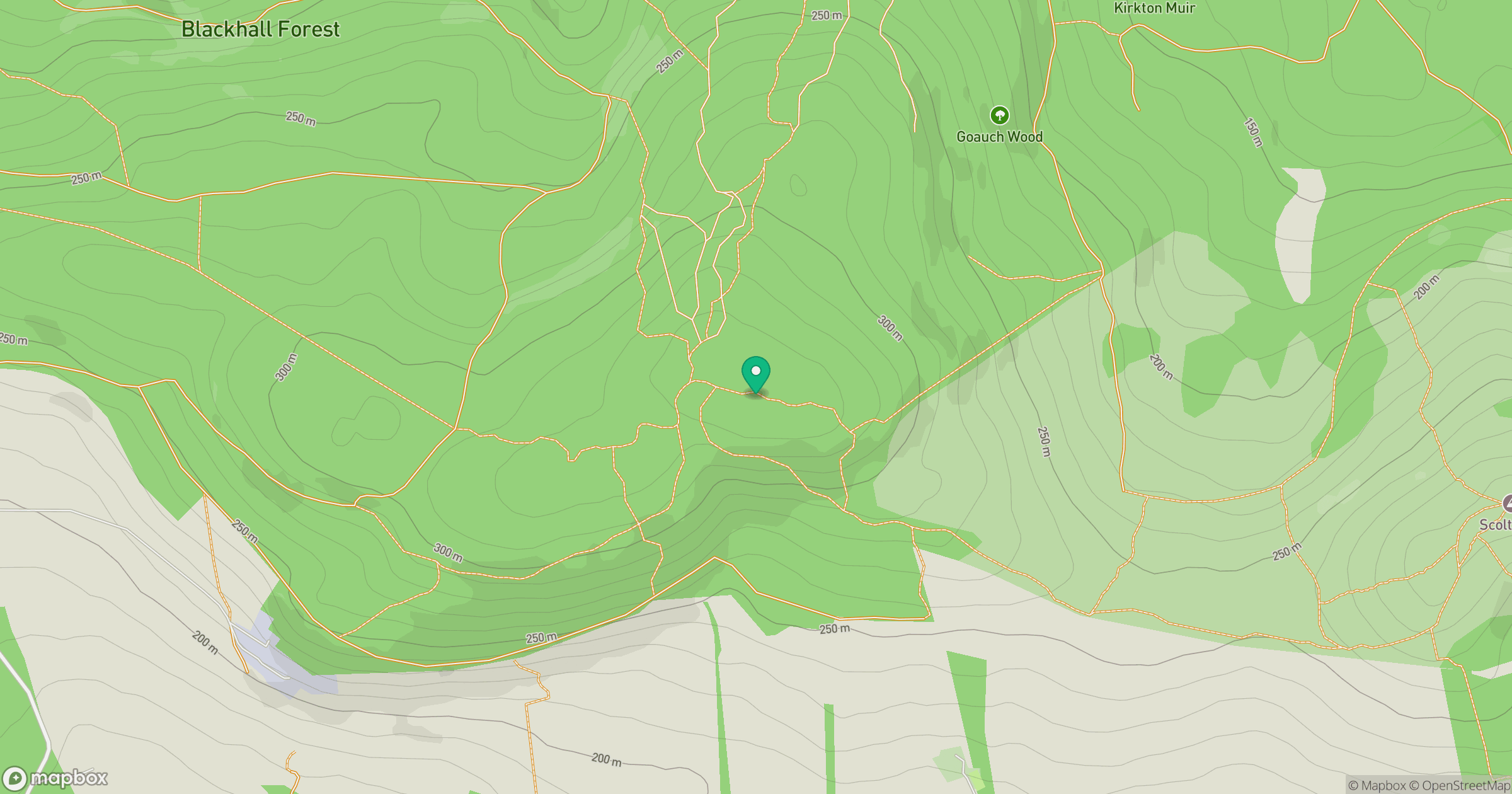
Grid reference: NO663941
View on OpenStreetMapOpens a map in a new tab, centred on the hill.
Hills within 30 km
Straight-line distance, not a walking route or confirmation of access.
No comments yet. Be the first.