

Hill of Wirren
Good walks are even better shared.
Overview
Hill of Wirren
Overview
The Hill of Wirren stands proudly at 493 meters, classified as a Marilyn, and is nestled within the scenic Grampian Mountains. For those who enjoy a bit of elevation without the daunting heights of a Munro, Wirren is the perfect choice.
Geology
Composed primarily of schists from the Caledonian orogeny, the rocky terrain offers hikers interesting rock formations and a glimpse into the earth's tectonic past. Keep your eyes peeled for unique lichen and hardy alpine plants that can tolerate these rugged conditions.
Routes
Wirren Hill Circuit
This delightful moderate route covers approximately 8.5 km and typically takes around 2.5 hours. Beginning on the eastern side of the hill, the circuit provides various stunning viewpoints and a gentle ascent to the summit. Bring your best legwork, as the views will reward your efforts!
Summit Features
At the summit, you’ll find a modest cairn which, while not a postcard-perfect monument, offers a great spot for a rest. Don’t forget to snap some pictures of the dramatic landscapes stretching out around you!
Terrain Type
Expect a delightfully rugged experience with undulating heather-covered hills and rocky outcrops along the way. It’s a bit of a mixed bag—perfect for keen adventurers looking for a genuine Scottish highland experience!
Views
From the summit, you can catch sight of the majestic Ben Rinnes and further on the famous Cairngorms. If you time your visit well, you’ll be graced with the stunning sights of hazy valleys and distant peaks glowing in the sunlight during Spring or Autumn.
Hazards
While the trails are generally well-defined, caution is advised on wet and rocky parts that can be surprisingly slippery. A pair of sturdy boots is highly recommended as you navigate this delightful terrain.
Nearby Summits
When you're done with Wirren, you might consider a trek over to nearby summits such as the towering Ben Rinnes (841 m) or Mither Tap (588 m) for some extended exploration.
Access
Nearest Parking: There’s a quaint little parking area at NO520730, just big enough for a handful of cars.
Public Transport: The closest bus service goes through Keith, about 10 km away, with taxis available for hire if your legs are feeling weary.
Nearest Town: Keith is your best bet for any pre-hike supplies, offering cafes and shops galore.
Facilities
Facilities are quite limited directly at Hill of Wirren; however, Keith has plenty of options, including cafes and public toilets for those basic needs.
History
Name Meaning
The name 'Wirren' is thought to be derived from the Gaelic 'Muirne', which translates to 'beloved'. This indicates the area's longstanding significance to local inhabitants.
Significance
The Hill of Wirren has ties to clan history and local legends, linking it to tales of yore that add a touch of magic to your hike.
In conclusion, Hill of Wirren is a superb choice for those looking to stretch their legs and absorb the beautiful Scottish landscapes without the crowds typically found on higher peaks. So, pack a snack, lace up those hiking boots, and head on over!
Explore routes near Hill of Wirren
Public walks starting within 80 km of this hill. Nearby does not mean a route reaches the summit; check its map and access before setting out.
Forfar to Lunanhead: East Road and the Ditches Walk
View route
Loch Muick full circuit from Spittal of Glen Muick
View route
Club outing: Auchnafree Hill (shared-car departure)
View route
Club outing: Lomond Hills (shared-car departure)
View route
Route planning notes
These notes describe possible approaches, not verified navigable routes or permission to cross land. Check current paths, local access rules and conditions before setting out.
Wirren Hill Circuit
A scenic loop starting from the eastern side, offering views of the surrounding heaths and shrubbery.
Make a day of it, together
Find someone to share the walk with, or organise a day out along a route you like.
Photo Gallery
View all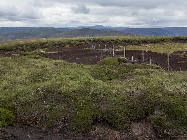 Photo could not load
NO5273 : Hill of Wirren
William Starkey
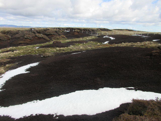 Photo could not load
NO5274 : Peathags, Hill of Wirren
Scott Cormie
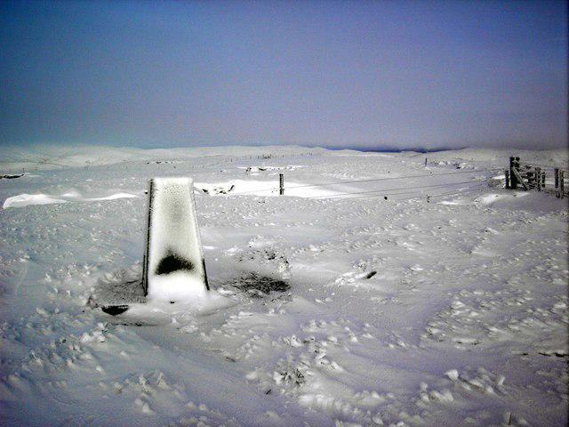 Photo could not load
NO5273 : Hill of Wirren Trig Point
Colin Kinnear
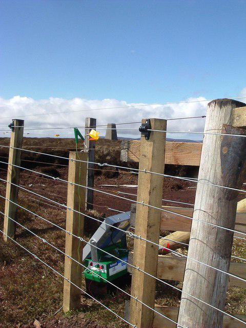 Photo could not load
NO5273 : Summit Hill of Wirren
ronnie leask
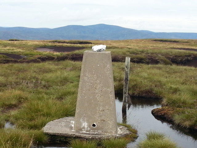 Photo could not load
NO5273 : Mount Battock from The Wirren
George Middleton
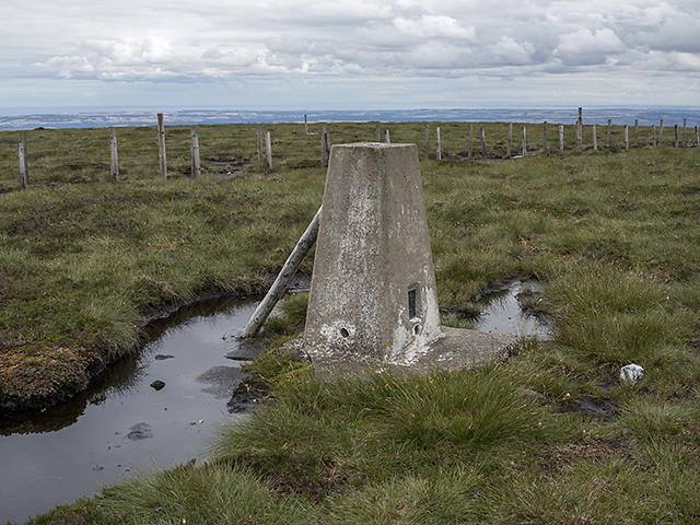 Photo could not load
NO5273 : OS trig pillar, Hill of Wirren
William Starkey
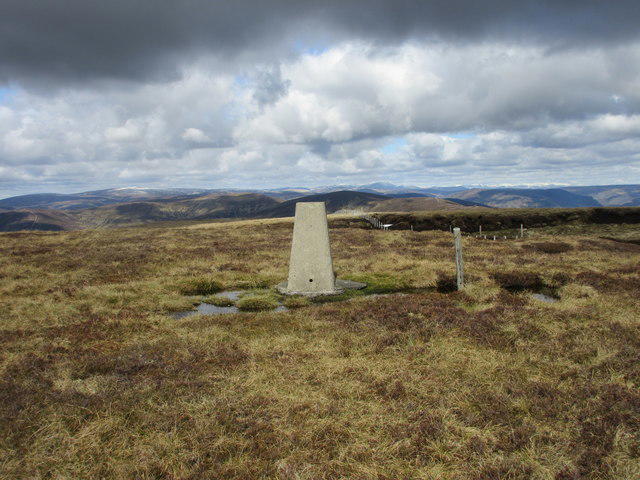 Photo could not load
NO5273 : Hll of Wirren trig pillar
Scott Cormie
Hill facts and local notes
Classifications
Elevation
678m
2,224 ft
Prominence
311m
Coordinates
56.8544, -2.7840
NO522739
OS Map
44
Explorer: 389
At the Summit
The summit is marked by a modest cairn and provides ample space for small groups to enjoy a snack or simply relish the views.
Terrain & Geology
The Hill of Wirren is primarily composed of metamorphic rocks, notably schists, which provide a unique and rugged landscape. These rocks were formed under high-pressure conditions during the Caledonian orogeny.
Views & Scenery
From the summit, you can see the sprawling landscapes of the Grampians, including nearby peaks such as the Ben Rinnes and the distant Cairngorms.
History & Heritage
Name Origin
The name 'Wirren' is thought to derive from the Gaelic word 'Muirne', meaning 'beloved', suggesting a cherished location in ancient times.
Historical Significance
Historically, the area around Hill of Wirren has been a site of clan activity and local folklore, adding a rich narrative layer to your hike.
Getting There & Facilities
Check current local access restrictions, parking rules and transport timetables before travelling. These notes do not confirm public access to the summit.
Parking
There is a small parking area at NO520730, suitable for a few cars, just off the minor road leading to the hill.
Public Transport
The nearest bus service operates through the village of Keith, which is approximately 10 km away, and taxis are available.
Nearby Facilities
While facilities are limited on-site, the town of Keith offers cafes, restaurants, and public toilets.
Safety Information
Known Hazards
- Care must be taken on rocky sections, especially in wet conditions, as they can become slippery.
General Safety Tips
- Check weather conditions before setting out
- Carry appropriate clothing and equipment
- Let someone know your planned route
- Take a map, compass, and GPS device
- Carry emergency supplies: food, water, first aid kit, torch
Hills
Some common questions about the hills answered
Are there group walks up Hill of Wirren?
Many walkers use Walkmates to join or organise walks with others. You can check for group walks around Hill of Wirren through the maps
Are there other walkers around Hill of Wirren?
Activity varies by location and time, but Walkmates lets you see whether others have shared walks or shown interest in this area. Find other people through the walking friends search walking friends for Hill of Wirren search or of course create your own walk for Hill of Wirren
Can I organise a walk to Hill of Wirren?
Yes. If there aren’t any walks listed already, you can create a walk and make it available for others to join.
If you're signed up to Walkmates, you can create a walk to Hill of Wirren.
How do I find a walk up this hill?
There are often multiple ways to walk this hill, depending on experience and route preference. Walkmates helps you explore walks and routes that others have shared.
Can I suggest a new route up Hill of Wirren?
Yes. You can suggest or create routes to share with others. Walkmates focuses on the social side of walking, so routes are used to help people organise walks and explore areas together, rather than as detailed navigation tools or route libraries.
Other uses really appreciate knowledgeable walkers sharing their routes. Share your favourite route to Hill of Wirren here
The is an error or something incorrect about this hill. How do I let you know?
We always strive to keep the information on Walkmates as accurate as possible. If you find an error, please let us know through the contact form and we'll aim to correct it as quickly as possible
Community Discussion
Comments
Location
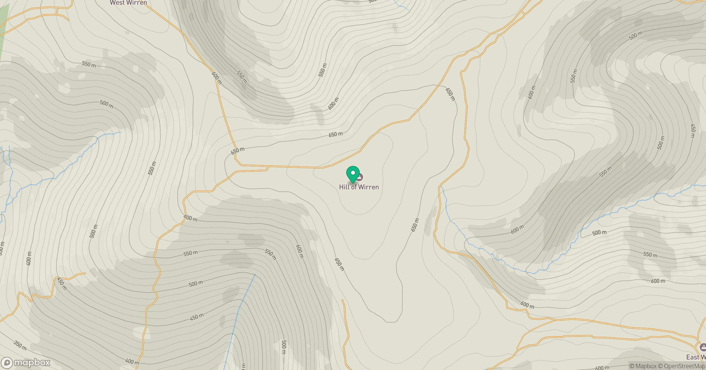
Grid reference: NO522739
View on OpenStreetMapOpens a map in a new tab, centred on the hill.
Hills within 30 km
Straight-line distance, not a walking route or confirmation of access.
No comments yet. Be the first.