

Carnferg
Good walks are even better shared.
Overview
Carnferg: A Hidden Gem in the Highlands
Carnferg, standing proud at 624 meters, is a delightful hiking destination nestled within the Scottish Highlands. With its granite peaks and serene landscapes, it's a mountain that often flies under the radar but shouldn't be overlooked.
Geology
The mountain is predominantly made up of ancient granite formations. This resilient stone provides a remarkable testament to geological history that has shaped the Scottish landscape over countless ages. Those with a keen eye will spot fascinating weathering patterns that tell tales of time.
Routes
One of the most popular routes up Carnferg begins at Inverharrow. The trail winds through lush woodlands and offers occasional breaks in the canopy to reveal stunning views. It’s a moderate hike, suitable for most walkers with a little fitness. It's about 8 km round trip and should take around four hours to complete.
Summit Features
The summit is crowned with a sizeable cairn that gives a palpable sense of accomplishment as you reach the top—perfect for that obligatory 'I've made it!' selfie. The trig point adds to this milestone, providing a sturdy backdrop for your photographs.
Terrain
Expect a mix of grassy slopes and rocky outcrops, offering a varied hiking experience. The terrain is quite forgiving overall, but watch out for any slippery patches, especially after wet weather.
Views
Once at the top, your efforts will be richly rewarded. The views extend across the Cairngorms, showcasing an awe-inspiring display of peaks and valleys. The best seasons for hiking are spring and early autumn when the scenery is at its most breathtaking, and you might just catch some wildflowers adding splashes of colour to the greenery.
Hazards
While the trail is generally safe, be prepared for the typical unpredictability of Highland weather. A sunny morning can quickly turn into a drizzly afternoon, so bringing a waterproof jacket is never a bad idea!
Nearby Summits
If you’re interested in more challenges, the nearby Mullachdubh and Carn an Tuirc offer additional adventures worth considering.
Access
To get to Carnferg, the nearest parking is at Inverharrow, with space for several vehicles. The closest town is Aboyne, complete with all the facilities you might need. For those relying on public transport, services from Aberdeen connect you to the region, so do check local timetables to plan your trip.
Facilities
Rest assured, after exploring the mountain, you can find cafes and toilets in Aboyne, perfect for refuelling post-hike.
History
The name Carnferg translates to 'cairn of the park' in Gaelic, and this area has long been a hiking favourite among locals and visitors alike. With its natural beauty and moderate challenge, Carnferg continually welcomes those eager to explore its charm.
In summary, whether you’re a seasoned hiker or new to the hillwalking scene, Carnferg offers a friendly and enjoyable day out with plenty of opportunities to immerse yourself in nature's beauty!
Happy hiking!
Explore routes near Carnferg
Public walks starting within 80 km of this hill. Nearby does not mean a route reaches the summit; check its map and access before setting out.
Potarch to Shooting Greens: Deeside Way return
View route
Loch Kinord: Muir of Dinnet Woodland Circuit
View route
Cairngorms night walk and stargazing (event meeting)
View route
Cairngorms night walk and stargazing (event meeting)
View route
Route planning notes
These notes describe possible approaches, not verified navigable routes or permission to cross land. Check current paths, local access rules and conditions before setting out.
Carnferg from Inverharrow
Starting at Inverharrow, this route meanders up through a mixture of woodland and grassy slopes before reaching the summit with its stunning views.
Make a day of it, together
Find someone to share the walk with, or organise a day out along a route you like.
Photo Gallery
View all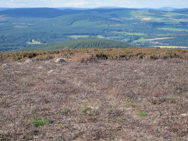 Photo could not load
NO5293 : Aboyne Castle, Village and Loch from Carnferg
Al
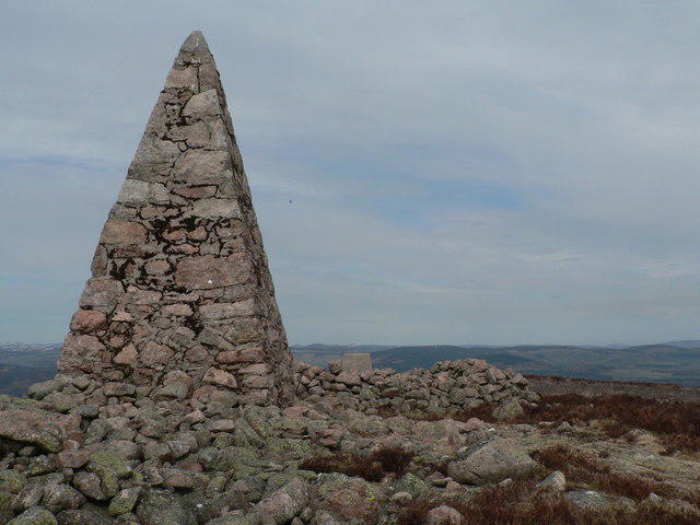 Photo could not load
NO5293 : Memorial & Trig
Liz Gray
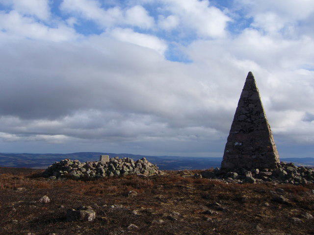 Photo could not load
NO5293 : Carn Ferg trig pillar and monument.
Iain Macaulay
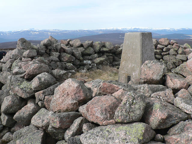 Photo could not load
NO5293 : Trig Pillar
Liz Gray
Hill facts and local notes
Classifications
Elevation
525m
1,722 ft
Prominence
118m
Coordinates
57.0287, -2.7887
NO522933
OS Map
37 44
Explorer: OL54 395
At the Summit
The summit of Carnferg boasts a large, well-constructed cairn that provides a sense of achievement for hikers. There's also a trig point, so don't forget to pose for a photo with it!
Terrain & Geology
Carnferg is predominantly composed of ancient granite formations, providing a glimpse into the geological history of the Scottish Highlands. The rock formations are weathered, showcasing interesting patterns and textures that have been shaped over millennia.
Views & Scenery
From the summit, one can see the towering peaks of the Cairngorms, shimmering lochs, and extensive glens, offering a breathtaking panorama that makes the hike worthwhile.
History & Heritage
Name Origin
The name 'Carnferg' derives from the Gaelic 'Carn a' Phairc', meaning 'cairn of the park', a nod to the beautiful parklands surrounding the area.
Historical Significance
Carnferg has been a treasured spot for local hikers and nature enthusiasts, often included in hiking itineraries for its picturesque scenery and moderate challenge.
Getting There & Facilities
Check current local access restrictions, parking rules and transport timetables before travelling. These notes do not confirm public access to the summit.
Parking
There is a small car park at Inverharrow, which can accommodate several vehicles. It's a popular start point for various walks in the area.
Public Transport
The nearest public transport option is from Aberdeen, with bus services available that connect to nearby villages. Check local schedules for precise times.
Nearby Facilities
While there are no facilities directly on the mountain, Aboyne has cafes, restaurants, and toilets to refresh after your hike.
Safety Information
Known Hazards
- Be mindful of sudden weather changes typical of the Highlands, and watch your step on the rocky terrain, as some areas can be a little slippery, especially after rain.
General Safety Tips
- Check weather conditions before setting out
- Carry appropriate clothing and equipment
- Let someone know your planned route
- Take a map, compass, and GPS device
- Carry emergency supplies: food, water, first aid kit, torch
Hills
Some common questions about the hills answered
Are there group walks up Carnferg?
Many walkers use Walkmates to join or organise walks with others. You can check for group walks around Carnferg through the maps
Are there other walkers around Carnferg?
Activity varies by location and time, but Walkmates lets you see whether others have shared walks or shown interest in this area. Find other people through the walking friends search walking friends for Carnferg search or of course create your own walk for Carnferg
Can I organise a walk to Carnferg?
Yes. If there aren’t any walks listed already, you can create a walk and make it available for others to join.
If you're signed up to Walkmates, you can create a walk to Carnferg.
How do I find a walk up this hill?
There are often multiple ways to walk this hill, depending on experience and route preference. Walkmates helps you explore walks and routes that others have shared.
Can I suggest a new route up Carnferg?
Yes. You can suggest or create routes to share with others. Walkmates focuses on the social side of walking, so routes are used to help people organise walks and explore areas together, rather than as detailed navigation tools or route libraries.
Other uses really appreciate knowledgeable walkers sharing their routes. Share your favourite route to Carnferg here
The is an error or something incorrect about this hill. How do I let you know?
We always strive to keep the information on Walkmates as accurate as possible. If you find an error, please let us know through the contact form and we'll aim to correct it as quickly as possible
Community Discussion
Comments
Location
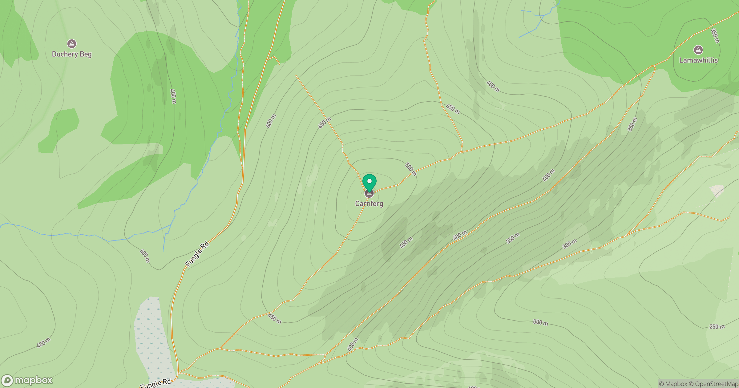
Grid reference: NO522933
View on OpenStreetMapOpens a map in a new tab, centred on the hill.
Hills within 30 km
Straight-line distance, not a walking route or confirmation of access.
No comments yet. Be the first.