

Stob Coire Sgriodain
Good walks are even better shared.
NN3574 : Summit area of Stob Coire Sgriodain
Steven Brown Photo source
Overview
Stob Coire Sgriodain
Situated within the majestic Scottish Highlands, Stob Coire Sgriodain rises proudly to 975 meters. This Munro is a testament to the natural beauty and geological history that characterises this region.
Geology
The mountain is formed predominantly of ancient volcanic rock, a part of the Great Glen Fault system. As you trek up, you’re essentially walking through layers of geological history that tell a story spanning millions of years. Who knew geology could be so interesting? Just don’t accidentally knock a rock down on your friends; they might not see the humour!
Routes
One of the most popular routes starts from the A86 at Achlecrag. It’s a 12 km round trip that takes roughly 4.5 hours to complete. This moderate route guides you through lush glens and follows an undulating ridge leading right to the top. Just remember, no one likes a show-off who sprints up the hill!
Summit Features
Upon reaching the summit, hikers are greeted by a sizeable stone cairn marking the highest point. The summit offers breathtaking panoramic views—perfect for that obligatory summit selfie!
Terrain Type
The terrain varies significantly; expect rocky paths, grassy slopes, and the occasional boggy area. A sturdy pair of boots is recommended—unless you fancy playing in the mud.
Views
From the pinnacle, you can spot notable landmarks such as Ben Nevis, Glencoe, and the sprawling Rannoch Moor. The best time to witness these stunning views is during spring and autumn when the scenery is most vibrant and clear. Talk about nature’s beauty pageant!
Hazards
Caution is always wise! Be prepared for unexpected weather changes common in the Highlands. Slippery rocks and boggy ground, especially after a good rain, can turn a hike into a slippery slide, but at least you’ll have a story to tell.
Nearby Summits
Just a stone's throw away, you’ll find Stob Coire an Albannaich at 974 meters and the majestic Ben Nevis, the crowning achievement of the area, standing proud at 1345 meters.
Access
Parking is conveniently located at a small layby on the A86, just south of Achlecrag. For those coming from afar, Fort William is the nearest town with regular bus services that can get you close to the trailhead (though you might still need to walk or rely on a taxi).
Facilities
You won’t find any cafes on the summit, but Fort William has plenty to offer in terms of facilities, including shops and public toilets. Don’t forget to treat yourself after the hike; you’ve earned it!
History
The name Stob Coire Sgriodain translates to ‘the peak of the stony hollow’, a fitting designation for this rugged landscape. It holds cultural significance, being a popular location for hikers and admirers of Highland scenery, making memories that last long after the hike.
In conclusion, Stob Coire Sgriodain is not merely a mountain; it’s an experience, a challenge, and an opportunity to truly soak in the beauty and tranquillity of the Scottish Highlands. Just ensure you’re prepared, and you’re in for a treat! Happy hiking!
Explore routes near Stob Coire Sgriodain
Walks starting near this hill. Open a route to check its map, distance and full itinerary.
Ben Nevis via Mountain Path
View route
Banavie to Glen Loy Aqueduct: Neptune’s Staircase Canal Towpath
View route
Fort Augustus to Kytra Lock: Caledonian Canal Towpath
View route
Killin: Falls of Dochart, Finlarig and Moirlanich Longhouse
View route
Route planning notes
These notes describe possible approaches. Check a route's map and access information when planning your walk.
From the A86 at Achlecrag
A popular ascent that takes you through beautiful glens and along an undulating ridge to the summit.
Make a day of it, together
Find someone to share the walk with, or organise a day out along a route you like.
Photo Gallery
View all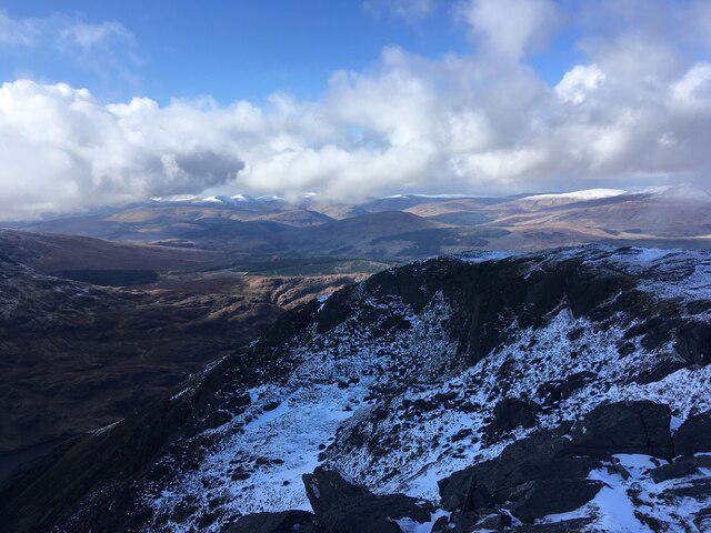 Photo could not load
NN3574 : Summit area of Stob Coire Sgriodain
Steven Brown
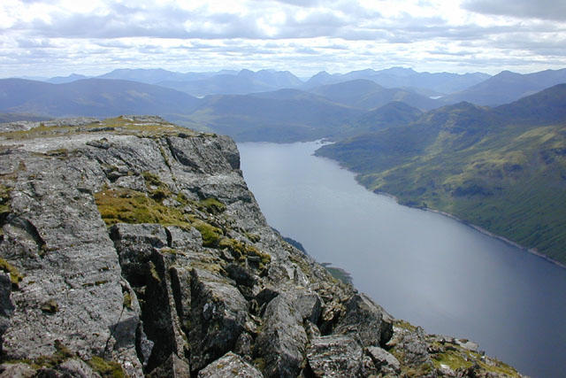 Photo could not load
NN3574 : View south west from Stob Coire Sgriodain
Nigel Brown
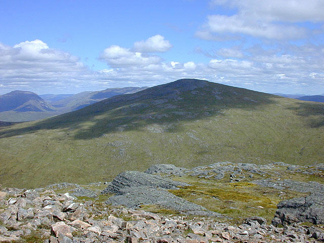 Photo could not load
NN3574 : View east from Stob Coire Sgriodain
Nigel Brown
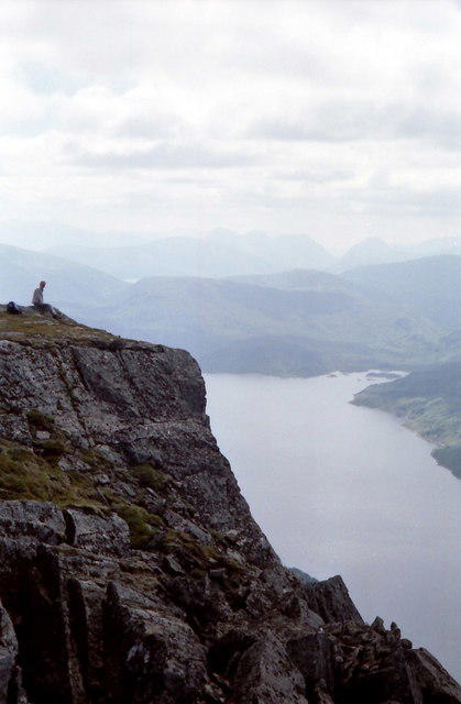 Photo could not load
NN3574 : The headwall of Coire Sgriodain
Russel Wills
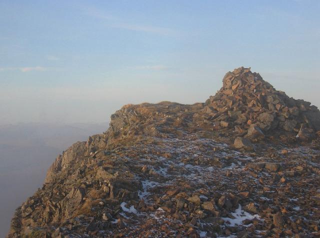 Photo could not load
NN3574 : Summit of Stob Coire Sgiodain
Hill Walker
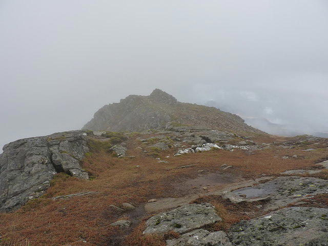 Photo could not load
NN3574 : Summit area from the south
Richard Law
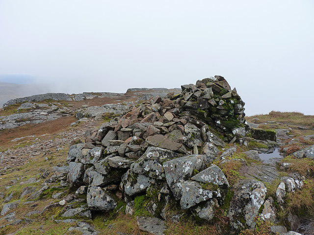 Photo could not load
NN3574 : Summit cairn on Stob Coire Sgrìodain
Richard Law
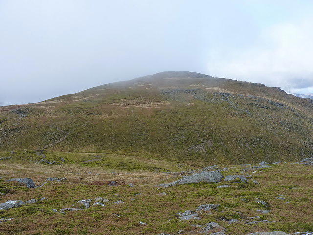 Photo could not load
NN3574 : Across the Glac Bhàn to Stob Coire Sgrìodain
Richard Law
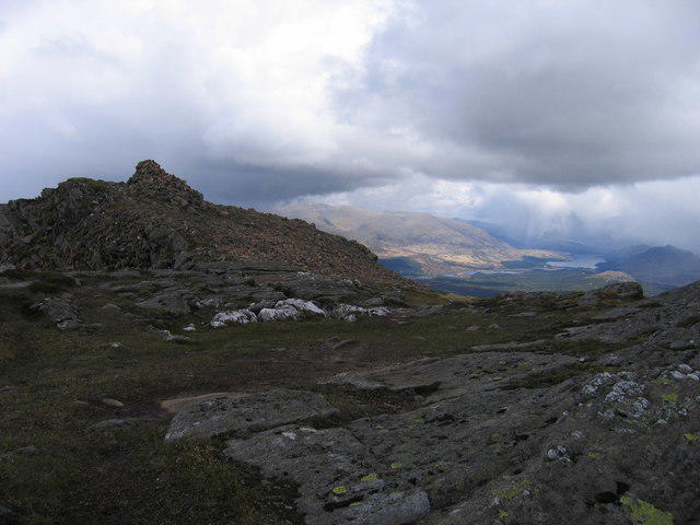 Photo could not load
NN3574 : Summit Stob Coire Sgriodain
Ali Ogden
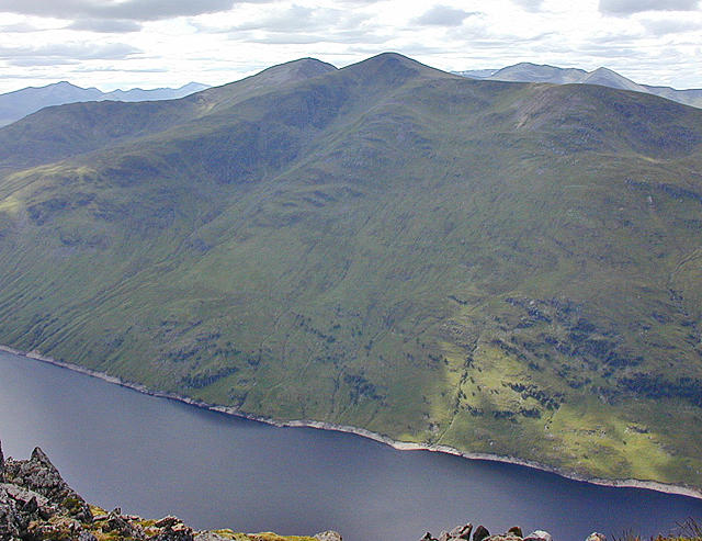
NN3574 : View west over Loch Treig
Nigel Brown
Hill facts and local notes
Classifications
Elevation
979m
3,212 ft
Prominence
90m
Coordinates
56.8317, -4.6949
NN356743
OS Map
41
Explorer: OL50 393
At the Summit
The summit features a substantial stone cairn and offers panoramic views across the surrounding peaks and glens.
Terrain & Geology
The mountain predominantly consists of ancient volcanic rock, part of the Great Glen Fault system, offering a glimpse into geological processes from millions of years ago.
Views & Scenery
From the summit, you can see the stunning sights of Ben Nevis, Glencoe, and the sprawling Rannoch Moor.
History & Heritage
Name Origin
Stob Coire Sgriodain translates roughly to 'the peak of the stony hollow', aptly describing its rugged features.
Historical Significance
The mountain is significant for its hiking routes and its position in the landscape around a region steeped in Highland culture.
Getting There & Facilities
Parking
Parking can be found at the small layby on the A86, just south of Achlecrag.
Public Transport
Regular bus services operate from Fort William to nearby communities, though a walk or taxi may be needed to reach the trailhead.
Nearby Facilities
Fort William has various facilities, including cafes, shops, and restrooms for hikers’ convenience.
Safety Information
Known Hazards
- Be aware of sudden weather changes, slippery rocks, and the possibility of boggy ground, especially after rain.
General Safety Tips
- Check weather conditions before setting out
- Carry appropriate clothing and equipment
- Let someone know your planned route
- Take a map, compass, and GPS device
- Carry emergency supplies: food, water, first aid kit, torch
Hills
Some common questions about the hills answered
Are there group walks up Stob Coire Sgriodain?
Many walkers use Walkmates to join or organise walks with others. You can check for group walks around Stob Coire Sgriodain through the maps
Are there other walkers around Stob Coire Sgriodain?
Activity varies by location and time, but Walkmates lets you see whether others have shared walks or shown interest in this area. Find other people through the walking friends search walking friends for Stob Coire Sgriodain search or of course create your own walk for Stob Coire Sgriodain
Can I organise a walk to Stob Coire Sgriodain?
Yes. If there aren’t any walks listed already, you can create a walk and make it available for others to join.
If you're signed up to Walkmates, you can create a walk to Stob Coire Sgriodain.
How do I find a walk up this hill?
There are often multiple ways to walk this hill, depending on experience and route preference. Walkmates helps you explore walks and routes that others have shared.
Can I suggest a new route up Stob Coire Sgriodain?
Yes. You can suggest or create routes to share with others. Walkmates focuses on the social side of walking, so routes are used to help people organise walks and explore areas together, rather than as detailed navigation tools or route libraries.
Other uses really appreciate knowledgeable walkers sharing their routes. Share your favourite route to Stob Coire Sgriodain here
The is an error or something incorrect about this hill. How do I let you know?
We always strive to keep the information on Walkmates as accurate as possible. If you find an error, please let us know through the contact form and we'll aim to correct it as quickly as possible
Community Discussion
Comments
Location
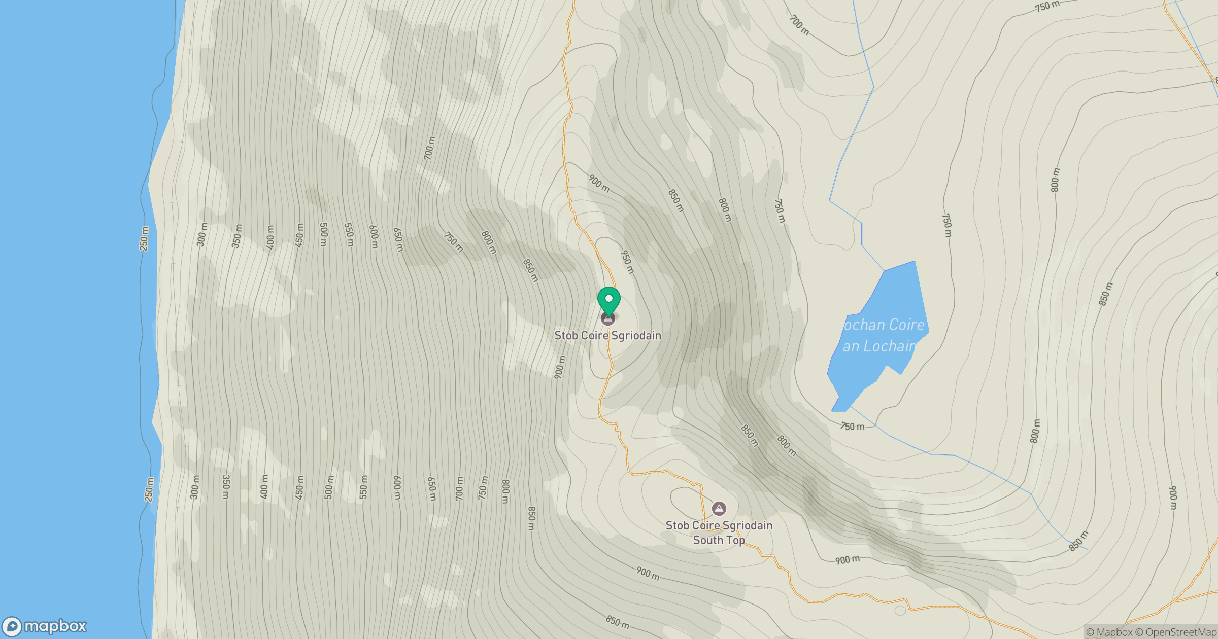
Grid reference: NN356743
View on OpenStreetMapOpens a map in a new tab, centred on the hill.
No comments yet. Be the first.