

Sron a' Choire Ghairbh
Good walks are even better shared.
NN2294 : Southeast ridge leading up to Sron a' Choire Ghairbh
Colin Park Photo source
Overview
Sron a' Choire Ghairbh
Overview
Sron a' Choire Ghairbh, standing proudly at 946 meters, is a distinguished Munro located in the rugged Scottish Highlands. This magnificent peak is a fantastic destination for hikers who relish the great outdoors.
Geology
The mountain is primarily composed of granite and schist, with its stunning geology forming through millions of years of natural processes. The glacial activity has sculpted the landscape into the distinct forms we see today, making it a geologist's delight.
Routes
The most popular route is the North-East Ridge Route, which starts near the Allt a' Chaochaidh. Spanning approximately 8 km, the climb is moderate and typically takes around four hours to complete. Hikers can enjoy breathtaking views as they ascend towards the summit.
Summit Features
The summit features a well-constructed cairn, a perfect spot for a photo or two. The panoramic views from the top are nothing short of spectacular, showcasing the dramatic beauty of the surrounding mountains and valleys.
Terrain
Expect a rocky path interspersed with grassy sections; however, be prepared for some boggy patches near the base—those hiking boots will get a workout!
Views
When it comes to views, Sron a' Choire Ghairbh doesn't disappoint. Majestic landmarks including Ben Nevis and the stunning Glencoe valley can be seen from the summit. The best times for these views are in late spring and summer when the weather is more predictable and the air is crystal clear.
Hazards
While the climb is relatively accessible, hikers should be cautious of loose rocks and the chance of sudden weather changes. It's advisable to check the forecast before setting off.
Nearby Summits
Those looking to extend their hiking adventure can also tackle nearby peaks such as Stob a' Choire Ghairbh (926m) and the mighty Ben Nevis (1345m).
Access
Parking is available near the A82 at Glen Nevis, providing easy access to the starting point of the hike. Public transport options are available from Fort William, making it convenient for anyone relying on buses.
Facilities
Fort William offers a variety of facilities, from cafes to public toilets, making it a great place to prepare for your mountain adventure. Stocking up on snacks and drinks before heading out is a smart move!
History
The mountain’s name translates to 'nose of the rough corrie', which perfectly captures this peak's character. As a Munro, Sron a' Choire Ghairbh is part of Scotland's rich climbing heritage, attracting adventurers from near and far who seek the satisfaction of bagging another peak.
In summary, Sron a' Choire Ghairbh is a splendid destination for both seasoned mountaineers and casual walkers alike. Just make sure to take your camera!
Explore routes near Sron a' Choire Ghairbh
Walks starting near this hill. Open a route to check its map, distance and full itinerary.
Banavie to Glen Loy Aqueduct: Neptune’s Staircase Canal Towpath
View route
Fort Augustus to Kytra Lock: Caledonian Canal Towpath
View route
Great Glen Way low route: Fort Augustus to Invermoriston Old Bridge
View route
Ben Nevis via Mountain Path
View route
Route planning notes
These notes describe possible approaches. Check a route's map and access information when planning your walk.
North-East Ridge Route
Starting near the Allt a' Chaochaidh, this route offers a relatively straightforward ascent with stunning views as you approach the summit.
Make a day of it, together
Find someone to share the walk with, or organise a day out along a route you like.
Photo Gallery
View all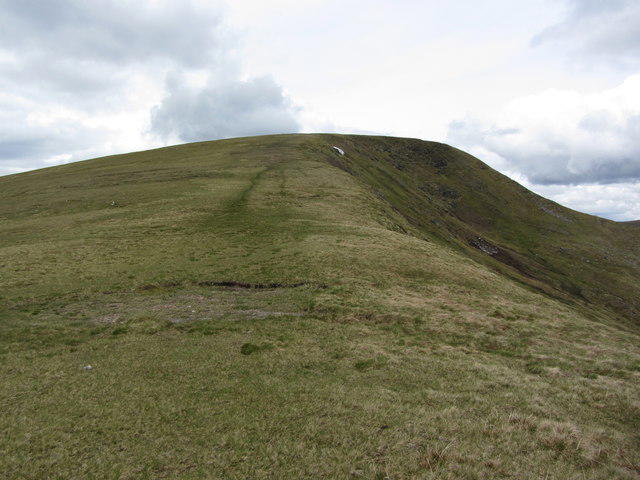 Photo could not load
NN2294 : Southeast ridge leading up to Sron a' Choire Ghairbh
Colin Park
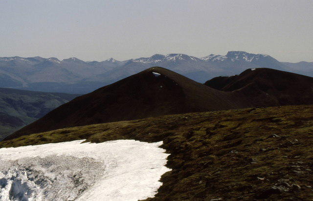 Photo could not load
NN2294 : Cornice on Sròn a' Choire Ghairbh
Russel Wills
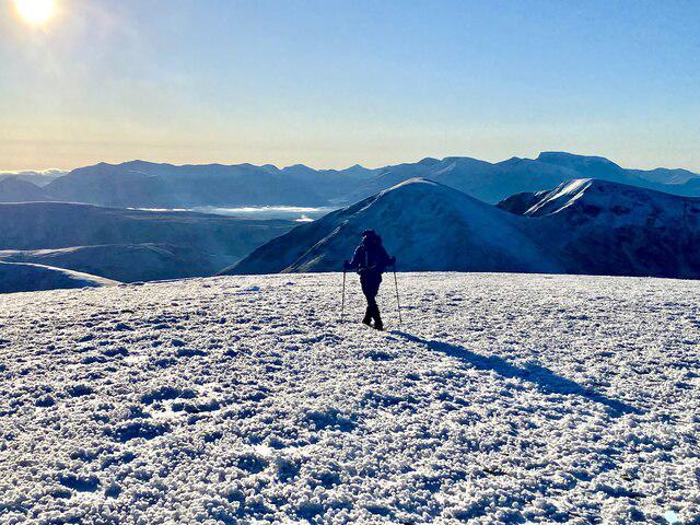 Photo could not load
NN2294 : Walking off Stron a’ Choire Ghairbh
Iain Lees
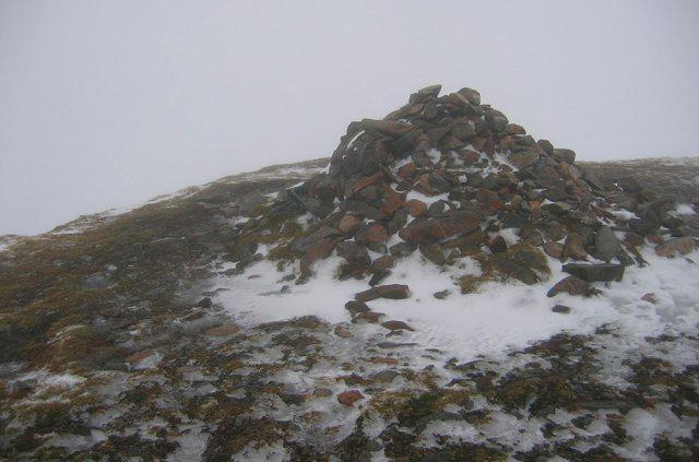 Photo could not load
NN2294 : Sron a' Choire Ghairbh
Richard Webb
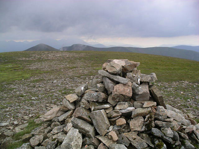 Photo could not load
NN2294 : Sron a' Choire Ghairbh : Munro No 239
Graham Ellis
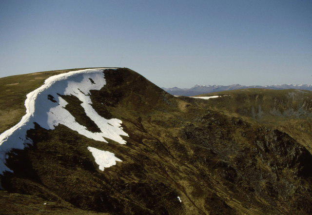 Photo could not load
NN2294 : Sròn a' Choire Ghairbh with cornice
Russel Wills
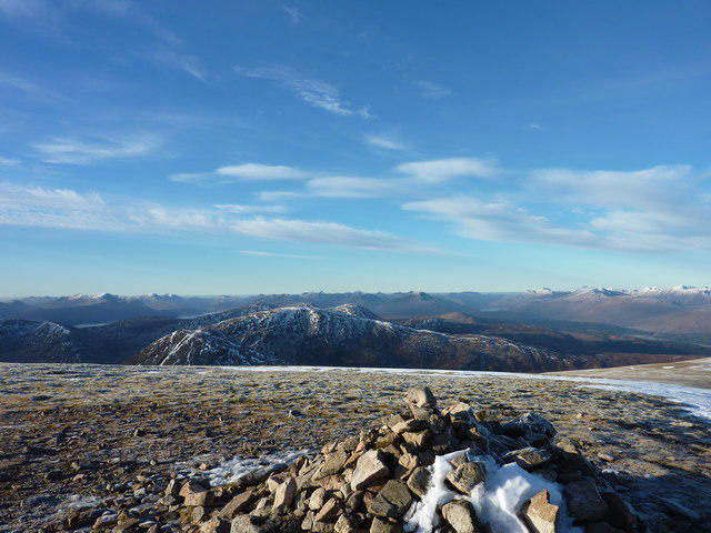 Photo could not load
NN2294 : Sron a Choire Ghairbh
Ian Stewart
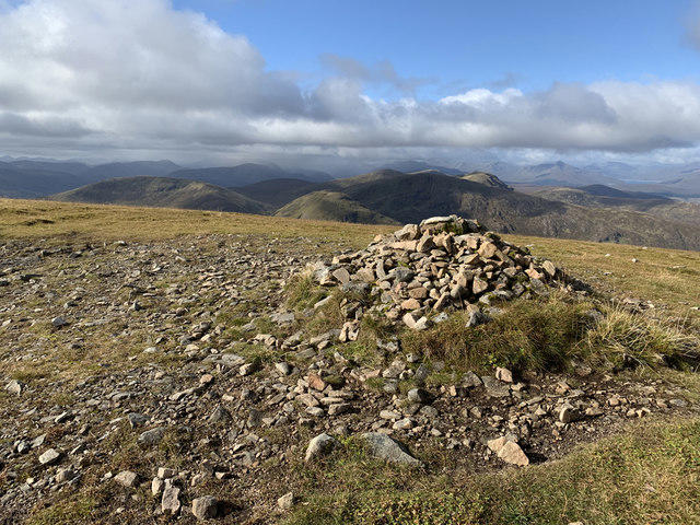 Photo could not load
NN2294 : Summit of Sròn a' Choire Ghairbh
John Allan
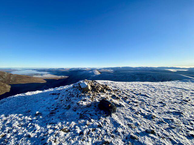 Photo could not load
NN2294 : The Summit Cairn on Stron a’ Choire Ghairbh
Iain Lees
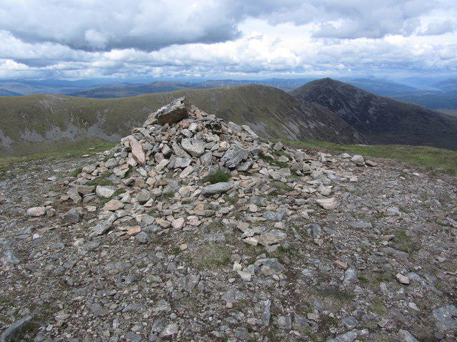
NN2294 : Summit of Sron a' Choire Ghairbh - View to Meall a' Choire Ghlai
Colin Park
Hill facts and local notes
Classifications
Elevation
936m
3,072 ft
Prominence
621m
Coordinates
57.0078, -4.9288
NN222945
OS Map
34
Explorer: 400
At the Summit
The summit features a prominent cairn and provides sweeping views across the surrounding mountains, offering ample photo opportunities for those who like to capture memories.
Terrain & Geology
Sron a' Choire Ghairbh is primarily composed of granite and schist, offering a rugged terrain shaped by ancient glacial activity. The exposures of these rocks can be observed along various parts of the ascent.
Views & Scenery
From the summit, one can see the mighty Ben Nevis, the sweeping lochs, and the breathtaking Glencoe valley. On a clear day, the panoramas are simply unforgettable.
History & Heritage
Name Origin
In Gaelic, Sron a' Choire Ghairbh translates to 'nose of the rough corrie,' aptly describing its landscape.
Historical Significance
As a Munro, Sron a' Choire Ghairbh holds a significant place in Scottish mountaineering culture, often attracting hikers seeking the challenge of bagging all Munros.
Getting There & Facilities
Parking
There is limited parking available on the A82 at the Glen Nevis area, allowing for easy access to the start of the North-East Ridge Route.
Public Transport
Regular bus services operate from Fort William to areas near the base; check local schedules for the latest information.
Nearby Facilities
Fort William boasts an array of cafes, restaurants, and public toilets. It's advisable to stock up on supplies before heading to the mountain.
Safety Information
Known Hazards
- Loose rocks can make footing tricky, particularly on steep sections; sudden weather changes can also occur, so be prepared.
General Safety Tips
- Check weather conditions before setting out
- Carry appropriate clothing and equipment
- Let someone know your planned route
- Take a map, compass, and GPS device
- Carry emergency supplies: food, water, first aid kit, torch
Hills
Some common questions about the hills answered
Are there group walks up Sron a' Choire Ghairbh?
Many walkers use Walkmates to join or organise walks with others. You can check for group walks around Sron a' Choire Ghairbh through the maps
Are there other walkers around Sron a' Choire Ghairbh?
Activity varies by location and time, but Walkmates lets you see whether others have shared walks or shown interest in this area. Find other people through the walking friends search walking friends for Sron a' Choire Ghairbh search or of course create your own walk for Sron a' Choire Ghairbh
Can I organise a walk to Sron a' Choire Ghairbh?
Yes. If there aren’t any walks listed already, you can create a walk and make it available for others to join.
If you're signed up to Walkmates, you can create a walk to Sron a' Choire Ghairbh.
How do I find a walk up this hill?
There are often multiple ways to walk this hill, depending on experience and route preference. Walkmates helps you explore walks and routes that others have shared.
Can I suggest a new route up Sron a' Choire Ghairbh?
Yes. You can suggest or create routes to share with others. Walkmates focuses on the social side of walking, so routes are used to help people organise walks and explore areas together, rather than as detailed navigation tools or route libraries.
Other uses really appreciate knowledgeable walkers sharing their routes. Share your favourite route to Sron a' Choire Ghairbh here
The is an error or something incorrect about this hill. How do I let you know?
We always strive to keep the information on Walkmates as accurate as possible. If you find an error, please let us know through the contact form and we'll aim to correct it as quickly as possible
Community Discussion
Comments
Location
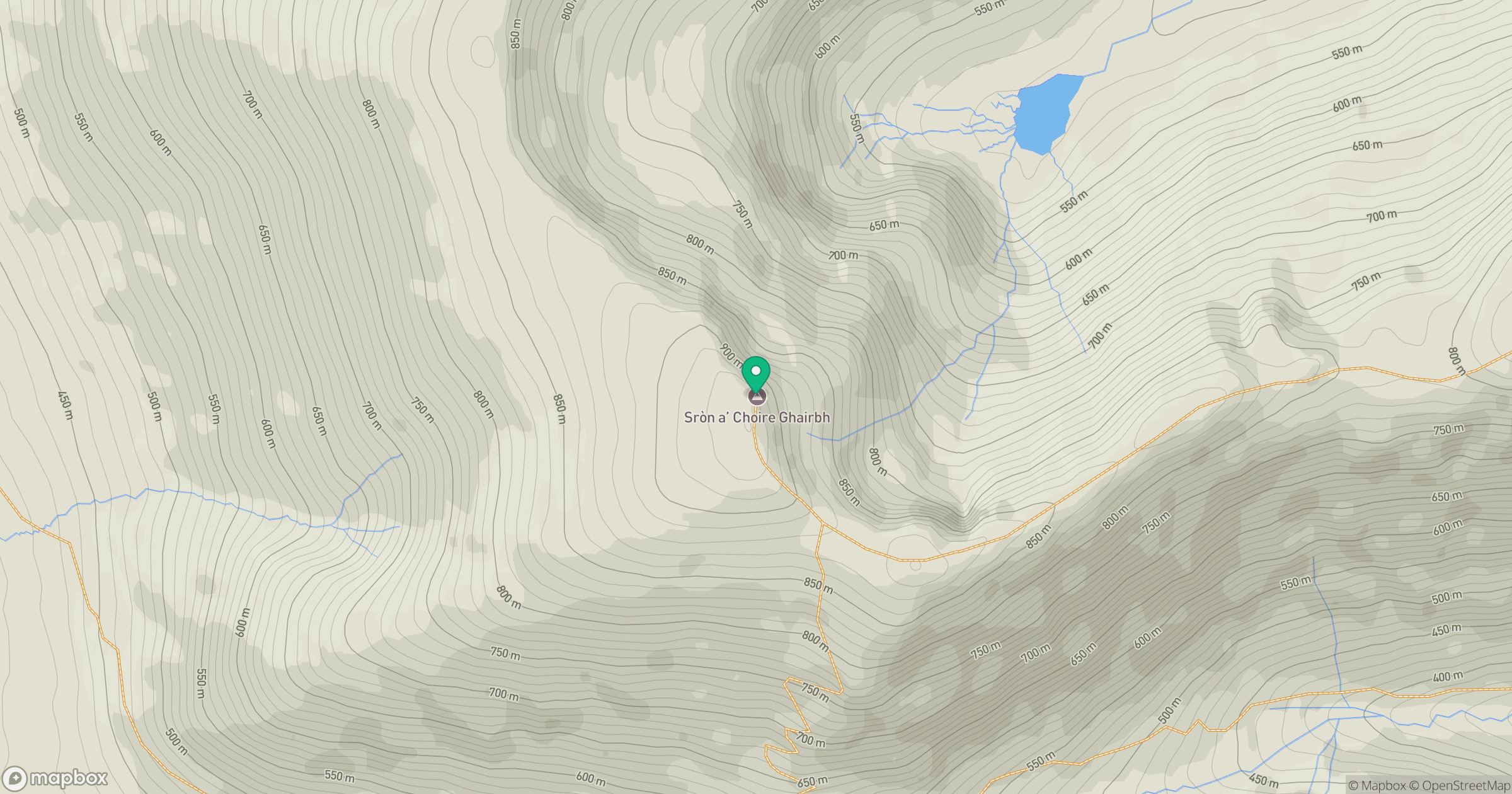
Grid reference: NN222945
View on OpenStreetMapOpens a map in a new tab, centred on the hill.
Nearby Hills
Aonach Mor
1,220m
Stob Choire Claurigh
1,177m
Aonach Beag
1,234m
Carn Mor Dearg
1,221m
Stob Ban
977m
No comments yet. Be the first.