

South Hessary Tor
Good walks are even better shared.
SX5972 : Ivybridge Lane
Derek Harper Photo source
Overview
South Hessary Tor
Overview
Nestled in the heart of Dartmoor, South Hessary Tor stands as a testament to the wild beauty of the moorlands. At an elevation of 415 metres, it is not the highest peak in the area, but it offers breathtaking vistas that make the hike well worth the effort.
Geology
The granite that composes South Hessary Tor has been here for thousands of years, shaped by the elements into fascinating formations and boulders that catch the eye. This granite is part of the Dartmoor granite formation, one of the defining geological features of South Devon.
Routes
Two popular routes lead to the summit:
- Cadover Bridge to South Hessary Tor: This route of 5.5 km is moderately challenging and leads you through a delightful mix of moorland flora.
- Moorland Walk from Drizzlecombe: A 7 km adventure, this route offers a longer trek across the beautiful Dartmoor landscape.
Summit Features
Upon reaching the summit, hikers are greeted with a delightful granite cairn. It's a perfect spot for a break or a photo op. You might even feel like a true explorer surveying your domain!
Terrain Type
Expect a mix of rocky paths with grassy patches, and watch out for some boggy bits, especially after a good rain. A waterproof pair of boots is recommended!
Views
The summit rewards efforts with stunning views over the Dartmoor landscape. You can see Haytor and even catch a glimpse of the South Hams on a clear day. Spring and autumn are prime times for spectacular viewpoints.
Hazards
Dartmoor’s weather is infamous for its unpredictability, so be prepared! Visibility can drop quickly, and some paths may be waterlogged. Always check forecasts before heading out.
Nearby Summits
If you're feeling adventurous, consider climbing nearby Hessary Tor or Great Mis Tor, both of which add a bit of height and variety to your Dartmoor experience.
Access
Parking is available at Cadover Bridge—great for getting your hike started promptly. Public transport is available from nearby towns, though a bit of hiking will get you to the starting point.
Facilities
After your hike, you can find cafes and shops in Ivybridge to refuel and refresh. After all, no adventurer wants a hangry hike!
History
The name 'Hessary' derives from an old term referencing rocky hills, fitting for a tor like this. South Hessary Tor holds its place in Dartmoor folklore and tradition, making it a culturally significant landmark.
In summary, South Hessary Tor is an accessible yet rewarding destination for anyone seeking the beauty of Dartmoor's wilds. Remember to pack yoursense of adventure and, perhaps, a cheeky snack or two!
Explore routes near South Hessary Tor
Walks starting near this hill. Open a route to check its map, distance and full itinerary.
Cotehele: Danescombe Valley and Mining Heritage Circuit
View route
Moretonhampstead to Lustleigh: Wray Valley woodland railway trail
View route
Castle Drogo and Fingle Bridge: Teign Gorge woodland circuit
View route
Cookworthy Woods Level 2 walk
View route
Route planning notes
These notes describe possible approaches. Check a route's map and access information when planning your walk.
Cadover Bridge to South Hessary Tor
A popular route starting at Cadover Bridge, this ascent takes you through gorse and heather, offering lovely Dartmoor scenery.
Moorland Walk from Drizzlecombe
A slightly longer trek that leads you over undulating moorland with wonderful vistas on the way to the summit.
Make a day of it, together
Find someone to share the walk with, or organise a day out along a route you like.
Photo Gallery
View all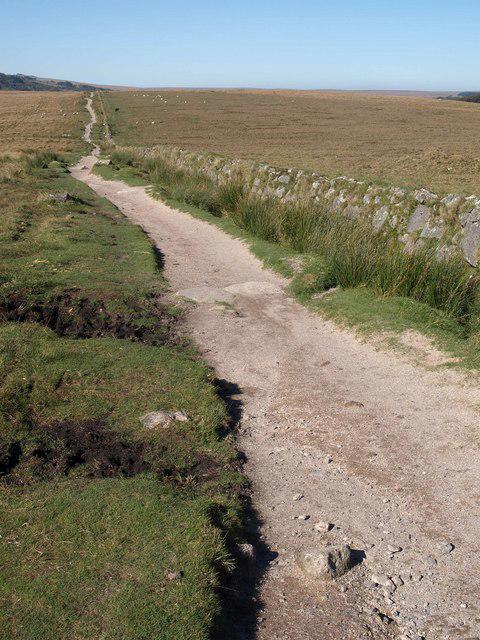 Photo could not load
SX5972 : Ivybridge Lane
Derek Harper
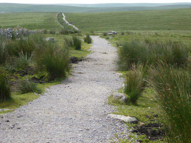 Photo could not load
SX5972 : Path running south from South Hessary Tor
David Smith
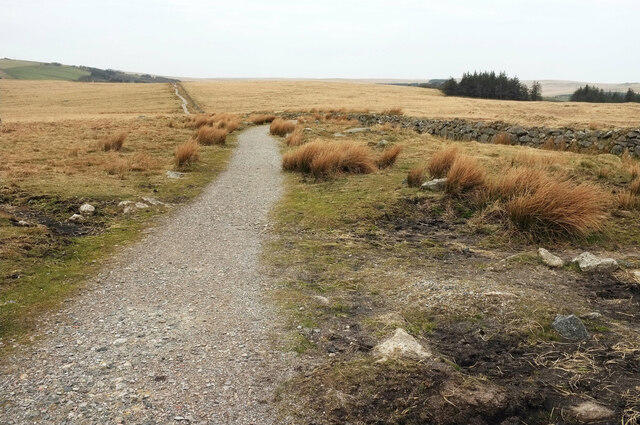 Photo could not load
SX5972 : Bridleway to Princetown
Derek Harper
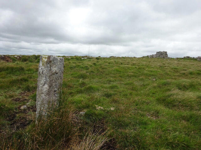 Photo could not load
SX5972 : Plymouth Water Works Boundary Stone
Mr Red
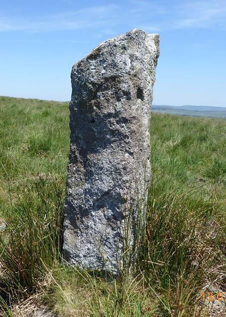 Photo could not load
SX5972 : Old Boundary Marker by South Hessary Tor, Walkhampton Parish
John Glew
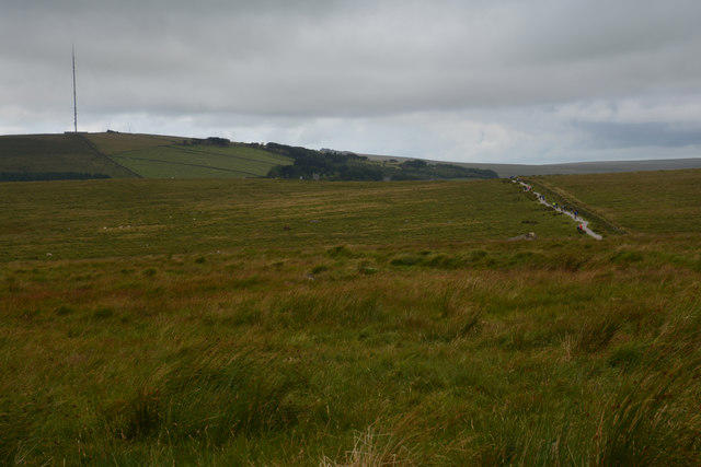 Photo could not load
SX5972 : West Devon : Dartmoor Scenery
Lewis Clarke
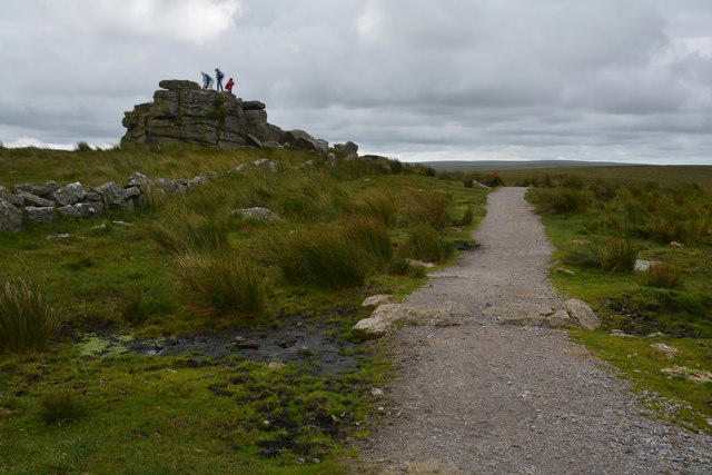 Photo could not load
SX5972 : West Devon : Ivybridge Lane
Lewis Clarke
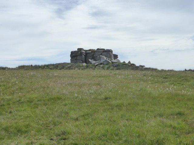 Photo could not load
SX5972 : Bog cotton and granite outcrop, South Hessary Tor
David Smith
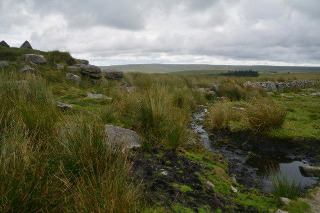 Photo could not load
SX5972 : West Devon : Dartmoor Scenery
Lewis Clarke
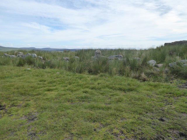
SX5972 : Boundary stone on South Hessary Tor
David Smith
Hill facts and local notes
Classifications
Elevation
454m
1,490 ft
Prominence
35m
Coordinates
50.5341, -3.9809
SX597723
OS Map
191
Explorer: OL28S
At the Summit
The summit features a prominent granite cairn, providing a great spot for a photo or to rest your weary legs. The views from here are one to write home about!
Terrain & Geology
The summit of South Hessary Tor is predominantly composed of granite, typical of Dartmoor. The tor features fascinating rock formations shaped by millennia of erosion, giving it a rugged beauty that photographers love.
Views & Scenery
From the summit, you can see across Dartmoor to iconic landmarks such as the granite outcrops of Haytor, and on a clear day, the expanse of the South Hams, all the way to the coast.
History & Heritage
Name Origin
The name 'Hessary' is believed to come from an old word referring to a rocky crag or hill.
Historical Significance
South Hessary Tor has been a part of Dartmoor's rich cultural tapestry, where tales of folklore and Dartmoor ponies intermingle with the landscape.
Getting There & Facilities
Parking
Cadover Bridge car park, which has space for several cars and is located a short walk away from the trailhead.
Public Transport
Buses from Plymouth can drop you off at the nearest villages, with a bit of a trek to get to the start of your adventure.
Nearby Facilities
While the summit itself is devoid of facilities, nearby in Ivybridge you can find cafes, shops, and public toilets, perfect for a post-hike treat.
Safety Information
Known Hazards
- Be mindful of sudden weather changes typical of Dartmoor, which can affect visibility. Some areas may also be boggy, especially after rain.
General Safety Tips
- Check weather conditions before setting out
- Carry appropriate clothing and equipment
- Let someone know your planned route
- Take a map, compass, and GPS device
- Carry emergency supplies: food, water, first aid kit, torch
Hills
Some common questions about the hills answered
Are there group walks up South Hessary Tor?
Many walkers use Walkmates to join or organise walks with others. You can check for group walks around South Hessary Tor through the maps
Are there other walkers around South Hessary Tor?
Activity varies by location and time, but Walkmates lets you see whether others have shared walks or shown interest in this area. Find other people through the walking friends search walking friends for South Hessary Tor search or of course create your own walk for South Hessary Tor
Can I organise a walk to South Hessary Tor?
Yes. If there aren’t any walks listed already, you can create a walk and make it available for others to join.
If you're signed up to Walkmates, you can create a walk to South Hessary Tor.
How do I find a walk up this hill?
There are often multiple ways to walk this hill, depending on experience and route preference. Walkmates helps you explore walks and routes that others have shared.
Can I suggest a new route up South Hessary Tor?
Yes. You can suggest or create routes to share with others. Walkmates focuses on the social side of walking, so routes are used to help people organise walks and explore areas together, rather than as detailed navigation tools or route libraries.
Other uses really appreciate knowledgeable walkers sharing their routes. Share your favourite route to South Hessary Tor here
The is an error or something incorrect about this hill. How do I let you know?
We always strive to keep the information on Walkmates as accurate as possible. If you find an error, please let us know through the contact form and we'll aim to correct it as quickly as possible
Community Discussion
Comments
Location
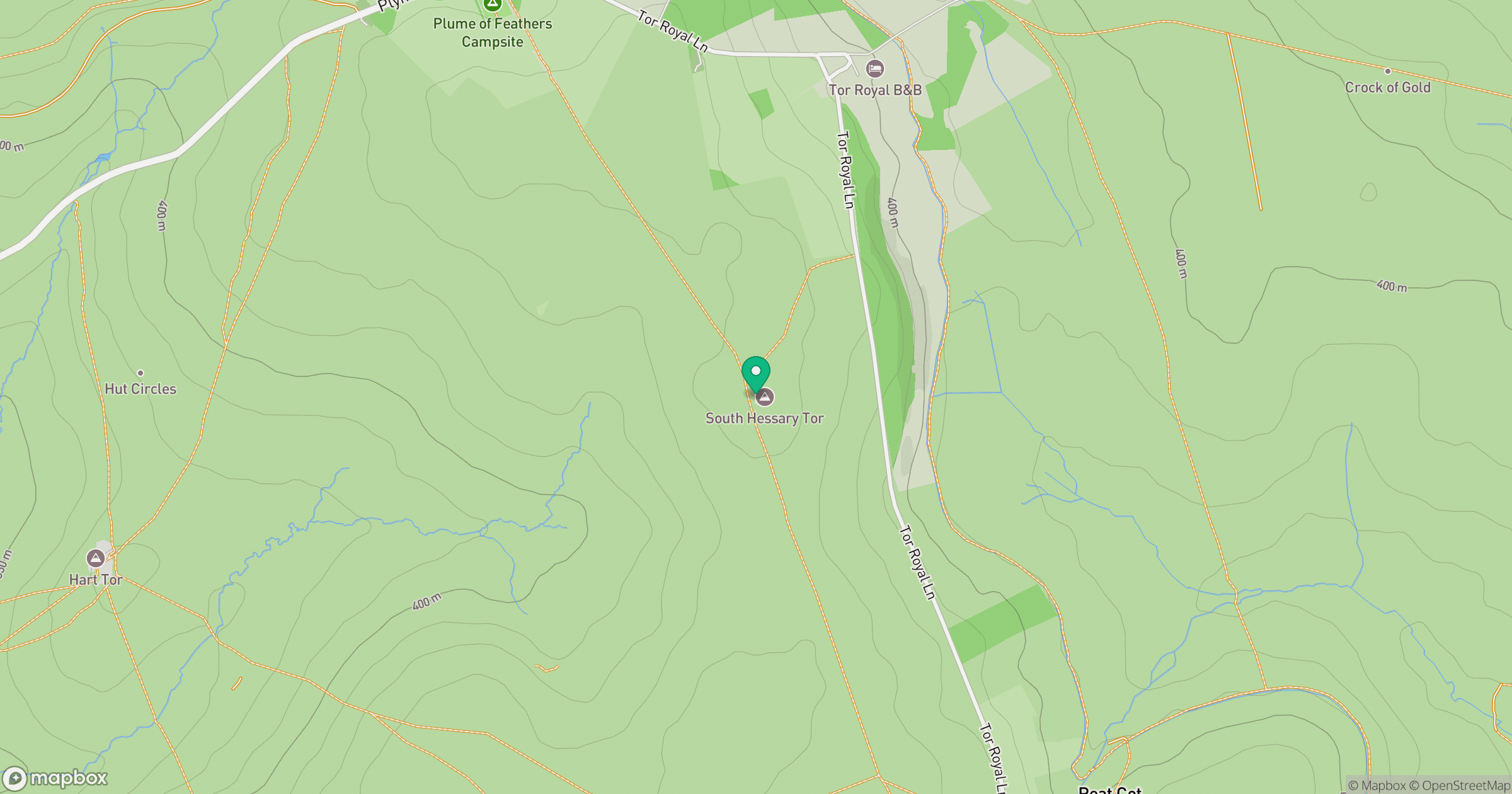
Grid reference: SX597723
View on OpenStreetMapOpens a map in a new tab, centred on the hill.
Nearby Hills

High Willhays
622m

Brent Tor
334m
Brown Willy
420m

Dunkery Beacon
520m
Rhossili Down - The Beacon
193m
No comments yet. Be the first.