

Rippon Tor
Good walks are even better shared.
Overview
Rippon Tor
Overview
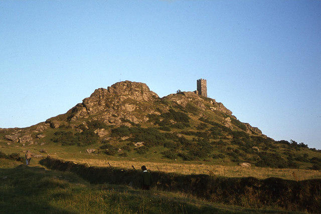
Rippon Tor, standing proudly at 436 meters elevation, is a gem nestled in Dartmoor, just waiting for outdoor enthusiasts to explore its rocky peaks. One might even argue that it’s the rockstar of Dartmoor, sharing its stage with the likes of Haytor and Sharpitor.
Geology
The tor is primarily made of granite, formed during the great geological upheaval known as the Variscan Orogeny. This gives Rippon Tor its distinctive ruggedness, showcasing age-old formations that have stood the test of time. Keep an eye out for those slippery patches—nature’s way of reminding hikers to stay on their toes!
Hiking Routes
For those keen on reaching the summit, the Rippon Tor Circular Walk is the most popular route. Spanning approximately 6.5 km, this moderately challenging path will take you around 2.5 hours to complete. Starting from a nearby car park, you'll be greeted with stunning views and maybe a cheeky grouse or two!
Summit Features
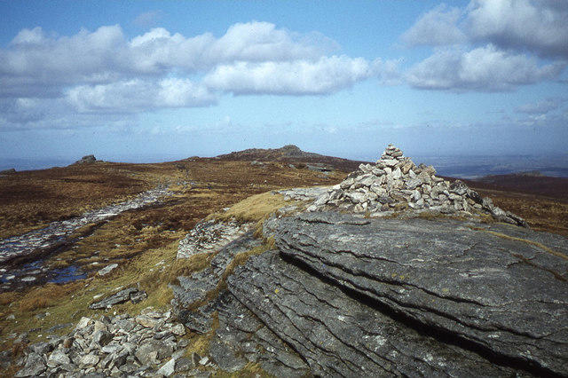
As you reach the top, you will be greeted by impressive granite outcrops, with the summit marked by a quaint stone cairn. The expansive views from Rippon Tor are truly a sight for sore eyes (so bring that camera!).
Terrain
The terrain can be described as rocky with patches of grass, dotted with boggy areas that can sneak up on you if you're not paying attention. Wear sturdy footwear and enjoy the challenge!
Views
Once on top, you can feast your eyes on Dartmoor’s undulating landscape, featuring distant tors and the winding River Dart. The best seasons to appreciate these views are spring and autumn, when the surrounding flora adds splashes of colour and life.
Hazards
Like any adventure on Dartmoor, be prepared for the unexpected. The terrain can vary from rocky to boggy, and the weather can change faster than you can say 'bring the waterproofs'. Always hike with caution and respect the nature around you.
Access
To get to Rippon Tor, park at the small car park near SX724748. The nearby village, Widecombe-in-the-Moor, provides bus services from larger towns. No need for a horse-drawn carriage in this day and age!
Facilities
While you’ll find no shops on the hill, a short jaunt into Widecombe will find you a cafe that serves hot drinks and toilet facilities—a worthy reward after a day in the wild.
Historical Significance
The name 'Rippon Tor' carries a rich history, reflecting its geographical features. It's a cultural hotspot in Dartmoor, making it an essential visit for history buffs as well.
Whether you're a seasoned hiker or just fancy a jaunt in the great outdoors, Rippon Tor is a must-visit destination. Just remember, don’t forget that water bottle—hydration is key!
Explore routes near Rippon Tor
Public walks starting within 80 km of this hill. Nearby does not mean a route reaches the summit; check its map and access before setting out.
Moretonhampstead to Lustleigh: Wray Valley woodland railway trail
View route
Castle Drogo and Fingle Bridge: Teign Gorge woodland circuit
View route
Exeter Canal, Double Locks and Countess Wear river circuit
View route
Drake's Trail: Yelverton to Plymbridge
View route
Route planning notes
These notes describe possible approaches, not verified navigable routes or permission to cross land. Check current paths, local access rules and conditions before setting out.
Rippon Tor Circular Walk
A scenic circular route starting from the nearby car park, leading to the summit and back through beautiful Dartmoor scenery.
Make a day of it, together
Find someone to share the walk with, or organise a day out along a route you like.
Photo Gallery
View all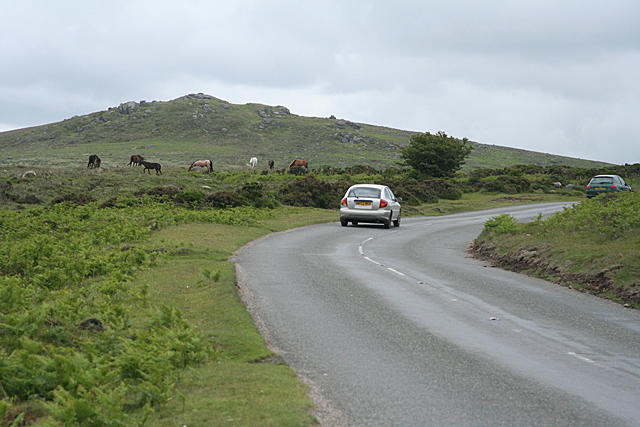 Photo could not load
SX7475 : Ilsington: towards Rippon Tor
Martin Bodman
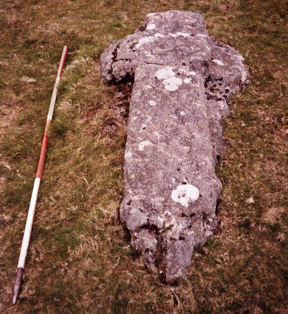 Photo could not load
SX7475 : Rippon Tor Cross
Sandy Gerrard
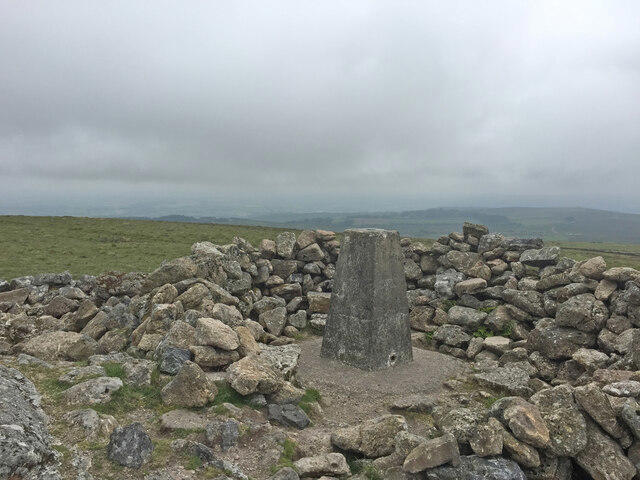 Photo could not load
SX7475 : Rippon Tor Trig Point Flush Bracket S3457
thejackrustles
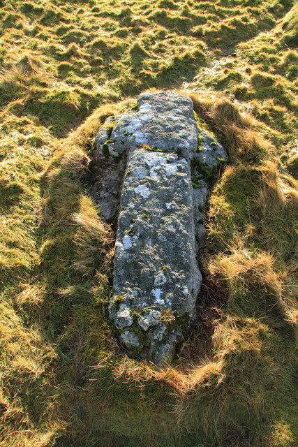 Photo could not load
SX7475 : Rippon Tor cross
Guy Wareham
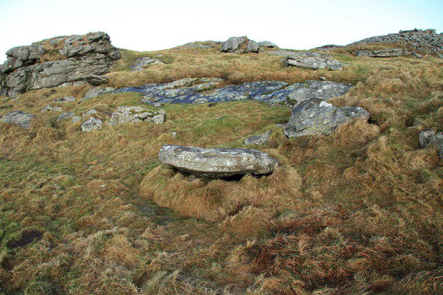 Photo could not load
SX7475 : Circular stone on Rippon Tor
Guy Wareham
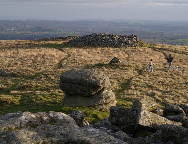 Photo could not load
SX7475 : Kite-flying among the cairns on Rippon Tor
Derek Harper
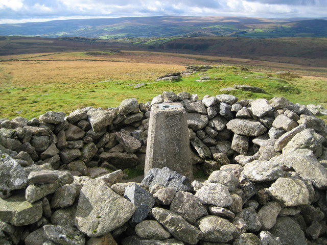 Photo could not load
SX7475 : Dartmoor: Rippon Tor Triangulation Pillar
Nigel Cox
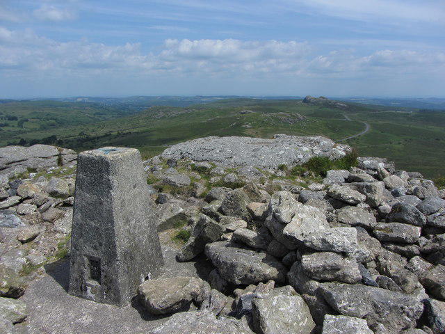 Photo could not load
SX7475 : View from Rippon Tor to Saddle Tor and Haytor Rocks
Gareth James
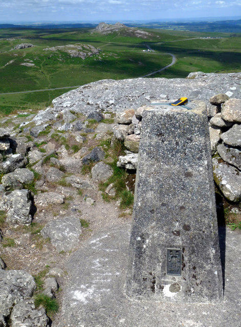 Photo could not load
SX7475 : GPS check on Trigpoint S3457, Rippon Tor, Dartmoor
Sloop John B
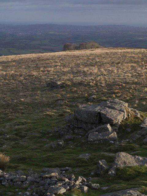
SX7475 : On Rippon Tor
Derek Harper
Hill facts and local notes
Classifications
Elevation
476m
1,562 ft
Prominence
118m
Coordinates
50.5664, -3.7712
SX746755
OS Map
191
Explorer: OL28N OL28S
At the Summit
The summit features a large granite outcrop offering a perfect vantage point. There is a small stone cairn marking the top, alongside impressive views in all directions.
Terrain & Geology
Rippon Tor is primarily composed of granite, which was formed during the Variscan Orogeny. Its rugged landscape showcases typical Dartmoor tors with vast expanses of peat and heathland.
Views & Scenery
From the summit, you can see the expansive Dartmoor landscape stretching out, including distant tors and landmarks such as Haytor and the River Dart.
History & Heritage
Name Origin
The name 'Rippon' is derived from the Old English word for 'ridge', while 'Tor' refers to a hill or rocky peak. Quite fitting for a rocky outcrop, wouldn’t you say?
Historical Significance
Rippon Tor has been significant to the local community and visitors for its scenic beauty and as a hiking destination within the Dartmoor National Park.
Getting There & Facilities
Check current local access restrictions, parking rules and transport timetables before travelling. These notes do not confirm public access to the summit.
Parking
There is a small car park at the entrance of the Dartmoor National Park near SX724748, providing direct access to the trails leading to Rippon Tor.
Public Transport
The nearest public transport links are available in the village of Widecombe-in-the-Moor, with bus services connecting to Bovey Tracey and Newton Abbot.
Nearby Facilities
Facilities are limited. The nearest cafe and toilets can be found in Widecombe-in-the-Moor, about 5 km away from the parking area.
Safety Information
Known Hazards
- Uneven rocky terrain, potential for sudden weather changes, and areas of boggy ground can pose a risk. Hikers should be prepared for Dartmoor's swiftly changing conditions.
General Safety Tips
- Check weather conditions before setting out
- Carry appropriate clothing and equipment
- Let someone know your planned route
- Take a map, compass, and GPS device
- Carry emergency supplies: food, water, first aid kit, torch
Hills
Some common questions about the hills answered
Are there group walks up Rippon Tor?
Many walkers use Walkmates to join or organise walks with others. You can check for group walks around Rippon Tor through the maps
Are there other walkers around Rippon Tor?
Activity varies by location and time, but Walkmates lets you see whether others have shared walks or shown interest in this area. Find other people through the walking friends search walking friends for Rippon Tor search or of course create your own walk for Rippon Tor
Can I organise a walk to Rippon Tor?
Yes. If there aren’t any walks listed already, you can create a walk and make it available for others to join.
If you're signed up to Walkmates, you can create a walk to Rippon Tor.
How do I find a walk up this hill?
There are often multiple ways to walk this hill, depending on experience and route preference. Walkmates helps you explore walks and routes that others have shared.
Can I suggest a new route up Rippon Tor?
Yes. You can suggest or create routes to share with others. Walkmates focuses on the social side of walking, so routes are used to help people organise walks and explore areas together, rather than as detailed navigation tools or route libraries.
Other uses really appreciate knowledgeable walkers sharing their routes. Share your favourite route to Rippon Tor here
The is an error or something incorrect about this hill. How do I let you know?
We always strive to keep the information on Walkmates as accurate as possible. If you find an error, please let us know through the contact form and we'll aim to correct it as quickly as possible
Community Discussion
Comments
Location
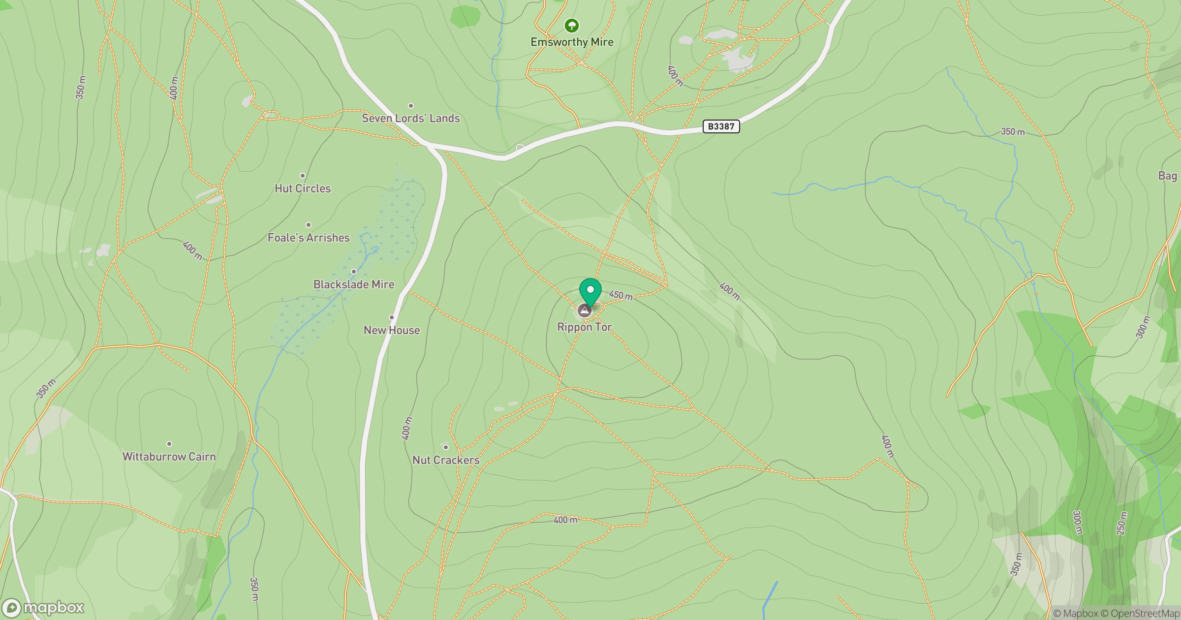
Grid reference: SX746755
View on OpenStreetMapOpens a map in a new tab, centred on the hill.
Hills within 30 km
Straight-line distance, not a walking route or confirmation of access.
No comments yet. Be the first.