

Slieveacarnane
Good walks are even better shared.
Overview
Slieveacarnane: A Hidden Gem in the Mourne Mountains
Nestled in the heart of the Western Mourne Mountains, Slieveacarnane may not be the highest peak, but it certainly packs a punch when it comes to breathtaking views and a robust hiking experience. At an elevation of 530 meters, this Hewitt stands out with its rugged terrain and stunning vistas.
Geology
Slieveacarnane's geological composition is dominated by granite, shaped by ancient volcanic activity and centuries of glacial erosion. As you ascend, take a moment to admire the outcrops and the sheer cliffs that tell tales of Earth's history. It’s like nature’s own version of a geology textbook—but much more interesting and without the homework!
Routes
The most popular route is undoubtedly the Mourne Wall Route, which not only guides you to Slieveacarnane's peak but also offers the chance to walk along the historic Mourne Wall. The 8 km trek may take roughly 3.5 hours, depending on your pace and the number of photos you take of the stunning landscape.
Summit Features
At the summit, you will find a sizeable stone cairn and a trig point, perfect for those Instagram-worthy shots. Don’t forget to give a hearty wave to Slieve Donard in the distance; it is watching you!
Terrain
The journey is not without its challenges. The rocky terrain can be unforgiving, especially in rainy weather, so don’t forget sturdy boots and perhaps some grumbling about the weather. Your knees will thank you for it later!
Views
When the clouds part, and the sun shines through, the views from Slieveacarnane are nothing short of spectacular. Gaze upon the Mourne Mountains' ridges, the shimmering Irish Sea, and, on particularly clear days, the Isle of Man might even wave back at you from a distance! Early autumn and spring are ideal times for enjoying these vistas.
Hazards
As you embark on your adventure, remember to be mindful of loose rocks and the unpredictable weather that can surprise even the most seasoned hiker. A light drizzle can quickly turn into a slippery challenge, so keep an eye on the weather forecast!
Access
To get there, park at the Carrick Little car park. It’s popular, so consider arriving early to snag a spot! The nearest town, Newcastle, offers some amenities and a charming place to grab a post-hike treat.
Facilities
In the surrounding area, you'll find cafes and public toilets in Newcastle, ensuring you can refuel post-adventure.
History
The name 'Slieveacarnane' reflects its history, translating literally to 'mountain of the cairn,' a fitting tribute to the stone structure marking its summit. Its presence in the scenic Mourne Mountains is significant both culturally and naturally, woven into the fabric of local legend.
In conclusion, a hike up Slieveacarnane not only offers a physical challenge but also an opportunity to connect with the breathtaking beauty and history of the Mourne Mountains. So lace up those boots and enjoy!
Happy hiking!
Explore routes near Slieveacarnane
Public walks starting within 80 km of this hill. Nearby does not mean a route reaches the summit; check its map and access before setting out.
Silent Valley to Ben Crom Dam: Reservoir Road Walk, County Down
View route
Tollymore Forest Park: Mountain and Drinns Trail
View route
Tollymore Forest Park: River Trail near Newcastle
View route
Scarva to Poyntzpass: Newry Canal and Lough Shark Return
View route
Route planning notes
These notes describe possible approaches, not verified navigable routes or permission to cross land. Check current paths, local access rules and conditions before setting out.
Mourne Wall Route
This classic route starts from the car park at Carrick Little and follows the iconic Mourne Wall before ascending Slieveacarnane. Stunning views accompanied by the challenge of navigating rocky terrain make this route a favourite among hikers.
Make a day of it, together
Find someone to share the walk with, or organise a day out along a route you like.
Photo Gallery
View all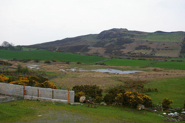 Photo could not load
J1524 : Slieveacarnane
David Crozier
Hill facts and local notes
Classifications
Elevation
296m
971 ft
Prominence
117m
Coordinates
54.1539, -6.2313
J156242
OS Map
29
At the Summit
The summit features a large stone cairn and a well-preserved trig point, providing perfect photo opportunities and a place to catch your breath while taking in the views.
Terrain & Geology
Slieveacarnane is primarily composed of granitic intrusions typical of the Mourne Mountains, with evidence of glacial sculpting evident in its rugged features and steep slopes. The cliffs and rock formations provide a fascinating insight into the mountain's geological history.
Views & Scenery
From the summit, you can enjoy panoramic views of the Mourne Mountains, the Irish Sea, and on clear days, the distant outline of the Isle of Man on the horizon.
History & Heritage
Name Origin
The name 'Slieveacarnane' translates to 'mountain of the cairn', highlighting the significance of the cairn at its summit.
Historical Significance
This mountain is part of the lush Mourne Mountains, which have a rich history intertwined with Irish folklore.
Getting There & Facilities
Check current local access restrictions, parking rules and transport timetables before travelling. These notes do not confirm public access to the summit.
Parking
The nearest parking is at the Carrick Little car park, which is accessible via the A1 road. It's a small but popular car park, so arrive early to secure a spot.
Public Transport
Public transport options are limited. The nearest bus stop is in Newcastle, roughly 8 km away. You may need to rely on taxis or private transport to reach the starting point.
Nearby Facilities
Nearby facilities include cafes in Newcastle, public toilets, and various accommodation options should you wish to linger longer in the area.
Safety Information
Known Hazards
- Loose rocks underfoot, potential for rapidly changing weather conditions, and mist can obscure visibility on the mountain.
General Safety Tips
- Check weather conditions before setting out
- Carry appropriate clothing and equipment
- Let someone know your planned route
- Take a map, compass, and GPS device
- Carry emergency supplies: food, water, first aid kit, torch
Hills
Some common questions about the hills answered
Are there group walks up Slieveacarnane?
Many walkers use Walkmates to join or organise walks with others. You can check for group walks around Slieveacarnane through the maps
Are there other walkers around Slieveacarnane?
Activity varies by location and time, but Walkmates lets you see whether others have shared walks or shown interest in this area. Find other people through the walking friends search walking friends for Slieveacarnane search or of course create your own walk for Slieveacarnane
Can I organise a walk to Slieveacarnane?
Yes. If there aren’t any walks listed already, you can create a walk and make it available for others to join.
If you're signed up to Walkmates, you can create a walk to Slieveacarnane.
How do I find a walk up this hill?
There are often multiple ways to walk this hill, depending on experience and route preference. Walkmates helps you explore walks and routes that others have shared.
Can I suggest a new route up Slieveacarnane?
Yes. You can suggest or create routes to share with others. Walkmates focuses on the social side of walking, so routes are used to help people organise walks and explore areas together, rather than as detailed navigation tools or route libraries.
Other uses really appreciate knowledgeable walkers sharing their routes. Share your favourite route to Slieveacarnane here
The is an error or something incorrect about this hill. How do I let you know?
We always strive to keep the information on Walkmates as accurate as possible. If you find an error, please let us know through the contact form and we'll aim to correct it as quickly as possible
Community Discussion
Comments
Location
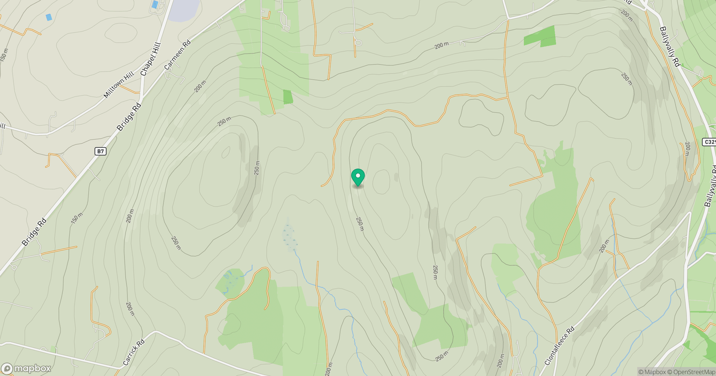
Grid reference: J156242
View on OpenStreetMapOpens a map in a new tab, centred on the hill.
Hills within 30 km
Straight-line distance, not a walking route or confirmation of access.
No comments yet. Be the first.