

Sgurr Eilde Mor
Good walks are even better shared.
NN2365 : Boulders on south-east ridge of Sgùrr Eilde Mòr
Trevor Littlewood Photo source
Overview
Sgurr Eilde Mor: The Peak of Great Adventure
Overview
Sgurr Eilde Mor, standing tall at 1026 meters, is a majestic Munro nestled in the heart of the Scottish Highlands. Its striking granite outcrops and awe-inspiring vistas make it a must-visit for hikers and mountain lovers alike.
Geology
This mountain is primarily crafted from granite, interspersed with slates and schists, a testament to the area's turbulent geological history. The landscape shows signs of glacial activity, with corries carved into its sides and rugged cliffs that create a dramatic backdrop.
Routes
One of the most popular routes starts at Loch Eilde Mor, covering approximately 8.5 km in about 5 hours. This moderate trail lures hikers with its picturesque landscapes and well-defined paths. For those seeking a bit more thrill, the Coire Eilde route offers a challenging ascent with stunning views of the Coire itself.
Summit Features
Reaching the summit rewards hikers with a sense of accomplishment and a stunning cairn framing the sweeping views. Don’t forget to pause at the trig point for that classic pic to show the world you made it!
Terrain
The terrain ranges from rocky underfoot to grassy slopes adorned with patches of heather, which soften the hike’s challenge. Expect some steep scree, particularly near the summit, so sturdy footwear is advised.
Views
The views from Sgurr Eilde Mor are nothing short of breathtaking! Majestic sights include the Aonach Eagach ridge, and on a clear day, even Ben Nevis makes an appearance. Late spring to early autumn is the ideal season for those picturesque panoramas, but take care; the Highlands are notorious for their capricious weather!
Hazards
Be mindful of loose rocks in steeper areas and always prepare for a sudden change in the weather. It’s the Highlands, after all! A well-packed rucksack is your best friend.
Nearby Summits
Take the opportunity to explore neighboring peaks like Sgurr Eilde Beag and Chno Dearg, each offering its unique charm and challenging routes.
Access
The best access point is the small parking area at Loch Eilde Mor. For those relying on public transport, a bus to Kinlochleven followed by a short taxi ride will do the trick.
Facilities
While you're out exploring, don’t forget Kinlochleven! The village boasts a few cafes and a pub to sate that post-hike hunger, not to mention the much-needed loos.
History
Sgurr Eilde Mor’s name speaks volumes and translates as 'peak of the great snare', a nod perhaps to its unpredictable weather. This mountain is deeply woven into the local culture and natural heritage of the Highlands, attracting outdoor enthusiasts for generations.
Conclusion
So gear up, lace your boots, and set off on an adventure to Sgurr Eilde Mor. Just remember to enjoy the journey as much as the destination, because every hike tells a story.
Explore routes near Sgurr Eilde Mor
Walks starting near this hill. Open a route to check its map, distance and full itinerary.
Ben Nevis via Mountain Path
View route
Banavie to Glen Loy Aqueduct: Neptune’s Staircase Canal Towpath
View route
Fort Augustus to Kytra Lock: Caledonian Canal Towpath
View route
Killin: Falls of Dochart, Finlarig and Moirlanich Longhouse
View route
Route planning notes
These notes describe possible approaches. Check a route's map and access information when planning your walk.
Normal Route from Loch Eilde Mor
A scenic ascent that starts at Loch Eilde Mor, following a well-defined path through breathtaking landscapes.
Coire Eilde Route
A more challenging route that approaches from the north, requiring some navigation skills and offering stunning views down into the coire.
Make a day of it, together
Find someone to share the walk with, or organise a day out along a route you like.
Photo Gallery
View all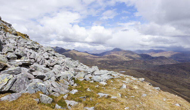 Photo could not load
NN2365 : Boulders on south-east ridge of Sgùrr Eilde Mòr
Trevor Littlewood
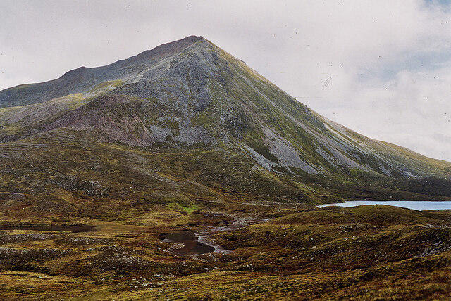 Photo could not load
NN2265 : Sgùrr Eilde Mòr from the west
Nigel Brown
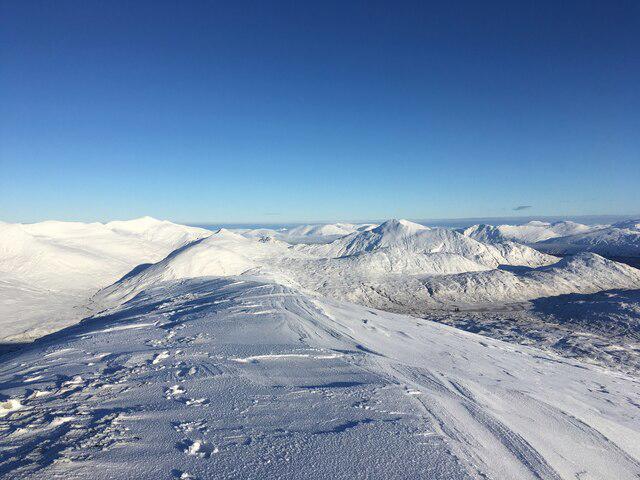 Photo could not load
NN2365 : Summit of Sgurr Eilde Mor
Steven Brown
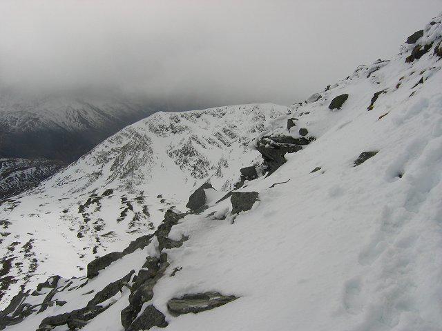 Photo could not load
NN2365 : Sgurr Eilde Mor, South Ridge.
Richard Webb
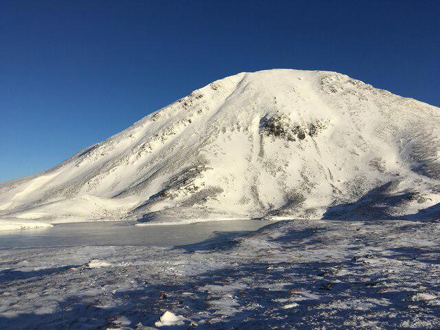 Photo could not load
NN2265 : Sgurr Eilde Mor
Steven Brown
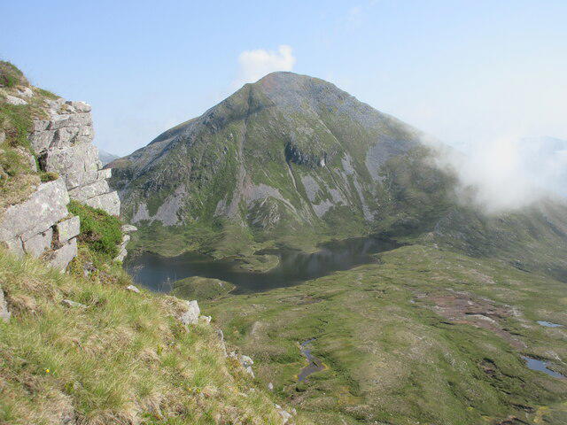 Photo could not load
NN2265 : Sgurr Eilde Mór from the south-west
Scott Cormie
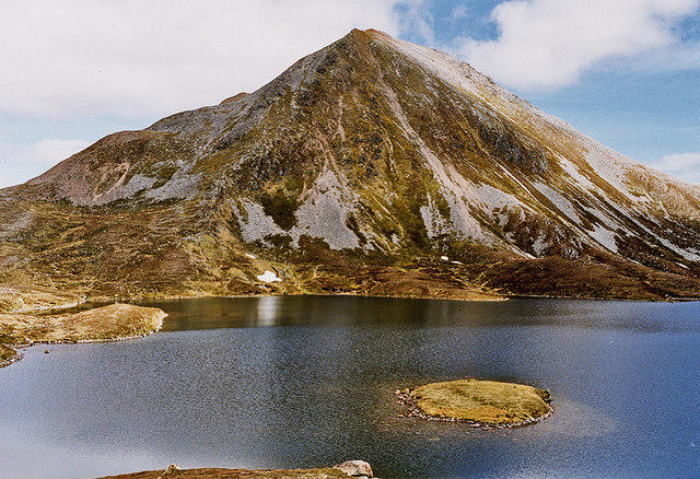 Photo could not load
NN2265 : Sgùrr Eilde Mòr from Coire an Lochain
Nigel Brown
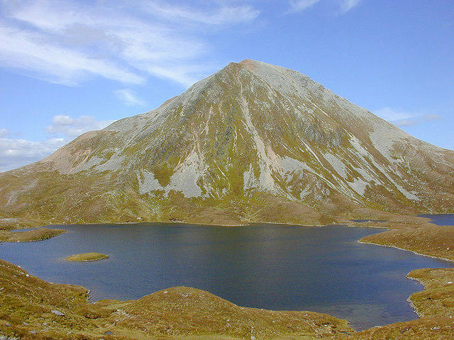 Photo could not load
NN2265 : Sgùrr Eilde Mòr
Nigel Brown
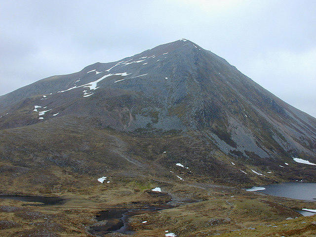 Photo could not load
NN2265 : Sgùrr Eilde Mòr from the west
Nigel Brown
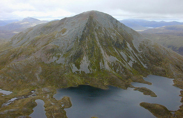
NN2265 : Sgurr Eilde Mòr
Nigel Brown
Hill facts and local notes
Classifications
Elevation
1,010m
3,314 ft
Prominence
271m
Coordinates
56.7500, -4.8954
NN230657
OS Map
41
Explorer: 392
At the Summit
The summit features a small cairn and a trig point, marking its status as a Munro. It also offers ample space for a well-deserved rest and a picnic.
Terrain & Geology
Sgurr Eilde Mor is primarily composed of granite, with slates and schists in its lower reaches. Its rugged topography has been sculpted by glacial actions, creating dramatic cliffs and beautiful corries.
Views & Scenery
From the summit, one can enjoy stunning views of the surrounding peaks, including the Aonach Eagach ridge and the mighty Ben Nevis in the distance, assuming the weather is kind.
History & Heritage
Name Origin
The name 'Sgurr Eilde Mor' translates from Gaelic to 'peak of the great snare' – arguably a reference to the tricky weather or perhaps the snares set for unsuspecting hikers!
Historical Significance
The mountain is known for its rich natural heritage, being part of the diverse ecosystems of the Highlands. It has attracted adventurous souls seeking its rugged beauty for centuries.
Getting There & Facilities
Parking
A parking area is available at the end of the road near the eastern end of Loch Eilde Mor, with space for about 6-8 cars.
Public Transport
The nearest public transport options include bus services from Fort William to Kinlochleven, followed by a short taxi ride.
Nearby Facilities
Facilities are available in Kinlochleven, including a few cafes, a pub, and public toilets, ideal for a pre or post-hike refreshment.
Safety Information
Known Hazards
- Watch out for loose rocks on steeper sections, and remain vigilant for changing weather conditions typical of the Highlands.
General Safety Tips
- Check weather conditions before setting out
- Carry appropriate clothing and equipment
- Let someone know your planned route
- Take a map, compass, and GPS device
- Carry emergency supplies: food, water, first aid kit, torch
Hills
Some common questions about the hills answered
Are there group walks up Sgurr Eilde Mor?
Many walkers use Walkmates to join or organise walks with others. You can check for group walks around Sgurr Eilde Mor through the maps
Are there other walkers around Sgurr Eilde Mor?
Activity varies by location and time, but Walkmates lets you see whether others have shared walks or shown interest in this area. Find other people through the walking friends search walking friends for Sgurr Eilde Mor search or of course create your own walk for Sgurr Eilde Mor
Can I organise a walk to Sgurr Eilde Mor?
Yes. If there aren’t any walks listed already, you can create a walk and make it available for others to join.
If you're signed up to Walkmates, you can create a walk to Sgurr Eilde Mor.
How do I find a walk up this hill?
There are often multiple ways to walk this hill, depending on experience and route preference. Walkmates helps you explore walks and routes that others have shared.
Can I suggest a new route up Sgurr Eilde Mor?
Yes. You can suggest or create routes to share with others. Walkmates focuses on the social side of walking, so routes are used to help people organise walks and explore areas together, rather than as detailed navigation tools or route libraries.
Other uses really appreciate knowledgeable walkers sharing their routes. Share your favourite route to Sgurr Eilde Mor here
The is an error or something incorrect about this hill. How do I let you know?
We always strive to keep the information on Walkmates as accurate as possible. If you find an error, please let us know through the contact form and we'll aim to correct it as quickly as possible
Community Discussion
Comments
Location
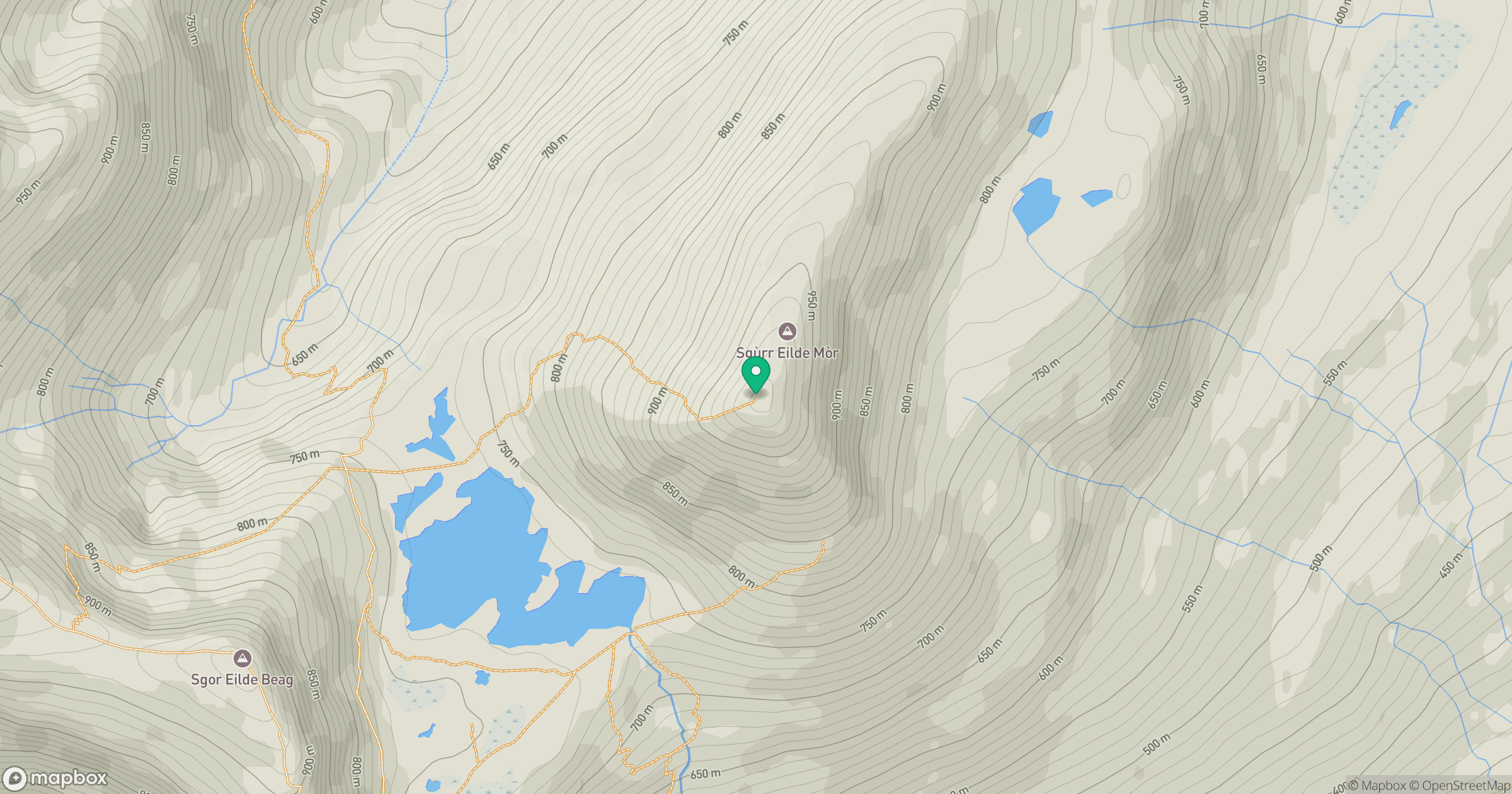
Grid reference: NN230657
View on OpenStreetMapOpens a map in a new tab, centred on the hill.
No comments yet. Be the first.