

Selborne Hill
Good walks are even better shared.
SU7333 : The Silver-washed fritillary on bramble
STEVE POVEY Photo source
Overview
Selborne Hill
Selborne Hill, a charming peak in the South Downs National Park, stands tall at 253 meters. It's a haven for hikers, nature enthusiasts, and those who simply need a break from the hustle of daily life.
Geology
The hill itself is primarily made up of chalk, typical of the South Downs, which means you’ll be trekking through areas rich in biodiversity. Keep an eye out for flint and fossils along the way—perfect for impressing your friends with your newfound geological knowledge!
Routes
Two popular routes offer diverse experiences:
- Selborne Village to Summit: This 3.5km trek starts in the quaint village of Selborne and meanders through woodlands and fields before reaching the summit.
- Hautboy Wood Loop: A 5km circular route that gives hikers a chance to explore local woodlands teeming with wildlife.
Summit Features
Upon reaching the summit, you’ll be greeted by a trig point, a testimony to the British tradition of mapping the land. It’s the perfect spot for a selfie with your hiking buddies.
Terrain Type
The terrain is predominantly grassy, with a few rocky outcrops. It’s fairly easy to navigate, but do watch your step!
Views
From the summit, the views are nothing short of spectacular. On a clear day, you might even catch a glimpse of the Isle of Wight—just don’t forget your binoculars. The best seasons for taking in the sights are spring and early autumn, when the landscapes really come alive.
Hazards
As with most hills, beware of sudden weather changes, as you can find yourself in the thick of it if you aren't vigilant. Paths may be slippery in rainy conditions, and some areas are prone to erosion. Always exercise caution!
Nearby Summits
If you feel particularly adventurous, why not check out nearby Butser Hill, which stands slightly taller at 270 meters? Or Nore Hill, a mere 216 meters away.
Access
Parking is available in Selborne village, about a 500-meter stroll from the starting point of your hike. For those relying on public transport, buses run from Alton to Selborne. Alton is the nearest town, offering further amenities to round off your trip nicely.
Facilities
Before or after your hike, you can indulge in a coffee or cake at one of Selborne’s welcoming cafes, and there are public toilets available for your convenience.
History
The name Selborne means 'hall by the stream,' a testament to its rustic charm. The area is historically significant, notably connected to the naturalist Gilbert White, who called Selborne home and documented its rich ecosystem in his famous writings.
In summary, Selborne Hill offers a delightful blend of natural beauty, historical richness, and a good dose of fresh air—making it an essential hike for outdoor lovers.
Happy hiking!
Explore routes near Selborne Hill
Walks starting near this hill. Open a route to check its map, distance and full itinerary.
Frensham Little Pond and Snowball Ridge Walk
View route
Hinton Ampner: Dutton Estate Woodland and Downland Circuit
View route
Hindhead Sailor's Stroll to Gibbet Hill
View route
Petworth Park: Capability Brown Hills and Lower Pond Circuit
View route
Route planning notes
These notes describe possible approaches. Check a route's map and access information when planning your walk.
Selborne Village to Summit
A pleasant route starting from the picturesque village of Selborne, winding through woodlands and meadows to the summit.
Hautboy Wood Loop
A circular path that offers woodland views and the chance to experience sensitive habitats.
Make a day of it, together
Find someone to share the walk with, or organise a day out along a route you like.
Photo Gallery
View all Photo could not load
SU7333 : The Silver-washed fritillary on bramble
STEVE POVEY
 Photo could not load
SU7333 : Selborne Hill
Colin Smith
Hill facts and local notes
Classifications
Elevation
211m
692 ft
Prominence
53m
Coordinates
51.0923, -0.9497
SU736330
OS Map
186
Explorer: OL33 133
At the Summit
The summit features a prominent trig point that provides an excellent vantage point for panoramic views.
Terrain & Geology
Selborne Hill is primarily composed of chalk, characteristic of the South Downs, which provides a unique ecosystem for various flora and fauna. The area also features exposed flint and fossilised remains.
Views & Scenery
Views of the rolling hills of the South Downs, and on a clear day, the Isle of Wight can be seen in the distance.
History & Heritage
Name Origin
The name Selborne likely derives from the Old English 'sele' meaning 'hall' and 'burn' which means 'stream'.
Historical Significance
Selborne has historical significance due to its connections with the naturalist Gilbert White, who wrote extensively about the flora and fauna of the area.
Getting There & Facilities
Parking
There is a small car park available in Selborne village, approximately 500 meters from the beginning of the trail to the summit.
Public Transport
Buses run from Alton to Selborne, with a short walk to the trailheads.
Nearby Facilities
There are cafes and public toilets in Selborne, providing refreshments before or after your hike.
Safety Information
Known Hazards
- Watch out for sudden changes in weather; the terrain can be slippery when wet, and exposed areas can be prone to erosion.
General Safety Tips
- Check weather conditions before setting out
- Carry appropriate clothing and equipment
- Let someone know your planned route
- Take a map, compass, and GPS device
- Carry emergency supplies: food, water, first aid kit, torch
Hills
Some common questions about the hills answered
Are there group walks up Selborne Hill?
Many walkers use Walkmates to join or organise walks with others. You can check for group walks around Selborne Hill through the maps
Are there other walkers around Selborne Hill?
Activity varies by location and time, but Walkmates lets you see whether others have shared walks or shown interest in this area. Find other people through the walking friends search walking friends for Selborne Hill search or of course create your own walk for Selborne Hill
Can I organise a walk to Selborne Hill?
Yes. If there aren’t any walks listed already, you can create a walk and make it available for others to join.
If you're signed up to Walkmates, you can create a walk to Selborne Hill.
How do I find a walk up this hill?
There are often multiple ways to walk this hill, depending on experience and route preference. Walkmates helps you explore walks and routes that others have shared.
Can I suggest a new route up Selborne Hill?
Yes. You can suggest or create routes to share with others. Walkmates focuses on the social side of walking, so routes are used to help people organise walks and explore areas together, rather than as detailed navigation tools or route libraries.
Other uses really appreciate knowledgeable walkers sharing their routes. Share your favourite route to Selborne Hill here
The is an error or something incorrect about this hill. How do I let you know?
We always strive to keep the information on Walkmates as accurate as possible. If you find an error, please let us know through the contact form and we'll aim to correct it as quickly as possible
Community Discussion
Comments
Location
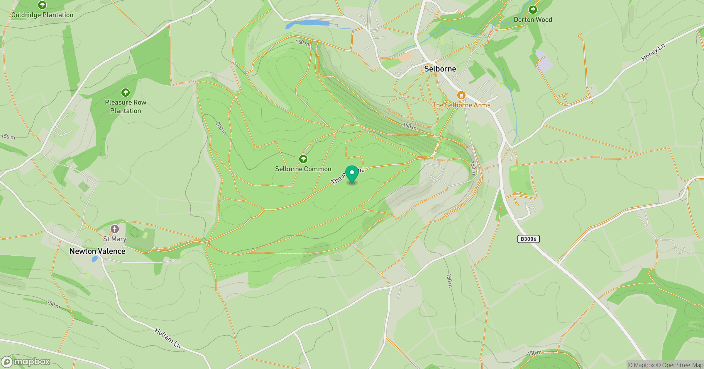
Grid reference: SU736330
View on OpenStreetMapOpens a map in a new tab, centred on the hill.
Nearby Hills
Leith Hill
294m
Ditchling Beacon
248m
Worcestershire Beacon
425m
Glastonbury Tor
158m
Titterstone Clee Hill
533m
No comments yet. Be the first.