

Littleton Down
Good walks are even better shared.
Overview
Littleton Down
Littleton Down may not be the tallest hill in the area, but it’s certainly a charming one! Nestled within the Hampshire Downs, it boasts an elevation of 140 meters and provides a splendid backdrop for any outdoor enthusiast. Whether you’re an avid hiker, a casual walker, or just someone who enjoys a jolly good ramble, you’ll find something to love here.
Geology
The hill is primarily composed of chalk, which has led to the development of rich biodiversity around it. Expect to see a vibrant array of wildflowers in spring, as the flora comes alive, painting the landscape with splashes of colour. Don’t be surprised if you spot a farmer tending to the fields; they surely appreciate the fertile ground here!
Routes
One popular route is the Cromwell’s Hill Trail, a lovely circular walk that starts in the quaint village of Littleton. Covering a distance of 5.1 km, this easy trail leads you through picturesque landscapes bursting with wildlife. It’s perfect for families and anyone looking to stretch their legs without breaking a sweat.
Summit Features
At the summit, the views are quite the reward for your efforts. Standing proud is a grassy knoll, and scattered stone formations that seem to have appeared right out of nature’s magic hat, just waiting for you to explore. Capture a photo or two because the memory will make good conversational fodder at the pub!
Terrain
The terrain is mainly grassy and gentle, suitable for all levels of walkers, though it can be rather soft after rain. So, if you enjoy watching where you step, perhaps avoid the muddy patches!
Views
Once you make it to the top, be ready to be spellbound by the scenery! On clear days, the sight of Winchester Cathedral shines bright against the landscape. The best time to enjoy the views is undoubtedly in spring or summer, when the blooming flowers are as abundant as the bees buzzing around them.
Hazards
Keep an eye out for livestock on the paths; it would be a shame to disturb a cow in its grazing zone. They’re surprisingly judgmental!
Nearby Summits
If you’re feeling adventurous, you might consider an ascent of Broughton Down nearby, standing slightly taller at 176 meters. It’s always good to have a backup adventure in your pocket!
Access
Nearest Parking: Limited roadside parking is available near Littleton village. Just don’t block any driveways – the locals might have a word with you! Alternatively, you can find a spot in the main village car park.
Public Transport: Regular bus services from Winchester make getting here a cinch. Just hop on and enjoy the short journey!
Nearest Town: Winchester, a delightful city steeped in history, is just a stone's throw away.
Facilities
After your excursion, head into Winchester where you’ll find lovely pubs and cafes to refuel. Let’s be honest; nothing quite compares to a well-deserved pint after a day of fresh air!
History
Littleton's name hints at its past - 'little farmstead' feels rather quaint, doesn’t it? The area is also rich with local legends, dating back to the Anglo-Saxon era. Take a moment to appreciate not just the hill, but the history it carries.
In conclusion, Littleton Down might humbly sit among the hills, but it’s a brilliant spot for those looking for a peaceful escape into nature, combined with stunning views and a dash of history. Why not lace up those boots and pay a visit? You never know what stories you might bring back!
Explore routes near Littleton Down
Public walks starting within 80 km of this hill. Nearby does not mean a route reaches the summit; check its map and access before setting out.
Petworth Walk with Men Walking & Talking
View route
Petworth Park: Capability Brown Hills and Lower Pond Circuit
View route
Bognor Regis Walk with Men Walking & Talking
View route
Bognor Regis Walk & Talk
View route
Route planning notes
These notes describe possible approaches, not verified navigable routes or permission to cross land. Check current paths, local access rules and conditions before setting out.
Cromwell’s Hill Trail
A pleasant circular route that begins at Littleton and takes you through picturesque fields and woodlands before looping back.
Make a day of it, together
Find someone to share the walk with, or organise a day out along a route you like.
Photo Gallery
View all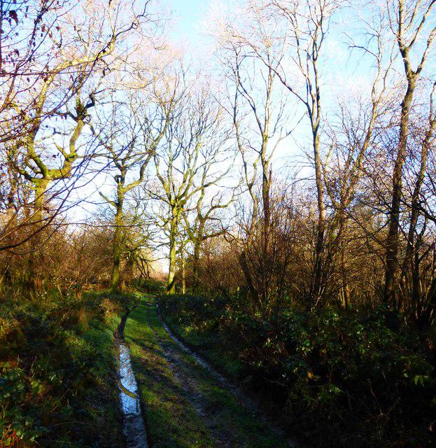 Photo could not load
SU9415 : The bridleway through Crown Tegleaze from Upwaltham
Shazz
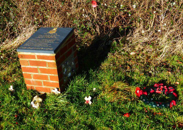 Photo could not load
SU9414 : Memorial on North Down
Shazz
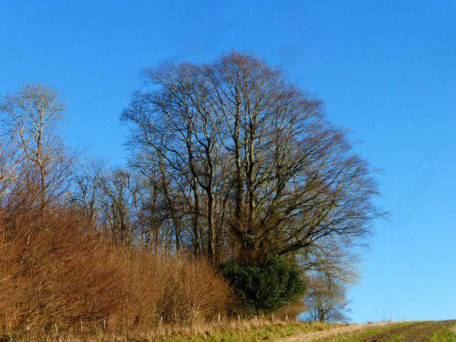 Photo could not load
SU9414 : Large tree on top of North Down
Shazz
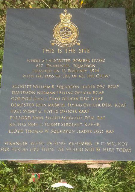 Photo could not load
SU9414 : Memorial at the crash site of a Lancaster Bomber
Chris Thomas-Atkin
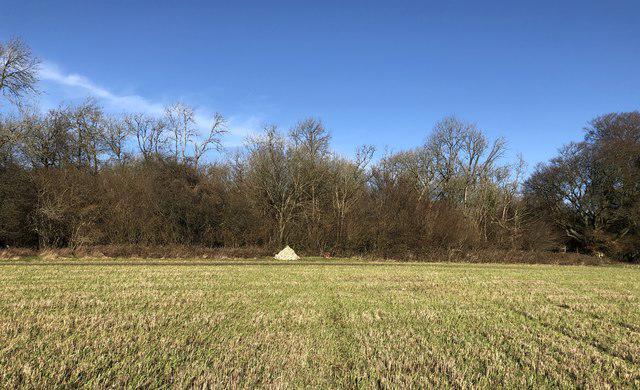 Photo could not load
SU9414 : Highs and Lows
Chris Thomas-Atkin
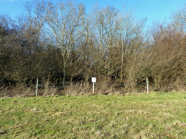 Photo could not load
SU9414 : Site of Lancaster bomber DV382 crash, 13/02/1944
Robin Webster
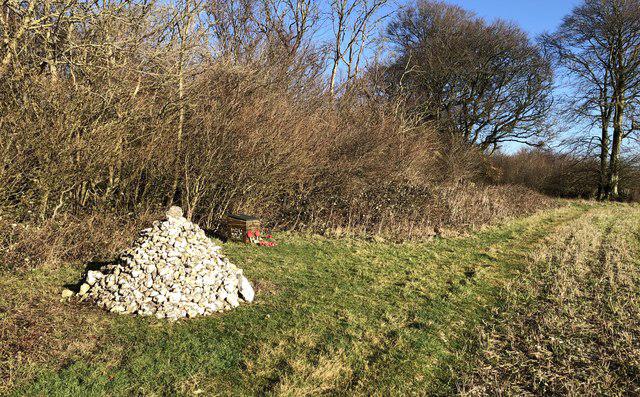 Photo could not load
SU9414 : Memorial and Cairn
Chris Thomas-Atkin
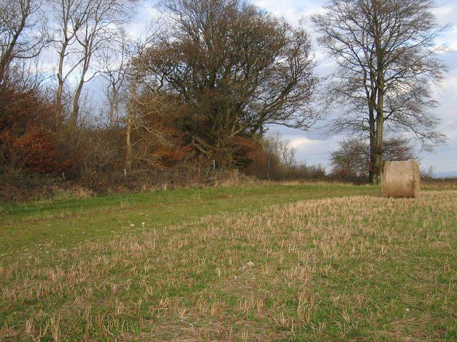 Photo could not load
SU9414 : Littleton Down
Rude Health
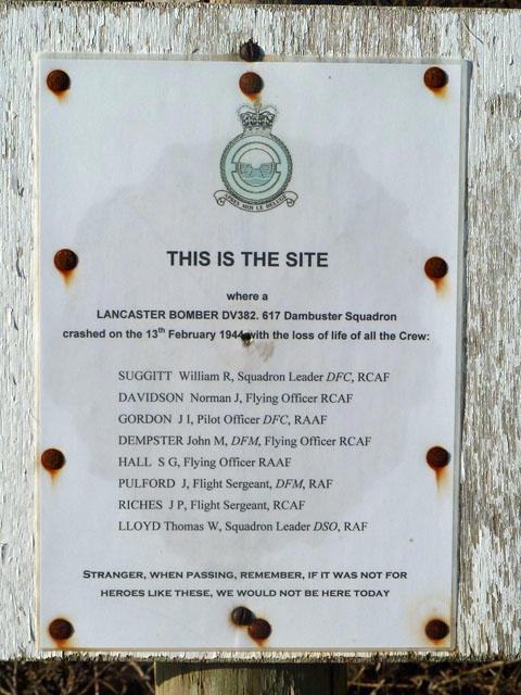 Photo could not load
SU9414 : Sign at site of Lancaster bomber DV382 crash, 13/02/1944
Robin Webster
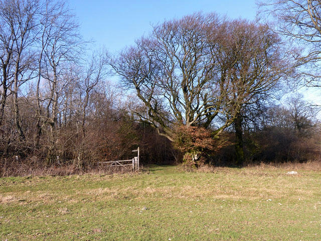 Photo could not load
SU9414 : Crown Tegleaze
Robin Webster
Hill facts and local notes
Classifications
Elevation
255m
836 ft
Prominence
149m
Coordinates
50.9262, -0.6621
SU941149
OS Map
197
Explorer: OL10 121
At the Summit
The summit features a modest grassy knoll with stunning views, but don’t forget to look for the curious stone formations scattered along the path.
Terrain & Geology
Primarily composed of chalk, which gives rise to a rich biodiversity including various flowering plants and grasses, offering excellent soil for agriculture. The erosion patterns create intriguing natural features.
Views & Scenery
On a clear day, you can gaze out towards Winchester Cathedral and the South Downs, making it feel like you're on top of the world, even if it’s just a hill.
History & Heritage
Name Origin
The name 'Littleton' derives from Old English meaning 'little farmstead'.
Historical Significance
Littleton has a rich agricultural history and the surrounding area is steeped in local legends dating back to Anglo-Saxon times.
Getting There & Facilities
Check current local access restrictions, parking rules and transport timetables before travelling. These notes do not confirm public access to the summit.
Parking
Limited roadside parking available near Littleton village, be sure not to block any driveways. Otherwise, park in the main village car park.
Public Transport
Regular bus services connect Littleton to Winchester. Check the local schedules for up-to-date information.
Nearby Facilities
There are local pubs and cafes in Winchester where you can grab a bite after your hike, and public toilets are available in the town centre.
Safety Information
Known Hazards
- Occasional livestock on paths; care should be taken not to disturb them.
General Safety Tips
- Check weather conditions before setting out
- Carry appropriate clothing and equipment
- Let someone know your planned route
- Take a map, compass, and GPS device
- Carry emergency supplies: food, water, first aid kit, torch
Hills
Some common questions about the hills answered
Are there group walks up Littleton Down?
Many walkers use Walkmates to join or organise walks with others. You can check for group walks around Littleton Down through the maps
Are there other walkers around Littleton Down?
Activity varies by location and time, but Walkmates lets you see whether others have shared walks or shown interest in this area. Find other people through the walking friends search walking friends for Littleton Down search or of course create your own walk for Littleton Down
Can I organise a walk to Littleton Down?
Yes. If there aren’t any walks listed already, you can create a walk and make it available for others to join.
If you're signed up to Walkmates, you can create a walk to Littleton Down.
How do I find a walk up this hill?
There are often multiple ways to walk this hill, depending on experience and route preference. Walkmates helps you explore walks and routes that others have shared.
Can I suggest a new route up Littleton Down?
Yes. You can suggest or create routes to share with others. Walkmates focuses on the social side of walking, so routes are used to help people organise walks and explore areas together, rather than as detailed navigation tools or route libraries.
Other uses really appreciate knowledgeable walkers sharing their routes. Share your favourite route to Littleton Down here
The is an error or something incorrect about this hill. How do I let you know?
We always strive to keep the information on Walkmates as accurate as possible. If you find an error, please let us know through the contact form and we'll aim to correct it as quickly as possible
Community Discussion
Comments
Location
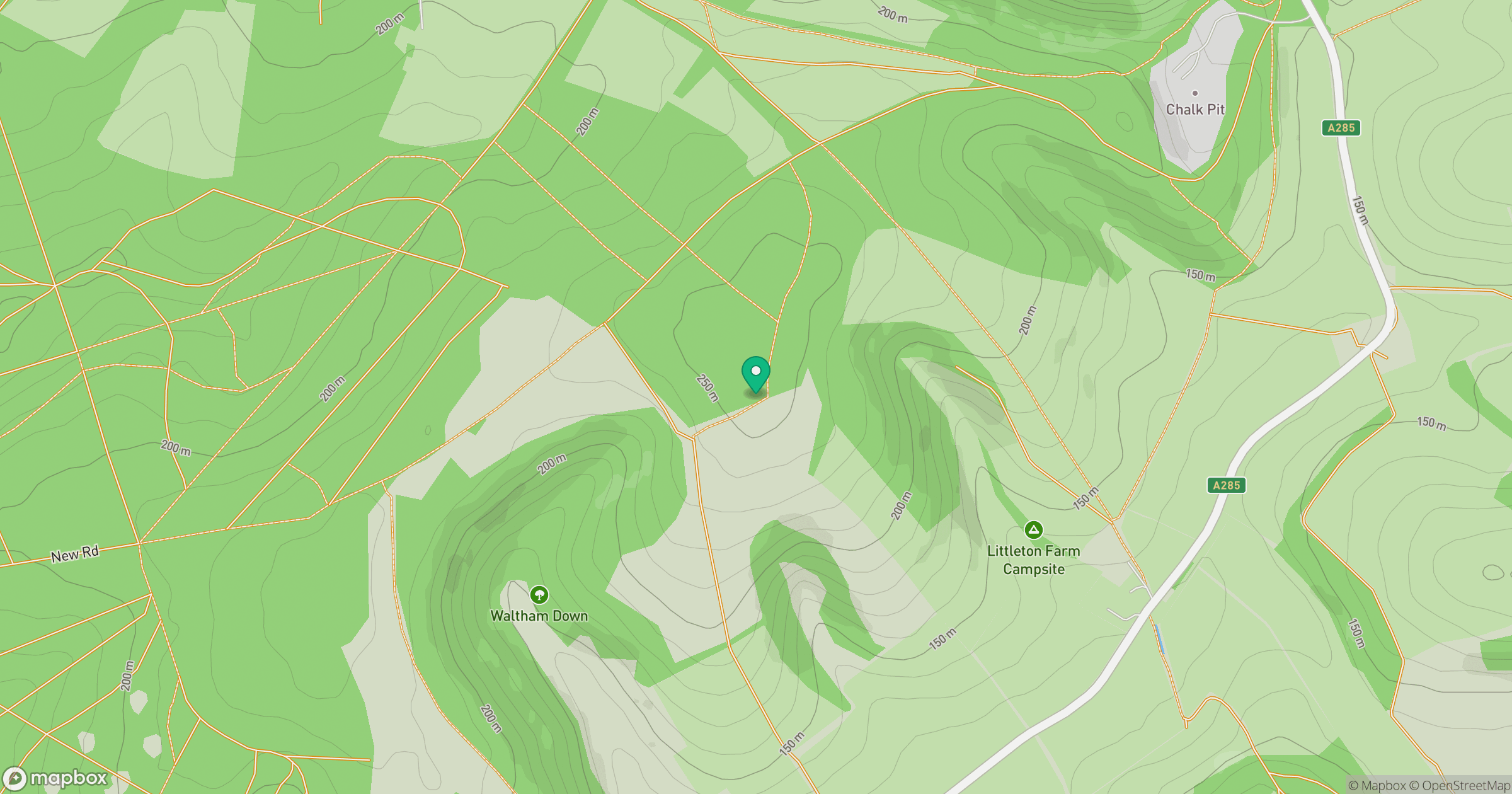
Grid reference: SU941149
View on OpenStreetMapOpens a map in a new tab, centred on the hill.
Hills within 30 km
Straight-line distance, not a walking route or confirmation of access.
No comments yet. Be the first.