

Wheatham Hill
Good walks are even better shared.
Overview
Wheatham Hill
Overview
Wheatham Hill offers a delightful blend of scenic beauty and a touch of English history. Nestled in the South Downs, this Marilyn is an excellent target for a day hike, whether you're in it for the fitness, the fun, or the fantastic views.
Geology
The hill is primarily formed from chalk, which provides not only a beautiful landscape but also contributes to the unique ecosystem, allowing for a variety of plant species that flourish in its calcareous soil.
Routes
One popular route starts in Eastbourne, accessible via the South Downs Way. This scenic path provides a pleasant ascent where you'll be able to take in rolling hills that roll like the waves of the nearby English Channel.
Summit Features
At the summit, hikers are greeted by a trig point that marks the highest point of the hill, accompanied by several benches perfect for a sit-down. You'll be tempted to whip out your camera as the views are far too pretty not to capture!
Terrain
Expect grassy fields interspersed with areas of rocky chalk outcrops, making your footing somewhat of a mind game—don’t be surprised if you end up playing hopscotch over the flint!
Views
The vistas from Wheatham Hill are nothing short of spectacular. To the south, you’ll be greeted by the shimmering English Channel while the expansive views of the South Downs leave you feeling on top of the world. For the best views, try to visit in either spring, when the landscape bursts into bloom, or autumn, when nature dons its warmest colours.
Hazards
As with any outdoor adventure, it pays to keep your wits about you. Be prepared for sudden changes in weather, and steer clear of the steep drops on the southern side. Keep an eye out for sheep as they wander freely, as they might just surprise you with their stealthy ways!
Access and Facilities
The nearest parking can be found in Alfriston—a charming village where you can grab a bite to eat either before or after conquering the hill. Eastbourne's connections also make getting to the area a breeze, so no need for a treasure map!
With a blend of physical challenge and rewarding views, Wheatham Hill is sure to satisfy the ambitious hiker, the casual walker, or anyone in need of some fresh air. Don’t forget your camera and your sense of humour—it might just come in handy!
Last Updated
2023-10-01
Explore routes near Wheatham Hill
Public walks starting within 80 km of this hill. Nearby does not mean a route reaches the summit; check its map and access before setting out.
Meon Valley Trail: West Meon to Wickham
View route
Hinton Ampner: Dutton Estate Woodland and Downland Circuit
View route
Hindhead Sailor's Stroll to Gibbet Hill
View route
Frensham Little Pond and Snowball Ridge Walk
View route
Route planning notes
These notes describe possible approaches, not verified navigable routes or permission to cross land. Check current paths, local access rules and conditions before setting out.
Wheatham Hill from Eastbourne
A gentle ascent from Eastbourne via the South Downs Way.
Make a day of it, together
Find someone to share the walk with, or organise a day out along a route you like.
Photo Gallery
View all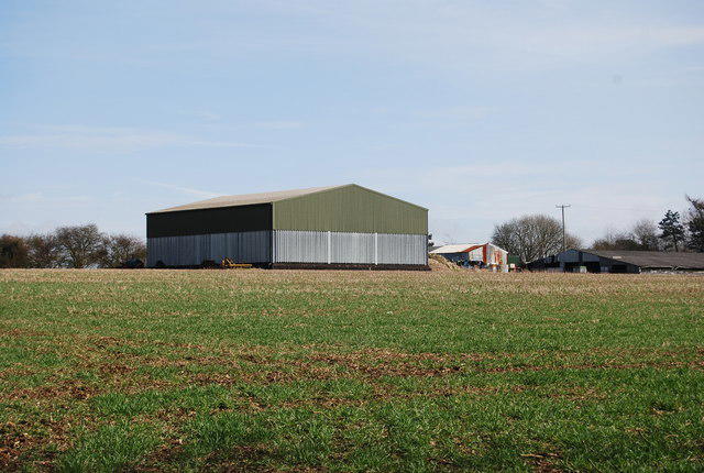 Photo could not load
SU7327 : Barn, Hill Farm
N Chadwick
Hill facts and local notes
Classifications
Elevation
249m
818 ft
Prominence
126m
Coordinates
51.0437, -0.9573
SU731276
OS Map
186 197
Explorer: OL33 133
At the Summit
The summit features a trig point with splendid panoramic views and a few weathered benches for tired legs to take a breather.
Terrain & Geology
Wheatham Hill is primarily comprised of chalk, a soft sedimentary rock that’s part of the larger Chalk Formation, giving rise to its rolling hills and unique flora. The chalk layers can be overlaid with flint nodules, creating interesting patterns in the landscape.
Views & Scenery
Beautiful vistas towards the English Channel and the surrounding South Downs, as well as distant views of historic towns.
History & Heritage
Name Origin
The name 'Wheatham' is derived from Old English, meaning 'homestead where wheat is grown'.
Historical Significance
Wheatham Hill has historical significance related to the South Downs' prehistoric inhabitants, and it forms part of the rich landscape often associated with English literature.
Getting There & Facilities
Check current local access restrictions, parking rules and transport timetables before travelling. These notes do not confirm public access to the summit.
Parking
Free parking is available at the nearby village of Alfriston, approximately 3 miles from the hill.
Public Transport
Eastbourne has regular train services from London, with bus connections to villages near Wheatham Hill.
Nearby Facilities
Alfriston boasts quaint cafes and public toilets, perfect for a pint of tea and a slice of cake after your hike.
Safety Information
Known Hazards
- Possibility of sudden weather changes, steep drops on the southern side, and farm animals on the path. Watch your step!
General Safety Tips
- Check weather conditions before setting out
- Carry appropriate clothing and equipment
- Let someone know your planned route
- Take a map, compass, and GPS device
- Carry emergency supplies: food, water, first aid kit, torch
Hills
Some common questions about the hills answered
Are there group walks up Wheatham Hill?
Many walkers use Walkmates to join or organise walks with others. You can check for group walks around Wheatham Hill through the maps
Are there other walkers around Wheatham Hill?
Activity varies by location and time, but Walkmates lets you see whether others have shared walks or shown interest in this area. Find other people through the walking friends search walking friends for Wheatham Hill search or of course create your own walk for Wheatham Hill
Can I organise a walk to Wheatham Hill?
Yes. If there aren’t any walks listed already, you can create a walk and make it available for others to join.
If you're signed up to Walkmates, you can create a walk to Wheatham Hill.
How do I find a walk up this hill?
There are often multiple ways to walk this hill, depending on experience and route preference. Walkmates helps you explore walks and routes that others have shared.
Can I suggest a new route up Wheatham Hill?
Yes. You can suggest or create routes to share with others. Walkmates focuses on the social side of walking, so routes are used to help people organise walks and explore areas together, rather than as detailed navigation tools or route libraries.
Other uses really appreciate knowledgeable walkers sharing their routes. Share your favourite route to Wheatham Hill here
The is an error or something incorrect about this hill. How do I let you know?
We always strive to keep the information on Walkmates as accurate as possible. If you find an error, please let us know through the contact form and we'll aim to correct it as quickly as possible
Community Discussion
Comments
Location
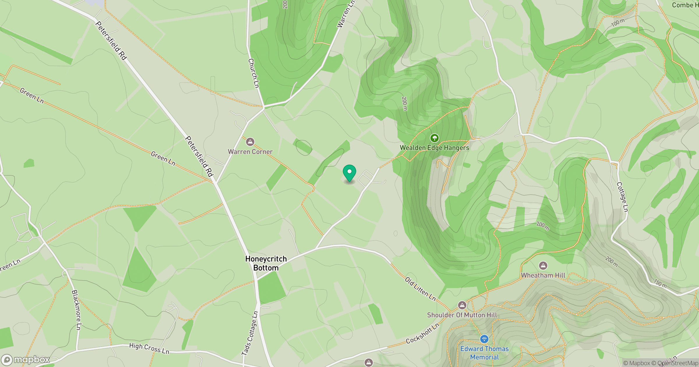
Grid reference: SU731276
View on OpenStreetMapOpens a map in a new tab, centred on the hill.
Hills within 30 km
Straight-line distance, not a walking route or confirmation of access.
No comments yet. Be the first.