

Raven Rock
Good walks are even better shared.
Overview
Raven Rock
Overview
Raven Rock, standing proudly at 591 metres, is one of the Peak District's hidden gems. Nestled within a captivating landscape of rolling hills and dramatic outcrops, it offers hikers both challenge and reward. Whether you're a seasoned climber or a humble walker, there's something captivating about this spot.
Geology
This magnificent rock formation is primarily composed of gritstone, a resilient geological material that has withstood the test of time. The craggy cliffs created by weathering and erosion present not only a fascinating spectacle but also an excellent playground for those who enjoy climbing.
Routes
One popular route is the Raven Rock Circular, a moderate 8.5 km trek suitable for most hikers. The trail weaves through the lush valleys and ascends towards the rocky summit, treating you to breathtaking views along the way. Expect to spend around 3.5 hours completing this circuit.
Summit Features
At the top, you'll be greeted by a historic stone cairn and a stunning rock outcrop that begs to be climbed, providing a perfect backdrop for those all-important summit photographs. Don’t forget to strike a pose!
Terrain
The journey to Raven Rock features a mix of rocky outcrops and grassy areas, with a few boggy patches to keep you on your toes. Good hiking boots are your best friends here, especially after rain.
Views
The vistas from the summit are nothing short of spectacular! On a clear day, you can admire the rolling hills of the Peak District, the heather-clad moors, and even catch a glimpse of the magnificent Chatsworth House. For the best views, aim for spring or autumn, when the landscape is at its most colourful.
Hazards
As with any hike, a few considerations are in order. Be cautious of uneven ground and slippery rocks, especially after a spell of wet weather. The Peak District weather can change faster than a chameleon in a bag of Skittles, so come prepared!
Nearby Summits
For those keen on more exploration, the neighbouring peaks of Mam Tor (517 m) and Lose Hill (576 m) are well worth your time and effort.
Access
Parking is available at Hope Valley, conveniently located near the trailhead. If you prefer public transport, there are regular train services to Hope station, making it easy to access this delightful hike.
Facilities
After a long day, you might fancy a bite to eat or a warm drink. Head back to the charming village of Hope, where you can find cafes, pubs, and public toilets—bliss!
History
The name 'Raven Rock' has its roots in Old English, referring to the birds often seen around the cliffs. The rock's presence in local stories and folklore highlights its cultural significance to the community.
In summary, a trek to Raven Rock is an adventure that blends stunning scenery, fascinating geology, and a touch of local folklore. Pack your bags and lace up your boots; it's time to explore this delightful destination!
Explore routes near Raven Rock
Public walks starting within 80 km of this hill. Nearby does not mean a route reaches the summit; check its map and access before setting out.
Inverness: River Ness and Caledonian Canal circuit
View route
Loch Migdale from Torroy: Spinningdale pinewood and loch shore walk
View route
Glen Affric: Coire Loch Woodland Trail
View route
Loch Affric full circuit from River Affric
View route
Route planning notes
These notes describe possible approaches, not verified navigable routes or permission to cross land. Check current paths, local access rules and conditions before setting out.
Raven Rock Circular
A delightful circular route starting from the valley, leading to the summit and back, offering varied terrain and scenic views.
Make a day of it, together
Find someone to share the walk with, or organise a day out along a route you like.
Photo Gallery
View all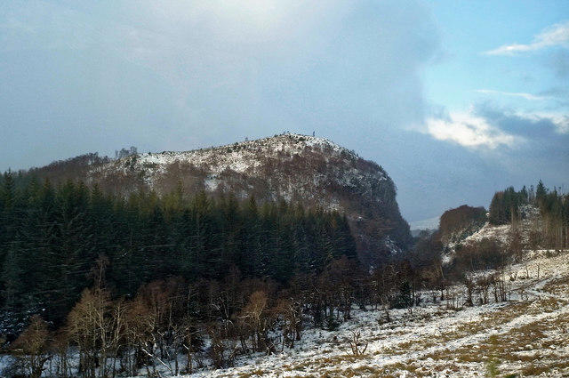 Photo could not load
NH4660 : Approaching the defile of Raven Rock on the Dingwall to Garve rail line
Julian Paren
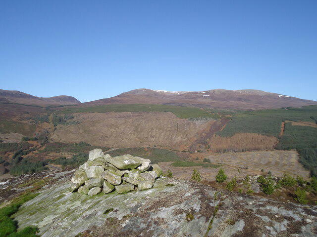 Photo could not load
NH4660 : The summit of Raven Rock, looking north to Ben Wyvis
Michael Earnshaw
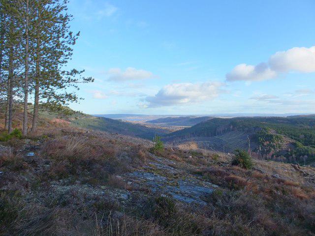 Photo could not load
NH4660 : Southern slope of Raven Rock, looking towards Dingwall
Alpin Stewart
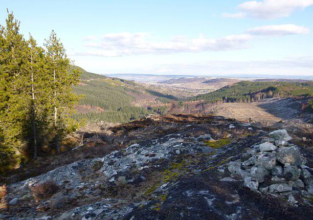 Photo could not load
NH4660 : Summit of Raven Rock
Craig Wallace
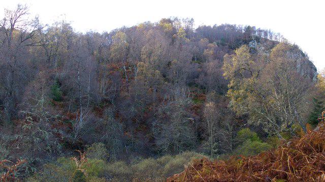 Photo could not load
NH4660 : Raven Rock beside the Kyle of Lochalsh railway line
Julian Paren
Hill facts and local notes
Classifications
Elevation
268m
879 ft
Prominence
123m
Coordinates
57.6082, -4.5726
NH463604
OS Map
20
Explorer: 437S
At the Summit
The summit boasts a classic rock outcrop, providing ample photo opportunities alongside a stone cairn. Perfect for those 'I conquered the peak!' selfies.
Terrain & Geology
Raven Rock is primarily composed of gritstone, a sedimentary rock common in the Peak District. The unique weathering patterns create distinctive crags and cliffs, popular among climbers. It offers a splendid glimpse into the geological forces that shaped the area.
Views & Scenery
From the summit, one can see the rolling hills of the Peak District, the distant heather-covered moors, and occasionally spot the iconic Chatsworth House far below.
History & Heritage
Name Origin
The name 'Raven Rock' likely derives from the Old English word for 'raven,' alluding to these birds often seen soaring around the cliffs.
Historical Significance
Raven Rock has been a spot of geological and cultural significance for locals, often featured in stories and folklore.
Getting There & Facilities
Check current local access restrictions, parking rules and transport timetables before travelling. These notes do not confirm public access to the summit.
Parking
Parking available at Hope Valley, just a short walk from the trailhead.
Public Transport
Regular train services to Hope station. Buses also run from nearby towns; check local schedules before your trek.
Nearby Facilities
Hope provides a range of facilities including cafes, pubs, and public toilets. A welcome sight after a long hike!
Safety Information
Known Hazards
- Care should be taken with uneven ground and slippery rocks, especially after rain. Watch out for sudden weather changes like they’re sneaking up on you!
General Safety Tips
- Check weather conditions before setting out
- Carry appropriate clothing and equipment
- Let someone know your planned route
- Take a map, compass, and GPS device
- Carry emergency supplies: food, water, first aid kit, torch
Hills
Some common questions about the hills answered
Are there group walks up Raven Rock?
Many walkers use Walkmates to join or organise walks with others. You can check for group walks around Raven Rock through the maps
Are there other walkers around Raven Rock?
Activity varies by location and time, but Walkmates lets you see whether others have shared walks or shown interest in this area. Find other people through the walking friends search walking friends for Raven Rock search or of course create your own walk for Raven Rock
Can I organise a walk to Raven Rock?
Yes. If there aren’t any walks listed already, you can create a walk and make it available for others to join.
If you're signed up to Walkmates, you can create a walk to Raven Rock.
How do I find a walk up this hill?
There are often multiple ways to walk this hill, depending on experience and route preference. Walkmates helps you explore walks and routes that others have shared.
Can I suggest a new route up Raven Rock?
Yes. You can suggest or create routes to share with others. Walkmates focuses on the social side of walking, so routes are used to help people organise walks and explore areas together, rather than as detailed navigation tools or route libraries.
Other uses really appreciate knowledgeable walkers sharing their routes. Share your favourite route to Raven Rock here
The is an error or something incorrect about this hill. How do I let you know?
We always strive to keep the information on Walkmates as accurate as possible. If you find an error, please let us know through the contact form and we'll aim to correct it as quickly as possible
Community Discussion
Comments
Location
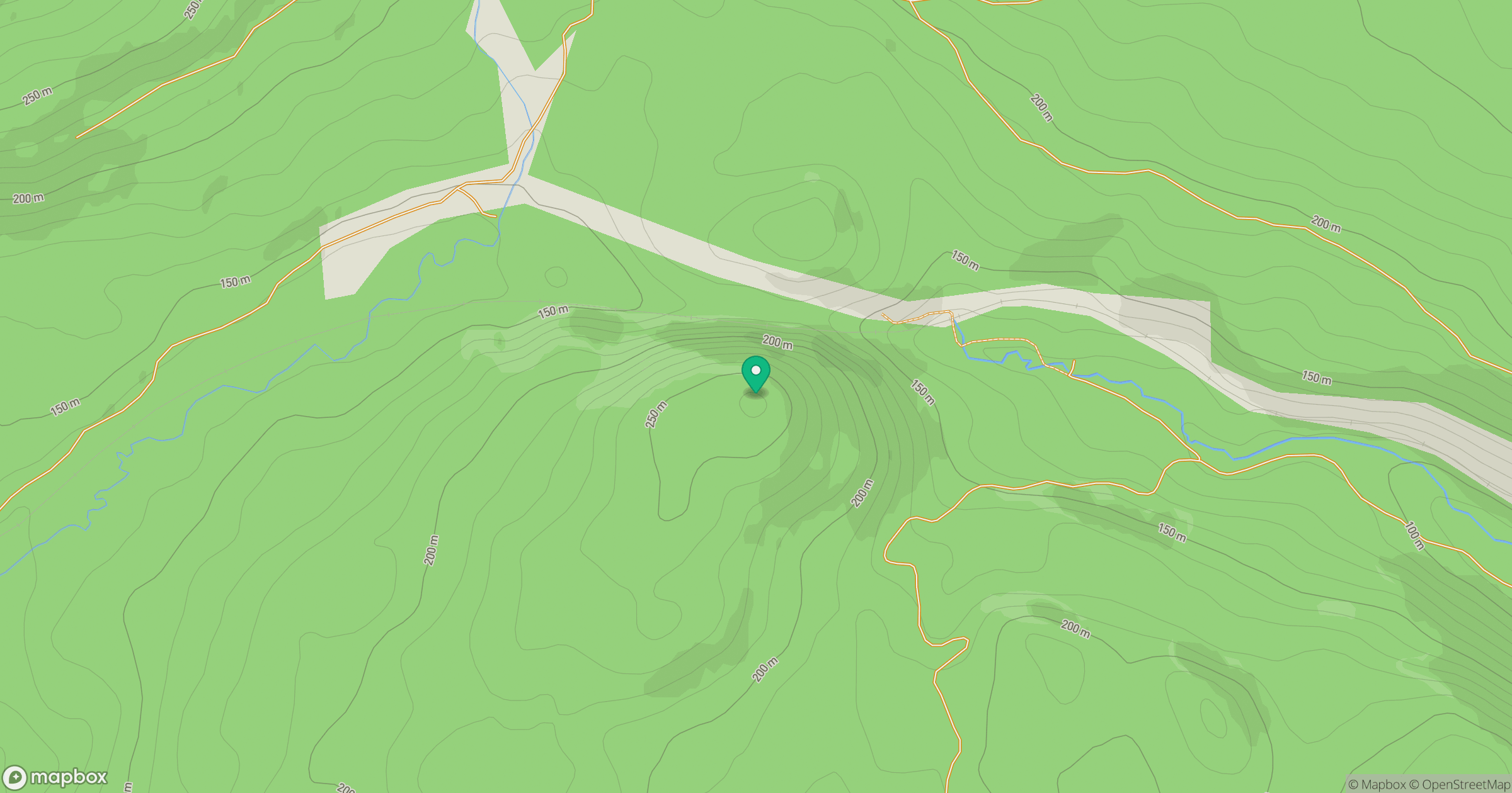
Grid reference: NH463604
View on OpenStreetMapOpens a map in a new tab, centred on the hill.
Hills within 30 km
Straight-line distance, not a walking route or confirmation of access.
No comments yet. Be the first.