

Ben Wyvis - Glas Leathad Mor
Good walks are even better shared.
NH4668 : Aerobatics Display on Ben Wyvis, Scottish Highlands
Andrew Tryon Photo source
Overview
Ben Wyvis is an isolated Munro in Easter Ross whose highest summit, Glas Leathad Mòr, reaches 1046 m. The usual return walk starts at Garbat beside the A835 and climbs via An Cabar. A broad, exposed ridge supports fragile moss habitat and breeding mountain birds.
Ben Wyvis - Glas Leathad Mor
Overview
Glas Leathad Mòr, 1046 m, is the highest summit of Ben Wyvis in Easter Ross. A trig point marks the top. Its broad ridge rises above surrounding moorland, with extensive Highland views in clear weather.
The Garbat return walk
Start at the Ben Wyvis car park beside the A835, NH410671. Cross the footbridge and follow the burn-side path through the forest, crossing the forestry track. The ascent steepens on the built path to An Cabar (946 m). Continue along the ridge to Glas Leathad Mòr, then return by the same route. Allow 4.5–5.5 hours for the 14 km walk, with 935 m of ascent.
Mountain conditions
The climb to An Cabar is steep, and the upper ridge is exposed. Carry a map and compass and check the return direction carefully in cloud. Choose clothing and equipment for the mountain forecast, including cold and wet conditions. A clear path does not remove the need for navigation skills.
Access and conservation
Parking at Garbat is limited. Use designated spaces without obstructing access; do not park on verges. Garve is the nearest public-transport connection, with an onward journey needed.
Stay in the centre of the established path across the plateau to protect its fragile moss. Keep dogs close and preferably on a lead, especially during April–August when ground-nesting birds are vulnerable to disturbance.
Landscape
The underlying Moine metamorphic rocks include schist and gneiss. Freeze–thaw processes have shaped the surface into distinctive patterned ground and slowly moving soil lobes. Centuries of grazing and nineteenth-century sporting-estate use also form part of the mountain's history.
Nearby tops
An Cabar is on the standard ascent. Tom a' Chòinnich (954 m) lies farther north, while Little Wyvis (763 m) is a separate hill to the south. A descent from Tom a' Chòinnich crosses rough, pathless ground; the standard return retraces the outward route.
Explore routes near Ben Wyvis - Glas Leathad Mor
Walks starting near this hill. Open a route to check its map, distance and full itinerary.
Loch Migdale from Torroy: Spinningdale pinewood and loch shore walk
View route
Glen Affric: Coire Loch Woodland Trail
View route
Beinn Eighe Lancaster Wreckage at Coire Mhic Fhearchair
View route
Culbin Forest: Hill 99, Gravel Pit Ponds and Dragonfly Pool
View route
Route planning notes
These notes describe possible approaches. Check a route's map and access information when planning your walk.
Ben Wyvis via An Cabar from Garbat (out and back)
From the Ben Wyvis car park on the A835 at NH410671, follow the path across the footbridge and through Garbat Forest beside the Allt a' Bhealaich Mhòir. Cross the forestry track and climb the steep built path to An Cabar. Follow the ridge to the summit trig point of Glas Leathad Mòr, then retrace the outward route to the car park. The full return is 14 km with 935 m of ascent; allow 4.5–5.5 hours. Stay on the worn path across the mossy plateau and navigate carefully in poor visibility.
Make a day of it, together
Find someone to share the walk with, or organise a day out along a route you like.
Photo Gallery
View all Photo could not load
NH4668 : Aerobatics Display on Ben Wyvis, Scottish Highlands
Andrew Tryon
 Photo could not load
NH4668 : Ben Wyvis
Gerald England
 Photo could not load
NH4668 : Outlook from the Black Isle towards Ben Wyvis
Julian Paren
 Photo could not load
NH4668 : View northwest from Ben Wyvis
Nigel Brown
 Photo could not load
NH4668 : View west northwest from Ben Wyvis
Nigel Brown
 Photo could not load
NH4668 : Ben Wyvis trig
Callum Black
 Photo could not load
NH4668 : Ben Wyvis from Loch Glascarnoch
M J Richardson
 Photo could not load
NH4668 : Ben Wyvis over Garbat Forest
Calum McRoberts
 Photo could not load
NH4668 : Imminent hailstorm on the top of Ben Wyvis
Julian Paren

NH4668 : The summit of Ben Wyvis
Nigel Brown
Hill facts and local notes
Classifications
Elevation
1,046m
3,432 ft
Prominence
691m
Coordinates
57.6789, -4.5793
NH462683
OS Map
20
Explorer: 437S
At the Summit
A trig point marks Glas Leathad Mòr, the 1046 m summit of Ben Wyvis, at NH 46299 68368.
Terrain & Geology
Ben Wyvis is underlain by Moine metamorphic rocks, including schist and gneiss derived from clay- and silt-rich sediments. Its weathered surface preserves notable periglacial patterned ground, including stripes and circles, alongside solifluction sheets and lobes.
Views & Scenery
In clear weather, views extend across the Moray Firth and Black Isle, towards Torridon and the Fannichs, and south towards the Cairngorms.
History & Heritage
Name Origin
NatureScot translates the summit name Glas Leathad Mòr as 'great, green, broad slope'.
Historical Significance
Grazing has shaped Ben Wyvis for centuries. NatureScot records that many of its paths, fences and rock shelters date from nineteenth-century sporting-estate use.
Getting There & Facilities
Parking
Ben Wyvis car park at Garbat, NH410671, on the east side of the A835 between Garve and Ullapool. Parking is free, with a 2.5 m height barrier. Spaces are limited; a layby about 400 m towards Ullapool has some additional room. Share a lift where possible. Do not park on the verge or block access for local residents.
Public Transport
Garve has the nearest bus stop and railway station, about 8 km from the car park. Some buses on the Inverness–Ullapool route may stop at Garbat by request; confirm this with the operator before travelling. Arrange both the onward journey and the return connection in advance.
Nearby Facilities
The nearest toilets are at Silverbridge, about 3 km south on the A835; Forestry and Land Scotland also lists toilets at Rogie Falls. Shops and places to eat are available in Contin and Strathpeffer. Carry food and water for the mountain walk.
Safety Information
Known Hazards
- The built path to An Cabar is steep; wet stones can be slippery.
- The exposed ridge offers little shelter from wind, cold or rain. Low cloud makes careful navigation essential.
- Do not substitute a direct descent from the summit for the outward route; the alternative via Tom a' Chòinnich includes rough, pathless ground.
Seasonal Hazards
Protect ground-nesting birds by keeping dogs in sight and under close control, preferably on a lead, especially on the summit plateau during April–August. Check mountain weather before setting out and adapt plans to snow, ice, wind and available daylight.
General Safety Tips
- Check weather conditions before setting out
- Carry appropriate clothing and equipment
- Let someone know your planned route
- Take a map, compass, and GPS device
- Carry emergency supplies: food, water, first aid kit, torch
Hills
Some common questions about the hills answered
Are there group walks up Ben Wyvis - Glas Leathad Mor?
Many walkers use Walkmates to join or organise walks with others. You can check for group walks around Ben Wyvis - Glas Leathad Mor through the maps
Are there other walkers around Ben Wyvis - Glas Leathad Mor?
Activity varies by location and time, but Walkmates lets you see whether others have shared walks or shown interest in this area. Find other people through the walking friends search walking friends for Ben Wyvis - Glas Leathad Mor search or of course create your own walk for Ben Wyvis - Glas Leathad Mor
Can I organise a walk to Ben Wyvis - Glas Leathad Mor?
Yes. If there aren’t any walks listed already, you can create a walk and make it available for others to join.
If you're signed up to Walkmates, you can create a walk to Ben Wyvis - Glas Leathad Mor.
How do I find a walk up this hill?
There are often multiple ways to walk this hill, depending on experience and route preference. Walkmates helps you explore walks and routes that others have shared.
Can I suggest a new route up Ben Wyvis - Glas Leathad Mor?
Yes. You can suggest or create routes to share with others. Walkmates focuses on the social side of walking, so routes are used to help people organise walks and explore areas together, rather than as detailed navigation tools or route libraries.
Other uses really appreciate knowledgeable walkers sharing their routes. Share your favourite route to Ben Wyvis - Glas Leathad Mor here
The is an error or something incorrect about this hill. How do I let you know?
We always strive to keep the information on Walkmates as accurate as possible. If you find an error, please let us know through the contact form and we'll aim to correct it as quickly as possible
Community Discussion
Comments
Location
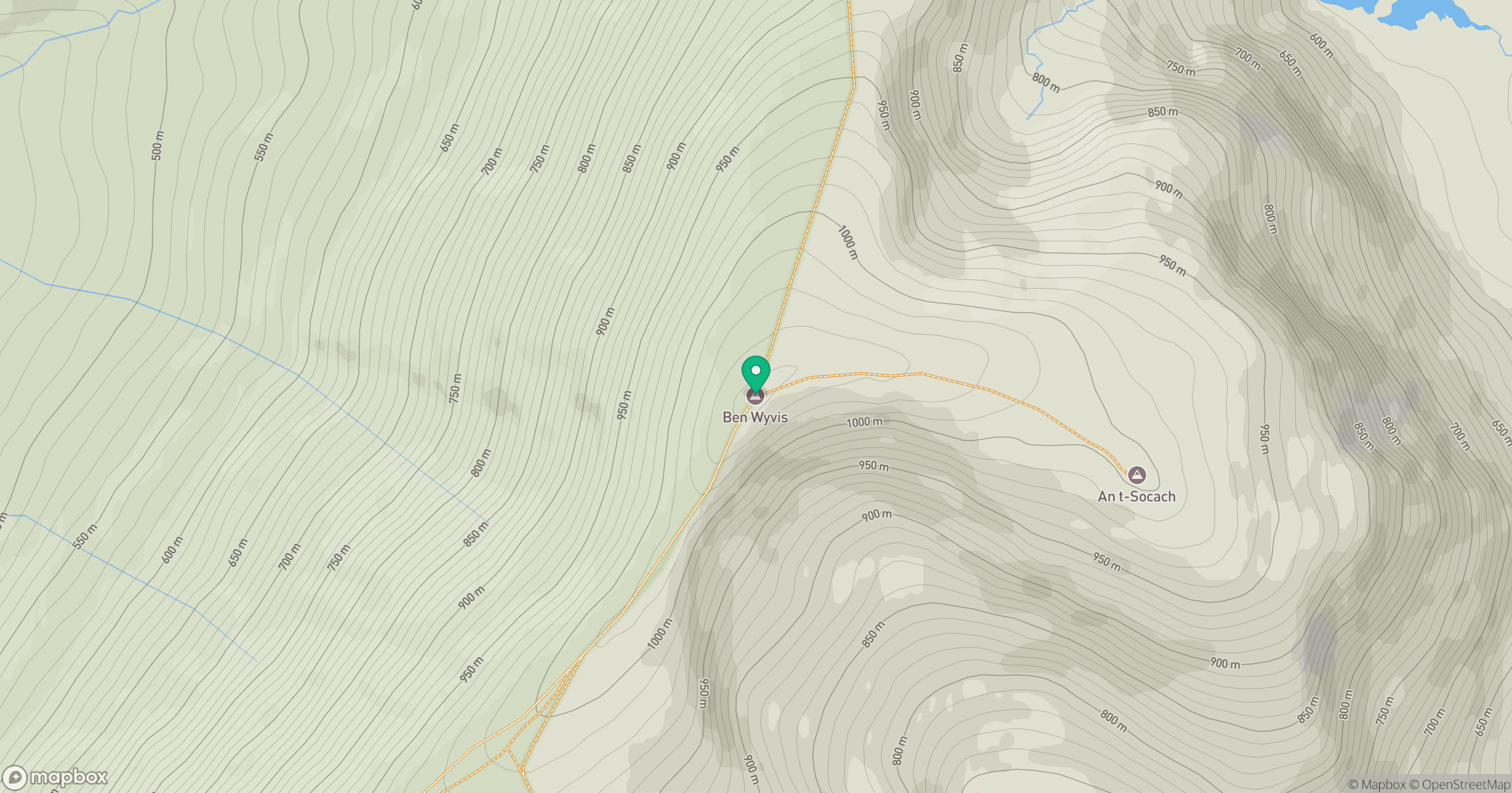
Grid reference: NH462683
View on OpenStreetMapOpens a map in a new tab, centred on the hill.
Nearby Hills
Cul Mor
393m
Seana Bhraigh
926m
Sgurr a' Choire Ghlais
1,084m
Beinn Mheadhoin
541m
Ben More Assynt
999m
No comments yet. Be the first.