

Cnoc a' Bhreacaich
Good walks are even better shared.
Overview
Cnoc a' Bhreacaich
Cnoc a' Bhreacaich stands proudly at 703 meters, a Marilyn that rewards hikers with spectacular panoramic views and an enchanting experience among the rugged beauty of the Scottish Highlands.
Geology
This mountain is composed primarily of ancient metamorphic rocks, typical of the Highlands, formed during the Caledonian Orogeny. This geological drama unfolded millions of years ago, resulting in the formidable yet picturesque formations that define the landscape today.
Access and Parking
For those eager to lace up their hiking boots, the nearest parking area is located at NH547619, a small space right at the trailhead for the west route. It's not a car park you'll find on every map, but it's enough to accommodate a handful of adventurous souls. If you're considering public transport, buses from Inverness to Ullapool can drop you off in nearby Garve, from where a short taxi ride will get you to the trailhead. The charming town of Garve offers basic amenities—always a good step before heading off on an adventure!
Routes
Cairn on the west
This popular route meanders from the forestry area to the summit, covering approximately 8 km round trip. The trail is well marked, making it ideal for moderate hikers, and generally takes about 3 hours to complete. Along the way, enjoy the scenic views of the woodland as your excitement builds for the final summit push!
South Ridge Approach
For those seeking solitude, the less-travelled south ridge is a challenging yet fulfilling option. Covering around 6.5 km and taking 2.5 hours, it promises an intimate encounter with nature, minus the crowds. Just you, the mountain, and perhaps a furry friend or two!
Summit Features
Reaching the summit, you'll be greeted by a large stone cairn, a worthy destination for any hiker. Settle in for a rest and be sure to snap some photos of the stunning vistas that stretch across the Highlands—trust us, Instagram will thank you!
Terrain and Hazards
Expect rugged terrain with patches of heather and rocky outcrops, a classic Highland landscape. However, do mind the loose rocks and potential boggy areas—after all, no one enjoys soggy socks! Always check the weather before setting out, as conditions can change faster than you can say 'haggis'.
Views
From the summit, the breathtaking sight of Ben Wyvis and the clear blue waters of Loch Meiklie await you, best enjoyed in Spring and Autumn when nature puts on its finest display.
History
The name Cnoc a' Bhreacaich, translating to 'Hill of the Bracken', perfectly captures the lush vegetation around its base. Historically, this mountain has played a role as a route for ancient tribes, and the remnants of old settlements can occasionally be spotted among the heather. A hike here not only rewards the feet but also the soul!
If you're seeking an invigorating experience in the Scottish Highlands, Cnoc a' Bhreacaich is waiting with open arms (and maybe a few clouds). Just remember to take your camera and pack a wee snack—those views will surely work up an appetite!
Explore routes near Cnoc a' Bhreacaich
Public walks starting within 80 km of this hill. Nearby does not mean a route reaches the summit; check its map and access before setting out.
Inverness: River Ness and Caledonian Canal circuit
View route
Loch Migdale from Torroy: Spinningdale pinewood and loch shore walk
View route
Glen Affric: Coire Loch Woodland Trail
View route
Culbin Forest: Hill 99, Gravel Pit Ponds and Dragonfly Pool
View route
Route planning notes
These notes describe possible approaches, not verified navigable routes or permission to cross land. Check current paths, local access rules and conditions before setting out.
Cairn on the west
A popular route starting from the forestry area which leads to the summit via a well-trodden path, offering scenic woodland views.
South Ridge Approach
Starting from the A835 road, this route follows the south ridge and is less frequented, providing a more solitary experience.
Make a day of it, together
Find someone to share the walk with, or organise a day out along a route you like.
Photo Gallery
View all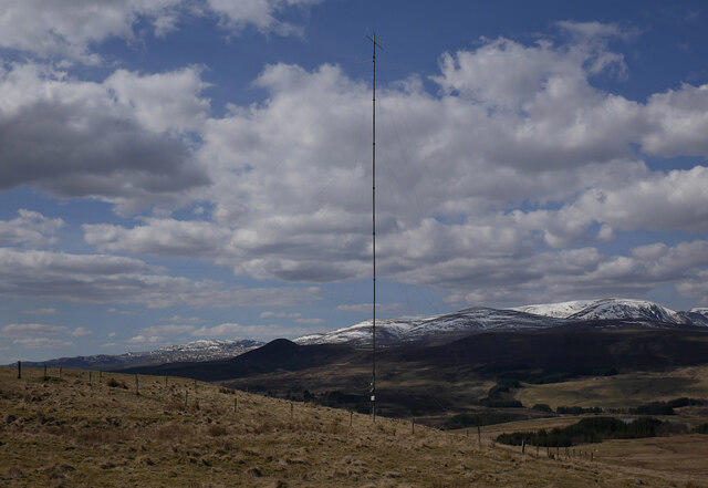 Photo could not load
NH5462 : Anemometer mast, Cnoc a' Bhreacaich
Craig Wallace
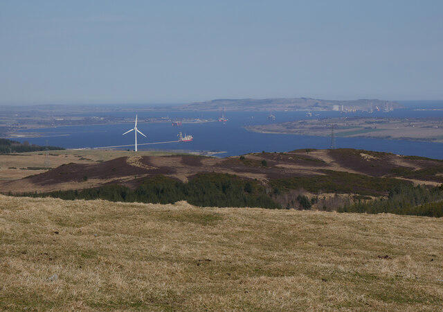 Photo could not load
NH5462 : Cnoc a' Bhreacaich view
Craig Wallace
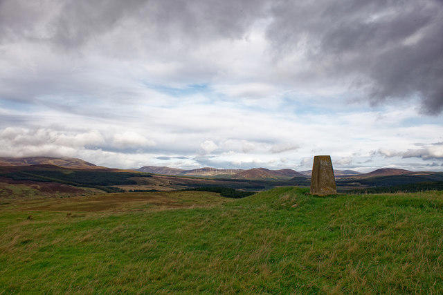 Photo could not load
NH5462 : OS Trig on Cnoc a' Bhreacaich
Julian Paren
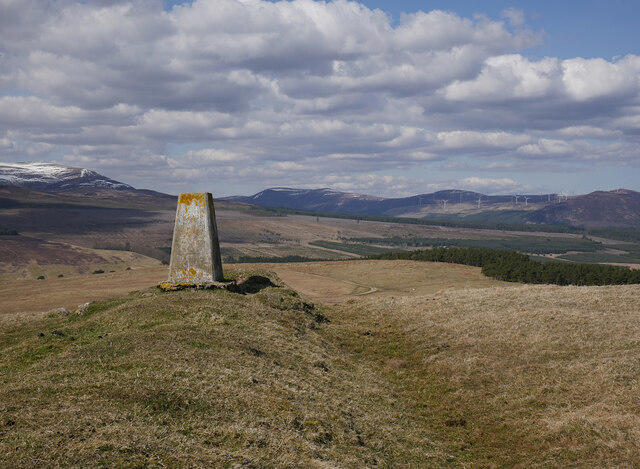 Photo could not load
NH5462 : Trig point, Cnoc a' Bhreacaich
Craig Wallace
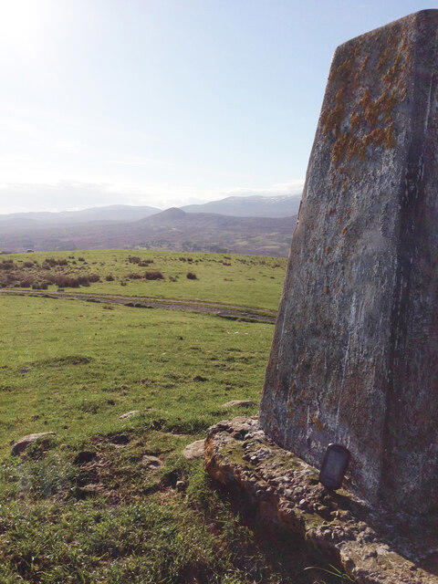 Photo could not load
NH5462 : View from Cnoc A' Bhreacaich Trig Point
thejackrustles
Hill facts and local notes
Classifications
Elevation
339m
1,112 ft
Prominence
122m
Coordinates
57.6285, -4.4397
NH544624
OS Map
21
Explorer: 432 437S
At the Summit
The summit features a large stone cairn and a fantastic panoramic view of the surrounding highlands.
Terrain & Geology
The mountain comprises primarily of ancient metamorphic rocks, typical of the Scottish Highlands, which were formed during the Caledonian Orogeny, giving it a rugged yet majestic appearance.
Views & Scenery
From the summit, you can catch stunning views of Ben Wyvis and the surrounding glens, with Loch Meiklie glistening in the distance.
History & Heritage
Name Origin
Cnoc a' Bhreacaich translates to 'Hill of the Bracken' in Gaelic, indicative of the lush vegetation around the lower slopes.
Historical Significance
The area holds historical significance as it has been a route for ancient tribes, and remnants of old settlements can sometimes be found on its slopes.
Getting There & Facilities
Check current local access restrictions, parking rules and transport timetables before travelling. These notes do not confirm public access to the summit.
Parking
There is a small parking area at NH547619, suitable for a few cars, located at the trailhead for the popular west side route.
Public Transport
Buses from Inverness to Ullapool stop at Garve, from which you can take a taxi to the trailhead.
Nearby Facilities
There are limited facilities in Garve, including a small shop and a café for a post-hike refreshment.
Safety Information
Known Hazards
- Loose rocks on the ascent, rapidly changing weather conditions, and boggy areas on lower paths.
General Safety Tips
- Check weather conditions before setting out
- Carry appropriate clothing and equipment
- Let someone know your planned route
- Take a map, compass, and GPS device
- Carry emergency supplies: food, water, first aid kit, torch
Hills
Some common questions about the hills answered
Are there group walks up Cnoc a' Bhreacaich?
Many walkers use Walkmates to join or organise walks with others. You can check for group walks around Cnoc a' Bhreacaich through the maps
Are there other walkers around Cnoc a' Bhreacaich?
Activity varies by location and time, but Walkmates lets you see whether others have shared walks or shown interest in this area. Find other people through the walking friends search walking friends for Cnoc a' Bhreacaich search or of course create your own walk for Cnoc a' Bhreacaich
Can I organise a walk to Cnoc a' Bhreacaich?
Yes. If there aren’t any walks listed already, you can create a walk and make it available for others to join.
If you're signed up to Walkmates, you can create a walk to Cnoc a' Bhreacaich.
How do I find a walk up this hill?
There are often multiple ways to walk this hill, depending on experience and route preference. Walkmates helps you explore walks and routes that others have shared.
Can I suggest a new route up Cnoc a' Bhreacaich?
Yes. You can suggest or create routes to share with others. Walkmates focuses on the social side of walking, so routes are used to help people organise walks and explore areas together, rather than as detailed navigation tools or route libraries.
Other uses really appreciate knowledgeable walkers sharing their routes. Share your favourite route to Cnoc a' Bhreacaich here
The is an error or something incorrect about this hill. How do I let you know?
We always strive to keep the information on Walkmates as accurate as possible. If you find an error, please let us know through the contact form and we'll aim to correct it as quickly as possible
Community Discussion
Comments
Location
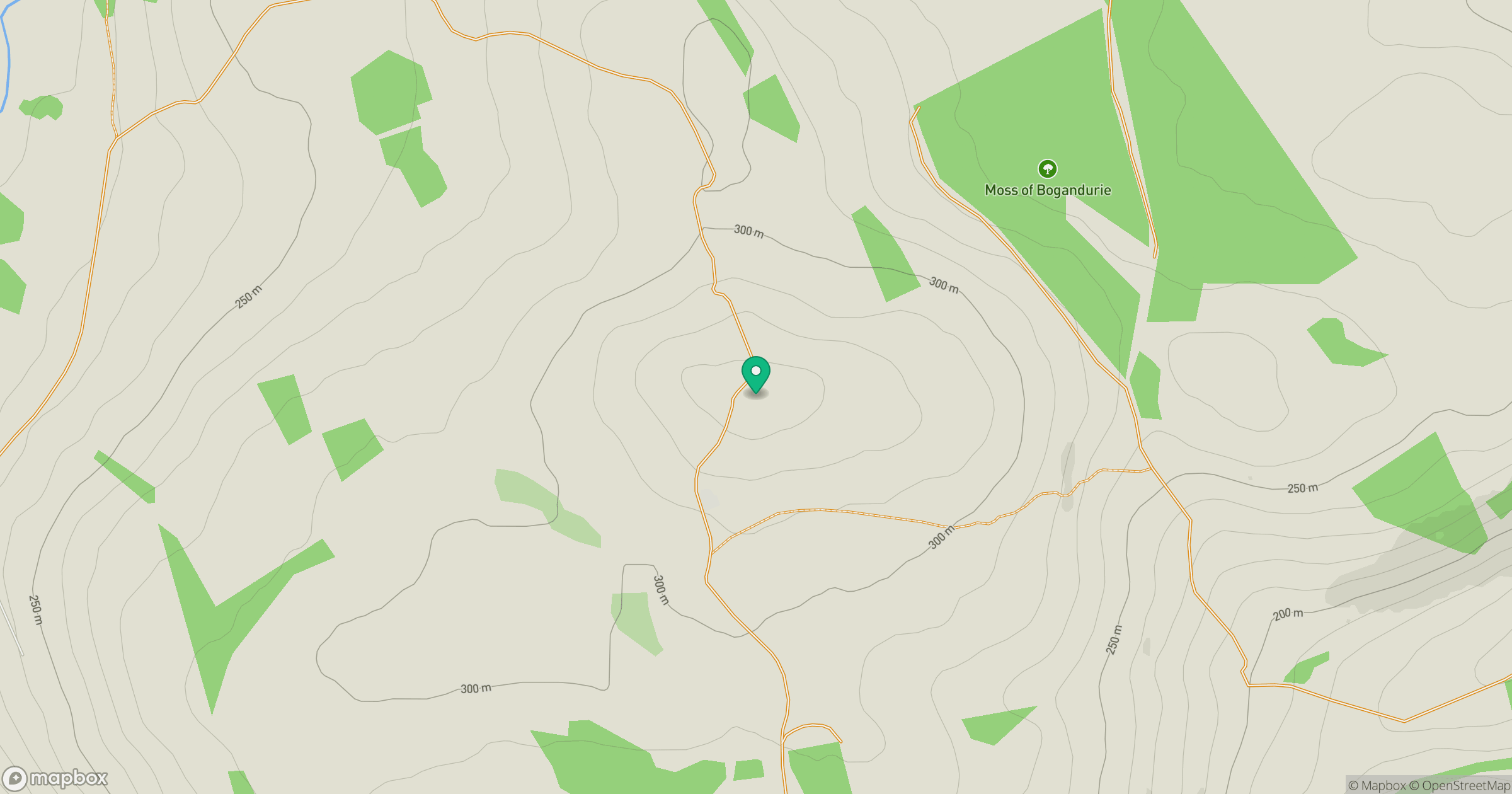
Grid reference: NH544624
View on OpenStreetMapOpens a map in a new tab, centred on the hill.
Hills within 30 km
Straight-line distance, not a walking route or confirmation of access.
No comments yet. Be the first.