

Pilsdon Pen
Good walks are even better shared.
ST4101 : Inside Pilsdon Pen
John M Photo source
Overview
Pilsdon Pen is a 276.7 m hill in west Dorset, with an open summit, an Iron Age hillfort and views over the Marshwood Vale towards the coast. The short approach from the B3164 is steep. Nearby Lewesdon Hill is slightly higher and is Dorset's county top.
Pilsdon Pen
Pilsdon Pen rises to 276.7 m above west Dorset. Its open hillfort gives broad views across the Marshwood Vale towards Golden Cap and the sea. It is a Tump, with 83 m of prominence. The nearby county top is Lewesdon Hill, at 278.6 m.
Choosing a walk
For a short summit visit, use the signed approach opposite the small B3164 lay-by near Pilsdon Lane. Climb the steep grassy path to the fort, then return by the same path. The steps, slopes and uneven earthworks call for secure footing.
For a longer outing, National Trust North and West Dorset publishes a 6.6 km circuit on Komoot. It crosses the summit, follows the Wessex Ridgeway north-west, and returns using a bridleway, the Jubilee Trail and the Monarch's Way. Its published guide time is 1 hour 56 minutes. Use the full itinerary and allow extra time to explore the earthworks.
Summit and landscape
The unmarked natural summit lies about 8 m south-east of the trig point; the trig base is approximately 0.4 m lower. The hill is capped by Upper Greensand above the clay landscape of the vale. The banks, ditches and mounds belong to its archaeological history.
A layered history
The scheduled hillfort encloses roughly 2.8 hectares. Earlier burial mounds, medieval cultivation remains and a post-medieval rabbit warren survive alongside the Iron Age defences. Follow established paths and leave these features undisturbed.
Planning your visit
Parking is limited to the roadside lay-by below the south-eastern end. Cross the B3164 with care. Bring supplies; the community shop is in Broadwindsor. Selected First Bus CR6 journeys serve Broadwindsor, with an onward walk on the Monarch's Way; check both outward and return services.
Wet grass and muddy paths can make the steep descent slippery. The hilltop is exposed to wind, and livestock may be grazing. Follow local notices and keep dogs on a short lead around sheep and ground-nesting birds.
Explore routes near Pilsdon Pen
Walks starting near this hill. Open a route to check its map, distance and full itinerary.
Langdon Hill Circular
View route
Dorchester Walk with Men Walking & Talking
View route
Taunton Walk with Men Walking & Talking
View route
Maunsel Lock to Charlton Bridge: Durston and Cogload canal return
View route
Route planning notes
These notes describe possible approaches. Check a route's map and access information when planning your walk.
Summit return from the B3164 lay-by
Start at the roadside lay-by below the south-eastern end of Pilsdon Pen, beside the B3164 near its junction with Pilsdon Lane. Cross the road carefully and use the signed hill access to climb the steep grassy path to the hillfort and trig point. The natural summit is an unmarked point about 8 m south-east of the trig. Return down the same path to the roadside start. Steps, uneven earthworks and steep slopes make this unsuitable as a level, step-free stroll.
Pilsdon Pen circuit via the Wessex Ridgeway
This is the full National Trust North and West Dorset circuit published on Komoot, starting and finishing at the B3164 lay-by below Pilsdon Pen. Cross to the hill and climb to the summit, then follow the ridge north-west on the Wessex Ridgeway. Beyond the fields, turn south-west and join the bridleway running south-east to the road. Continue briefly west along the road, then take the track south on the Jubilee Trail. At the next lane, turn a short way north and take the gated footpath on the left, joining the Monarch's Way. Follow it to the lane and turn north to return to the starting lay-by. The publisher gives 6.6 km and 1 hour 56 minutes for the complete loop; allow extra time for stops. The early return where the bridleway first meets the road is a shorter variant, not this full circuit. Take care on the road sections and keep dogs on a short lead around livestock.
Make a day of it, together
Find someone to share the walk with, or organise a day out along a route you like.
Photo Gallery
View all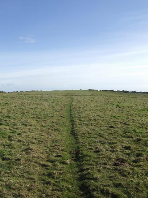 Photo could not load
ST4101 : Inside Pilsdon Pen
John M
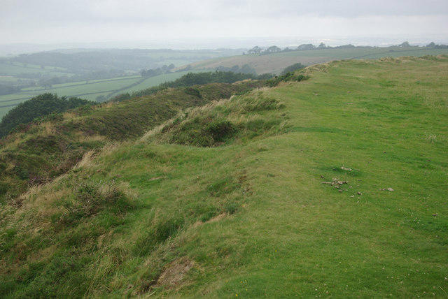 Photo could not load
ST4101 : Pilsdon Pen
Stephen McKay
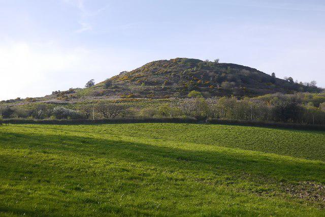 Photo could not load
ST4101 : Pilsdon Pen
Richard Webb
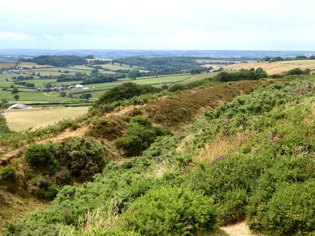 Photo could not load
ST4101 : Looking west from Pilsdon Pen
Oliver Dixon
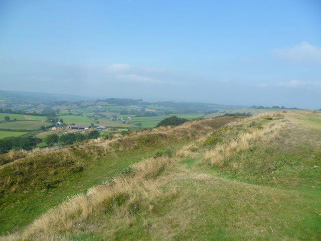 Photo could not load
ST4101 : On Pilsdon Pen
Michael Graham
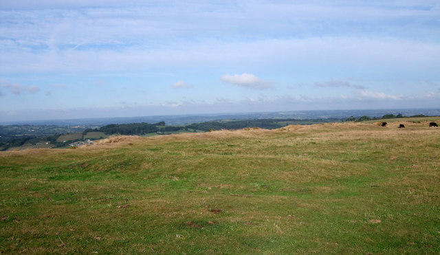 Photo could not load
ST4101 : Mound on top of Pilsdon Pen
Vieve Forward
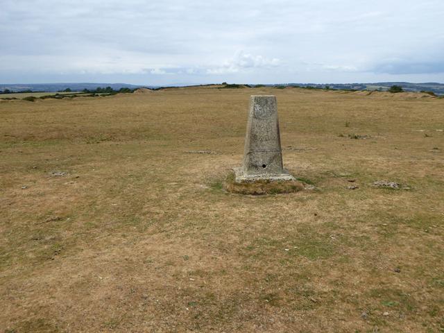 Photo could not load
ST4101 : Summit plateau of Pilsdon Pen
Oliver Dixon
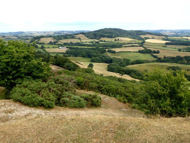 Photo could not load
ST4101 : View east from Pilsdon Pen
Oliver Dixon
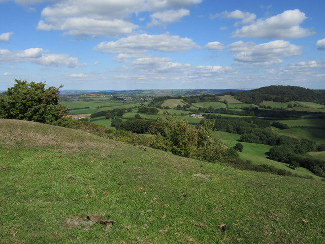 Photo could not load
ST4101 : Pilsdon Pen view
T Eyre
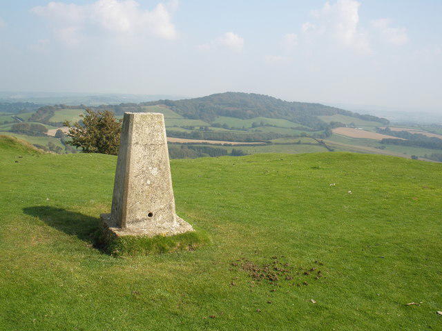
ST4101 : View from Pilsdon Pen
Roger Cornfoot
Hill facts and local notes
Classifications
Elevation
277m
908 ft
Prominence
83m
Coordinates
50.8068, -2.8336
ST413011
OS Map
193
Explorer: 116
At the Summit
The natural high point is unmarked ground about 8 m south-east of the trig point. The trig base is about 0.4 m lower, according to the hill survey record. The surrounding hillfort ramparts and mounds are archaeological features, not the surveyed natural summit.
Terrain & Geology
Pilsdon Pen is capped by Cretaceous Upper Greensand, a surviving harder layer above the Lower Jurassic clays of the Marshwood Vale. Its hillfort banks and burial mounds are archaeological earthworks.
Views & Scenery
The open summit overlooks the Marshwood Vale towards Golden Cap and the sea. In clear weather, the wider panorama includes Hardy Monument to the east, Exmoor and the Quantocks to the west, and the Polden and Mendip hills to the north.
History & Heritage
Historical Significance
Pilsdon Pen hillfort and its associated remains are a scheduled monument. The Iron Age enclosure covers about 2.8 hectares and has multiple banks and ditches. Two earlier Late Neolithic to Bronze Age barrows survive inside, together with traces of medieval cultivation and a later rabbit warren. Excavations revealed roundhouses, pits and evidence of metalworking.
Getting There & Facilities
Parking
A small roadside lay-by lies below the south-eastern end of Pilsdon Pen on the B3164, near the junction with Pilsdon Lane. It is outside the National Trust property. Spaces are limited; keep gateways and the road clear. The hill access is across the road and leads straight into a steep climb.
Public Transport
Selected First Bus CR6 journeys between Bridport and Yeovil serve Broadwindsor via Beaminster and Crewkerne. Check the current timetable, the correct stop for each direction and the last return before travelling. From Broadwindsor, the Monarch's Way provides an onward walk to Pilsdon Pen; the bus does not take you to the hillfoot.
Nearby Facilities
Bring food and water for the hill. Broadwindsor Community Stores offers supplies in Broadwindsor; check its opening hours before travelling. The National Trust lists no cafe or toilets at Pilsdon Pen.
Safety Information
Known Hazards
- The approach from the B3164 is steep, with steps, uneven grass and earthwork banks; take particular care on the descent.
- Cross the B3164 carefully at the lay-by. Longer circuits also include lane and road sections.
- Grazing animals may be present. Follow local signs and keep dogs on a short lead around sheep and ground-nesting birds.
Seasonal Hazards
After rain, grass and earth paths can be slippery or muddy, especially on the steep approach and descent. The open hilltop offers little shelter in strong winds.
General Safety Tips
- Check weather conditions before setting out
- Carry appropriate clothing and equipment
- Let someone know your planned route
- Take a map, compass, and GPS device
- Carry emergency supplies: food, water, first aid kit, torch
Hills
Some common questions about the hills answered
Are there group walks up Pilsdon Pen?
Many walkers use Walkmates to join or organise walks with others. You can check for group walks around Pilsdon Pen through the maps
Are there other walkers around Pilsdon Pen?
Activity varies by location and time, but Walkmates lets you see whether others have shared walks or shown interest in this area. Find other people through the walking friends search walking friends for Pilsdon Pen search or of course create your own walk for Pilsdon Pen
Can I organise a walk to Pilsdon Pen?
Yes. If there aren’t any walks listed already, you can create a walk and make it available for others to join.
If you're signed up to Walkmates, you can create a walk to Pilsdon Pen.
How do I find a walk up this hill?
There are often multiple ways to walk this hill, depending on experience and route preference. Walkmates helps you explore walks and routes that others have shared.
Can I suggest a new route up Pilsdon Pen?
Yes. You can suggest or create routes to share with others. Walkmates focuses on the social side of walking, so routes are used to help people organise walks and explore areas together, rather than as detailed navigation tools or route libraries.
Other uses really appreciate knowledgeable walkers sharing their routes. Share your favourite route to Pilsdon Pen here
The is an error or something incorrect about this hill. How do I let you know?
We always strive to keep the information on Walkmates as accurate as possible. If you find an error, please let us know through the contact form and we'll aim to correct it as quickly as possible
Community Discussion
Comments
Location
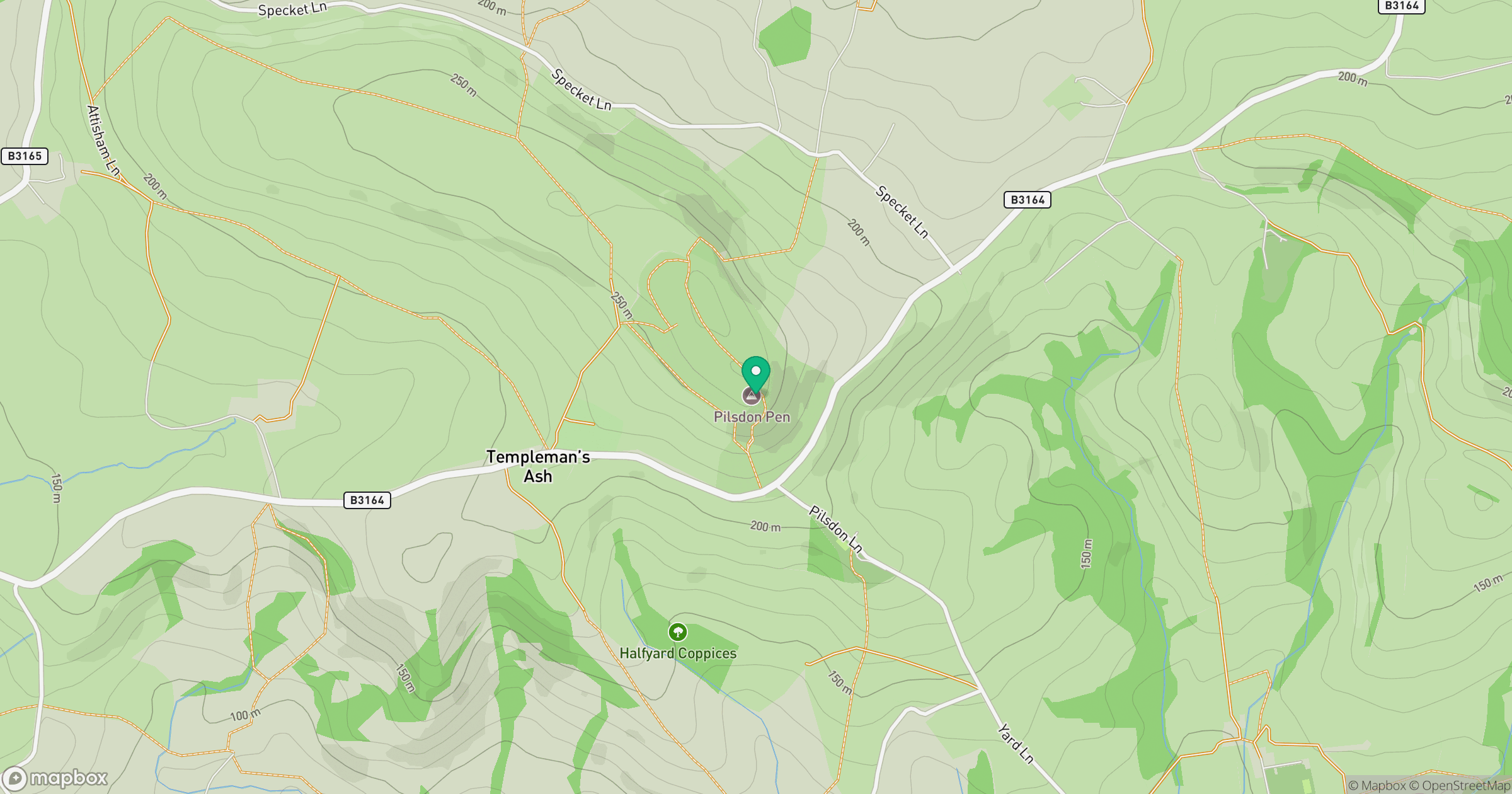
Grid reference: ST413011
View on OpenStreetMapOpens a map in a new tab, centred on the hill.



No comments yet. Be the first.