

Pen Llithrig y Wrach
Good walks are even better shared.
SH7162 : Fallen wall on the south ridge of Pen Llithrig y Wrach
Richard Law Photo source
Overview
Pen Llithrig y Wrach
Nestled in the heart of Snowdonia National Park, Pen Llithrig y Wrach rises proudly at an elevation of 720 meters. With its craggy character and an impressive prominence of 160 meters, this Marilyn offers a rewarding experience for keen walkers and casual hikers alike.
Geology
As part of the volcanic landscape of North Wales, Pen Llithrig y Wrach is primarily composed of rhyolitic rock. This geological feature tells a story of volcanic activity from millions of years ago. The diverse rock types can be observed along the trails, making it a perfect location for geology enthusiasts to study and admire the ancient processes that shaped the region.
Routes
Two main routes will take you to the summit:
- Cwm Pen Llithrig y Wrach is ideal for those looking for a moderate challenge. The scenery is simply breathtaking.
- A497 Approach provides an easier ascent for families, ensuring that all ages can enjoy the magnificent views.
Summit Features
Upon reaching the top, you will be greeted by a stone cairn and a trig point. Perfect for social media posts or just a proud moment of achievement, the views from here are also second to none.
Terrain Type
Expect a mix of rocky paths and grassy slopes. The terrain can be challenging in some sections, especially after a downpour, so solid footwear is a must. Don’t forget to bring your hiking poles to navigate the tricky bits!
Views
The highlight of the hike is undoubtedly the 360-degree views from the summit. On a clear day, catch glimpses of Snowdon and the enchanting Llyn Peninsula. The best time for these vistas is during spring or autumn, when the skies are typically clear and the scenery is awe-inspiring.
Hazards
Take heed: the mountain has steep drop-offs and loose rocks, especially near the summit. Weather can change quicker than you can say “where’s my waterproof jacket?”, so be prepared.
Nearby Summits
For those who fancy an extended adventure, consider tackling nearby peaks like Carnedd Llewelyn and Glyder Fawr.
Access
Getting to Pen Llithrig y Wrach is relatively straightforward. The nearest parking area is at Cwm Pen Llithrig y Wrach, but arrive early on sunny days to guarantee a spot.
Public transport options from Bethesda can ferry you close to start points, while Capel Curig is your nearby village for supplies and facilities.
Facilities
Unfortunately, you won't find facilities on the mountain, but Capel Curig has you covered for cafes and restrooms to refresh and regroup after your hike.
History
The name Pen Llithrig y Wrach adds a hint of folklore to your adventure. Be on the lookout for any 'sliding witches'! The mountain carries a rich history, beloved by both local and visiting hikers.
Conclusion
Pen Llithrig y Wrach is not just another mountain; it’s a journey through history, geology, and stunning natural beauty. Whether you're a seasoned trekker or a family out for some weekend fun, this mountain promises to deliver an experience to remember. Happy hiking!
Explore routes near Pen Llithrig y Wrach
Walks starting near this hill. Open a route to check its map, distance and full itinerary.
Llyn Crafnant: Lakeside Circuit from the NRW Car Park
View route
Snowdon Pyg Track returning by Miner's Track
View route
Beddgelert Forest: Derwen Circuit and Llyn Llywelyn
View route
Beddgelert Forest: Llyn Llywelyn Woodland Circuit
View route
Route planning notes
These notes describe possible approaches. Check a route's map and access information when planning your walk.
Cwm Pen Llithrig y Wrach
A scenic and moderately challenging route starting at Cwm Pen Llithrig y Wrach, featuring beautiful landscapes and stunning views as you ascend to the summit.
A497 Approach
An easier, more direct route suitable for families, starting from the Elidir Fawr car park, encompassing gentle slopes and expansive views throughout.
Make a day of it, together
Find someone to share the walk with, or organise a day out along a route you like.
Photo Gallery
View all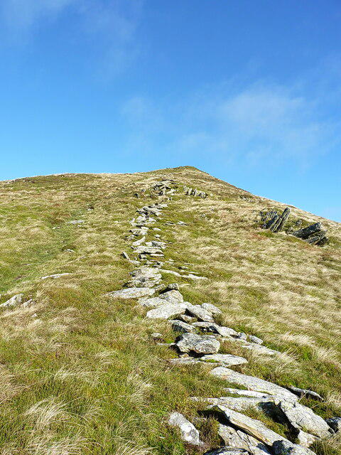 Photo could not load
SH7162 : Fallen wall on the south ridge of Pen Llithrig y Wrach
Richard Law
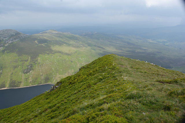 Photo could not load
SH7162 : Looking back down the ridge
Ian Greig
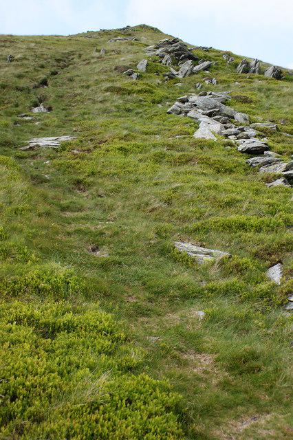 Photo could not load
SH7162 : Looking up the final (?) approach to Pen Llithrig y Wrach
Ian Greig
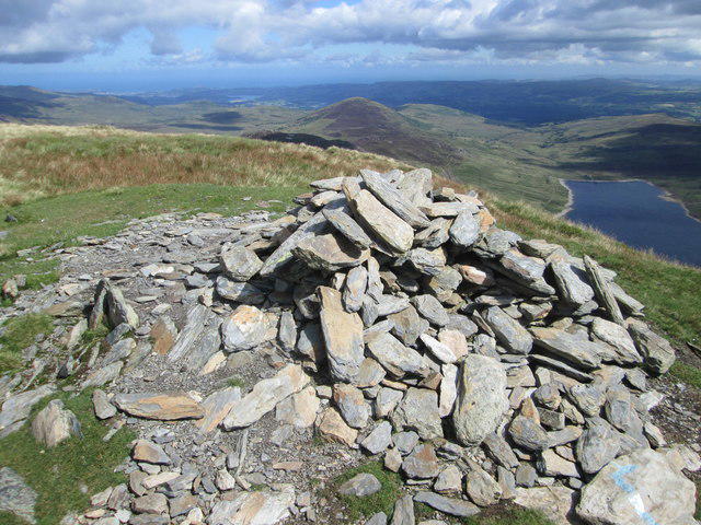 Photo could not load
SH7162 : Summit cairn, Pen Llithrig y Wrach (2,622 feet)
Peter S
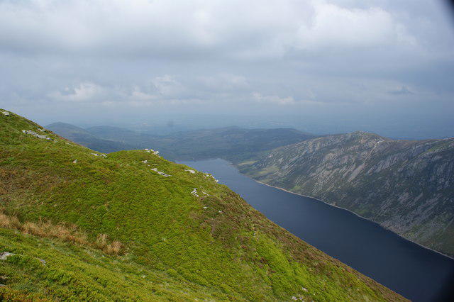 Photo could not load
SH7162 : Looking easterly with a view of Llyn Cowlyd and Creigiau Gleision
Ian Greig
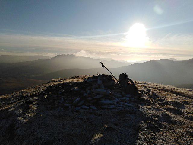 Photo could not load
SH7162 : Pen Llithrig y Wrach summit
Kevin Williams
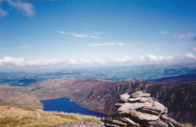 Photo could not load
SH7162 : The summit cairn on Pen Llithrig y Wrach
Eric Jones
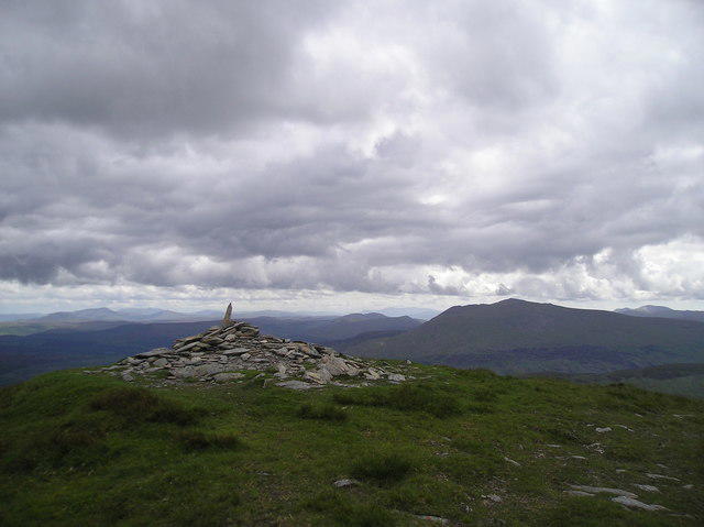 Photo could not load
SH7162 : Summit Cairn, Pen Llithrig y Wrach
Chris Andrews
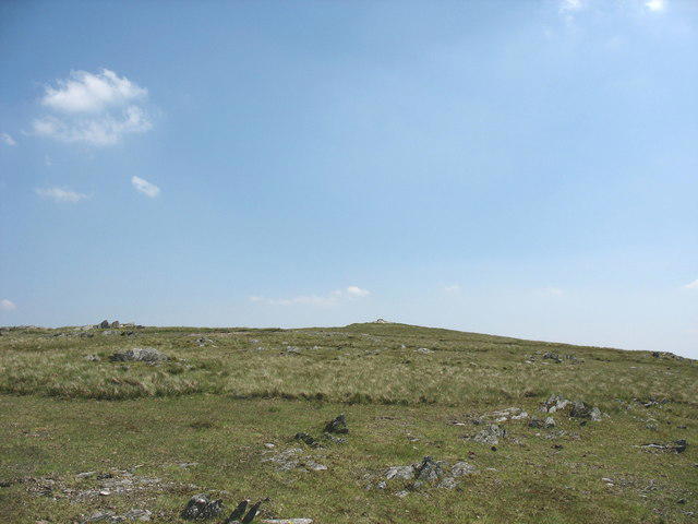 Photo could not load
SH7162 : Approaching the Summit of Pen Llithrig y Wrach
Eric Jones
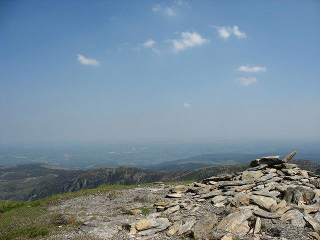
SH7162 : The Summit Cairn of Pen Llithrig y Wrach
Eric Jones
Hill facts and local notes
Classifications
Elevation
799m
2,620 ft
Prominence
180m
Coordinates
53.1423, -3.9208
SH716622
OS Map
115
Explorer: OL17E
At the Summit
The summit features a weathered stone cairn and a prominent trig point, perfect for capturing that elusive summit selfie while enjoying panoramic views.
Terrain & Geology
The mountain is predominantly composed of volcanic rock, specifically rhyolitic, showcasing the dynamic geological history of North Wales. The steep cliffs are a testament to ancient volcanic activity, making it a fascinating study for geology enthusiasts.
Views & Scenery
From the summit, hikers can enjoy views of the surrounding peaks like Snowdon, the rugged Carneddau range, and the Llyn Peninsula, with the shimmering waters of Llyn Ogwen in the foreground.
History & Heritage
Name Origin
The name 'Pen Llithrig y Wrach' translates to 'the hill of the sliding witch,' adding a touch of local folklore and mystique to the mountain.
Historical Significance
Historically, the area around Pen Llithrig y Wrach has seen the footprints of both ancient and modern adventurers and remains prized for its stunning scenery and outdoor pursuits.
Getting There & Facilities
Parking
The nearest parking is at the Cwm Pen Llithrig y Wrach car park (SH 721 628) accommodating several cars, but it can fill up quickly on sunny weekends.
Public Transport
The nearest public transport connection is from Bethesda, which has regular bus services that can take hikers close to the starting points.
Nearby Facilities
There are no facilities on the mountain itself, but Capel Curig provides shops, cafes, and public toilets to replenish your energy (and, importantly, empty your bladder!).
Safety Information
Known Hazards
- Steep drop-offs near the summit, potential for loose rock on paths, and rapid weather changes typical of the area.
General Safety Tips
- Check weather conditions before setting out
- Carry appropriate clothing and equipment
- Let someone know your planned route
- Take a map, compass, and GPS device
- Carry emergency supplies: food, water, first aid kit, torch
Hills
Some common questions about the hills answered
Are there group walks up Pen Llithrig y Wrach?
Many walkers use Walkmates to join or organise walks with others. You can check for group walks around Pen Llithrig y Wrach through the maps
Are there other walkers around Pen Llithrig y Wrach?
Activity varies by location and time, but Walkmates lets you see whether others have shared walks or shown interest in this area. Find other people through the walking friends search walking friends for Pen Llithrig y Wrach search or of course create your own walk for Pen Llithrig y Wrach
Can I organise a walk to Pen Llithrig y Wrach?
Yes. If there aren’t any walks listed already, you can create a walk and make it available for others to join.
If you're signed up to Walkmates, you can create a walk to Pen Llithrig y Wrach.
How do I find a walk up this hill?
There are often multiple ways to walk this hill, depending on experience and route preference. Walkmates helps you explore walks and routes that others have shared.
Can I suggest a new route up Pen Llithrig y Wrach?
Yes. You can suggest or create routes to share with others. Walkmates focuses on the social side of walking, so routes are used to help people organise walks and explore areas together, rather than as detailed navigation tools or route libraries.
Other uses really appreciate knowledgeable walkers sharing their routes. Share your favourite route to Pen Llithrig y Wrach here
The is an error or something incorrect about this hill. How do I let you know?
We always strive to keep the information on Walkmates as accurate as possible. If you find an error, please let us know through the contact form and we'll aim to correct it as quickly as possible
Community Discussion
Comments
Location
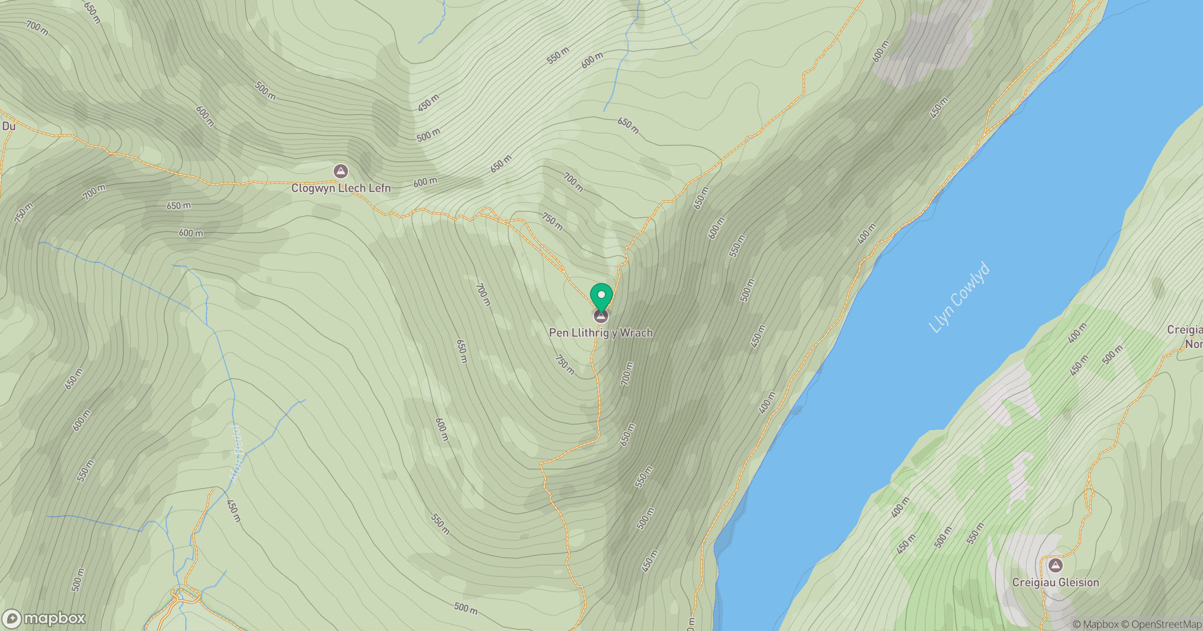
Grid reference: SH716622
View on OpenStreetMapOpens a map in a new tab, centred on the hill.
No comments yet. Be the first.