

Glasgwm
Good walks are even better shared.
SH8319 : Grid reference marker near Glasgwm
Dave Croker Photo source
Overview
Glasgwm: The Hidden Gem of the Brecon Beacons
Nestled within the stunning landscape of the Brecon Beacons National Park, Glasgwm is often overshadowed by its taller neighbours, yet it offers adventurers a delightful blend of serene beauty and rugged terrain. Standing at an elevation of 749 meters, Glasgwm, meaning 'Blue Ridge' in Welsh, presents a captivating journey for those seeking peace away from crowded trails.
Geology
One of the geological wonders of Glasgwm is its Old Red Sandstone structure, shaped and polished by the natural elements. The considerable glacial activity in the past has given this region its defining features, making the ascent a visual treat. Hiking here is not just a pastime; it's a journey through geological history.
Routes
From the A479
This route boasts a distance of about 10 kilometers and will take approximately four hours to complete. Initially following a well-trodden path, the trail gradually ascends, allowing you to soak in nature's beauty at a leisurely pace. It's a moderate hike, making it accessible for most walkers—just remember to watch your step, especially as you near the summit!
Summit Features
At the summit, you are welcomed by a small rocky outcrop where a trig point proudly stands. This makes for a classic 'top of the world' photo; just keep an eye out for the sheep—they're known to photobomb when they're feeling cheeky!
Terrain
Expect a mixture of rocky and grassy terrain. While parts of the trail will delight your trekking boots with soft grass, others might feel like a meeting with an uninvited swamp, so be prepared!
Views
The panoramic views from Glasgwm are breathtaking. When conditions are favourable, you can see the panoramic spectacle of the Wye Valley stretching out below, with the majestic Black Mountains flanking your view. Timing your hike for the spring or autumn allows for the best visibility—it's worth it!
Hazards
Every adventure has its pitfalls, and Glasgwm has its fair share. The muddy patches can be slippery after rain, so watch your footing. Also, be ready for the occasional sheep blockade—these woolly residents have the right of way on their home turf!
Nearby Summits
For those who like to chase more summits, Waun Fach and Pen y Fan are just a stone's throw away. Each offers different experiences, but you may find they seek to compete for your heart!
Access
Parking is conveniently located at the A479, close to the start of your adventure. If you prefer public transport, make your way to Talgarth, where a short bus ride from Brecon will bring you to the nearest town. Talgarth also offers cafes and shops for your pre-hike necessities.
Conclusion
In summary, Glasgwm is a marvellous little mountain that promises an exhilarating experience without the crowd. So lace up your boots and get ready to experience this hidden treasure—your new favourite hike awaits!
Explore routes near Glasgwm
Walks starting near this hill. Open a route to check its map, distance and full itinerary.
Waun-oer, Maesglase and Cribin Fawr guided mountain walk
View route
Aran Benllyn and Aran Fawddwy from LLanuwchllyn
View route
Coed y Brenin: Pont Ty'n-y-groes and Mawddach Forest Trail
View route
Mawddach Trail: Penmaenpool to Arthog Estuary Return
View route
Route planning notes
These notes describe possible approaches. Check a route's map and access information when planning your walk.
From the A479
A relatively straightforward ascent starting from the A479, following a well-defined path up to the summit with stunning views en route.
Make a day of it, together
Find someone to share the walk with, or organise a day out along a route you like.
Photo Gallery
View all Photo could not load
SH8319 : Grid reference marker near Glasgwm
Dave Croker
 Photo could not load
SH8319 : Camfa ar Glasgwm (Pen y Fign) / A stile on Glasgwm (Pen y Fign)
Ian Medcalf
 Photo could not load
SH8319 : Llyn Y Fign with ice fence
Dave Croker
 Photo could not load
SH8319 : Llyn y Fign from summit cairn of Glasgwm
Dave Croker
 Photo could not load
SH8319 : Llyn y Fign
Michael Graham
 Photo could not load
SH8319 : How thick is the ice on Llyn y Fign?
Dave Croker
 Photo could not load
SH8319 : Llyn y Fign
Ian Medcalf
 Photo could not load
SH8319 : Llyn Bach, on Glasgwm
Nigel Brown
 Photo could not load
SH8319 : Llyn y Fign
Alan Richards

SH8319 : Llyn y Fign and the summit of Glasgwm
Nigel Brown
Hill facts and local notes
Classifications
Elevation
779m
2,556 ft
Prominence
215m
Coordinates
52.7602, -3.7253
SH836194
OS Map
124 125
Explorer: OL23E
At the Summit
The summit is marked by a small rocky outcrop and a prominent trig point, perfect for standing on top of the world—or at least, Wales.
Terrain & Geology
Glasgwm is primarily composed of Old Red Sandstone, a sedimentary rock that has been sculpted by glacial activity over thousands of years, giving it the characteristic ruggedness typical of the Welsh mountains.
Views & Scenery
From the top, one can catch glimpses of the Wye Valley, the Black Mountains, and even the distant peaks of the Malvern Hills on a clear day.
History & Heritage
Name Origin
The name 'Glasgwm' can be translated to 'Blue Ridge' in Welsh, a fitting description for its stunningly beautiful landscape.
Historical Significance
Glasgwm is often regarded as a hidden gem within the Brecon Beacons, less frequented than some of its more famous neighbours but offering equally impressive views and a rewarding experience.
Getting There & Facilities
Parking
There is parking available at the start of the route on the A479, just south of the turn for Glasgwm.
Public Transport
The nearest main public transport links are in the town of Talgarth, which is approximately six miles away, with bus services connecting from Brecon.
Nearby Facilities
Cafes and public toilets are available in Talgarth, as well as shops for any last-minute supplies you might require before tackling Glasgwm.
Safety Information
Known Hazards
- Be wary of muddy sections, especially after rain, and the occasional sheep who might insist on blocking your path.
General Safety Tips
- Check weather conditions before setting out
- Carry appropriate clothing and equipment
- Let someone know your planned route
- Take a map, compass, and GPS device
- Carry emergency supplies: food, water, first aid kit, torch
Hills
Some common questions about the hills answered
Are there group walks up Glasgwm?
Many walkers use Walkmates to join or organise walks with others. You can check for group walks around Glasgwm through the maps
Are there other walkers around Glasgwm?
Activity varies by location and time, but Walkmates lets you see whether others have shared walks or shown interest in this area. Find other people through the walking friends search walking friends for Glasgwm search or of course create your own walk for Glasgwm
Can I organise a walk to Glasgwm?
Yes. If there aren’t any walks listed already, you can create a walk and make it available for others to join.
If you're signed up to Walkmates, you can create a walk to Glasgwm.
How do I find a walk up this hill?
There are often multiple ways to walk this hill, depending on experience and route preference. Walkmates helps you explore walks and routes that others have shared.
Can I suggest a new route up Glasgwm?
Yes. You can suggest or create routes to share with others. Walkmates focuses on the social side of walking, so routes are used to help people organise walks and explore areas together, rather than as detailed navigation tools or route libraries.
Other uses really appreciate knowledgeable walkers sharing their routes. Share your favourite route to Glasgwm here
The is an error or something incorrect about this hill. How do I let you know?
We always strive to keep the information on Walkmates as accurate as possible. If you find an error, please let us know through the contact form and we'll aim to correct it as quickly as possible
Community Discussion
Comments
Location
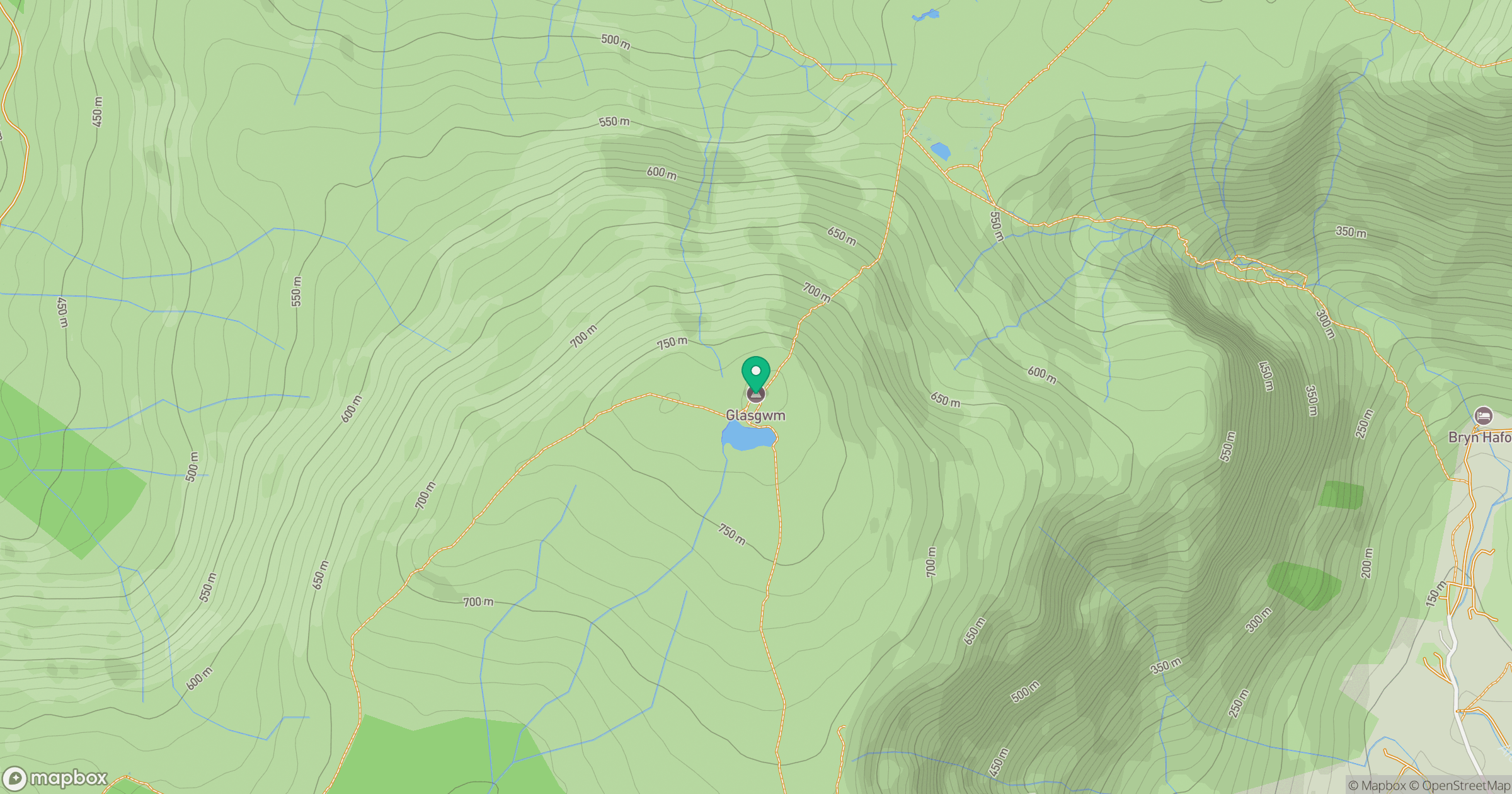
Grid reference: SH836194
View on OpenStreetMapOpens a map in a new tab, centred on the hill.
No comments yet. Be the first.