
Pen Cwm Silyn
Good walks are even better shared.
Overview
Pen Cwm Silyn: A Hiker's Delight
Pen Cwm Silyn, standing proudly at 734 meters, is the jewel of Snowdonia's spectacular landscape. With its volcanic rhyolite rock formations and varied terrain, this mountain invites both seasoned climbers and casual hikers alike.
Geology
The mountain’s rugged beauty is primarily comprised of volcanic rock, with underlying glacial till adding to its fascinating structure. You'll see some mesmerising rocky outcrops and sparse vegetation as you ascend, providing ample opportunities for photo ops.
Routes
Whether you're looking for a leisurely stroll or a serious workout, Pen Cwm Silyn offers several routes:
- Cwm Silyn Approach: This 8 km trek is the go-to for many walkers. Expect a moderate hike with stunning views of the rolling hills and deep valleys.
- Yr Eifl Ridge: For those seeking a challenge, this 12 km route is harder but rewardingly scenic. It takes you via the nearby Yr Eifl mountain range, with dramatic vistas along the way.
Terrain
The terrain varies significantly, with rocky trails and grassy slopes dominating the ascent interspersed with the occasional bog. A sturdy pair of walking boots is highly recommended!
Views
Upon reaching the summit, prepare to be mesmerised by breathtaking views of the Llyn Peninsula and the majestic peaks of Snowdon in the distance. The best times for these sights? Aim for spring or early autumn, when visibility is generally at its peak.
Hazards
Be mindful of the rapidly changing weather conditions in this region. It's wise to check the forecast before setting off. Additionally, the rocky outcrops can be treacherous, and some boggy areas may try to swallow your boots whole.
Access
You can park nearby at the Cwm Silyn car park, but be aware spots fill up quickly on a sunny weekend. If you're coming by bus, the service from Caernarfon is limited, but it can be a quaint journey through the countryside.
Facilities
Though there are no facilities on the hike itself, the nearby town of Penygroes offers cafes and public toilets for when you’ve earned that post-hike slice of cake (and who hasn’t?).
History
The name Pen Cwm Silyn evokes the mystery and folklore of the area, meaning 'Head of the Cwm of Silyn.' A captivating spot steeped in history, this mountain has been a backdrop for various local tales.
In summary, whether you're after a gentle climb or looking to push your limits, Pen Cwm Silyn welcomes you with open arms and stunning views. Happy hiking!
Explore routes near Pen Cwm Silyn
Walks starting near this hill. Open a route to check its map, distance and full itinerary.
Beddgelert Forest: Llyn Llywelyn Woodland Circuit
View route
Beddgelert Forest: Derwen Circuit and Llyn Llywelyn
View route
Snowdon Pyg Track returning by Miner's Track
View route
Yr Eifl and the Gyrns guided mountain walk
View route
Route planning notes
These notes describe possible approaches. Check a route's map and access information when planning your walk.
Cwm Silyn Approach
The most popular route starting from the east of the mountain, leading hikers through stunning valleys and eventually up to the summit.
Yr Eifl Ridge
An alternative route that includes a ridge walk starting from the nearby Yr Eifl mountains, offering breathtaking views along the way.
Make a day of it, together
Find someone to share the walk with, or organise a day out along a route you like.
Hill facts and local notes
Classifications
Elevation
422m
1,384 ft
Prominence
36m
Coordinates
53.0371, -4.2121
SH517511
OS Map
115
Explorer: OL17W 254
At the Summit
The summit features a prominent trig point and a small cairn, making it a perfect spot for triumphantly raising your arms and shouting 'I made it!'
Terrain & Geology
The mountain is primarily composed of volcanic rock, specifically rhyolite, which gives it a unique, rugged appearance. The surrounding area features glacial till and slate deposits, typical of this stunning part of Wales.
Views & Scenery
Panoramic views of the Llyn Peninsula, Snowdon in the distance, and the dramatic coastline along Cardigan Bay.
History & Heritage
Name Origin
The name Pen Cwm Silyn translates to 'Head of the Cwm (Hollow) of Silyn,' reflecting its prominent position in the landscape.
Historical Significance
Historically, the area has been important for local agriculture and is steeped in local folklore about the surrounding valleys and hills.
Getting There & Facilities
Parking
Parking is available at the Cwm Silyn car park, approximately 2 km from the trailhead, with space for around 15 cars.
Public Transport
The nearest bus service is available from Caernarfon, with a limited schedule, so plan ahead if you prefer public transport.
Nearby Facilities
No facilities on the mountain itself, but cafes and public toilets can be found in Penygroes, around a 10-minute drive away.
Safety Information
Known Hazards
- Variable weather conditions can change rapidly, rocky terrain requires caution, and some boggy areas can be treacherous.
General Safety Tips
- Check weather conditions before setting out
- Carry appropriate clothing and equipment
- Let someone know your planned route
- Take a map, compass, and GPS device
- Carry emergency supplies: food, water, first aid kit, torch
Hills
Some common questions about the hills answered
Are there group walks up Pen Cwm Silyn?
Many walkers use Walkmates to join or organise walks with others. You can check for group walks around Pen Cwm Silyn through the maps
Are there other walkers around Pen Cwm Silyn?
Activity varies by location and time, but Walkmates lets you see whether others have shared walks or shown interest in this area. Find other people through the walking friends search walking friends for Pen Cwm Silyn search or of course create your own walk for Pen Cwm Silyn
Can I organise a walk to Pen Cwm Silyn?
Yes. If there aren’t any walks listed already, you can create a walk and make it available for others to join.
If you're signed up to Walkmates, you can create a walk to Pen Cwm Silyn.
How do I find a walk up this hill?
There are often multiple ways to walk this hill, depending on experience and route preference. Walkmates helps you explore walks and routes that others have shared.
Can I suggest a new route up Pen Cwm Silyn?
Yes. You can suggest or create routes to share with others. Walkmates focuses on the social side of walking, so routes are used to help people organise walks and explore areas together, rather than as detailed navigation tools or route libraries.
Other uses really appreciate knowledgeable walkers sharing their routes. Share your favourite route to Pen Cwm Silyn here
The is an error or something incorrect about this hill. How do I let you know?
We always strive to keep the information on Walkmates as accurate as possible. If you find an error, please let us know through the contact form and we'll aim to correct it as quickly as possible
Community Discussion
Comments
Location
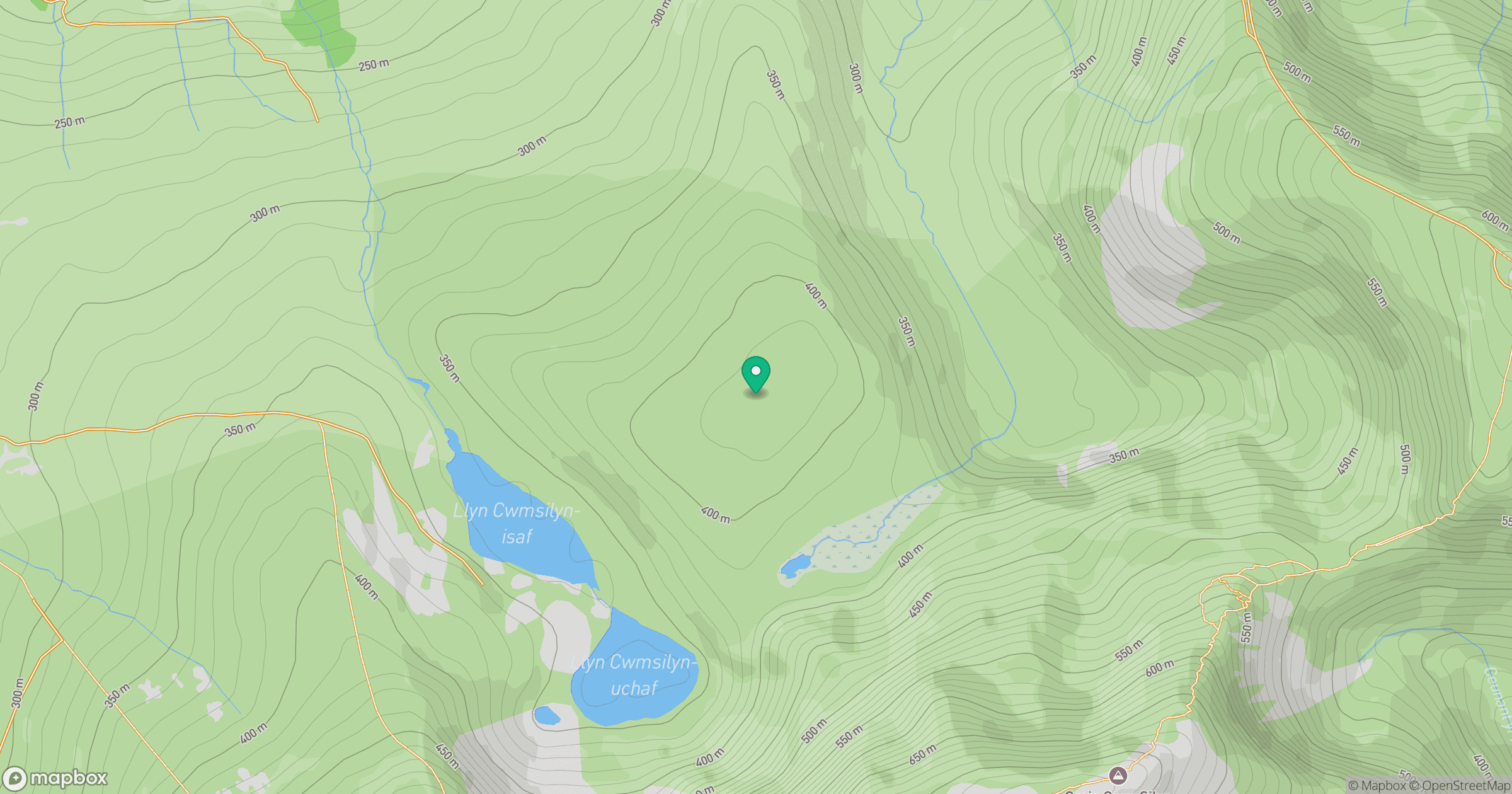
Grid reference: SH517511
View on OpenStreetMapOpens a map in a new tab, centred on the hill.
No comments yet. Be the first.