

Mynydd Mawr
Good walks are even better shared.
SH5454 : Mynydd Mawr
Roger Cornfoot Photo source
Overview
Mynydd Mawr (697.5 m) rises northwest of Yr Wyddfa in Gwynedd, above Rhyd Ddu and Y Fron. Its cairned summit overlooks the Nantlle Ridge, Anglesey and the Menai Strait. Forest paths and steep open slopes lead to the top, with substantial crags around Cwm Planwydd.
Mynydd Mawr
Summit and setting
Mynydd Mawr stands northwest of Yr Wyddfa in Gwynedd, between the Rhyd Ddu valley and the uplands above Y Fron. DoBIH records 697.5 m elevation and 462.5 m prominence. Its highest point is the cairn southeast of the wind shelter. The mountain is a Marilyn, Simm, Hewitt and Nuttall.
Rhyd Ddu via Foel Rudd
Start at the station pay-and-display car park, SH571526. Walk through the village along the A4085, turn onto the B4418 and enter the forestry track. Leave it for the climbing path near SH562540, cross the stiles and climb beside the forest to Foel Rudd. Follow the ridge around Cwm Planwydd to Mynydd Mawr. Return along the same ridge, forest path and village roads to the car park.
Walking Britain’s complete out-and-back is 9.8 km with 576 m ascent and an estimated 4 hours 40 minutes. The Rhyd Ddu Path on the opposite side of the valley climbs Yr Wyddfa and is a different walk.
From Y Fron
Begin in the centre of Y Fron. Follow the eastward road, turn left at its last junction before the cul-de-sac and continue over the cattle grid onto Uwchgwyrfai Common. Pass above Llyn Ffynhonau to the main climb near SH531555. The old mine track climbs steeply before becoming a fainter grassy path towards the summit. Retrace this route to Y Fron, taking particular care to find the upper descent and to keep clear of old workings.
Dave Roberts’ village-start route is 8.25 km, 436 m ascent and about 3 hours, including the return. Walking Britain describes a shorter 6.5 km/379 m version from SH516551 beyond the village; those figures belong to that different start.
Llyn y Dywarchen return option
Mud and Routes describes a separate circuit starting at the B4418 forestry entrance. Ascend via Foel Rudd as above. Descend the summit ridge to the forest stile, then remain outside the plantation and follow the grassy ridge down towards Llyn y Dywarchen. Follow the lake edge to the B4418 and turn left along the road to the forestry entrance. Its published figures are 9.31 km and 510 m ascent; no duration is given. Allow separately for walking from the station car park and for any optional Clogwynygarreg detour.
Access and mountain safety
The upper slopes are steep, and the rim of Cwm Planwydd has substantial drops at Craig y Bera. Stay back from cliff edges. The western path is loose in places and can disappear into grass near the top, making the descent difficult to locate in mist. Abandoned workings are another reason to keep to the route. Road sections need care around traffic.
The forest is a working landscape. Follow posted forestry closures and diversions, and keep gates and access roads clear. Carry mountain clothing, food, water and a map and compass, and check the forecast. Snow and ice require suitable winter experience and equipment.
Rhyd Ddu’s car park is beside its Welsh Highland Railway station. Sherpa’r Wyddfa S3 connects the village with Caernarfon and Beddgelert; S4 connects Porthmadog with Beddgelert. Check return services before setting out. Public toilets are listed at Rhyd Ddu; the accessible toilet requires a RADAR key according to the railway operator. Y Fron has limited roadside parking, and the community centre’s accommodation parking is not automatically available to walkers. Its operator page currently lists the café as closed.
Rock, views and heritage
BGS identifies riebeckite-bearing microgranite, an intrusion that hardened surrounding older sedimentary rocks. Slate workings on the lower western and southern flanks recall the area’s industrial past. In clear weather the summit looks across Yr Wyddfa, Moel Hebog and the Nantlle Ridge towards Anglesey, the Menai Strait and the Llŷn hills. Mynydd Mawr means “Big Mountain”.
Explore routes near Mynydd Mawr
Walks starting near this hill. Open a route to check its map, distance and full itinerary.
Beddgelert Forest: Llyn Llywelyn Woodland Circuit
View route
Beddgelert Forest: Derwen Circuit and Llyn Llywelyn
View route
Snowdon Pyg Track returning by Miner's Track
View route
Carnedd Circular from Ogwen Valley
View route
Route planning notes
These notes describe possible approaches. Check a route's map and access information when planning your walk.
Rhyd Ddu via Foel Rudd, out and back
Start and finish at Rhyd Ddu station car park (SH571526). Follow the village roads to the B4418 forestry entrance, then the track to the uphill path near SH562540. Climb beside the forest to Foel Rudd and follow the curving ridge above Cwm Planwydd to the summit. Retrace the same route to the car park. Walking Britain gives 576 m ascent and 4 h 40 min for the full return walk.
Y Fron via Uwchgwyrfai Common, out and back
Start and finish in central Y Fron. Follow the road east, take the last left before the cul-de-sac, cross the cattle grid and continue onto Uwchgwyrfai Common above Llyn Ffynhonau. At SH531555 take the steep old mine path, then the faint grassy upper line to the summit. Return by the same route, carefully locating the descent in mist and avoiding old workings. Dave Roberts gives 436 m ascent and about 3 hours for this village-start return walk.
Make a day of it, together
Find someone to share the walk with, or organise a day out along a route you like.
Photo Gallery
View all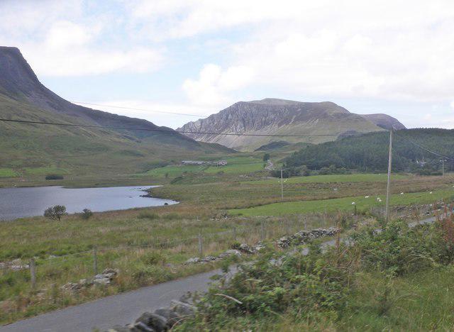 Photo could not load
SH5454 : Mynydd Mawr
Roger Cornfoot
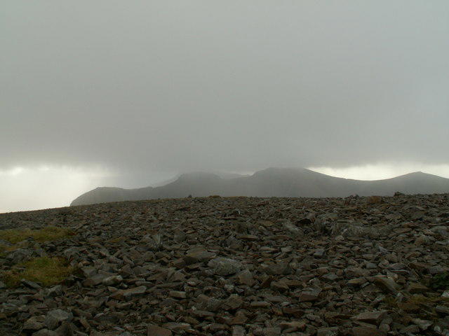 Photo could not load
SH5454 : The Nantlle Ridge Range from Mynydd Mawr Summit.
John Fielding
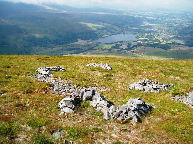 Photo could not load
SH5354 : Point of Impact
Chris Andrews
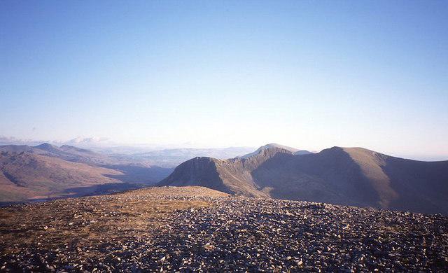 Photo could not load
SH5454 : On Mynydd Mawr
Richard Webb
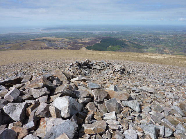 Photo could not load
SH5354 : Anglesey from Mynydd Mawr Summit
Ivan Hall
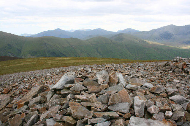 Photo could not load
SH5354 : Mynydd Mawr Summit Cairn
Terry Hughes
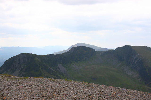 Photo could not load
SH5354 : Nantlle Ridge from Mynydd Mawr Summit
Terry Hughes
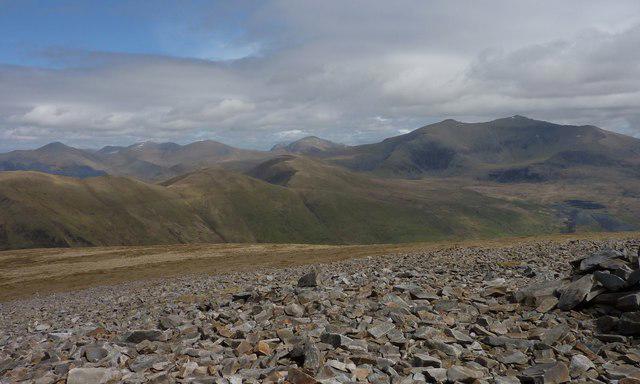 Photo could not load
SH5354 : Summit Plateau, Mynydd Mawr
Ivan Hall
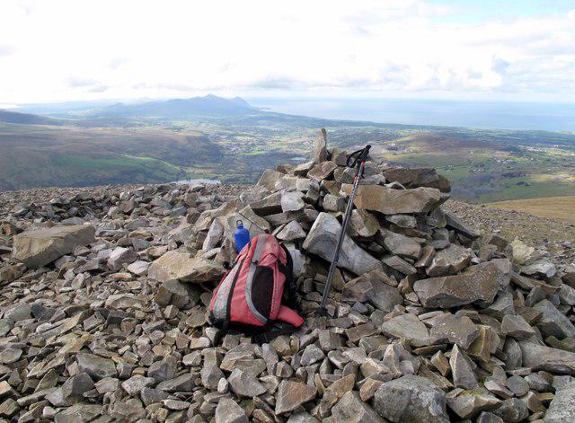 Photo could not load
SH5354 : Mynydd Mawr
Rude Health
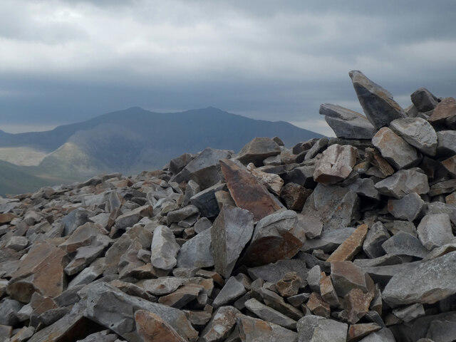
SH5354 : Carnedd ar gopa Mynydd Mawr / Cairn on the summit of The Elephant
Ceri Thomas
Hill facts and local notes
Classifications
Elevation
698m
2,288 ft
Prominence
462m
Coordinates
53.0695, -4.1810
SH539546
OS Map
115
Explorer: 017W 254
At the Summit
The highest point is the cairn southeast of the wind shelter, recorded by DoBIH at 697.5 m. The summit has cairns and low stone shelters.
Terrain & Geology
Mynydd Mawr is formed by a steep-sided intrusion of fine-grained, riebeckite-bearing microgranite. It cuts older Cambrian and Ordovician sedimentary rocks, which were hardened and thermally altered beside the intrusion.
Views & Scenery
In clear weather the summit overlooks Yr Wyddfa and its neighbouring peaks, the Nantlle Ridge, Moel Hebog, Anglesey, the Menai Strait and the Llŷn hills.
History & Heritage
Name Origin
Mynydd Mawr means “Big Mountain” in Welsh.
Historical Significance
Slate quarrying and mining left workings and spoil on the western and southern slopes. The Y Fron approach passes through this former industrial landscape.
Getting There & Facilities
Parking
For the Rhyd Ddu route use the National Park pay-and-display car park beside the Welsh Highland Railway station, SH571526. Keep forestry gates clear. Y Fron has limited roadside parking: obey signs and leave residents’ access clear. Parking advertised by Canolfan y Fron for accommodation guests is not a public walker-parking entitlement.
Public Transport
Sherpa’r Wyddfa S3 serves Rhyd Ddu station from Caernarfon and Beddgelert; from Porthmadog, take S4 and change at Beddgelert. Check the current timetable and return bus. Rhyd Ddu also has a Welsh Highland Railway station; check operating dates and suitable trains separately.
Nearby Facilities
Rhyd Ddu has National Park toilets, listed as open all year; the railway operator specifies a RADAR key for the accessible toilet. Take food and water for the mountain. Canolfan y Fron’s accommodation page currently lists its café as closed, so check reopening before relying on it.
Safety Information
Known Hazards
- Steep cliff drops surround Cwm Planwydd and Craig y Bera. Keep back from edges, especially in wind or poor visibility.
- The Y Fron upper path can be faint and difficult to relocate on descent; loose and eroded sections need careful footing. Carry a map and compass and know how to navigate.
- Keep clear of abandoned quarry and mine workings on the western approach; do not rely on fencing to protect every drop.
- Forestry operations can change the Rhyd Ddu approach. Follow Natural Resources Wales signs, diversions and closures.
- Road walking is part of the approaches and the Llyn y Dywarchen return; watch for traffic.
Seasonal Hazards
Snow or ice makes steep paths and crag edges more serious and requires suitable winter skills and equipment. Low cloud can hide the descent line; strong wind affects exposed upper slopes. Check the mountain forecast and allow enough daylight.
General Safety Tips
- Check weather conditions before setting out
- Carry appropriate clothing and equipment
- Let someone know your planned route
- Take a map, compass, and GPS device
- Carry emergency supplies: food, water, first aid kit, torch
Hills
Some common questions about the hills answered
Are there group walks up Mynydd Mawr?
Many walkers use Walkmates to join or organise walks with others. You can check for group walks around Mynydd Mawr through the maps
Are there other walkers around Mynydd Mawr?
Activity varies by location and time, but Walkmates lets you see whether others have shared walks or shown interest in this area. Find other people through the walking friends search walking friends for Mynydd Mawr search or of course create your own walk for Mynydd Mawr
Can I organise a walk to Mynydd Mawr?
Yes. If there aren’t any walks listed already, you can create a walk and make it available for others to join.
If you're signed up to Walkmates, you can create a walk to Mynydd Mawr.
How do I find a walk up this hill?
There are often multiple ways to walk this hill, depending on experience and route preference. Walkmates helps you explore walks and routes that others have shared.
Can I suggest a new route up Mynydd Mawr?
Yes. You can suggest or create routes to share with others. Walkmates focuses on the social side of walking, so routes are used to help people organise walks and explore areas together, rather than as detailed navigation tools or route libraries.
Other uses really appreciate knowledgeable walkers sharing their routes. Share your favourite route to Mynydd Mawr here
The is an error or something incorrect about this hill. How do I let you know?
We always strive to keep the information on Walkmates as accurate as possible. If you find an error, please let us know through the contact form and we'll aim to correct it as quickly as possible
Community Discussion
Comments
Location
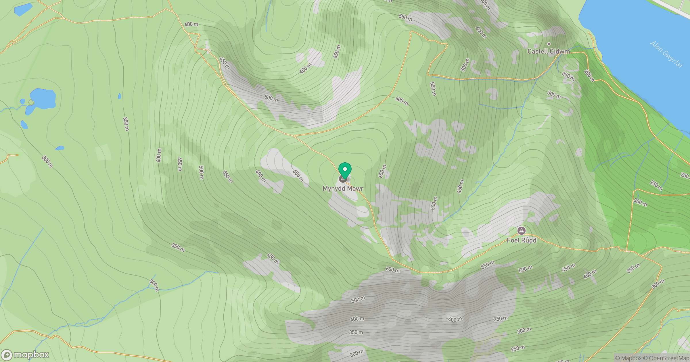
Grid reference: SH539546
View on OpenStreetMapOpens a map in a new tab, centred on the hill.
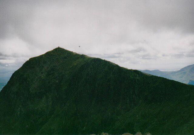
No comments yet. Be the first.