

Mynydd Llangorse
Good walks are even better shared.
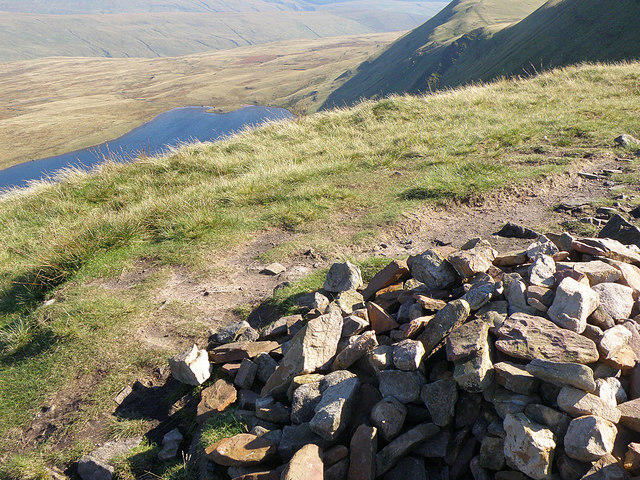
SO1526 : Cairn on Mynydd Llangors
Gareth James Photo source
Overview
Mynydd Llangorse
Welcome to Mynydd Llangorse, the Marilyn that gives you a lofty perspective on the lovely Brecon Beacons National Park! At an elevation of 600 meters, it’s a perfect day hike destination that showcases both natural beauty and cultural history.
Geology
Mynydd Llangorse is composed primarily of Old Red Sandstone, a sedimentary rock that has aged gracefully over millions of years. The landscape features vibrant hues of red and orange, giving hikers plenty of photo opportunities. If you're keen on geology, you'll find the various rock outcrops interesting.
Routes
One popular route begins at the picturesque Llangorse Lake. This circular hike covers about 8 km and generally takes around 3.5 hours. While it is a moderate trek, there are no major scrambling sections. Just remember to bring your water bottle and your best hiking boots!
Summit Features
At the peak, you're greeted by a lovely stone cairn, worthy of a proud pose for your Instagram. The panoramic views from the top are certainly Instagram-worthy, showcasing the vibrant landscapes of both Llangorse Lake and the rising peaks of the Black Mountains.
Terrain
Expect a mix of grassy slopes, perfectly designed for a leisurely stroll or an invigorating bolt to higher ground. However, watch your step near the summit; those rocky outcrops can be a bit cheeky!
Views
The lock-down views from the summit are breath-taking, especially during spring and autumn when everything looks like it’s been painted by the great masters. Look out towards the Black Mountains and Llangorse Lake, where you might even spot a swan or two.
Hazards
As with all mountain hiking adventures, there are certain hazards to consider. Sudden weather changes can be as unpredictable as a cat on a hot tin roof, and rocks can be quite slippery after rain. Always be prepared and don't let a dodgy forecast deter you!
Nearby Summits
If you’re feeling particularly adventurous, consider extending your hike to nearby peaks such as Mynydd Troed (654m) and Mynydd Llangatwg (638m) for even more stunning views.
Access
For those driving, the nearest parking is at Llangorse Lake car park, just a short trek from the trailhead. If you prefer to let someone else do the driving, local buses operate frequently from Brecon to Llangorse, making this an accessible spot for everyone.
Facilities
After your adventure, you can refuel at the charming café near Llangorse Lake, where you can enjoy a slice of cake as a reward for your hard work. Public toilets are also available, so no worries there!
History
The name Mynydd Llangorse translates to 'the mountain of Llangorse', which has deep roots in the region's history. Used primarily for agriculture in the past, today it stands as a beloved location for hiking and outdoor enthusiasts.
So pack your bags, lace up those boots, and head to Mynydd Llangorse. Whether you're a serious hiker or just a casual wanderer, there’s something special waiting for you at the peak!
Happy hiking!
Explore routes near Mynydd Llangorse
Walks starting near this hill. Open a route to check its map, distance and full itinerary.
A Very Merry Winter Walk ending with Cake & a Hot Drink!
View route
Brecon Basin to Brynich Aqueduct: Canal Towpath Walk
View route
Pen y Fan via Corn Du from Storey Arms
View route
Merthyr Tydfil with Men Walking & Talking
View route
Route planning notes
These notes describe possible approaches. Check a route's map and access information when planning your walk.
Llangorse Lake Circular Route
This scenic route starts at Llangorse Lake and features a gentle ascent to the summit with stunning views over the lake and surrounding hills.
Make a day of it, together
Find someone to share the walk with, or organise a day out along a route you like.
Photo Gallery
View all Photo could not load
SO1526 : Cairn on Mynydd Llangors
Gareth James
 Photo could not load
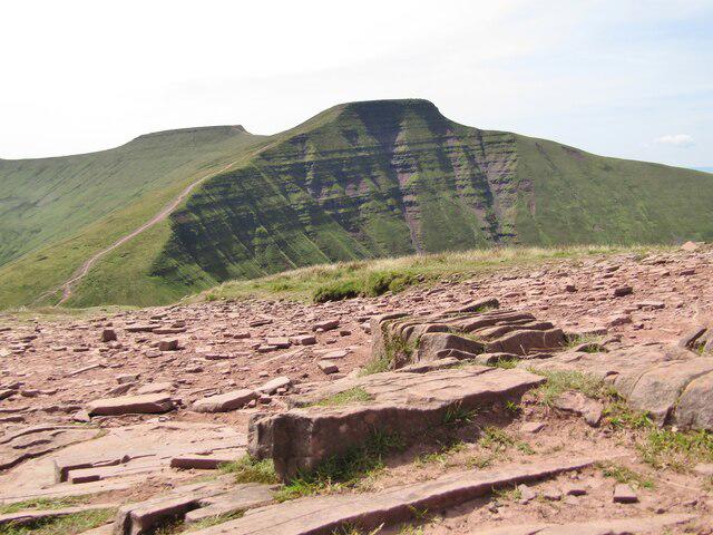
SO1526 : Mynydd Llangorse
Alan Hughes
 Photo could not load
SO1526 : Dried Pool,Mynydd Llangorse
Michael Graham
 Photo could not load
SO1526 : Mynydd Llangorse
Rude Health
Hill facts and local notes
Classifications
Elevation
515m
1,690 ft
Prominence
161m
Coordinates
51.9324, -3.2241
SO159266
OS Map
161
Explorer: OL13N
At the Summit
The summit is marked by a stone cairn, providing a perfect spot for a selfie with panoramic views!
Terrain & Geology
Mynydd Llangorse primarily consists of Old Red Sandstone which provides a rich tapestry of colours and rugged formations, making it a delight for geologists and photographers alike.
Views & Scenery
From the summit, you can see the majestic Black Mountains and the sprawling Llangorse Lake below, not to mention glimpses of the Beacons beyond.
History & Heritage
Name Origin
The name 'Mynydd Llangorse' translates to 'the mountain of Llangorse', referring to the nearby village.
Historical Significance
Historically, the area has been important for agriculture and now serves as a popular spot for outdoor recreation.
Getting There & Facilities
Parking
Parking is available at Llangorse Lake car park, which is approximately a 15-minute walk from the beginning of the ascent.
Public Transport
Regular buses operate from Brecon to Llangorse, with the nearest bus stop being a short walk from the lake.
Nearby Facilities
The Llangorse Lake area has a café and public toilets, perfect for a pre-hike coffee or a post-hike snack!
Safety Information
Known Hazards
- Beware of sudden weather changes, as conditions can turn sour quicker than a dog can chase its tail. Slippery slopes and loose rocks can also pose a risk.
General Safety Tips
- Check weather conditions before setting out
- Carry appropriate clothing and equipment
- Let someone know your planned route
- Take a map, compass, and GPS device
- Carry emergency supplies: food, water, first aid kit, torch
Hills
Some common questions about the hills answered
Are there group walks up Mynydd Llangorse?
Many walkers use Walkmates to join or organise walks with others. You can check for group walks around Mynydd Llangorse through the maps
Are there other walkers around Mynydd Llangorse?
Activity varies by location and time, but Walkmates lets you see whether others have shared walks or shown interest in this area. Find other people through the walking friends search walking friends for Mynydd Llangorse search or of course create your own walk for Mynydd Llangorse
Can I organise a walk to Mynydd Llangorse?
Yes. If there aren’t any walks listed already, you can create a walk and make it available for others to join.
If you're signed up to Walkmates, you can create a walk to Mynydd Llangorse.
How do I find a walk up this hill?
There are often multiple ways to walk this hill, depending on experience and route preference. Walkmates helps you explore walks and routes that others have shared.
Can I suggest a new route up Mynydd Llangorse?
Yes. You can suggest or create routes to share with others. Walkmates focuses on the social side of walking, so routes are used to help people organise walks and explore areas together, rather than as detailed navigation tools or route libraries.
Other uses really appreciate knowledgeable walkers sharing their routes. Share your favourite route to Mynydd Llangorse here
The is an error or something incorrect about this hill. How do I let you know?
We always strive to keep the information on Walkmates as accurate as possible. If you find an error, please let us know through the contact form and we'll aim to correct it as quickly as possible
Community Discussion
Comments
Location
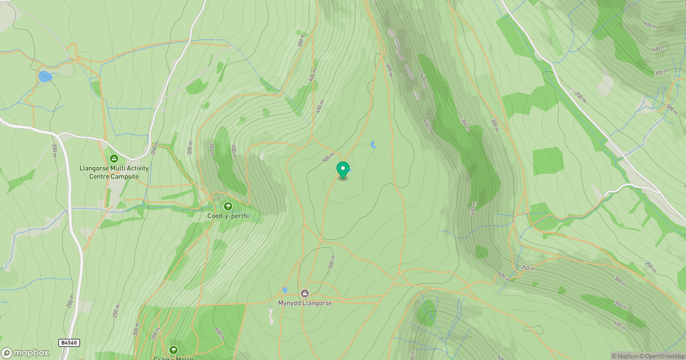
Grid reference: SO159266
View on OpenStreetMapOpens a map in a new tab, centred on the hill.
No comments yet. Be the first.