

Myarth
Good walks are even better shared.
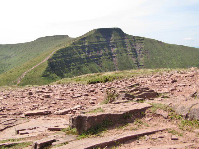
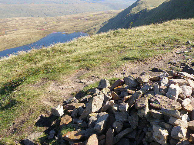
SO1720 : Myarth Path Junction Near Summit
Rude Health Photo source
Overview
Myarth: A Hidden Gem in the Brecon Beacons
Nestled in the heart of the Brecon Beacons, Myarth is often overshadowed by its more famous neighbours. However, this Marilyn offers an enticing blend of stunning scenery, manageable routes, and a rich tapestry of history.
Geology
The geology of Myarth is characterised by its sandstone and mudstone formation, typical of the Brecon Beacons. This region has fascinating geological features which date back hundreds of millions of years, showcasing the dynamic processes that shaped this wonderful landscape. It reminds us all that nature is one heck of an artist!
Routes
The Myarth Ridge Trail is a favourite among locals and visitors alike. Starting from Trecastle, this 4.5 km trek takes approximately two hours, making it perfect for a morning jaunt. The moderate difficulty makes it accessible for most hikers, though be prepared for some mildly tricky bits!
Summit Features
Upon reaching the summit, hikers are greeted with a small cairn and a stone monument, perfect for taking your token summit photo. Don't forget to give it a salute; it's been there longer than most of us!
Terrain Type
The terrain is a delightful mix of grassy hills and rocky outcrops. As you meander your way to the top, do take care on the boggy patches that can appear after a good downpour. A slippery slope can turn an enjoyable hike into a slapstick comedy!
Views
The views from the summit are truly breathtaking. You can see the Black Mountains stretching into the distance, and on a particularly clear day, Pen y Fan proudly stands out to the north. For the best spectacle, aim for spring or autumn when the landscape bursts with colour. Early morning sunrises might offer a serene sight of mist rising from the valleys.
Hazards
While there are not many major hazards, it is wise to keep an eye on wet spots, which can be more slippery than your average Highland cow! So watch your footing to avoid any comical tumbles.
Nearby Summits
If you're up for more adventure, consider tackling nearby Cribyn or Pen y Fan, both of which are popular among seasoned walkers and offer more spectacular views.
Access
The nearest parking area is conveniently located at the start of the Myarth Ridge Trail in Trecastle, making it simple for hikers to access the route. Public transport is limited, so it may be wise to drive. Trecastle itself provides necessary amenities including a delightful café and all-important public toilets.
Facilities
Fancy a bite to eat post-hike? The local café in Trecastle offers coffee and snacks to fuel your adventure. Facilities such as toilets are located near the village hall.
History
The etymology of Myarth is intriguing, with its Welsh roots hinting at a 'bitter place'. This might evoke images of grumpy sheep or sour-faced farmers! Historically, the area resonates with local folklore and tales of ancient times, allowing visitors to imagine themselves as the heroes of a bygone era.
In conclusion, Myarth is a remarkable mountain that captures the spirit of the Brecon Beacons. Ideal for a day out, it offers a unique combination of natural beauty, history, and a touch of adventure. Happy hiking!
Explore routes near Myarth
Walks starting near this hill. Open a route to check its map, distance and full itinerary.
A Very Merry Winter Walk ending with Cake & a Hot Drink!
View route
Brecon Basin to Brynich Aqueduct: Canal Towpath Walk
View route
Pen y Fan via Corn Du from Storey Arms
View route
Merthyr Tydfil with Men Walking & Talking
View route
Route planning notes
These notes describe possible approaches. Check a route's map and access information when planning your walk.
Myarth Ridge Trail
A scenic route starting from the village of Trecastle, which follows the ridge towards the summit, offering panoramic views along the way.
Make a day of it, together
Find someone to share the walk with, or organise a day out along a route you like.
Photo Gallery
View all Photo could not load
SO1720 : Myarth Path Junction Near Summit
Rude Health
Hill facts and local notes
Classifications
Elevation
292m
958 ft
Prominence
163m
Coordinates
51.8799, -3.2058
SO170208
OS Map
161
Explorer: OL13S
At the Summit
The summit is adorned with a small cairn and a weathered stone monument, giving hikers a perfect backdrop for their summit selfie.
Terrain & Geology
Primarily composed of sandstone and mudstone, Myarth showcases the classic geological features typical of the Brecon Beacons, providing a glimpse into the tumultuous geological past that shaped South Wales.
Views & Scenery
Breathtaking views of the Black Mountains and the sprawling valleys below. On a clear day, one could easily spot Pen y Fan to the north.
History & Heritage
Name Origin
The name 'Myarth' is believed to derive from the Welsh meaning 'the bitter place', a nod to its rugged terrain and unpredictable weather.
Historical Significance
Historically, the area is steeped in myths and legends, resonating with tales of ancient warriors and local folklore.
Getting There & Facilities
Parking
There is a designated parking area at the start of the Myarth Ridge Trail near Trecastle, with space for several cars.
Public Transport
Limited public transport is available; the nearest bus service operates from Brecon to Trecastle.
Nearby Facilities
A quaint café in Trecastle provides snacks and drinks, while public toilets are available near the village hall.
Safety Information
Known Hazards
- Wet and boggy areas can be slippery. Always watch your step, or you might end up in a muddy embrace!
General Safety Tips
- Check weather conditions before setting out
- Carry appropriate clothing and equipment
- Let someone know your planned route
- Take a map, compass, and GPS device
- Carry emergency supplies: food, water, first aid kit, torch
Hills
Some common questions about the hills answered
Are there group walks up Myarth?
Many walkers use Walkmates to join or organise walks with others. You can check for group walks around Myarth through the maps
Are there other walkers around Myarth?
Activity varies by location and time, but Walkmates lets you see whether others have shared walks or shown interest in this area. Find other people through the walking friends search walking friends for Myarth search or of course create your own walk for Myarth
Can I organise a walk to Myarth?
Yes. If there aren’t any walks listed already, you can create a walk and make it available for others to join.
If you're signed up to Walkmates, you can create a walk to Myarth.
How do I find a walk up this hill?
There are often multiple ways to walk this hill, depending on experience and route preference. Walkmates helps you explore walks and routes that others have shared.
Can I suggest a new route up Myarth?
Yes. You can suggest or create routes to share with others. Walkmates focuses on the social side of walking, so routes are used to help people organise walks and explore areas together, rather than as detailed navigation tools or route libraries.
Other uses really appreciate knowledgeable walkers sharing their routes. Share your favourite route to Myarth here
The is an error or something incorrect about this hill. How do I let you know?
We always strive to keep the information on Walkmates as accurate as possible. If you find an error, please let us know through the contact form and we'll aim to correct it as quickly as possible
Community Discussion
Comments
Location
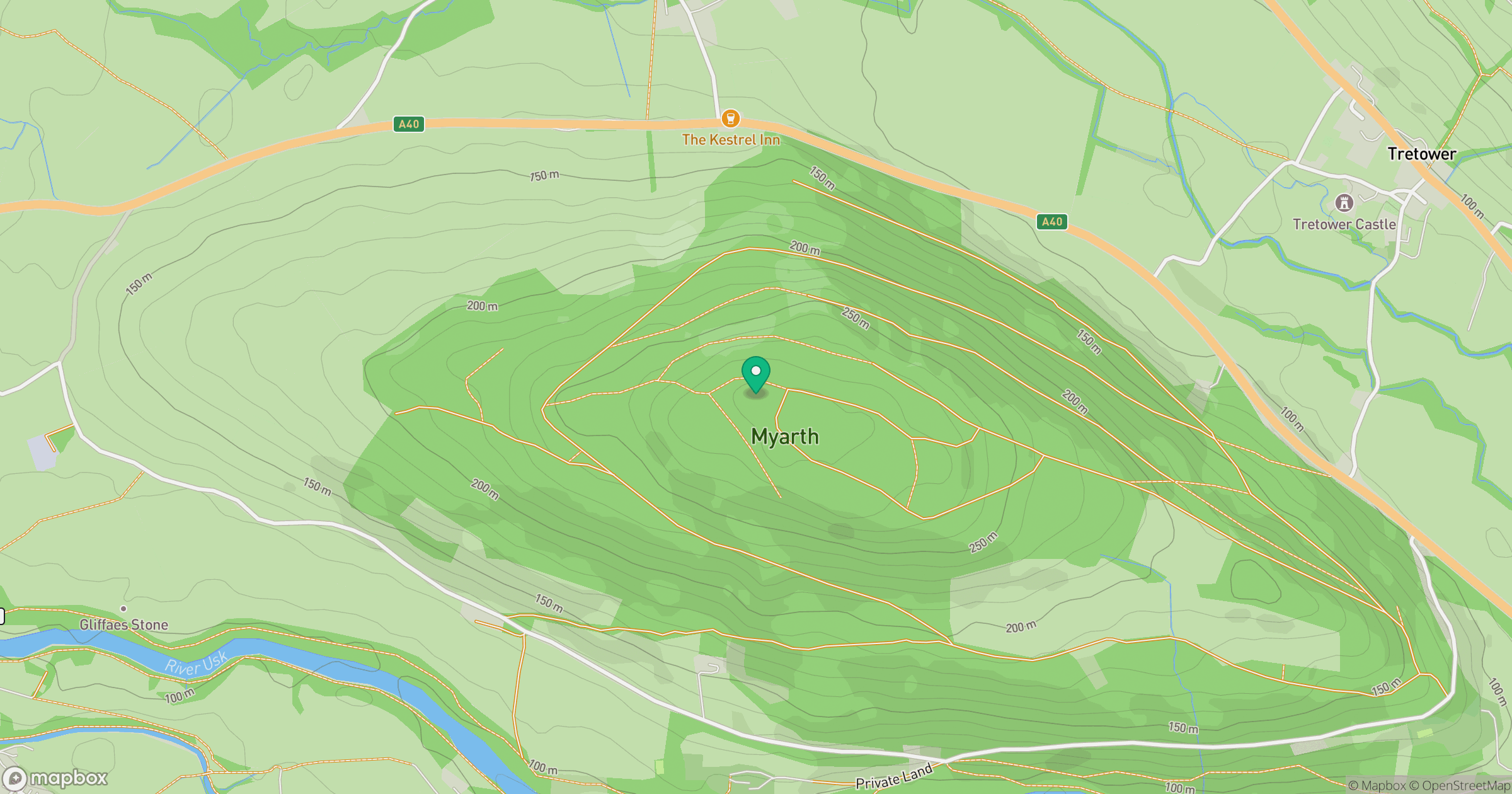
Grid reference: SO170208
View on OpenStreetMapOpens a map in a new tab, centred on the hill.
No comments yet. Be the first.