

Mynydd Eglwysilan
Good walks are even better shared.
ST1292 : Mynydd Eglwysilan, South Side of Summit
Colin Smith Photo source
Overview
Mynydd Eglwysilan
Nestled in the scenic hills of South Wales, Mynydd Eglwysilan stands proudly at 486 meters, commanding respect and admiration from hikers and nature lovers alike. This Marilyn offers not just a great workout but also views that make the effort worthwhile.
Geology
The underlying geological formations encompass Carboniferous limestone and mudstone, reminiscent of a long-forgotten era. If you fancy yourself a bit of a land detective, keep an eye out for intriguing rock formations!
Routes
The most popular route, named The Eglwysilan Circular, is an inviting trek. Clocking in at around 5.6 km, this moderate hike weaves through lush grassy fields and craggy outcrops. Allow about 2.5 hours to fully enjoy the journey; after all, it’s not a race, unless you’re racing a sheep!
Summit Features
At the summit, there's a charming trig point that has quite a few tales to tell if it could speak. It’s an excellent spot for a well-deserved snack break and to take in the encompassing views.
Terrain Type
Expect a delightful tapestry of grassy hills interspersed with rocky patches that may challenge your footing, especially after rain. Watch your step, and you might avoid a muddy mishap!
Views
The vistas from the top are second to none, with sights falling upon the surrounding Brecon Beacons, Cardiff, and even the Bristol Channel! Late spring through early autumn is the golden window for picture-perfect views.
Hazards
Don’t forget to prepare for the whimsical Welsh weather! Be wary of slippery paths post-rain and keep your eyes peeled for sheep crossing – they can be surprisingly bold!
Nearby Summits
If you’re up for more adventure, consider visiting the nearby summits like Mynydd Y Grug or Mynydd Machen, both offering their own unique charm.
Access
For access, park in the village of Eglwysilan, being considerate of the locals. Public transport from Caerphilly makes it convenient for those without a car.
Facilities
While facilities atop the mountain are scarce, the nearby town of Caerphilly has cafes and toilets - always a good consideration before or after your hike!
History
The name Eglwysilan is steeped in history, meaning 'Church of Silan'. This mountain has served as a place of recreation and reflection for many generations, straddling the realms of natural beauty and cultural importance.
So, whether you're in it for the fitness or the views, Mynydd Eglwysilan is a splendid spot to liven up your outdoor agenda! Pack your bag, grab your boots, and get ready to explore this charming Welsh hill.
Enjoy your adventure!
Explore routes near Mynydd Eglwysilan
Walks starting near this hill. Open a route to check its map, distance and full itinerary.
Cardiff: Hailey Park to Blackweir Bridge on the Taff Trail
View route
Merthyr Tydfil with Men Walking & Talking
View route
Aberdare Walk with Men Walking & Talking
View route
Newport Fourteen Locks to Risca: Monmouthshire Canal Return
View route
Route planning notes
These notes describe possible approaches. Check a route's map and access information when planning your walk.
The Eglwysilan Circular
A well-marked circular route starting from the village of Eglwysilan, taking in gentle slopes and more rugged terrain, perfect for a family outing or a leisurely day.
Make a day of it, together
Find someone to share the walk with, or organise a day out along a route you like.
Photo Gallery
View all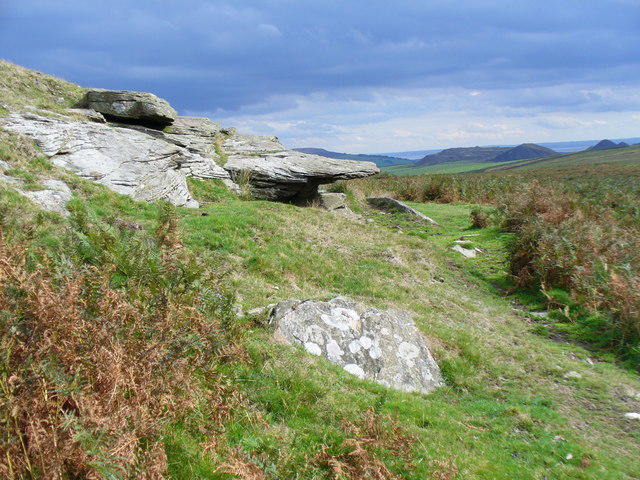 Photo could not load
ST1292 : Mynydd Eglwysilan, South Side of Summit
Colin Smith
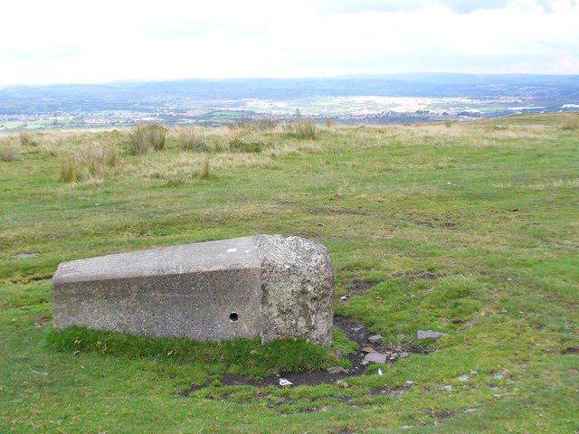 Photo could not load
ST1292 : Toppled Trig Pillar on Mynydd Eglwysilan
Colin Smith
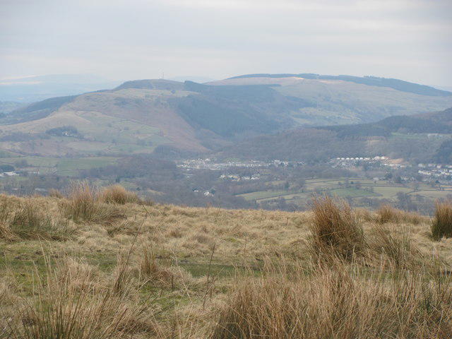 Photo could not load
ST1292 : View north west from Mynydd Eglwysilan
John Light
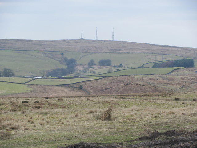 Photo could not load
ST1292 : Transmitters on Cefn Eglwysilan
John Light
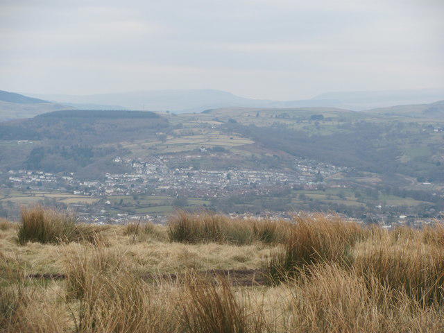 Photo could not load
ST1292 : Treharris from Mynydd Eglwysilan
John Light
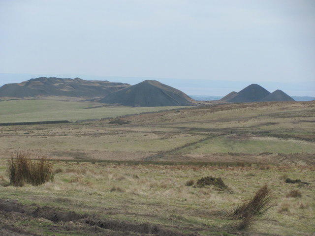 Photo could not load
ST1292 : Llanbradach spoil tips from Mynydd Eglwysilan
John Light
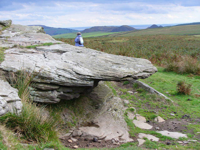 Photo could not load
ST1292 : Tor on Mynydd Eglwysilan
Colin Smith
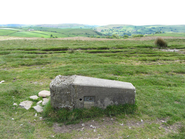 Photo could not load
ST1292 : Fallen trig point on Mynydd Eglwysilan
Gareth James
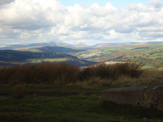 Photo could not load
ST1292 : View north from fallen trig point
Mike Kohnstamm
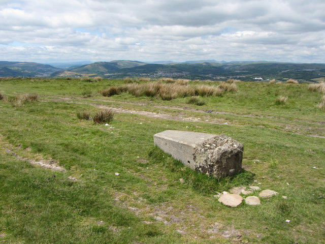
ST1292 : Fallen trig point on Mynydd Eglwysilan
Gareth James
Hill facts and local notes
Classifications
Elevation
355m
1,165 ft
Prominence
40m
Coordinates
51.6255, -3.2680
ST123926
OS Map
171
Explorer: 166E
At the Summit
At the summit, hikers will be delighted to find a conspicuous trig point, serving as a reminder of man's need to leave no stone unturned in their quest for navigation. The site also offers plenty of room to spread out a picnic and enjoy the vistas.
Terrain & Geology
Mynydd Eglwysilan features Carboniferous limestone and mudstone, providing a fascinating glimpse into geological history and a natural playground for budding geologists. The landscape is also punctuated by some delightful limestone cliffs.
Views & Scenery
From the summit, one can see across to the Brecon Beacons, Cardiff, and the Bristol Channel on a clear day, making it a real treat for the eyes and a snap-happy moment for any photographer.
History & Heritage
Name Origin
Eglwysilan translates to 'Church of Silan', hinting at the area's ecclesiastical history and inviting visitors to ponder the practices of the past.
Historical Significance
The area around Eglwysilan has long been associated with local religious significance, and the mountain has been a cherished walking destination for generations.
Getting There & Facilities
Parking
Street parking is available in the village of Eglwysilan. Be mindful to not block residents’ driveways!
Public Transport
Regular bus services connect to nearby towns such as Caerphilly, from where a short taxi ride or a bit of walking will lead you to the trailhead.
Nearby Facilities
While Mynydd Eglwysilan itself offers little in way of facilities, the nearest cafes and toilets can be found in Caerphilly, perfect for pre-hike coffee or post-hike cake.
Safety Information
Known Hazards
- Beware of sudden weather changes common in the area, slippery paths after rainfall, and the occasional curious sheep that may decide to veer into your path.
General Safety Tips
- Check weather conditions before setting out
- Carry appropriate clothing and equipment
- Let someone know your planned route
- Take a map, compass, and GPS device
- Carry emergency supplies: food, water, first aid kit, torch
Hills
Some common questions about the hills answered
Are there group walks up Mynydd Eglwysilan?
Many walkers use Walkmates to join or organise walks with others. You can check for group walks around Mynydd Eglwysilan through the maps
Are there other walkers around Mynydd Eglwysilan?
Activity varies by location and time, but Walkmates lets you see whether others have shared walks or shown interest in this area. Find other people through the walking friends search walking friends for Mynydd Eglwysilan search or of course create your own walk for Mynydd Eglwysilan
Can I organise a walk to Mynydd Eglwysilan?
Yes. If there aren’t any walks listed already, you can create a walk and make it available for others to join.
If you're signed up to Walkmates, you can create a walk to Mynydd Eglwysilan.
How do I find a walk up this hill?
There are often multiple ways to walk this hill, depending on experience and route preference. Walkmates helps you explore walks and routes that others have shared.
Can I suggest a new route up Mynydd Eglwysilan?
Yes. You can suggest or create routes to share with others. Walkmates focuses on the social side of walking, so routes are used to help people organise walks and explore areas together, rather than as detailed navigation tools or route libraries.
Other uses really appreciate knowledgeable walkers sharing their routes. Share your favourite route to Mynydd Eglwysilan here
The is an error or something incorrect about this hill. How do I let you know?
We always strive to keep the information on Walkmates as accurate as possible. If you find an error, please let us know through the contact form and we'll aim to correct it as quickly as possible
Community Discussion
Comments
Location
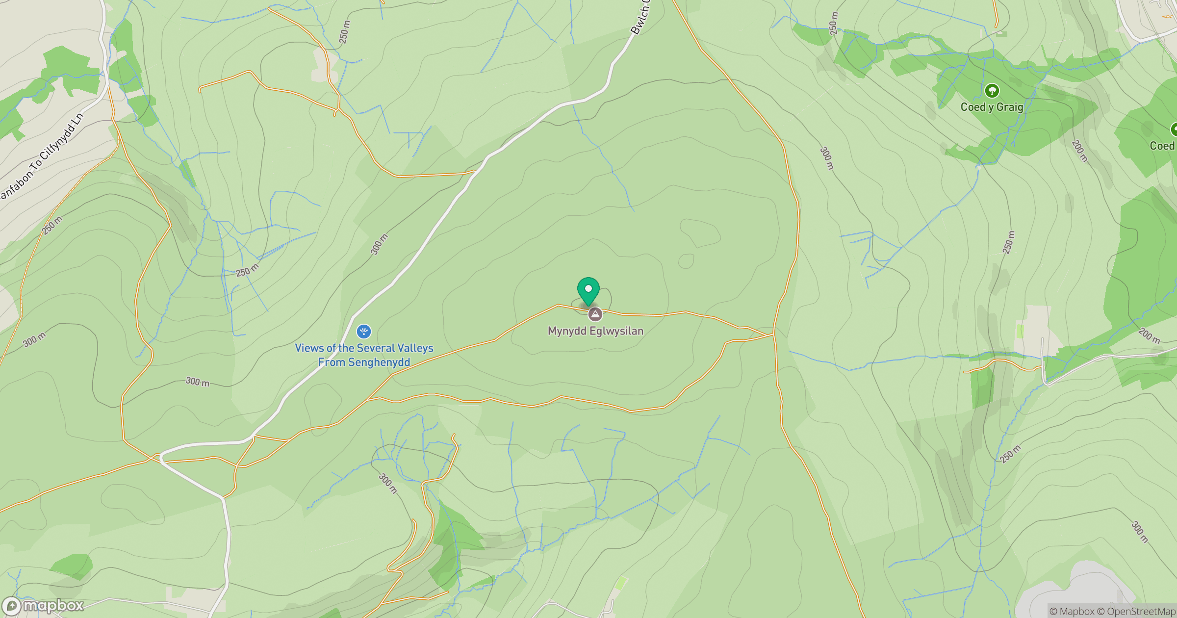
Grid reference: ST123926
View on OpenStreetMapOpens a map in a new tab, centred on the hill.
Nearby Hills

Cribyn
794m
Pen y Fan
886m
Fan Gyhirych
726m

Fan Brycheiniog - Twr y Fan Foel
802m

Dunkery Beacon
520m
No comments yet. Be the first.