

Mynydd Enlli
Good walks are even better shared.
Overview
Mynydd Enlli
Mynydd Enlli, rising to an elevation of 186 meters, is a cherished gem of the Llŷn Peninsula in North Wales. This Marilyn not only offers a delightful hike but also a glimpse into the area's rich geological and cultural heritage.
Geology
Composed mainly of volcanic rock, Mynydd Enlli bears the marks of ancient geological activity that has shaped the landscape. The layers of basalt that form the mountain are fascinating to study, and while the geology may not be everyone's cup of tea, it certainly adds character to the hike.
Routes
One of the most popular routes is the Southwest Approach from Aberdaron. This path is moderate in difficulty and stretches about 8 km, estimated at around 3.5 hours of walking. Along the way, you'll be treated to scenic views that make each step worth it.
Summit Features
Reaching the summit, adventurers will find a charming cairn, perfect for a celebratory group selfie or a moment of reflection. Don’t forget to take in the views while nibbling on your sandwich—after all, that’s a reward in itself!
Terrain
The terrain consists of grassy areas with rocky patches and a few boggy spots. It's important to remain vigilant of the ground beneath your feet, especially after rainfall, as some areas can get surprisingly slippery!
Views
From the summit, hikers are greeted with breathtaking views of Bardsey Island, the rugged coastline, and the vast expanse of the Irish Sea. On particularly clear days, the majestic peaks of Snowdonia can be seen painting a dramatic backdrop to your adventure. The best seasons for views are spring and early summer when the skies are often clear and the landscapes vibrant.
Hazards
As lovely as this route can be, it’s not without its hazards. The Welsh weather is notoriously fickle, so be prepared for anything from sunshine to sudden downpours. Additionally, the wet and boggy areas can pose a challenge, so sturdy footwear is highly recommended.
Access
The nearest parking can be found in the charming village of Aberdaron, just 4 km away from the trailhead. If you're relying on public transport, buses from Pwllheli will get you to Aberdaron with ease.
Facilities
The village of Aberdaron offers several delightful cafes and shops to replenish your energy after the hike. Public toilets are also available for convenience.
History
'Mynydd Enlli' translates to 'Mountain of Enlli' and is linked to the nearby Bardsey Island, a site of historical pilgrimage. The area resonates with tales and legends, making your hike not just a physical journey but a cultural one as well.
So grab your gear, put on your walking boots, and get ready to revel in the natural beauty and history that is Mynydd Enlli. You won’t regret it!
Explore routes near Mynydd Enlli
Public walks starting within 80 km of this hill. Nearby does not mean a route reaches the summit; check its map and access before setting out.
Yr Eifl and the Gyrns guided mountain walk
View route
Northern Rhinogydd guided mountain walk
View route
Beddgelert Forest: Llyn Llywelyn Woodland Circuit
View route
Beddgelert Forest: Derwen Circuit and Llyn Llywelyn
View route
Route planning notes
These notes describe possible approaches, not verified navigable routes or permission to cross land. Check current paths, local access rules and conditions before setting out.
Southwest Approach from Aberdaron
A scenic route that takes you from Aberdaron through rolling hills to the summit of Mynydd Enlli, offering stunning coastal views.
Make a day of it, together
Find someone to share the walk with, or organise a day out along a route you like.
Photo Gallery
View all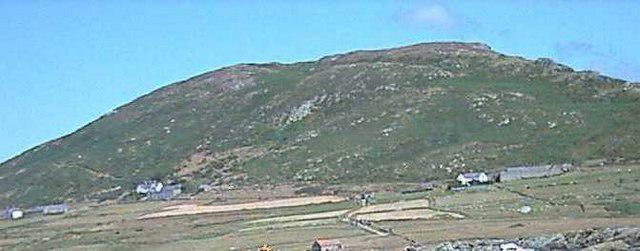 Photo could not load
SH1221 : Mynydd Enlli Bardsey
Alan Fryer
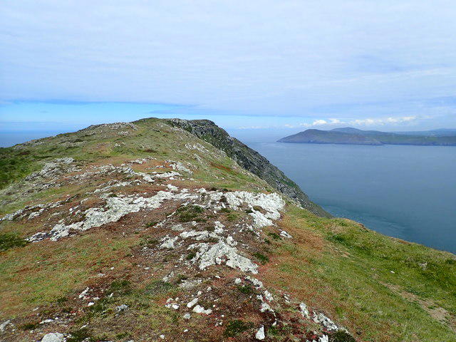 Photo could not load
SH1221 : Summit ridge, Mynydd Enlli
Eirian Evans
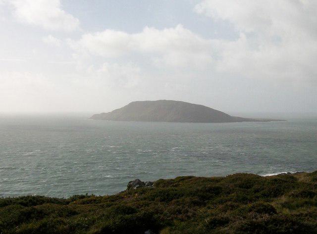 Photo could not load
SH1221 : Mynydd Enlli from Pen y Cil head
Eric Jones
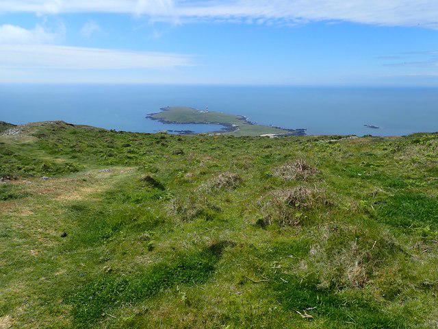 Photo could not load
SH1221 : Heading south on Bardsey Mountain
Eirian Evans
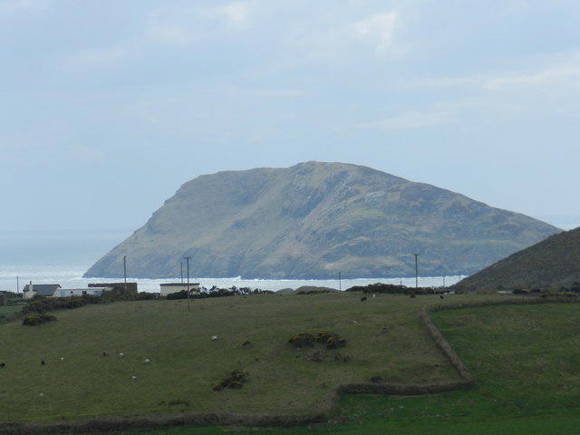 Photo could not load
SH1222 : Bardsey Island
Peter Barr
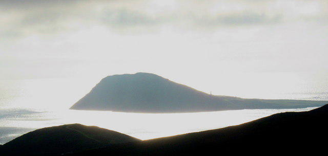 Photo could not load
SH1222 : Ynys Enlli
Eric Jones
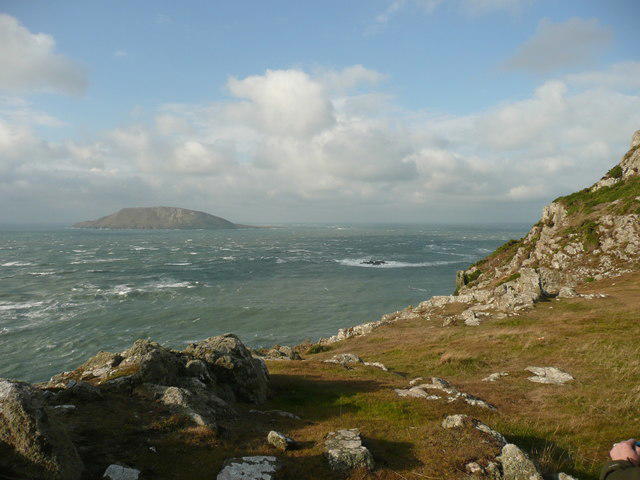 Photo could not load
SH1222 : Bardsey Island from Pen y Cil
Colin Cheesman
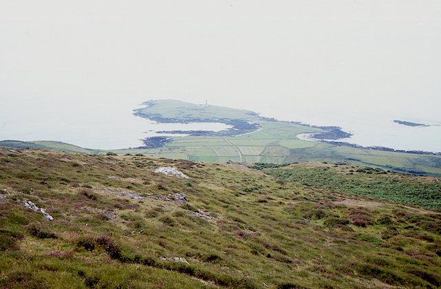 Photo could not load
SH1221 : View from Mynydd Enlli
Richard Webb
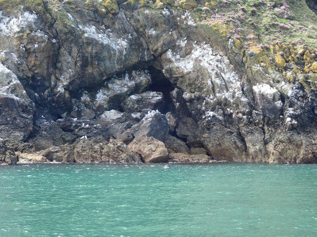 Photo could not load
SH1221 : Nesting sites at Bae Felen
Eirian Evans
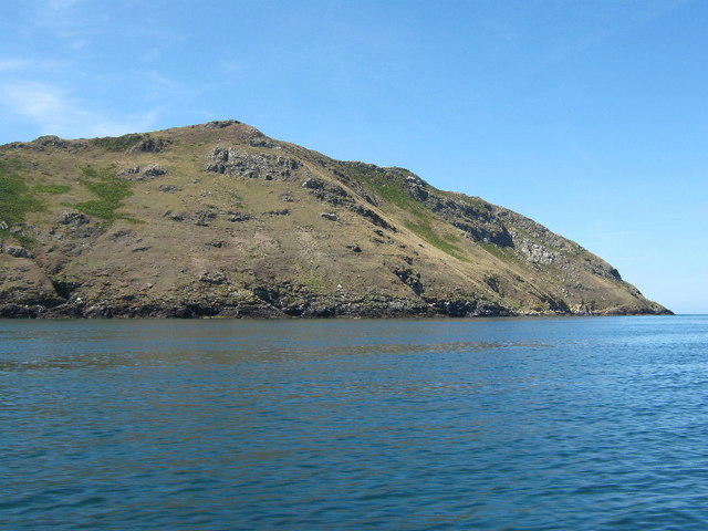
SH1221 : Looking up to the summit of Mynydd Enlli
David Medcalf
Hill facts and local notes
Classifications
Elevation
168m
551 ft
Prominence
168m
Coordinates
52.7623, -4.7831
SH123219
OS Map
123
Explorer: 253
At the Summit
At the summit, hikers will find a quaint cairn and a small stone shelter, providing a perfect spot for a well-deserved break and perhaps a cheeky sandwich.
Terrain & Geology
Mynydd Enlli is primarily composed of volcanic rock, with layers of basalt forming the rugged terrain. This unique geology is a testament to the volcanic activity that shaped the region millions of years ago.
Views & Scenery
The summit offers breathtaking views of the surrounding coastline, including Bardsey Island and the Irish Sea. On clear days, the distant Snowdonia mountain range can be spotted on the horizon.
History & Heritage
Name Origin
The name 'Mynydd Enlli' translates to 'Mountain of Enlli', with 'Enlli' being derived from the nearby Bardsey Island, which is steeped in legend.
Historical Significance
Mynydd Enlli holds cultural significance, often associated with ancient pilgrimage routes. The area is rich in history, with the nearby Bardsey Island considered a sacred site.
Getting There & Facilities
Check current local access restrictions, parking rules and transport timetables before travelling. These notes do not confirm public access to the summit.
Parking
Parking is available at the vibrant village of Aberdaron, which is approximately 4 km away from the trailhead. The car park is small but typically has enough space, and it’s got a lovely view to boot.
Public Transport
Buses run regularly from Pwllheli to Aberdaron, making it accessible for those relying on public transport.
Nearby Facilities
In Aberdaron, you'll find several cafes and shops where you can refuel before or after your adventure. Public toilets are available too, so no need to go bush!
Safety Information
Known Hazards
- Beware of sudden weather changes; the unpredictable Welsh weather can turn in a jiffy. Wet and boggy sections can be slippery, so sturdy boots are a must!
General Safety Tips
- Check weather conditions before setting out
- Carry appropriate clothing and equipment
- Let someone know your planned route
- Take a map, compass, and GPS device
- Carry emergency supplies: food, water, first aid kit, torch
Hills
Some common questions about the hills answered
Are there group walks up Mynydd Enlli?
Many walkers use Walkmates to join or organise walks with others. You can check for group walks around Mynydd Enlli through the maps
Are there other walkers around Mynydd Enlli?
Activity varies by location and time, but Walkmates lets you see whether others have shared walks or shown interest in this area. Find other people through the walking friends search walking friends for Mynydd Enlli search or of course create your own walk for Mynydd Enlli
Can I organise a walk to Mynydd Enlli?
Yes. If there aren’t any walks listed already, you can create a walk and make it available for others to join.
If you're signed up to Walkmates, you can create a walk to Mynydd Enlli.
How do I find a walk up this hill?
There are often multiple ways to walk this hill, depending on experience and route preference. Walkmates helps you explore walks and routes that others have shared.
Can I suggest a new route up Mynydd Enlli?
Yes. You can suggest or create routes to share with others. Walkmates focuses on the social side of walking, so routes are used to help people organise walks and explore areas together, rather than as detailed navigation tools or route libraries.
Other uses really appreciate knowledgeable walkers sharing their routes. Share your favourite route to Mynydd Enlli here
The is an error or something incorrect about this hill. How do I let you know?
We always strive to keep the information on Walkmates as accurate as possible. If you find an error, please let us know through the contact form and we'll aim to correct it as quickly as possible
Community Discussion
Comments
Location
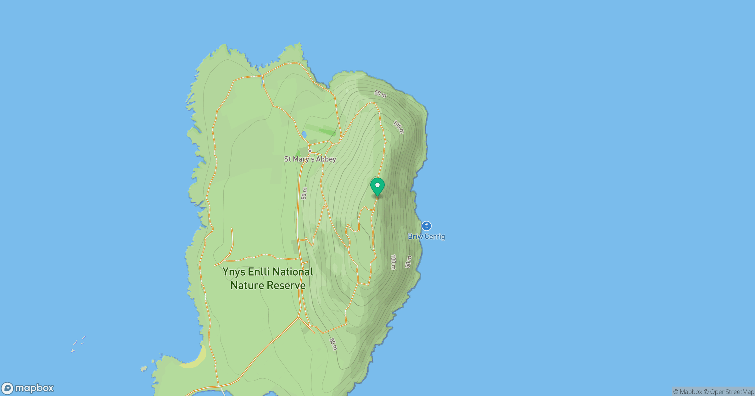
Grid reference: SH123219
View on OpenStreetMapOpens a map in a new tab, centred on the hill.
Hills within 30 km
Straight-line distance, not a walking route or confirmation of access.
No comments yet. Be the first.