

Moel Wnion
Good walks are even better shared.
Overview
Moel Wnion: A Hidden Gem in Snowdonia
Introduction
Nestled within the charming Snowdonia National Park, Moel Wnion stands at a proud 572 meters, offering both challenge and reward to avid hikers and casual stroll enthusiasts alike. Its unique topography and historical significance make it an excellent destination for those looking to explore the quirks of Welsh uplands.
Geology
The rocky foundations of Moel Wnion are steeped in volcanic history, a testament to its ancient geological past. The diverse landscape boasts an array of rocky outcrops that create a captivating contrast with the lush, sweeping grassy slopes that fill the valleys.
Routes
Glen Mawr Route
This moderate trail begins in the picturesque village of Llanuwchllyn. Follow the gentle meanders through a peaceful valley dotted with sheep—the only things that might judge your pace! The route becomes steeper as you approach the summit, testing your fitness level, but the panoramic views will surely provide all the fuel you need to reach the top.
Summit Features
Upon reaching the summit, you'll be greeted by a sturdy cairn—ideal for a quick selfie to boast to your friends about your latest adventure! Look closely, and you might spot the remains of a small stone shelter, perhaps a relic of past hikers seeking refuge from the racing winds.
Terrain Type
The terrain is primarily grassy but do come prepared for rocky outcrops and the occasional boggy stretch, especially after a good Welsh downpour. Sturdy footwear is a must; after all, you wouldn't want to squelch your way into some questionable squish!
Views
The views from Moel Wnion are nothing short of spectacular. Gaze out towards the beautiful Llyn Tegid, explore the distant Berwyn hills, and take in the majestic Cadair Idris on the horizon. Late spring and early autumn are prime times for visibility, and don't miss the chance for a glorious sunrise atop the ridge!
Hazards
While Moel Wnion isn’t the steepest mountain out there, it does come with its fair share of hazards. Keep an eye out for slippery rocks, particularly when it's rainy—it's not uncommon to find fellow hikers sporting a muddy backside after unexpected tumbles. Sudden weather shifts are also a classic hallmark of the Welsh mountains, so bring extra layers to keep warm!
Access
Nearest Parking
Parking is conveniently located in Llanuwchllyn. However, space is limited, so it’s wise to arrive early in the day.
Public Transport
For those using public transport, local buses operate between Bala and Llanuwchllyn. Be sure to check the local timetables, as services can vary.
Nearest Town
Bala, a short drive away, has everything you might need before or after your hike—from shops to eateries, it’s a welcoming hub surrounded by scenic beauty.
Facilities
While the summit offers no facilities, the nearby village has a delightful café and a local pub where you can relax and replenish your energy after a long day of hiking. Just don't forget to respect the local sheep—they are the true kings and queens of the grazed hills!
Conclusion
Moel Wnion is a splendid outing for those wanting to experience the beauty of Snowdonia without tackling the giants. With its unique geology, stunning views, and a solid dose of Welsh charm, you'll be keen to share your adventures far and wide. Happy hiking!
Explore routes near Moel Wnion
Public walks starting within 80 km of this hill. Nearby does not mean a route reaches the summit; check its map and access before setting out.
Llyn Crafnant: Lakeside Circuit from the NRW Car Park
View route
Snowdon Pyg Track returning by Miner's Track
View route
Conwy Quay to Llanfairfechan: the upland coast-path alternative
View route
Beddgelert Forest: Derwen Circuit and Llyn Llywelyn
View route
Route planning notes
These notes describe possible approaches, not verified navigable routes or permission to cross land. Check current paths, local access rules and conditions before setting out.
Glen Mawr Route
A scenic ascent starting from the village of Llanuwchllyn, meandering through tranquil valleys before tackling the steeper gradient towards the summit.
Make a day of it, together
Find someone to share the walk with, or organise a day out along a route you like.
Photo Gallery
View all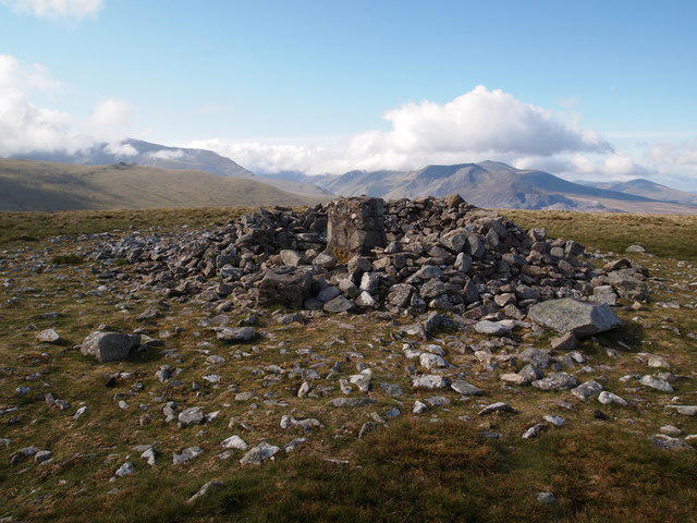 Photo could not load
SH6469 : Summit Cairn, Moel Wnion
Chris Andrews
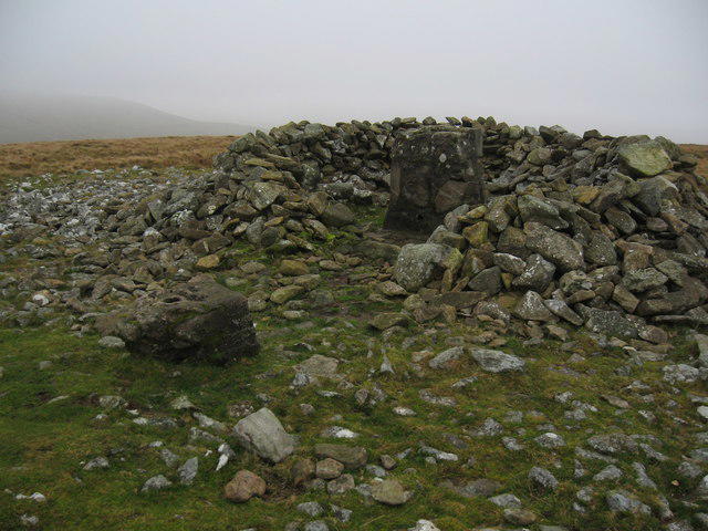 Photo could not load
SH6469 : Summit cairn and remains of trig point, Moel Wnion
Chris Andrews
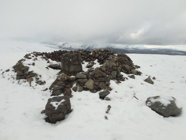 Photo could not load
SH6469 : Summit Cairn on Moel Wnion
Chris Andrews
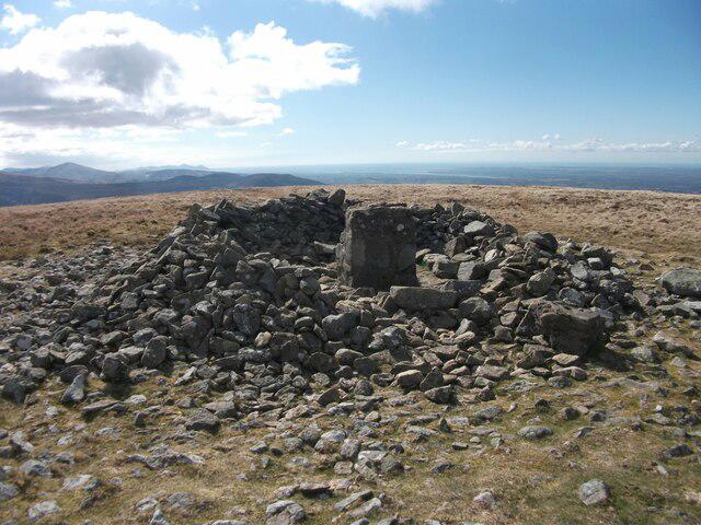 Photo could not load
SH6469 : Cairn at the summit of Moel Wnion and triangulation pillar remains, Llanllechid
Meirion
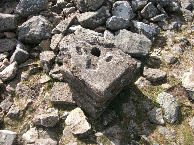 Photo could not load
SH6469 : Remains of upper section of Moel Wnion triangulation pillar, Llanllechid
Meirion
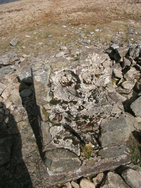 Photo could not load
SH6469 : Remains of lower section of Moel Wnion triangulation pillar, Llanllechid
Meirion
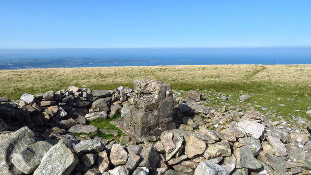 Photo could not load
SH6469 : Summit of Moel Wnion with Anglesey beyond
Colin Park
Hill facts and local notes
Classifications
Elevation
580m
1,903 ft
Prominence
104m
Coordinates
53.2073, -4.0233
SH649697
OS Map
115
Explorer: OL17W
At the Summit
The summit features a prominent cairn, providing a perfect spot for a post-walk snack, and a small weathered stone structure that serves as a shelter from the elements.
Terrain & Geology
Moel Wnion is primarily composed of volcanic rock, reflecting its ancient origins. The landscape showcases a mixture of rocky outcrops and lush, grassy slopes, characteristic of the rugged Welsh uplands.
Views & Scenery
The expansive views include the shimmering shores of Llyn Tegid, the rolling hills of the Berwyn range, and a delightful glimpse of nearby Cadair Idris.
History & Heritage
Name Origin
The name 'Moel Wnion' translates to 'hill of the marsh', reflecting the proximity of marshy land to its base.
Historical Significance
This area has been important for centuries, with local folklore linking it to ancient tribes and traditional livestock grazing.
Getting There & Facilities
Check current local access restrictions, parking rules and transport timetables before travelling. These notes do not confirm public access to the summit.
Parking
Parking is available at the village of Llanuwchllyn, where there is a small car park with limited spaces. Arrive early to secure a spot.
Public Transport
Buses run periodically from Bala to Llanuwchllyn; check local schedules for the latest information.
Nearby Facilities
There are no facilities at the summit itself, but Llanuwchllyn nearby has a pub and a quaint café for thirsty walkers seeking refreshments.
Safety Information
Known Hazards
- Beware of slippery rocks in wet conditions and be cautious of sudden weather changes typical of the Welsh mountains.
General Safety Tips
- Check weather conditions before setting out
- Carry appropriate clothing and equipment
- Let someone know your planned route
- Take a map, compass, and GPS device
- Carry emergency supplies: food, water, first aid kit, torch
Hills
Some common questions about the hills answered
Are there group walks up Moel Wnion?
Many walkers use Walkmates to join or organise walks with others. You can check for group walks around Moel Wnion through the maps
Are there other walkers around Moel Wnion?
Activity varies by location and time, but Walkmates lets you see whether others have shared walks or shown interest in this area. Find other people through the walking friends search walking friends for Moel Wnion search or of course create your own walk for Moel Wnion
Can I organise a walk to Moel Wnion?
Yes. If there aren’t any walks listed already, you can create a walk and make it available for others to join.
If you're signed up to Walkmates, you can create a walk to Moel Wnion.
How do I find a walk up this hill?
There are often multiple ways to walk this hill, depending on experience and route preference. Walkmates helps you explore walks and routes that others have shared.
Can I suggest a new route up Moel Wnion?
Yes. You can suggest or create routes to share with others. Walkmates focuses on the social side of walking, so routes are used to help people organise walks and explore areas together, rather than as detailed navigation tools or route libraries.
Other uses really appreciate knowledgeable walkers sharing their routes. Share your favourite route to Moel Wnion here
The is an error or something incorrect about this hill. How do I let you know?
We always strive to keep the information on Walkmates as accurate as possible. If you find an error, please let us know through the contact form and we'll aim to correct it as quickly as possible
Community Discussion
Comments
Location
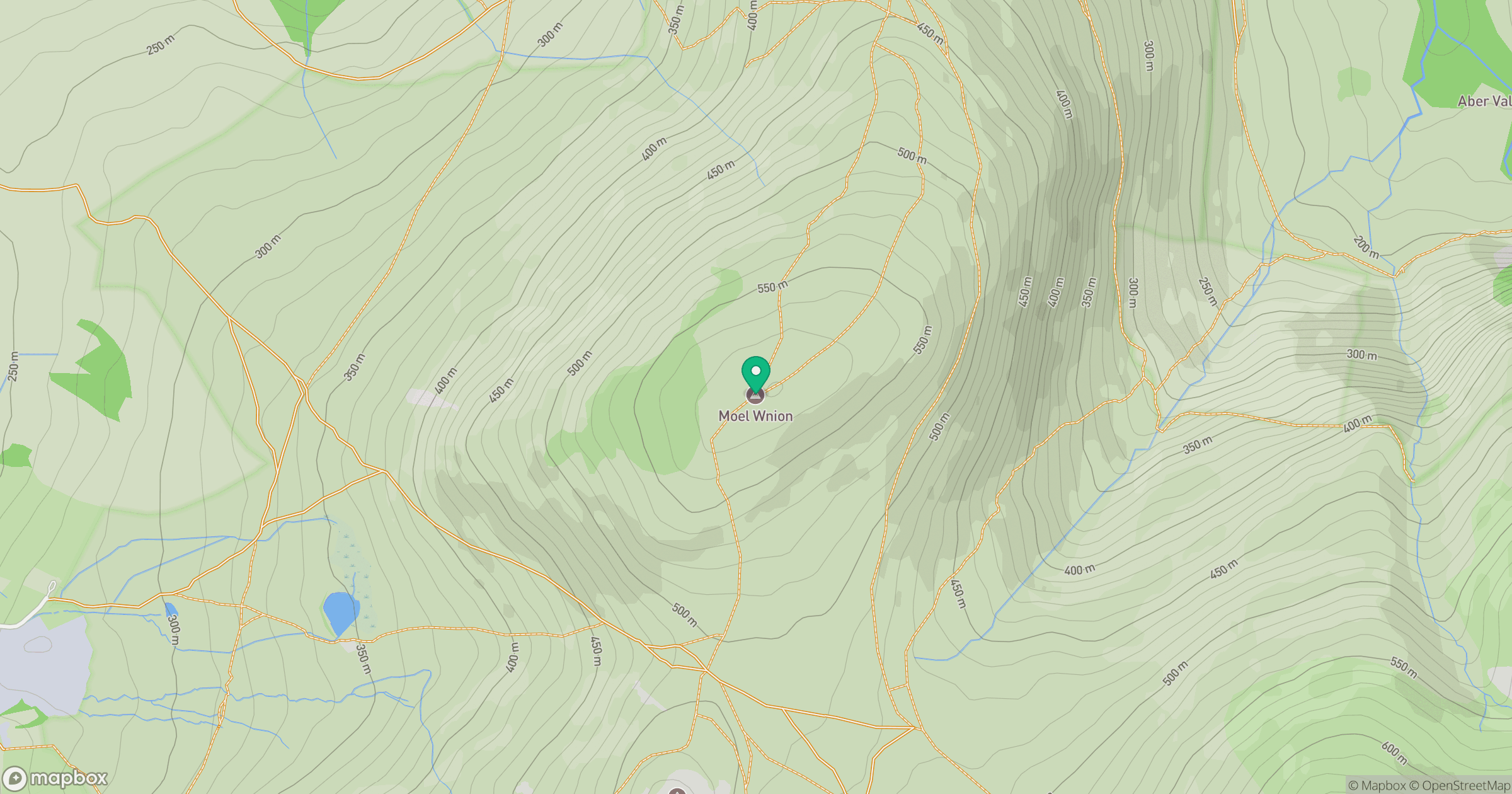
Grid reference: SH649697
View on OpenStreetMapOpens a map in a new tab, centred on the hill.
Hills within 30 km
Straight-line distance, not a walking route or confirmation of access.
No comments yet. Be the first.