

Moel Hafodowen
Good walks are even better shared.
Overview
Moel Hafodowen: A Hiker's Delight
Introduction
Perched elegantly in the Brecon Beacons, Moel Hafodowen is a Marilyn that charms hikers with both its stunning vistas and manageable trails. Whether you’re a seasoned rambler or merely fancy a stroll, it's a peak that promises both a sense of achievement and an excellent excuse for a post-hike pint in Talybont-on-Usk.
Geology
The geology of Moel Hafodowen contributes significantly to its rugged character. Mainly built of Old Red Sandstone, the landscape tells a tale of ancient river systems and volcanic activity. Thus, every step on its ground is a step through time.
Routes
From Talybont-on-Usk
This route is incredibly popular due to its accessibility and scenic beauty. As you navigate through vibrant woodlands and rolling meadows, you’ll find plenty of spots to rest and take in the view. After gaining some elevation, the trail becomes moderately challenging as you approach the summit. Expect to spend about 3.5 hours to complete this 6.5 km route.
From the Usk Reservoir
Embarking from the Usk Reservoir, hikers are treated to stunning lakeside views alongside the path. This route stretches around 8 km and takes approximately 4 hours. It’s a lovely choice if you appreciate an approach with water views!
Summit Features
At the top, you’ll find a large stone cairn that’s perfect for taking a well-deserved breather. It’s also a spot where sheep have claimed the high ground—so be prepared for some woolly company!
Terrain Type
Expect a mix of grassy slopes, rocky patches, and just a hint of bog, particularly when the weather has been unkind. A sturdy pair of hiking boots will do wonders here, ensuring you stay upright while navigating the ever-charming terrain.
Views
The views from Moel Hafodowen are simply captivating. Revel in the sight of the distant Snowdonia peaks and the expansive Brecon Beacons. For the freshest air and best scenery, head up in spring or early summer when flora is bursting into life.
Hazards
While the trek is generally safe, keep an eye out for slippery rocks and sudden weather changes. The mountains have a playful way of throwing in some unpredictability!
Nearby Summits
If you're looking for more peaks to conquer, you're in luck! Mynydd Troed and Waun Fach are both within easy reach and provide fantastic views and challenging hikes as well.
Access
Nearest Parking
Parking is available at Talybont-on-Usk, where hikers can find plenty of space to leave their vehicles—just remember not to block local access!
Public Transport
Public transport options include buses running from Cardiff and nearby towns. It’s a wise choice for those wanting a pint after their hike!
Nearest Town
The delightful village of Talybont-on-Usk is where your journey commences.
Facilities
Once you’ve happily scaled the peak, there are cafes and pubs in Talybont-on-Usk where you can warm up and recount your adventures. Essentials can be found at the local shop as well.
History
The very name 'Moel Hafodowen' hints at a rich history—quite literally tied to farming traditions and ancient dwellings that pepper the landscape around it. Knowing you’re walking a path with such depth adds a lovely layer to your adventure.
Conclusion
In conclusion, Moel Hafodowen is a gem in the Brecon Beacons, ideal for a day out. With intriguing geology, accessible routes, and views that can make the heart skip a beat, it’s a must-visit for anyone who enjoys the great outdoors. So pack your gear, lace up those boots, and prepare for a day of hiking that’s as memorable as the views are breathtaking!
Explore routes near Moel Hafodowen
Public walks starting within 80 km of this hill. Nearby does not mean a route reaches the summit; check its map and access before setting out.
Coed y Brenin: Pont Ty'n-y-groes and Mawddach Forest Trail
View route
Mawddach Trail: Dolgellau to Barmouth
View route
Mawddach Trail: Penmaenpool to Arthog Estuary Return
View route
Mawddach Trail: Penmaenpool to Dolgellau Riverside Return
View route
Route planning notes
These notes describe possible approaches, not verified navigable routes or permission to cross land. Check current paths, local access rules and conditions before setting out.
Beginnings from Talybont-on-Usk
A popular route starting from the village of Talybont-on-Usk, winding through lush woodland and grassy slopes before ascending the summit.
From the Usk Reservoir
A scenic approach alongside the Usk Reservoir, offering delightful views of the water before heading uphill towards Moel Hafodowen.
Make a day of it, together
Find someone to share the walk with, or organise a day out along a route you like.
Photo Gallery
View all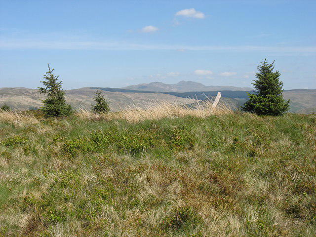 Photo could not load
SH7526 : The summit of Moel Hafodowen
David Purchase
Hill facts and local notes
Classifications
Elevation
435m
1,427 ft
Prominence
128m
Coordinates
52.8229, -3.8500
SH754266
OS Map
124
Explorer: OL18W
At the Summit
The summit features a large stone cairn and a few scattered rocks, making it a perfect picnic spot atop the wonderful views. Look out for the occasional curious sheep!
Terrain & Geology
The mountain is primarily composed of Old Red Sandstone, a sedimentary rock that creates dramatic cliffs and rolling hills characteristic of the region. There are also areas with volcanic rock, providing a varied landscape.
Views & Scenery
From the summit, hikers can relish views of the Brecon Beacons range, the rolling countryside, and on clear days, the distant peaks of Snowdonia.
History & Heritage
Name Origin
The name 'Hafodowen' relates to 'Hafod', meaning summer dwelling, and 'Owen', a personal name, likely indicating historical significance to farming or local families.
Historical Significance
The area has a rich history of farming and trade, being part of the ancient trade routes through the Beacons.
Getting There & Facilities
Check current local access restrictions, parking rules and transport timetables before travelling. These notes do not confirm public access to the summit.
Parking
The nearest parking is in the village of Talybont-on-Usk, where you'll find space for several cars. Be mindful of not blocking local access.
Public Transport
Buses run from Cardiff and other nearby towns to Talybont-on-Usk. Check local timetables for up-to-date services.
Nearby Facilities
There are a few cafes and pubs in Talybont-on-Usk, including restrooms and a small shop for essentials.
Safety Information
Known Hazards
- The terrain can be slippery, particularly after rain. Watch out for sudden weather changes that are common in this mountainous area.
General Safety Tips
- Check weather conditions before setting out
- Carry appropriate clothing and equipment
- Let someone know your planned route
- Take a map, compass, and GPS device
- Carry emergency supplies: food, water, first aid kit, torch
Hills
Some common questions about the hills answered
Are there group walks up Moel Hafodowen?
Many walkers use Walkmates to join or organise walks with others. You can check for group walks around Moel Hafodowen through the maps
Are there other walkers around Moel Hafodowen?
Activity varies by location and time, but Walkmates lets you see whether others have shared walks or shown interest in this area. Find other people through the walking friends search walking friends for Moel Hafodowen search or of course create your own walk for Moel Hafodowen
Can I organise a walk to Moel Hafodowen?
Yes. If there aren’t any walks listed already, you can create a walk and make it available for others to join.
If you're signed up to Walkmates, you can create a walk to Moel Hafodowen.
How do I find a walk up this hill?
There are often multiple ways to walk this hill, depending on experience and route preference. Walkmates helps you explore walks and routes that others have shared.
Can I suggest a new route up Moel Hafodowen?
Yes. You can suggest or create routes to share with others. Walkmates focuses on the social side of walking, so routes are used to help people organise walks and explore areas together, rather than as detailed navigation tools or route libraries.
Other uses really appreciate knowledgeable walkers sharing their routes. Share your favourite route to Moel Hafodowen here
The is an error or something incorrect about this hill. How do I let you know?
We always strive to keep the information on Walkmates as accurate as possible. If you find an error, please let us know through the contact form and we'll aim to correct it as quickly as possible
Community Discussion
Comments
Location
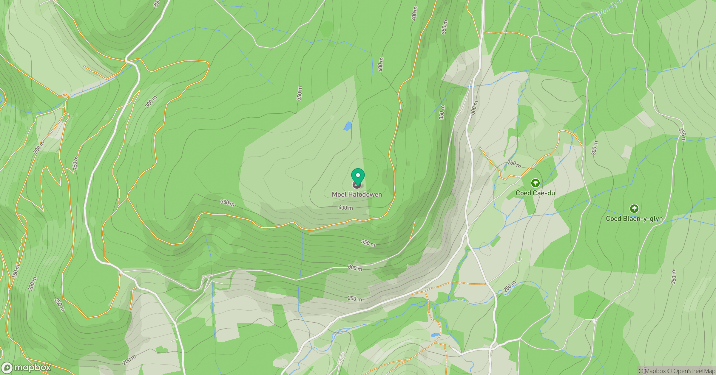
Grid reference: SH754266
View on OpenStreetMapOpens a map in a new tab, centred on the hill.
Hills within 30 km
Straight-line distance, not a walking route or confirmation of access.
No comments yet. Be the first.