

Meallan a' Chuail
Good walks are even better shared.
NC3429 : Summit area of Meallan a' Chuail
Trevor Littlewood Photo source
Overview
Meallan a' Chuail: An Outdoor Enthusiast's Delight
Nestled in the heart of the Scottish Highlands, Meallan a' Chuail stands proudly as a Munro at 812 meters. With a prominence of 106 meters, it may not be the tallest peak, but it certainly holds its own when it comes to charm and panoramic views.
Geology
The rugged landscape is primarily composed of granite and schist. This geological foundation makes for a rocky yet scenic ascent, with fascinating formations and sweeping vistas that will make you feel on top of the world - quite literally!
The Ascent
The most popular route starts at a lay-by on the B845. It’s a moderate trek of roughly 8 km round trip, taking about 3.5 hours, depending on your fitness levels and enthusiasm for spontaneous photo ops. The path navigates through heather and alpine meadows, giving off major Scottish vibes. Keep your eyes peeled for local wildlife – you might just spot a deer or two.
Summit Features
At the summit, you'll find a well-constructed cairn adorned with rocks collected from explorers past. It’s the perfect spot to enjoy a flask of tea and reflect on the beauty surrounding you.
The Views
The highlight of the hike is undoubtedly the views from the top. On a clear day, be sure to snap a photo of the iconic Ben Nevis in the distance, along with the shimmering waters of Loch Awe. The best time to enjoy these views? Definitely in spring or late summer, when the landscape is bursting with colour and the sky is often cooperative.
Hazards
Highland weather can be notoriously fickle. It’s always wise to check the forecast and be prepared for all eventualities, including sudden rain showers or brisk winds. Some sections of the trail can be boggy, so good hiking boots are a must!
Access and Facilities
For those coming by car, parking is straightforward and located conveniently near the B845. Hikers without personal transport may find the local bus services a bit limited, mainly connecting through Dalmally.
The nearby town offers amenities like cafes and public toilets - so fuel up before your adventure begins!
Final Thoughts
Meallan a' Chuail may not be the highest peak in the Highlands, but its unique character and stunning views make it a must-visit for anyone keen to explore the heart of Scotland. Happy hiking!
Explore routes near Meallan a' Chuail
Walks starting near this hill. Open a route to check its map, distance and full itinerary.
Ben Klibreck
View route
Loch Migdale from Torroy: Spinningdale pinewood and loch shore walk
View route
Fairy Lochs Liberator Wreckage Circuit
View route
Route planning notes
These notes describe possible approaches. Check a route's map and access information when planning your walk.
The Eastern Approach
This moderately challenging ascent begins at the parking area near the B845 road. It follows a well-defined path that weaves through heather and rocky outcrops, leading up to the summit.
Make a day of it, together
Find someone to share the walk with, or organise a day out along a route you like.
Photo Gallery
View all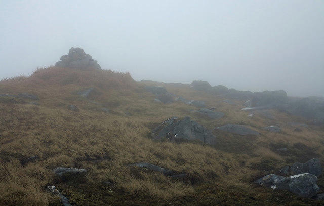 Photo could not load
NC3429 : Summit area of Meallan a' Chuail
Trevor Littlewood
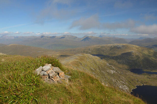 Photo could not load
NC3429 : The Summit of Meallan a' Chuail, Sutherland
Andrew Tryon
Hill facts and local notes
Classifications
Elevation
750m
2,462 ft
Prominence
205m
Coordinates
58.2207, -4.8200
NC344292
OS Map
15
Explorer: 440N 442E
At the Summit
The summit is marked by a prominent cairn, providing a perfect spot for a well-deserved snack while soaking in the stunning vistas.
Terrain & Geology
Predominantly composed of granite and schist, Meallan a' Chuail exhibits rugged terrain typical of the Scottish Highlands. The geological forces that shaped this area have led to dramatic cliffs and a wealth of diverse flora and fauna.
Views & Scenery
From the summit, strong binoculars may reveal the distant peaks of Ben Nevis and the vast expanse of Loch Awe. On a clear day, the views are simply breathtaking.
History & Heritage
Name Origin
The name 'Meallan a' Chuail' translates loosely to 'Hill of the Musk Deer' in Gaelic, linking its identity to local wildlife.
Historical Significance
This mountain has been a cherished peak among local hillwalkers and is a testament to the natural beauty of the region, often traversed by those seeking the Munro bagging experience.
Getting There & Facilities
Parking
Parking is available at the roadside near the B845, with space for several vehicles, though it can get busy during peak seasons.
Public Transport
Local buses run services from Oban to the nearby village of Dalmally, but check schedules as they can be infrequent.
Nearby Facilities
Dalmally and the nearby village of Taynuilt offer basic amenities, including cafes, shops, and public restrooms.
Safety Information
Known Hazards
- Beware of sudden weather changes typical in the Highlands. Some sections may be boggy, so sturdy footwear is recommended.
General Safety Tips
- Check weather conditions before setting out
- Carry appropriate clothing and equipment
- Let someone know your planned route
- Take a map, compass, and GPS device
- Carry emergency supplies: food, water, first aid kit, torch
Hills
Some common questions about the hills answered
Are there group walks up Meallan a' Chuail?
Many walkers use Walkmates to join or organise walks with others. You can check for group walks around Meallan a' Chuail through the maps
Are there other walkers around Meallan a' Chuail?
Activity varies by location and time, but Walkmates lets you see whether others have shared walks or shown interest in this area. Find other people through the walking friends search walking friends for Meallan a' Chuail search or of course create your own walk for Meallan a' Chuail
Can I organise a walk to Meallan a' Chuail?
Yes. If there aren’t any walks listed already, you can create a walk and make it available for others to join.
If you're signed up to Walkmates, you can create a walk to Meallan a' Chuail.
How do I find a walk up this hill?
There are often multiple ways to walk this hill, depending on experience and route preference. Walkmates helps you explore walks and routes that others have shared.
Can I suggest a new route up Meallan a' Chuail?
Yes. You can suggest or create routes to share with others. Walkmates focuses on the social side of walking, so routes are used to help people organise walks and explore areas together, rather than as detailed navigation tools or route libraries.
Other uses really appreciate knowledgeable walkers sharing their routes. Share your favourite route to Meallan a' Chuail here
The is an error or something incorrect about this hill. How do I let you know?
We always strive to keep the information on Walkmates as accurate as possible. If you find an error, please let us know through the contact form and we'll aim to correct it as quickly as possible
Community Discussion
Comments
Location
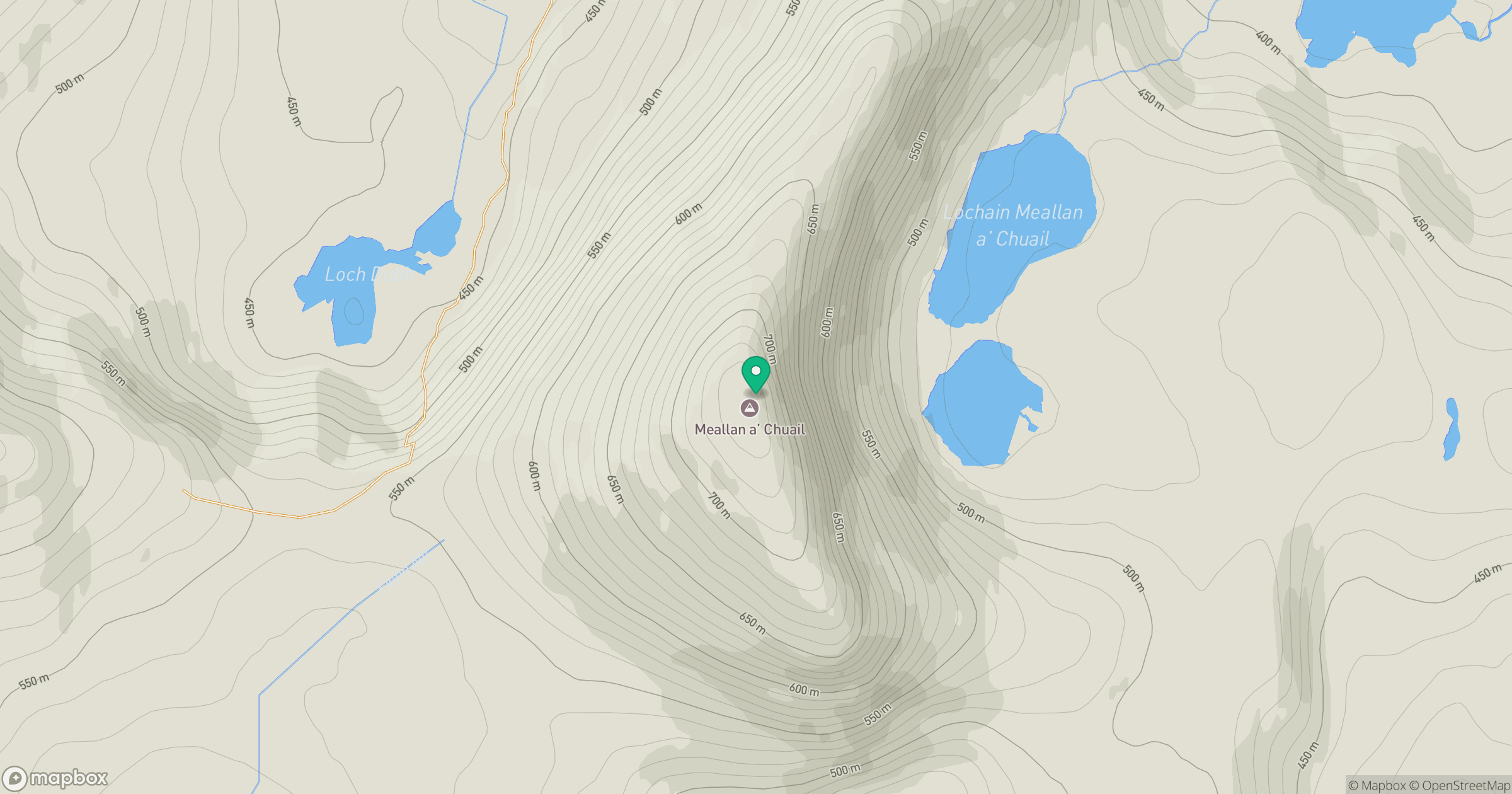
Grid reference: NC344292
View on OpenStreetMapOpens a map in a new tab, centred on the hill.
Nearby Hills
Ben More Assynt
999m
Ben Stack
721m
Quinag - Sail Gharbh
809m
Quinag - Spidean Coinich
764m
Quinag - Sail Ghorm [Sail Gorm]
776m
No comments yet. Be the first.