
Meall na Leitreach
Good walks are even better shared.
Overview
Meall na Leitreach
Overview
Nestled in the magnificent Scottish Highlands, Meall na Leitreach is a gem for hikers and outdoor enthusiasts. Standing at an elevation of 775 meters, it boasts stunning views and a diverse landscape that represents the quintessential Highland experience.
Getting There
For access, park at Invergarry where the welcome sign promises all sorts of Highland adventures. Public transport is also an option, with buses regularly connecting Invergarry to Fort William. Remember to check schedules beforehand; you wouldn’t want to miss the bus and have to start a new career as a Highlander!
The Route
The most popular route to Meall na Leitreach begins from Invergarry. This moderate trek of about 9.5 kilometers takes roughly 4 hours to complete, depending on your pace and your coffee breaks. The path meanders through lush woodlands before opening up to the rugged terrain that characterises the summit.
Summit Features
Once at the top, you'll encounter a cairn, the perfect backdrop for a photo-op or just to sit back, rest and enjoy the surrounding landscapes. Don't forget to snap a pic with the cairn; it’s just sitting there waiting for some love!
Terrain and Views
The terrain varies from rocky surfaces to grassy patches, with a few boggy areas that can be charmingly squelchy if you're not careful. On a clear day, the views are nothing short of breathtaking; gaze out over Loch Ness and see what mythical creatures might be lurking beneath the surface!
Hazards
While the trek is generally straightforward, be cautious of loose rocks and rapidly changing weather conditions typical in the Highlands. And keep your eyes peeled for those cheeky sheep; they have been known to steal the show!
Nearby Summits
If you’re in the mood for more climbing, nearby summits like Sgurr na Càisgein (828 meters) and Meall Fuar-mhonaidh (796 meters) offer additional challenges with the same spectacular Highland views.
Conclusion
Meall na Leitreach is more than just a hill; it's a journey through some of Scotland's finest landscapes. Whether you're a seasoned hiker or a beginner, this Munro promises adventure and stunning vistas aplenty. Just remember—what goes up, must come down!
Last Updated
2023-10-15
Explore routes near Meall na Leitreach
Public walks starting within 80 km of this hill. Nearby does not mean a route reaches the summit; check its map and access before setting out.
Ben Klibreck
View route
Loch Migdale from Torroy: Spinningdale pinewood and loch shore walk
View route
Route planning notes
These notes describe possible approaches, not verified navigable routes or permission to cross land. Check current paths, local access rules and conditions before setting out.
Invergarry to Meall na Leitreach
A popular route accessible from the village of Invergarry, offering a mix of woodland trails and open hillside walking.
Make a day of it, together
Find someone to share the walk with, or organise a day out along a route you like.
Hill facts and local notes
Classifications
Elevation
566m
1,857 ft
Prominence
109m
Coordinates
58.2503, -4.8274
NC341325
OS Map
15
Explorer: 440N 442E 445
At the Summit
The summit is adorned with a traditional cairn, providing a great spot for a picnic or a puffed-out pause while taking in the splendid views.
Terrain & Geology
Composed mainly of granite and gneiss, Meall na Leitreach showcases classic Highland geology. Its rugged cliffs and rocky surfaces are a haven for rock climbers and geology enthusiasts alike.
Views & Scenery
From the summit, you can enjoy panoramic views of Loch Ness, the surrounding glens, and even glimpse the distant peaks of the Great Glen.
History & Heritage
Name Origin
The name 'Meall na Leitreach' translates roughly to 'the hill of the grave', echoing the mountain's longstanding presence in local culture.
Historical Significance
Historically, this mountain has been used as a landmark for navigation through the Highlands and is part of many local legends.
Getting There & Facilities
Check current local access restrictions, parking rules and transport timetables before travelling. These notes do not confirm public access to the summit.
Parking
The nearest parking area is at Invergarry, which offers free parking but can get quite busy on weekends.
Public Transport
Regular bus services run from Fort William to Invergarry, making it relatively easy to access without a car.
Nearby Facilities
Invergarry has a few small shops and eateries where you can grab a bite or a hot drink before setting off on your adventure.
Safety Information
Known Hazards
- Be aware of unstable rocks, sudden changes in weather, and the occasional mischievous sheep who think they own the place.
General Safety Tips
- Check weather conditions before setting out
- Carry appropriate clothing and equipment
- Let someone know your planned route
- Take a map, compass, and GPS device
- Carry emergency supplies: food, water, first aid kit, torch
Hills
Some common questions about the hills answered
Are there group walks up Meall na Leitreach?
Many walkers use Walkmates to join or organise walks with others. You can check for group walks around Meall na Leitreach through the maps
Are there other walkers around Meall na Leitreach?
Activity varies by location and time, but Walkmates lets you see whether others have shared walks or shown interest in this area. Find other people through the walking friends search walking friends for Meall na Leitreach search or of course create your own walk for Meall na Leitreach
Can I organise a walk to Meall na Leitreach?
Yes. If there aren’t any walks listed already, you can create a walk and make it available for others to join.
If you're signed up to Walkmates, you can create a walk to Meall na Leitreach.
How do I find a walk up this hill?
There are often multiple ways to walk this hill, depending on experience and route preference. Walkmates helps you explore walks and routes that others have shared.
Can I suggest a new route up Meall na Leitreach?
Yes. You can suggest or create routes to share with others. Walkmates focuses on the social side of walking, so routes are used to help people organise walks and explore areas together, rather than as detailed navigation tools or route libraries.
Other uses really appreciate knowledgeable walkers sharing their routes. Share your favourite route to Meall na Leitreach here
The is an error or something incorrect about this hill. How do I let you know?
We always strive to keep the information on Walkmates as accurate as possible. If you find an error, please let us know through the contact form and we'll aim to correct it as quickly as possible
Community Discussion
Comments
Location
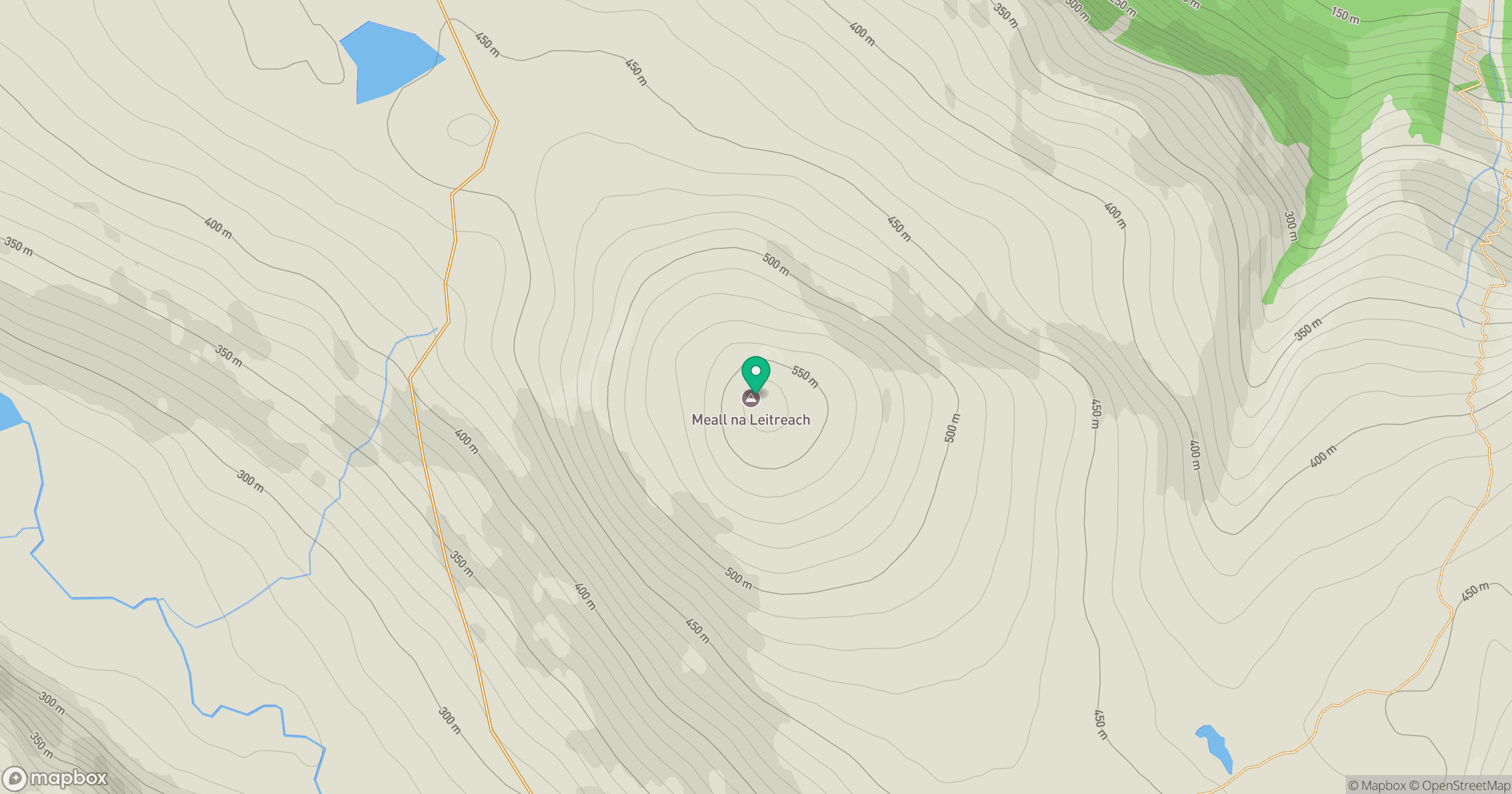
Grid reference: NC341325
View on OpenStreetMapOpens a map in a new tab, centred on the hill.
Hills within 30 km
Straight-line distance, not a walking route or confirmation of access.
Ben More Assynt
999m
Ben Stack
721m
Quinag - Sail Gharbh
809m
Quinag - Spidean Coinich
764m
Quinag - Sail Ghorm [Sail Gorm]
776m
No comments yet. Be the first.