
Meall Tarsuinn
Good walks are even better shared.
Overview
Meall Tarsuinn: A Highland Gem
Nestled in the heart of the Scottish Highlands, Meall Tarsuinn stands proudly among fellow Munros, beckoning hikers with its distinctive shape and stunning vistas. At an elevation of 889 meters, it’s not the tallest of the lot, but it certainly offers a fair share of beauty and adventure.
Geology
The mountain showcases fascinating geological features, primarily composed of ancient schists and gneisses. This rocky prominence was shaped during the Caledonian orogeny, giving the area its rugged terrain and dramatic landscapes. Glacial activity has carved out the features we see today, so you could say the mountain has a pretty impressive wardrobe made of rocks and ice!
Routes
For those keen on exploring Meall Tarsuinn, there are several well-marked routes. The East Ridge Route is a popular choice, providing a moderate trek of approximately 8.5 km, typically taking around 4.5 hours. This route offers a gradual ascent through stunning Highland scenery.
If you’re feeling a bit more adventurous, the North Face Route presents more of a challenge, involving some scrambling and a shorter distance of 7.2 km, usually tackled in around 5 hours. Make sure you’re prepared for a bit of a workout!
Summit Features
Upon reaching the summit, adventurers are greeted by a stone cairn – a classic hallmark of many Munro tops. This cairn isn’t just for decoration; it’s a trusty guidepost amidst the sprawling wilderness. Don't be surprised if you find the occasional trig point having a philosophical debate with hikers regarding the meaning of elevation.
Views
From the top, the views are nothing short of spectacular. On a clear day, gaze upon the mighty Ben Nevis to the south, the Great Glen stretching far and wide, and the shimmering waters of Loch Lochy. Autumn, with its brilliant hues, and spring, when the wildflowers blossom, are by far your best bets for breathtaking sights.
Hazards
While Meall Tarsuinn is a gem of a mountain, it’s wise to keep a weather eye out – conditions can change quicker than a Highlander's mood! The paths can also be boggy, so invest in a solid pair of waterproof boots unless you fancy squelching your way back down.
Access
Getting to Meall Tarsuinn is relatively simple. A small parking area can be found along the A82, though it can fill up rather quickly. Fort William, just a stone's throw away, serves as the nearest town, bustling with cafes, shops, and a warm welcome.
Facilities
In Fort William, you'll find all the amenities you might need. Whether it’s a hearty meal or a quick cup of coffee, you’re sorted. Just remember, sometimes a meal taken after a good hike tastes way better than one enjoyed in the comfort of home!
Conclusion
Meall Tarsuinn is not just a mountain; it's an experience waiting to happen. Whether you're raising your heart rate on the ascent or soaking in the views from the summit, you're in for a treat. So pack your bags, grab your gear, and don’t forget the camera; adventure awaits!
Explore routes near Meall Tarsuinn
Public walks starting within 80 km of this hill. Nearby does not mean a route reaches the summit; check its map and access before setting out.
Banavie to Glen Loy Aqueduct: Neptune’s Staircase Canal Towpath
View route
Ben Nevis via Mountain Path
View route
Fort Augustus to Kytra Lock: Caledonian Canal Towpath
View route
Great Glen Way low route: Fort Augustus to Invermoriston Old Bridge
View route
Route planning notes
These notes describe possible approaches, not verified navigable routes or permission to cross land. Check current paths, local access rules and conditions before setting out.
East Ridge Route
A scenic ascent along the eastern ridge, starting from the A82.
North Face Route
A more challenging approach that offers a rewarding experience with some scrambling involved.
Make a day of it, together
Find someone to share the walk with, or organise a day out along a route you like.
Hill facts and local notes
Classifications
Elevation
659m
2,161 ft
Prominence
101m
Coordinates
57.0188, -5.0188
NN168960
OS Map
34
Explorer: 399
At the Summit
The summit of Meall Tarsuinn is crowned with a stone cairn that provides a superb vantage point. On a clear day, you can find a trusty trig pillar debating whether it was a mountain climber or a GPS installation.
Terrain & Geology
The summit is primarily composed of ancient metamorphic rocks, specifically schists and gneisses, formed during the Caledonian orogeny. The distinctive rugged terrain showcases glacial features, making it a perfect playground for geologists and outdoor enthusiasts alike.
Views & Scenery
Panoramic views extend to Ben Nevis, the Great Glen, and Loch Lochy, providing a feast for the eyes.
History & Heritage
Name Origin
The name 'Meall Tarsuinn' translates roughly to 'hill of the cross', possibly indicating a once-significant religious landmark or a local meeting point.
Historical Significance
Historically, the area is steeped in local lore and has been a site for various regional gatherings and events, particularly during clan conflicts in the 18th century.
Getting There & Facilities
Check current local access restrictions, parking rules and transport timetables before travelling. These notes do not confirm public access to the summit.
Parking
There is a small gravel parking area at the start of the East Ridge Route off the A82. Be sure to arrive early to grab a spot, as it can fill up swiftly with fellow adventurers.
Public Transport
Frequent bus services run along the nearby A82, with the nearest stops at Fort William.
Nearby Facilities
Fort William offers a variety of facilities including cafes, restaurants, and public toilets. Just don't expect a Michelin star; but hey, the chip butty might be unbeatable!
Safety Information
Known Hazards
- Watch for changing weather conditions that can transform a sunny day into a foggy mystery in no time. Additionally, some paths can be boggy, so a good pair of waterproof boots is essential.
General Safety Tips
- Check weather conditions before setting out
- Carry appropriate clothing and equipment
- Let someone know your planned route
- Take a map, compass, and GPS device
- Carry emergency supplies: food, water, first aid kit, torch
Hills
Some common questions about the hills answered
Are there group walks up Meall Tarsuinn?
Many walkers use Walkmates to join or organise walks with others. You can check for group walks around Meall Tarsuinn through the maps
Are there other walkers around Meall Tarsuinn?
Activity varies by location and time, but Walkmates lets you see whether others have shared walks or shown interest in this area. Find other people through the walking friends search walking friends for Meall Tarsuinn search or of course create your own walk for Meall Tarsuinn
Can I organise a walk to Meall Tarsuinn?
Yes. If there aren’t any walks listed already, you can create a walk and make it available for others to join.
If you're signed up to Walkmates, you can create a walk to Meall Tarsuinn.
How do I find a walk up this hill?
There are often multiple ways to walk this hill, depending on experience and route preference. Walkmates helps you explore walks and routes that others have shared.
Can I suggest a new route up Meall Tarsuinn?
Yes. You can suggest or create routes to share with others. Walkmates focuses on the social side of walking, so routes are used to help people organise walks and explore areas together, rather than as detailed navigation tools or route libraries.
Other uses really appreciate knowledgeable walkers sharing their routes. Share your favourite route to Meall Tarsuinn here
The is an error or something incorrect about this hill. How do I let you know?
We always strive to keep the information on Walkmates as accurate as possible. If you find an error, please let us know through the contact form and we'll aim to correct it as quickly as possible
Community Discussion
Comments
Location
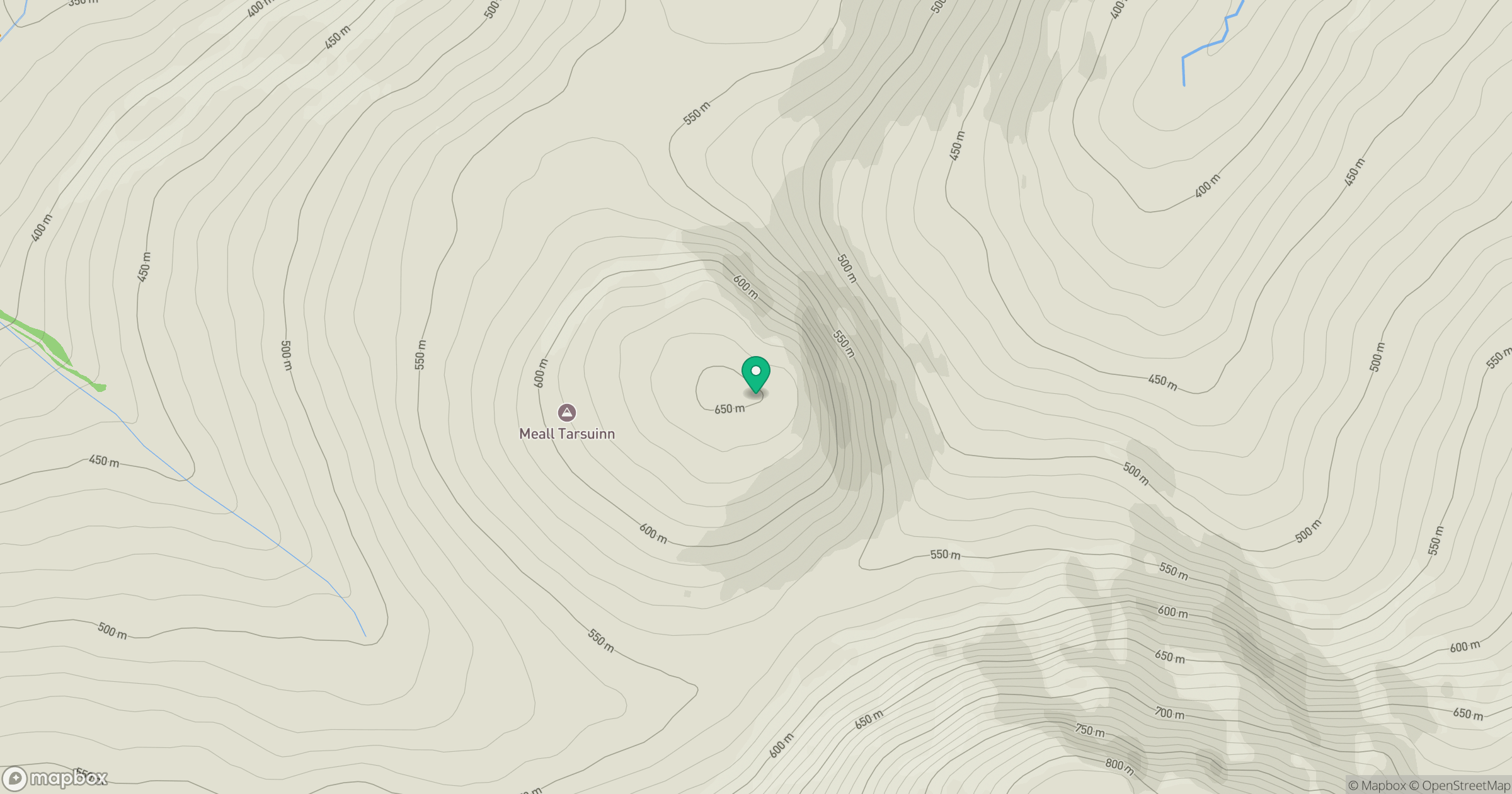
Grid reference: NN168960
View on OpenStreetMapOpens a map in a new tab, centred on the hill.
Hills within 30 km
Straight-line distance, not a walking route or confirmation of access.
Aonach Mor
1,220m
Carn Mor Dearg
1,221m

Ben Nevis [Beinn Nibheis]
1,345m
Aonach Beag
1,234m
Gleouraich
1,035m
No comments yet. Be the first.