

Ben Loyal - An Caisteal
Good walks are even better shared.
NC5748 : View towards Sgòr Chaonasaid
Mick Garratt Photo source
Overview
Ben Loyal is a multi-topped mountain south of Tongue in Sutherland. Its highest summit, An Caisteal, is a 764.2 m Corbett. The usual Ribigill approach crosses very boggy ground and unbridged burns before a steep ascent and short summit scramble; it returns by the same route. Longer ridge traverses demand more time and careful navigation.
Ben Loyal – An Caisteal
The mountain
An Caisteal is the 764.2 m high point of Ben Loyal, a Corbett south of Tongue in Sutherland. Ben Loyal is a broad, multi-topped massif, with rocky tors and extensive views. The surveyed summit is a rock slab 7 m east of the trig point; Sgor Chaonasaid and Beinn Bheag are lower tops, not the main summit.
Walking routes
Start the usual northern approach at the Ribigill track parking area, NC584546 (also recorded as NC584547). The approach changes from farm track to very boggy ground near Cunside. Allt Lon Malmsgaig must be forded: the footbridge shown on older maps does not exist. Do not attempt the crossing when unsafe, and remember that water may rise before the return.
The ascent towards the ridge is steep and partly pathless. Approach An Caisteal from the west/northwest for the short scramble onto its tor. Other faces have serious crags. The simplest return retraces the ascent to Ribigill.
- An Caisteal out and back: Walkhighlands gives 13.75 km, 804 m ascent and 5.5–6.5 hours.
- Beinn Bheag extension: Scotland Off the Beaten Track describes a 15 km, 800 m ascent, 5.5–6.5-hour out-and-back over Sgor Chaonasaid and An Caisteal to Beinn Bheag. Return by the outward route, with repeated subsidiary tops bypassed where appropriate.
- Full western circuit: UKHillwalking describes 17.4 km, 848 m ascent and 7.5–8.5 hours, continuing to Carn an Tionail and returning past Loch Fhionnaich and the woods to Cunside. Its steep, pathless, crag-avoiding descent is for experienced hillwalkers with good navigation. This is a different and harder itinerary than the summit return.
Terrain and conditions
Expect prolonged wet and boggy ground, unbridged burns, steep grass and heather, faint paths and rocky summit ground. Cloud can make both navigation and the correct summit approach hard to identify. Snow, ice and wind increase the seriousness of slopes and scrambling. Winter conditions require appropriate equipment and skills; allow sufficient daylight and check the mountain forecast.
Geology, names and views
The massif is chiefly quartz syenite, part of the Loch Loyal Syenite Complex, intruded into the surrounding Moine rocks. In clear conditions the ridge overlooks the Kyle of Tongue, northern coast, Loch Loyal, Ben Hope and Ben Klibreck.
An Caisteal is Gaelic for “the castle”. Beinn Laghail probably derives from the Norse for “law mountain”. Local folklore links the name to the proclamation of laws, but this should not be treated as established historical evidence.
Access and facilities
Keep farm access clear at Ribigill. No bus reaches the trailhead; infrequent services reach Tongue, so plan the additional road walk and check the current return timetable. Tongue has public toilets. Bring food and water for the hill.
Explore routes near Ben Loyal - An Caisteal
Walks starting near this hill. Open a route to check its map, distance and full itinerary.
Ben Klibreck
View route
Loch Migdale from Torroy: Spinningdale pinewood and loch shore walk
View route
Route planning notes
These notes describe possible approaches. Check a route's map and access information when planning your walk.
An Caisteal from Ribigill (out and back)
Start at the Ribigill track car park (NC584546). Follow the track and boggy path to Cunside; ford Allt Lon Malmsgaig only when safe. The old footbridge is absent and spate can prevent passage. Climb steep, partly pathless ground by Bealach Clais nan Ceap, then head south along the ridge. Reach An Caisteal by its west/northwest side, with short scrambling. Retrace the ascent to Ribigill. Walkhighlands: 5.5–6.5 hours.
Full traverse via Carn an Tionail and Loch Fhionnaich
From Ribigill, ford by Cunside only in safe conditions; no footbridge. Climb via Sgor Chaonasaid to An Caisteal, then continue over Beinn Bheag to Carn an Tionail. Descend northwest towards the burn, then north to Loch Fhionnaich. Follow its west shore and cross the saddle; avoid crags on the steep, pathless descent to Allt a' Bhealaich Dhuibh. Follow woods and boggy ground back to Cunside and Ribigill. UKHillwalking: 7.5–8.5 hours. Spate may block return.
An Caisteal and Beinn Bheag from Ribigill
From Ribigill (NC584547), take the boggy approach and ford Allt Lon Malmsgaig only when safe; the old footbridge is absent. Climb steep ground to Sgor Chaonasaid, then follow the ridge to An Caisteal, using its west/northwest approach with short scrambling. Continue south to Beinn Bheag. Return along the outward route to Ribigill, bypassing repeated subsidiary tops where appropriate. Scotland Off the Beaten Track: 5.5–6.5 hours. Spate may prevent the return crossing.
Make a day of it, together
Find someone to share the walk with, or organise a day out along a route you like.
Photo Gallery
View all Photo could not load
NC5748 : View towards Sgòr Chaonasaid
Mick Garratt
 Photo could not load
NC5748 : Ben Loyal Summit, An Caisteal - Looking ENE
John Earnshaw
 Photo could not load
NC5748 : An Caisteal from Beinn Bheag, Ben Loyal
Colin Park
 Photo could not load
NC5748 : Ben Loyal from the mountain path between Beinn Ceannabeinne & Meall Meadhonach
Alan Murray Walsh
 Photo could not load
NC5748 : Ben Loyal from the west slopes of Ben Hutig
Alan Reid
 Photo could not load
NC5748 : Crag at summit area of An Caisteal
Trevor Littlewood
 Photo could not load
NC5748 : Evening light on Ben Loyal
Jim Barton
 Photo could not load
NC5748 : An Caisteal
CMackay
 Photo could not load
NC5748 : On An Caisteal, the highest top of Ben Loyal (765m)
Karl and Ali

NC5748 : Ben Loyal
John Chroston
Hill facts and local notes
Classifications
Elevation
764m
2,507 ft
Prominence
609m
Coordinates
58.4049, -4.4350
NC578488
OS Map
10
Explorer: 447S
At the Summit
An Caisteal is the highest summit of the Ben Loyal massif. The surveyed high point is a rock slab 7 m east of the trig point. The normal approach reaches the summit tor from the west/northwest and involves a short scramble; the craggy tops elsewhere on the ridge are separate, lower summits.
Terrain & Geology
Ben Loyal is formed chiefly from quartz syenite, an igneous intrusion within the Loch Loyal Syenite Complex. The surrounding country rocks include Moine metamorphic rocks.
Views & Scenery
In clear weather, the ridge looks north across the Kyle of Tongue to the coast, east over Loch Loyal, west towards Ben Hope and south towards Ben Klibreck.
History & Heritage
Name Origin
An Caisteal means “the castle” in Gaelic. Ben Loyal, Gaelic Beinn Laghail, probably derives from the Norse Laga-fjall, “law mountain”; the derivation is not certain.
Historical Significance
The place-name study Gaelic and Norse in the Landscape records local folklore that laws were once proclaimed on Ben Loyal. This is a traditional explanation associated with the name, rather than proof of a documented law-making site.
Getting There & Facilities
Parking
Parking area at the start of the track to Ribigill, off the minor road south of Tongue (NC584546; also recorded as NC584547). Begin the walk along the farm track. Keep gates and farm access clear.
Public Transport
No bus serves the Ribigill trailhead. Tongue has infrequent buses, including The Durness Bus route 803; check current operating days and return connections. Allow for the extra road walk between Tongue and the start.
Nearby Facilities
Public toilets are available in Tongue. Carry food and water for the mountain day.
Safety Information
Known Hazards
- The Allt Lon Malmsgaig ford near Cunside has no footbridge, despite one appearing on older maps. The burn can be impassable in spate. Do not force a dangerous crossing; consider rising water on the return as well as the outward journey.
- Very boggy ground, steep pathless slopes and intermittent tracks require careful navigation. Low cloud can hide both the ridge and the correct way onto the summit tor.
- An Caisteal requires short scrambling from its west/northwest side. Other faces and subsidiary tors have steep crags; wet or icy rock and strong wind make movement harder.
- The full circuit via Carn an Tionail and Loch Fhionnaich includes a steep, pathless descent avoiding crags. It is substantially more demanding than returning by the ascent route.
Seasonal Hazards
Heavy rain or snowmelt can make the burns unsafe. Snow and ice increase the seriousness of steep slopes and summit scrambling, and winter conditions can persist into spring. Carry suitable winter equipment and know how to use it when conditions require; check the mountain forecast and allow enough daylight.
General Safety Tips
- Check weather conditions before setting out
- Carry appropriate clothing and equipment
- Let someone know your planned route
- Take a map, compass, and GPS device
- Carry emergency supplies: food, water, first aid kit, torch
Hills
Some common questions about the hills answered
Are there group walks up Ben Loyal - An Caisteal?
Many walkers use Walkmates to join or organise walks with others. You can check for group walks around Ben Loyal - An Caisteal through the maps
Are there other walkers around Ben Loyal - An Caisteal?
Activity varies by location and time, but Walkmates lets you see whether others have shared walks or shown interest in this area. Find other people through the walking friends search walking friends for Ben Loyal - An Caisteal search or of course create your own walk for Ben Loyal - An Caisteal
Can I organise a walk to Ben Loyal - An Caisteal?
Yes. If there aren’t any walks listed already, you can create a walk and make it available for others to join.
If you're signed up to Walkmates, you can create a walk to Ben Loyal - An Caisteal.
How do I find a walk up this hill?
There are often multiple ways to walk this hill, depending on experience and route preference. Walkmates helps you explore walks and routes that others have shared.
Can I suggest a new route up Ben Loyal - An Caisteal?
Yes. You can suggest or create routes to share with others. Walkmates focuses on the social side of walking, so routes are used to help people organise walks and explore areas together, rather than as detailed navigation tools or route libraries.
Other uses really appreciate knowledgeable walkers sharing their routes. Share your favourite route to Ben Loyal - An Caisteal here
The is an error or something incorrect about this hill. How do I let you know?
We always strive to keep the information on Walkmates as accurate as possible. If you find an error, please let us know through the contact form and we'll aim to correct it as quickly as possible
Community Discussion
Comments
Location
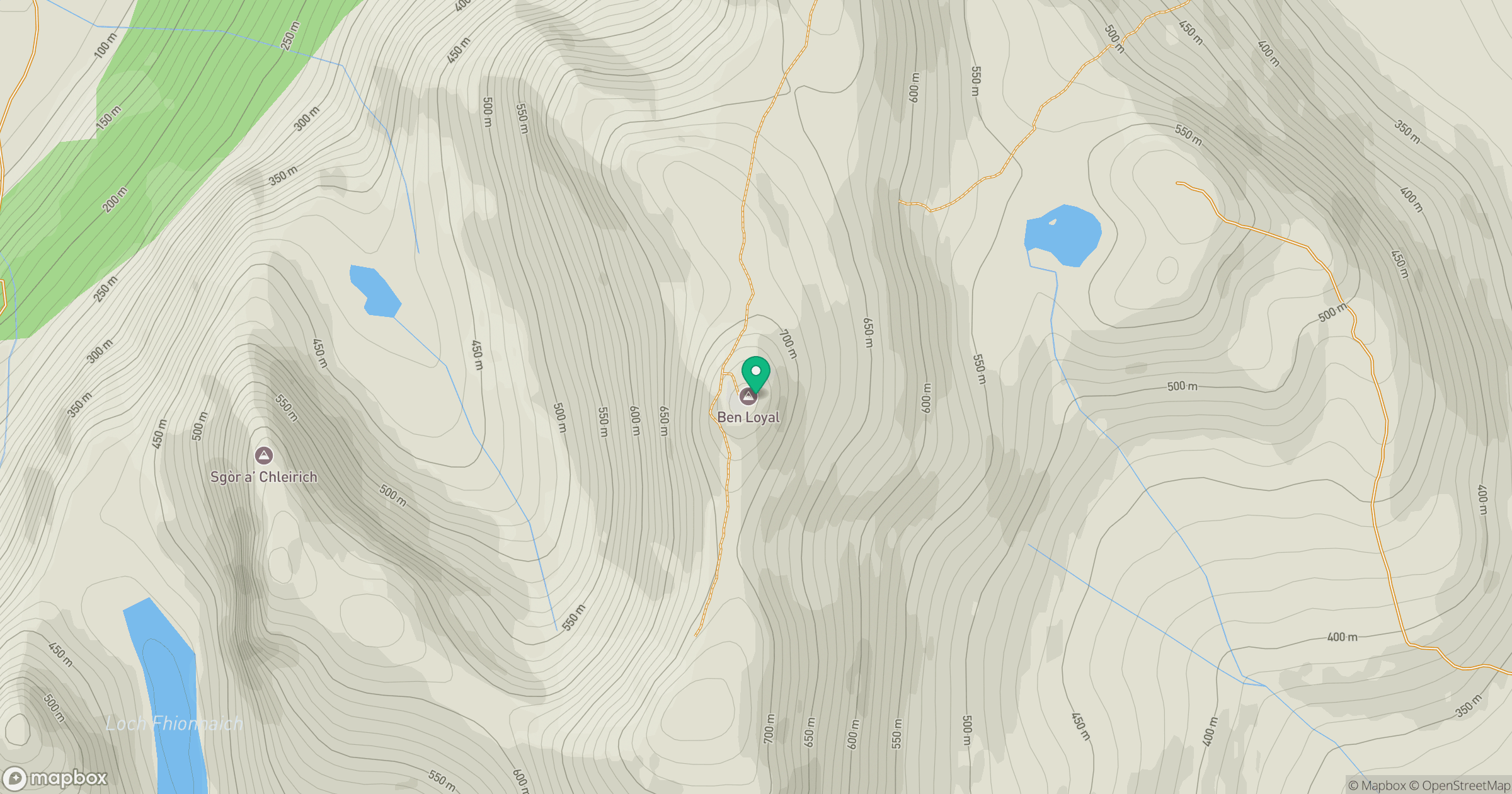
Grid reference: NC578488
View on OpenStreetMapOpens a map in a new tab, centred on the hill.
Nearby Hills
Ben Hope
927m
Ben More Assynt
999m
Ben Stack
721m
Quinag - Sail Gharbh
809m
Quinag - Spidean Coinich
764m
No comments yet. Be the first.