

Meall na h-Aodainn Moire
Good walks are even better shared.
Overview
Meall na h-Aodainn Moire
Overview
Nestled in the heart of the Scottish Highlands, Meall na h-Aodainn Moire stands at a respectable 749 meters. This Munro boasts not only an impressive height but also stunning panoramic views that have captured the hearts of many hikers.
Geology
The rugged landscape is primarily composed of ancient granite formations, all shaped by the relentless forces of glaciation. As you trek towards the peak, take a moment to appreciate the beautiful patterns and textures etched into the rocky outcrops.
Routes
Two popular routes provide access to the summit. The Allt a' Chaoil route offers a more gentle ascent, perfect for those who wish to enjoy the scenery without too many sweat beads on their brow. On the other hand, the East Ridge route demands a bit more stamina and concentration; it’s a shifting deck of rocks that can test your balance just as much as your legs!
Summit Features
Reaching the summit is a celebration of effort rewarded by the sight of a large stone cairn. It's the ideal place to rest and snap those all-important Instagram pictures. Don’t be surprised if you find yourself mentally high-fiving every fellow hiker who reaches the top!
Terrain
Be prepared for rocky and uneven surfaces, with grassy patches interrupting the rugged walks. As you gain elevation, the terrain morphs into a steeper incline that requires careful navigation over rocky outcrops. Good boots and a steady foot are your best friends here!
Views
Once at the summit, the vista is simply breathtaking. The shimmering waters of Loch Awe and the towering Ben Cruachan can be seen stretching far into the horizon. There is no shortage of beauty here, especially during the spring and autumn when the landscape is painted in a riot of colours.
Hazards
As with most Highland hikes, look out for loose rocks and be mindful of the ever-changing weather conditions. Additionally, moorland bogs can catch even the best of trekkers off-guard. A good motto: don’t step where you wouldn’t want your wellies to sink!
Nearby Summits
For those wanting to extend their adventure, consider tackling nearby mountains such as Ben Cruachan and Beinn A'Chochuill, both equally mesmerizing in their own right.
Access
The starting point for your adventure can be found at the foot of Meall na h-Aodainn Moire, with parking available in Dalmally – a delightful little village that wishes you a good morning! Public transport options abound, with regular trains to Dalmally station followed by a simple bus or taxi ride.
Facilities
Although Dalmally is quaint, it offers essential facilities such as local cafes and public toilets near the village hall. Make sure to pack your snacks or stop by for a haggis roll post-hike; you’ll have earned it!
History
The name Meall na h-Aodainn Moire harkens back to its Gaelic roots, meaning 'hill of the great face'. A fitting description for a mountain that seems to gaze down upon the memories of countless adventures over the years.
Conclusion
Meall na h-Aodainn Moire is not just another mountain; it’s an experience, a lesson in geology, a stage for breathtaking views, and a celebration of the great Scottish outdoors. So lace up those boots, grab your hiking poles, and prepare for a journey that promises to be as rewarding as it is challenging. Happy hiking!
Explore routes near Meall na h-Aodainn Moire
Public walks starting within 80 km of this hill. Nearby does not mean a route reaches the summit; check its map and access before setting out.
Glen Banvie Trail with the Bruar viewpoint
View route
Aberfeldy: Glassie Woodland and River Tay Circular
View route
Kenmore: Drummond Hill Black Rock Trail above Loch Tay
View route
Unled club outing: Glenesk (coach departure)
View route
Route planning notes
These notes describe possible approaches, not verified navigable routes or permission to cross land. Check current paths, local access rules and conditions before setting out.
Allt a' Chaoil route
A scenic ascent starting by following the Allt a' Chaoil burn which leads to the summit through gentle slopes and rocky outcrops.
East Ridge route
An adventurous route starting at the east of the mountain which requires careful navigation over rocky terrain.
Make a day of it, together
Find someone to share the walk with, or organise a day out along a route you like.
Photo Gallery
View all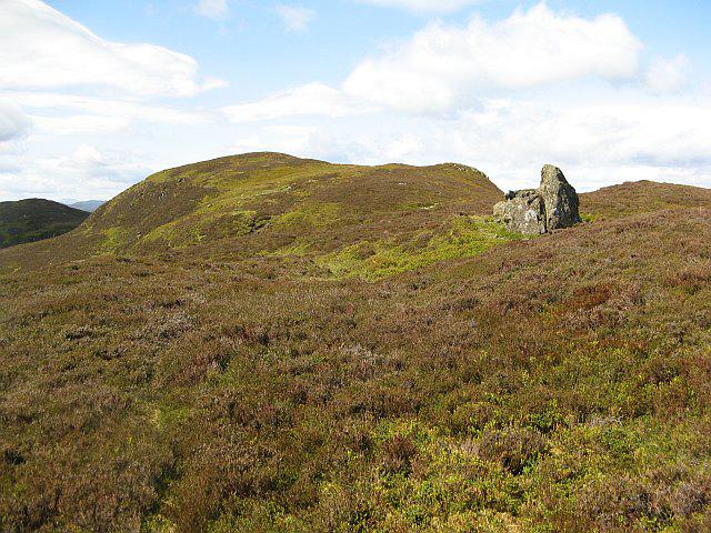 Photo could not load
NN9462 : Meall na h-Aodainn Mòire
Richard Webb
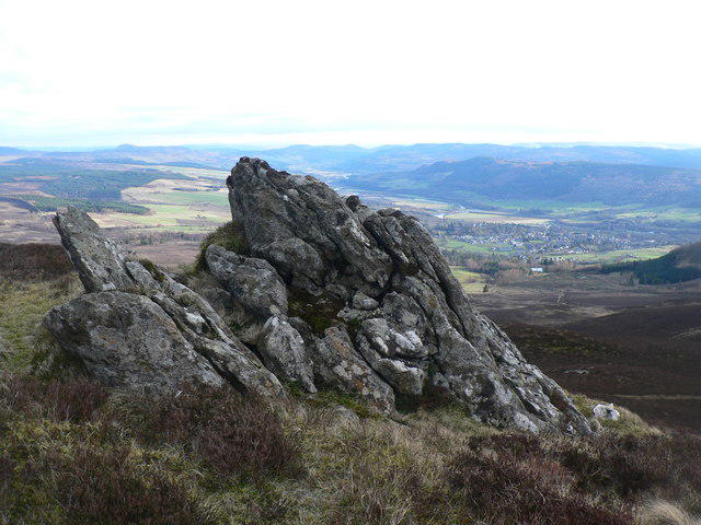 Photo could not load
NN9462 : Rocky outcrop
Liz Gray
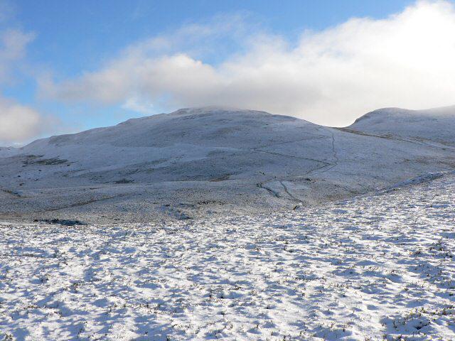 Photo could not load
NN9462 : Meall na h-Aodainn Moire
Rob Burke
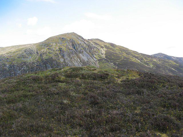 Photo could not load
NN9462 : Summit of Meall na h-Aodainn Mòire
Richard Webb
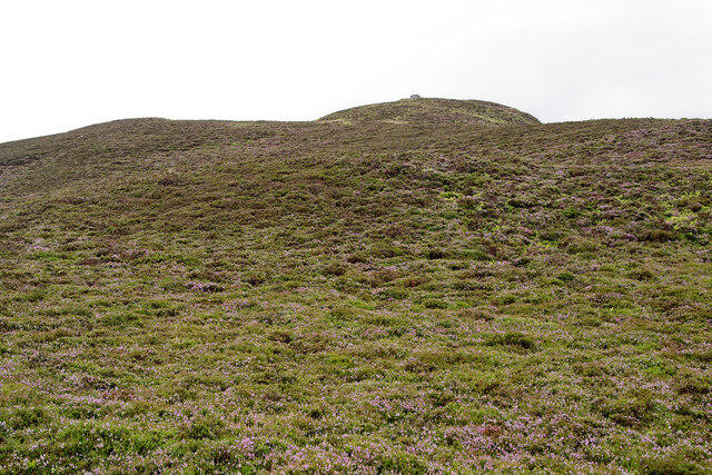 Photo could not load
NN9462 : Meall na h-Aodainn Mòire
Julian Paren
Hill facts and local notes
Classifications
Elevation
633m
2,077 ft
Prominence
110m
Coordinates
56.7397, -3.7318
NN941622
OS Map
43
Explorer: OL49E 386E
At the Summit
A large stone cairn marks the summit, offering a perfect spot to take a well-deserved breather and admire the breathtaking views.
Terrain & Geology
Composed mainly of ancient granites, Meall na h-Aodainn Moire showcases a rocky terrain shaped by glaciers during the last Ice Age. Its cliffs and slopes are a textbook example of glacial erosion.
Views & Scenery
From the summit, one can see the sprawling landscapes of Loch Awe, Ben Cruachan, and the vastness of the Scottish Highlands.
History & Heritage
Name Origin
The name translates from Gaelic as 'hill of the great face', possibly referring to its striking profile when viewed from certain angles.
Historical Significance
The mountain holds cultural significance in local folklore and has been a silent witness to the tumultuous history of the Highlands.
Getting There & Facilities
Check current local access restrictions, parking rules and transport timetables before travelling. These notes do not confirm public access to the summit.
Parking
Parking is available at the foot of the mountain, near the village of Dalmally. Limited spaces so arrive early!
Public Transport
Regular train services to Dalmally station, followed by a short bus ride or a taxi to the start of the hiking routes.
Nearby Facilities
There are few facilities at Dalmally, with options for food and drink available at local cafes. Public toilets are located at the village hall.
Safety Information
Known Hazards
- Loose rocks, sudden weather changes, and the possibility of encountering moorland bogs should be taken into account.
General Safety Tips
- Check weather conditions before setting out
- Carry appropriate clothing and equipment
- Let someone know your planned route
- Take a map, compass, and GPS device
- Carry emergency supplies: food, water, first aid kit, torch
Hills
Some common questions about the hills answered
Are there group walks up Meall na h-Aodainn Moire?
Many walkers use Walkmates to join or organise walks with others. You can check for group walks around Meall na h-Aodainn Moire through the maps
Are there other walkers around Meall na h-Aodainn Moire?
Activity varies by location and time, but Walkmates lets you see whether others have shared walks or shown interest in this area. Find other people through the walking friends search walking friends for Meall na h-Aodainn Moire search or of course create your own walk for Meall na h-Aodainn Moire
Can I organise a walk to Meall na h-Aodainn Moire?
Yes. If there aren’t any walks listed already, you can create a walk and make it available for others to join.
If you're signed up to Walkmates, you can create a walk to Meall na h-Aodainn Moire.
How do I find a walk up this hill?
There are often multiple ways to walk this hill, depending on experience and route preference. Walkmates helps you explore walks and routes that others have shared.
Can I suggest a new route up Meall na h-Aodainn Moire?
Yes. You can suggest or create routes to share with others. Walkmates focuses on the social side of walking, so routes are used to help people organise walks and explore areas together, rather than as detailed navigation tools or route libraries.
Other uses really appreciate knowledgeable walkers sharing their routes. Share your favourite route to Meall na h-Aodainn Moire here
The is an error or something incorrect about this hill. How do I let you know?
We always strive to keep the information on Walkmates as accurate as possible. If you find an error, please let us know through the contact form and we'll aim to correct it as quickly as possible
Community Discussion
Comments
Location
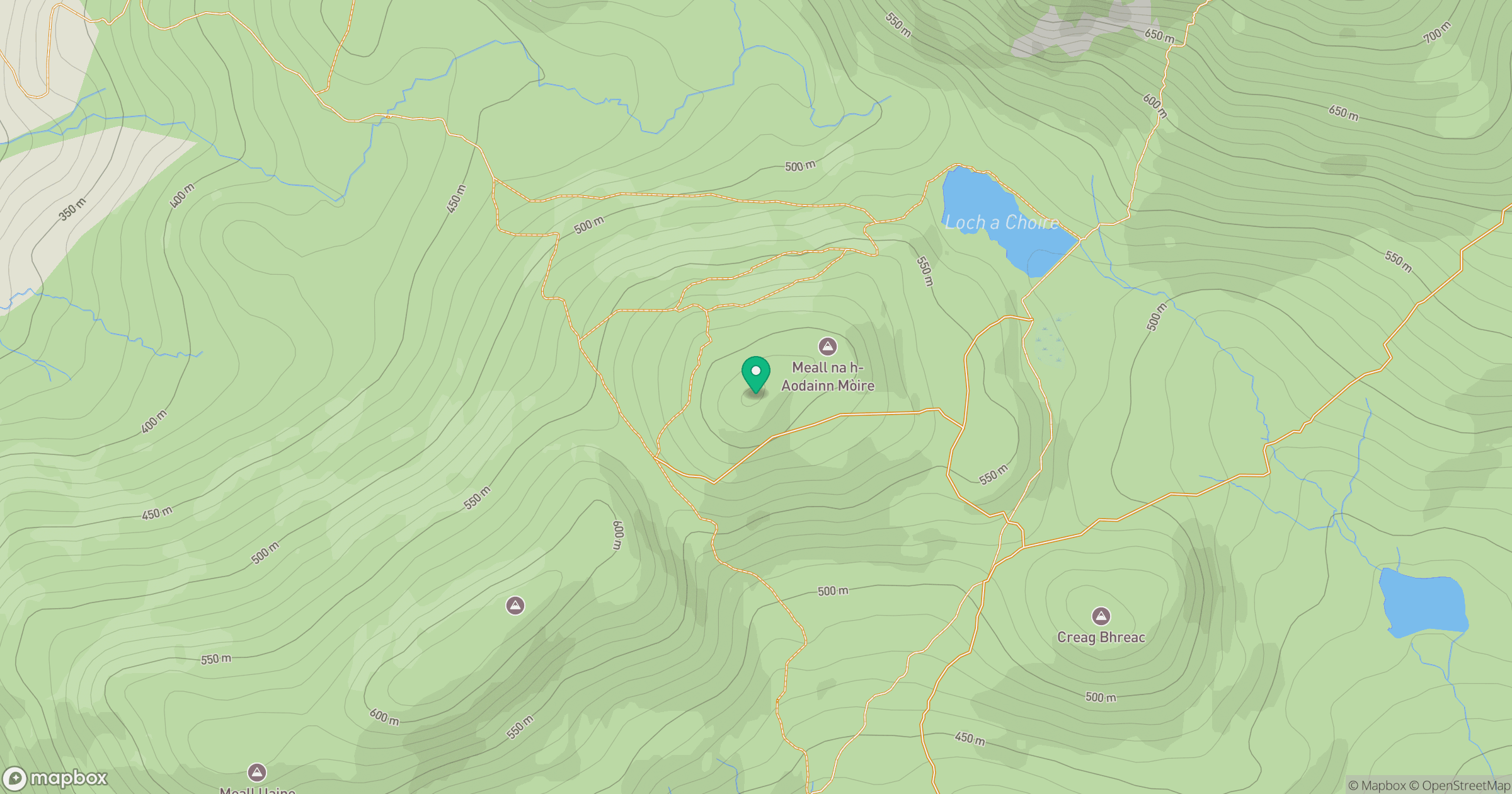
Grid reference: NN941622
View on OpenStreetMapOpens a map in a new tab, centred on the hill.
Hills within 30 km
Straight-line distance, not a walking route or confirmation of access.
Beinn a' Ghlo - Carn Liath
976m
Beinn a' Ghlo - Braigh Coire Chruinn-bhalgain
1,070m
Beinn a' Ghlo - Carn nan Gabhar
1,122m
Schiehallion
1,083m
Ben Vrackie
842m
No comments yet. Be the first.