

Tulach Hill
Good walks are even better shared.
Overview
Tulach Hill: A Hidden Gem of the Scottish Highlands
Tulach Hill, with its gentle rounded peak, stands proud at 610 meters. Often overshadowed by its taller neighbours, it offers a splendid outing for those who prefer a leisurely walk with breathtaking views.
Geology
Composed mainly of Old Red Sandstone, the geology of Tulach Hill is as fascinating as it is picturesque. The smooth slopes and rocky outcrops form a landscape that tells the story of millennia in the making.
Routes
From the A85 Road
This well-trodden route is perfect for a sunny afternoon. Covering 3.5 km, it usually takes around 1.5 hours to reach the summit. The path is moderate, making it accessible for many.
Summit Features
Reaching the top, you'll find a cairn and a trig point — essential for those Instagram shots!
Terrain Type
The hill offers a mix of grassy stretches and rocky patches that can keep you on your toes. A perfect opportunity to marvel at nature while testing your footing.
Views
Once at the summit, the reward is worth every step. From here, you can see Loch Awe shimmering like a gem and the undulating hills of the Trossachs in the distance. For the best views, spring and early summer provide crystal-clear skies and vibrant flora.
Hazards
As always, keep an eye on the weather; it can change quicker than a rabbit caught in headlights! Wet rocks can be slippery, so do tread carefully.
Nearby Summits
If you're keen on an adventure, consider tackling nearby giants like Ben Cruachan and Ben Lui. Just keep your wits about you!
Access
Parking is available at a layby on the A85. If public transport is your style, buses run to Taynuilt, just a 5 km stroll away from the trailhead.
Facilities
Before you head for the hills, Taynuilt offers cafes and essential facilities, ensuring you start your adventure well-fed!
History
The name Tulach, meaning 'hillock' in Gaelic, is fitting for this charming hill. Historically, it has ties to Clan Campbell, making it a place of cultural heritage too.
So pack your bag, lace up your boots, and enjoy a day on Tulach Hill. Who knows, you might just find peace amongst the peaks and valleys while having a good chuckle or two!
Enjoy the gentle allure of Tulach Hill!
Explore routes near Tulach Hill
Public walks starting within 80 km of this hill. Nearby does not mean a route reaches the summit; check its map and access before setting out.
Glen Banvie Trail with the Bruar viewpoint
View route
Aberfeldy: Glassie Woodland and River Tay Circular
View route
Kenmore: Drummond Hill Black Rock Trail above Loch Tay
View route
Unled club outing: Glenesk (coach departure)
View route
Route planning notes
These notes describe possible approaches, not verified navigable routes or permission to cross land. Check current paths, local access rules and conditions before setting out.
From the A85 Road
A popular and straightforward approach to the summit, starting from the nearby A85 road.
Make a day of it, together
Find someone to share the walk with, or organise a day out along a route you like.
Photo Gallery
View all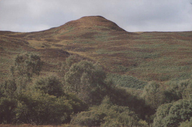 Photo could not load
NN8664 : Tulach Hill Blair Atholl south
MDS
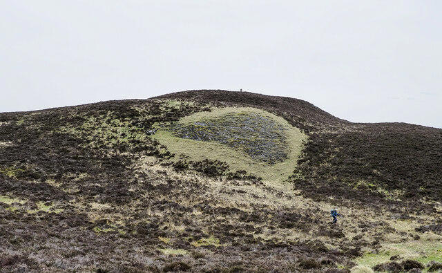 Photo could not load
NN8564 : Thinly vegetated rock exposure on Tulach Hill
Trevor Littlewood
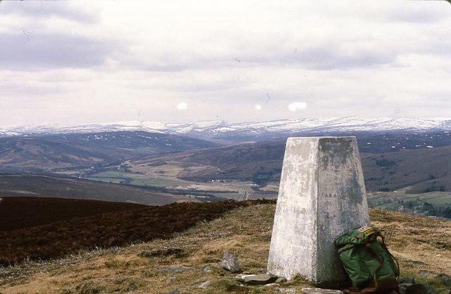 Photo could not load
NN8564 : Tulach Hill summit
Gordon Hatton
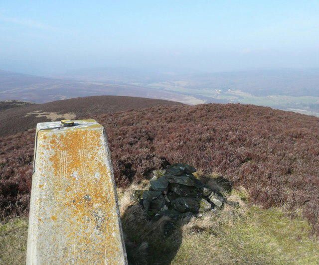 Photo could not load
NN8564 : Cairn, trig point and GPS on Tulach Hill
Russel Wills
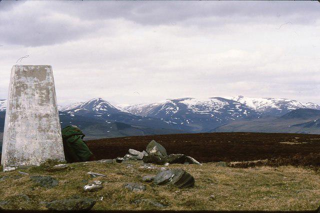 Photo could not load
NN8564 : Tulach Hill
Gordon Hatton
Hill facts and local notes
Classifications
Elevation
470m
1,542 ft
Prominence
135m
Coordinates
56.7538, -3.8665
NN859640
OS Map
43
Explorer: OL49E 386E
At the Summit
The summit features a well-maintained cairn and a trig point, offering a great spot for a well-deserved photo op.
Terrain & Geology
Tulach Hill primarily consists of Old Red Sandstone, with striking features such as gently sloping hills and rocky outcrops, providing a diverse and visually interesting landscape.
Views & Scenery
From the summit, hikers can enjoy panoramic views of the surrounding glens, including Loch Awe and the distant hills of the Trossachs.
History & Heritage
Name Origin
The Gaelic name 'Tulach' translates to 'hillock', a fitting description for this modest but lovely peak.
Historical Significance
Tulach Hill is part of the traditional territory of the Clan Campbell, and its scenic beauty has long attracted locals and visitors alike.
Getting There & Facilities
Check current local access restrictions, parking rules and transport timetables before travelling. These notes do not confirm public access to the summit.
Parking
There is a small layby along the A85 road near the start of the walking route where parking is available.
Public Transport
Buses run regularly to the nearby town of Taynuilt, and from there it's around a 5 km walk to the trailhead.
Nearby Facilities
The nearest cafes and toilets can be found in Taynuilt, making it a good place to stock up on snacks before or after your hike.
Safety Information
Known Hazards
- Watch out for sudden changes in weather, as conditions can vary dramatically. Slippery rocks in wet conditions can also pose a risk.
General Safety Tips
- Check weather conditions before setting out
- Carry appropriate clothing and equipment
- Let someone know your planned route
- Take a map, compass, and GPS device
- Carry emergency supplies: food, water, first aid kit, torch
Hills
Some common questions about the hills answered
Are there group walks up Tulach Hill?
Many walkers use Walkmates to join or organise walks with others. You can check for group walks around Tulach Hill through the maps
Are there other walkers around Tulach Hill?
Activity varies by location and time, but Walkmates lets you see whether others have shared walks or shown interest in this area. Find other people through the walking friends search walking friends for Tulach Hill search or of course create your own walk for Tulach Hill
Can I organise a walk to Tulach Hill?
Yes. If there aren’t any walks listed already, you can create a walk and make it available for others to join.
If you're signed up to Walkmates, you can create a walk to Tulach Hill.
How do I find a walk up this hill?
There are often multiple ways to walk this hill, depending on experience and route preference. Walkmates helps you explore walks and routes that others have shared.
Can I suggest a new route up Tulach Hill?
Yes. You can suggest or create routes to share with others. Walkmates focuses on the social side of walking, so routes are used to help people organise walks and explore areas together, rather than as detailed navigation tools or route libraries.
Other uses really appreciate knowledgeable walkers sharing their routes. Share your favourite route to Tulach Hill here
The is an error or something incorrect about this hill. How do I let you know?
We always strive to keep the information on Walkmates as accurate as possible. If you find an error, please let us know through the contact form and we'll aim to correct it as quickly as possible
Community Discussion
Comments
Location
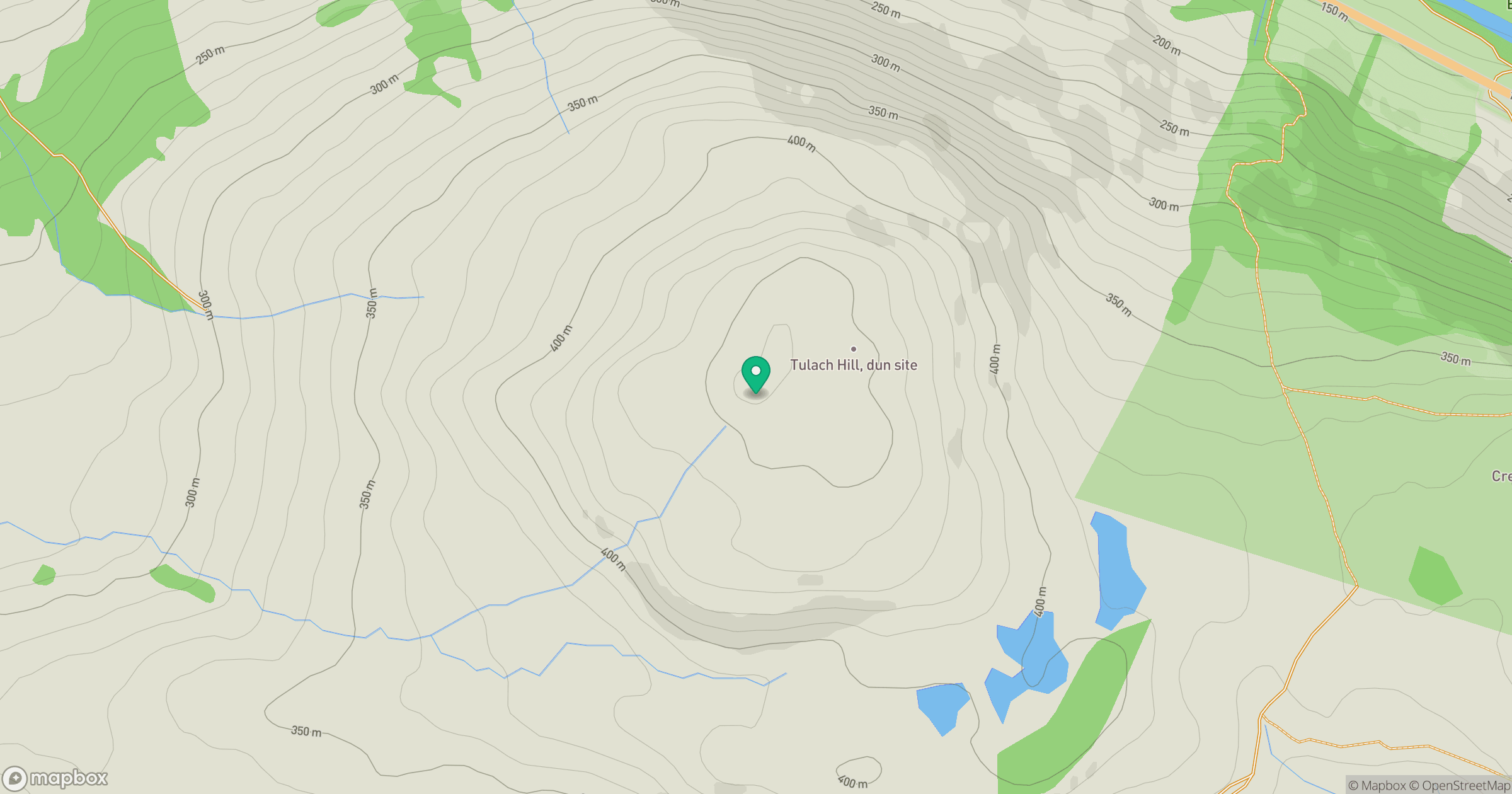
Grid reference: NN859640
View on OpenStreetMapOpens a map in a new tab, centred on the hill.
Hills within 30 km
Straight-line distance, not a walking route or confirmation of access.
Beinn a' Ghlo - Carn Liath
976m
Beinn a' Ghlo - Braigh Coire Chruinn-bhalgain
1,070m
Beinn a' Ghlo - Carn nan Gabhar
1,122m
Schiehallion
1,083m
Beinn Eagagach
691m
No comments yet. Be the first.