

Ben Vrackie
Good walks are even better shared.
NN9563 : Ben Vrackie’s Summit 841m
Iain Lees Photo source
Overview
Ben Vrackie is an 842.2 m Corbett above Pitlochry in Perth and Kinross. The usual approach from Moulin crosses woodland and heather moorland, passes Loch a' Choire and climbs a steep stone-built path to a wide-ranging summit viewpoint.
Ben Vrackie
Ben Vrackie is a Corbett north of Pitlochry in Perth and Kinross. Its surveyed height is 842.2 m. The highest ground is beside the viewpoint indicator; the trig pillar stands nearby. The name is commonly translated as 'speckled mountain'.
Walking from Moulin
The usual approach passes through woodland and heather moorland to Loch a' Choire, followed by a steep ascent on a stone-built path. Two different outings are described in the route notes: Walking Britain's 8.1 km, 4.5-hour out-and-back starts at the upper car park; Walkhighlands' 10.2 km circuit starts at the lower car park and returns by the loch and Bealach na Searmoin, taking 3.5–4.5 hours.
Landscape and views
The summit looks across Pitlochry and towards Beinn a' Ghlo and the Cairngorms. The mountain's lime-rich schists, limestone and igneous rocks support notable upland plants. Ben Vrackie was first notified as a Site of Special Scientific Interest in 1955.
Access and safety
The car parks are reached by the lane behind the Moulin Inn. Pitlochry has rail, bus and coach connections, with an onward walk to Moulin. The inn and town provide refreshments; public toilets are in Pitlochry.
The upper path is steep and uneven. Wet stone, poor visibility and changing mountain weather require care. Carry suitable clothing, food, navigation equipment and a torch. Snow or ice can turn the ascent into a winter mountaineering outing requiring appropriate boots, an ice axe, crampons and the skills to use them.
Explore routes near Ben Vrackie
Walks starting near this hill. Open a route to check its map, distance and full itinerary.
Aberfeldy: Glassie Woodland and River Tay Circular
View route
Kenmore: Drummond Hill Black Rock Trail above Loch Tay
View route
Unled club outing: West Drumochter/Beinn Udlamain (coach departure)
View route
Unled club outing: Glenesk (coach departure)
View route
Route planning notes
These notes describe possible approaches. Check a route's map and access information when planning your walk.
Moulin upper car park out-and-back
Start at the upper Ben Vrackie car park above Moulin (NN944598). Follow the signed path through woodland and moorland, cross the dam at Loch a' Choire, then climb the steep summit path. Return the same way to the upper car park. Walking Britain lists 8.1 km and 4.5 hours for the complete walk.
Moulin with Loch a' Choire and Bealach return
Start at the lower Ben Vrackie car park (NN943595), pass the upper car park and climb via Loch a' Choire. Descend to the loch, take the narrower shore path, then return through Bealach na Searmoin to rejoin the outward path and finish at the lower car park. Walkhighlands gives 3.5–4.5 hours for this 10.2 km circuit; the loch-side path can be boggy.
Make a day of it, together
Find someone to share the walk with, or organise a day out along a route you like.
Photo Gallery
View all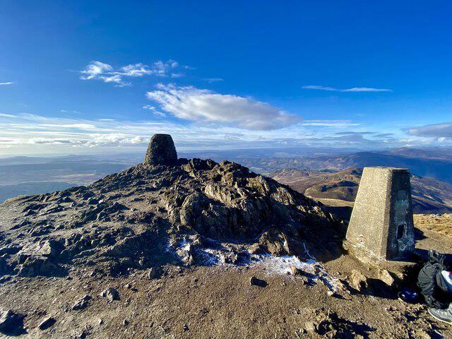 Photo could not load
NN9563 : Ben Vrackie’s Summit 841m
Iain Lees
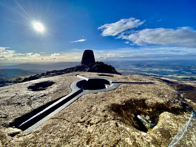 Photo could not load
NN9563 : Looking to the Viewpoint Indicator on Ben Vrackie from the Triangulation Pillar
Iain Lees
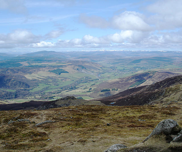 Photo could not load
NN9563 : Ben Vrackie's western slopes
Andy Waddington
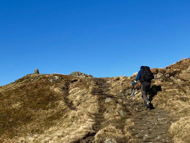 Photo could not load
NN9563 : Approaching the summit of Ben Vrackie
Iain Lees
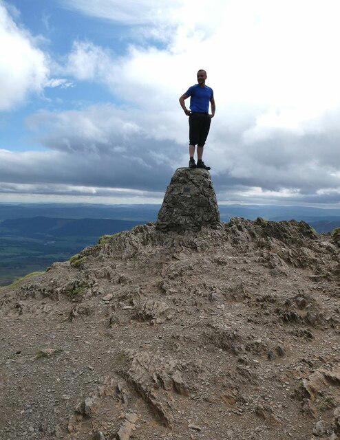 Photo could not load
NN9563 : On top of the toposcope
Oliver Dixon
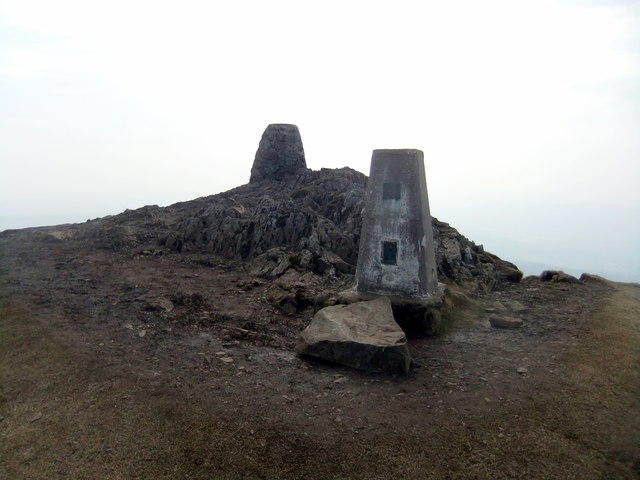 Photo could not load
NN9563 : Ben Vrackie
David Brown
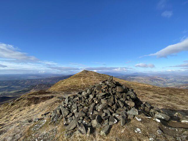 Photo could not load
NN9563 : Looking over to the summit of Ben Vrackie
Iain Lees
 Photo could not load
NN9563 : Summit of Ben Vrackie
Scott Cormie
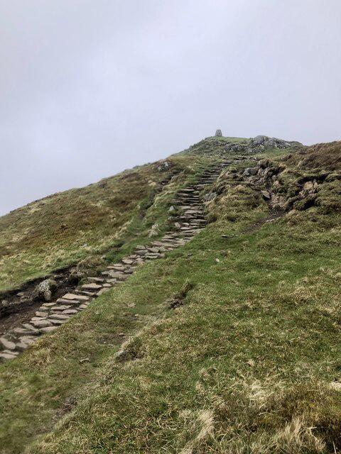 Photo could not load
NN9563 : Ben Vrackie Beckons
Mick Garratt
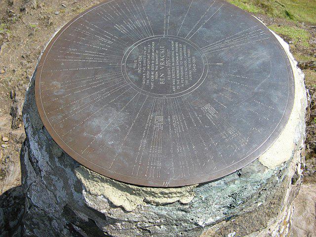
NN9563 : Ben Vrackie toposcope
Richard Webb
Hill facts and local notes
Classifications
Elevation
842m
2,763 ft
Prominence
406m
Coordinates
56.7490, -3.7173
NN950632
OS Map
43
Explorer: OL49E 386E
At the Summit
The highest ground is beside the viewpoint indicator. An OS trig pillar stands about 8 m to the north-west; the indicator and pillar are useful summit landmarks.
Terrain & Geology
Ben Vrackie's bedrock includes lime-rich Dalradian schists, limestone and igneous rocks. These support a rich variety of upland plants, including arctic-alpine species within the Ben Vrackie Site of Special Scientific Interest.
Views & Scenery
Views over Pitlochry and the surrounding glens, towards Blair Atholl, Beinn a' Ghlo and the Cairngorms in clear weather.
History & Heritage
Name Origin
Commonly translated from Gaelic as 'speckled mountain'.
Historical Significance
Ben Vrackie was first notified as a Site of Special Scientific Interest in 1955. It is recognised for its upland habitats, plants and breeding birds.
Getting There & Facilities
Parking
Two Ben Vrackie car parks lie on the lane north-west of Moulin, reached by turning off the A924 behind the Moulin Inn. The lower car park is at NN943595; the upper one is about 250 m farther along the lane at NN944598. Spaces are limited and can fill on busy days.
Public Transport
Pitlochry is served by trains, buses and long-distance coaches. Continue on foot to Moulin and the Ben Vrackie car parks. Check current connections and allow for this extra walk when planning the day.
Nearby Facilities
The village of Moulin has a pub and nearby Pitlochry offers more extensive facilities, including cafes, shops, and public restrooms.
Safety Information
Known Hazards
- Steep, uneven stone steps on the upper ascent can be slippery when wet or icy.
- Open upper slopes are exposed to changing weather and poor visibility; carry navigation equipment.
- The optional path around Loch a' Choire can be boggy.
Seasonal Hazards
Snow and ice make the steep upper path substantially more serious and can hide the summer route. Winter conditions require appropriate boots, an ice axe and crampons, and the skills to use them. Check a mountain forecast and allow enough daylight for the return.
General Safety Tips
- Check weather conditions before setting out
- Carry appropriate clothing and equipment
- Let someone know your planned route
- Take a map, compass, and GPS device
- Carry emergency supplies: food, water, first aid kit, torch
Hills
Some common questions about the hills answered
Are there group walks up Ben Vrackie?
Many walkers use Walkmates to join or organise walks with others. You can check for group walks around Ben Vrackie through the maps
Are there other walkers around Ben Vrackie?
Activity varies by location and time, but Walkmates lets you see whether others have shared walks or shown interest in this area. Find other people through the walking friends search walking friends for Ben Vrackie search or of course create your own walk for Ben Vrackie
Can I organise a walk to Ben Vrackie?
Yes. If there aren’t any walks listed already, you can create a walk and make it available for others to join.
If you're signed up to Walkmates, you can create a walk to Ben Vrackie.
How do I find a walk up this hill?
There are often multiple ways to walk this hill, depending on experience and route preference. Walkmates helps you explore walks and routes that others have shared.
Can I suggest a new route up Ben Vrackie?
Yes. You can suggest or create routes to share with others. Walkmates focuses on the social side of walking, so routes are used to help people organise walks and explore areas together, rather than as detailed navigation tools or route libraries.
Other uses really appreciate knowledgeable walkers sharing their routes. Share your favourite route to Ben Vrackie here
The is an error or something incorrect about this hill. How do I let you know?
We always strive to keep the information on Walkmates as accurate as possible. If you find an error, please let us know through the contact form and we'll aim to correct it as quickly as possible
Community Discussion
Comments
Location
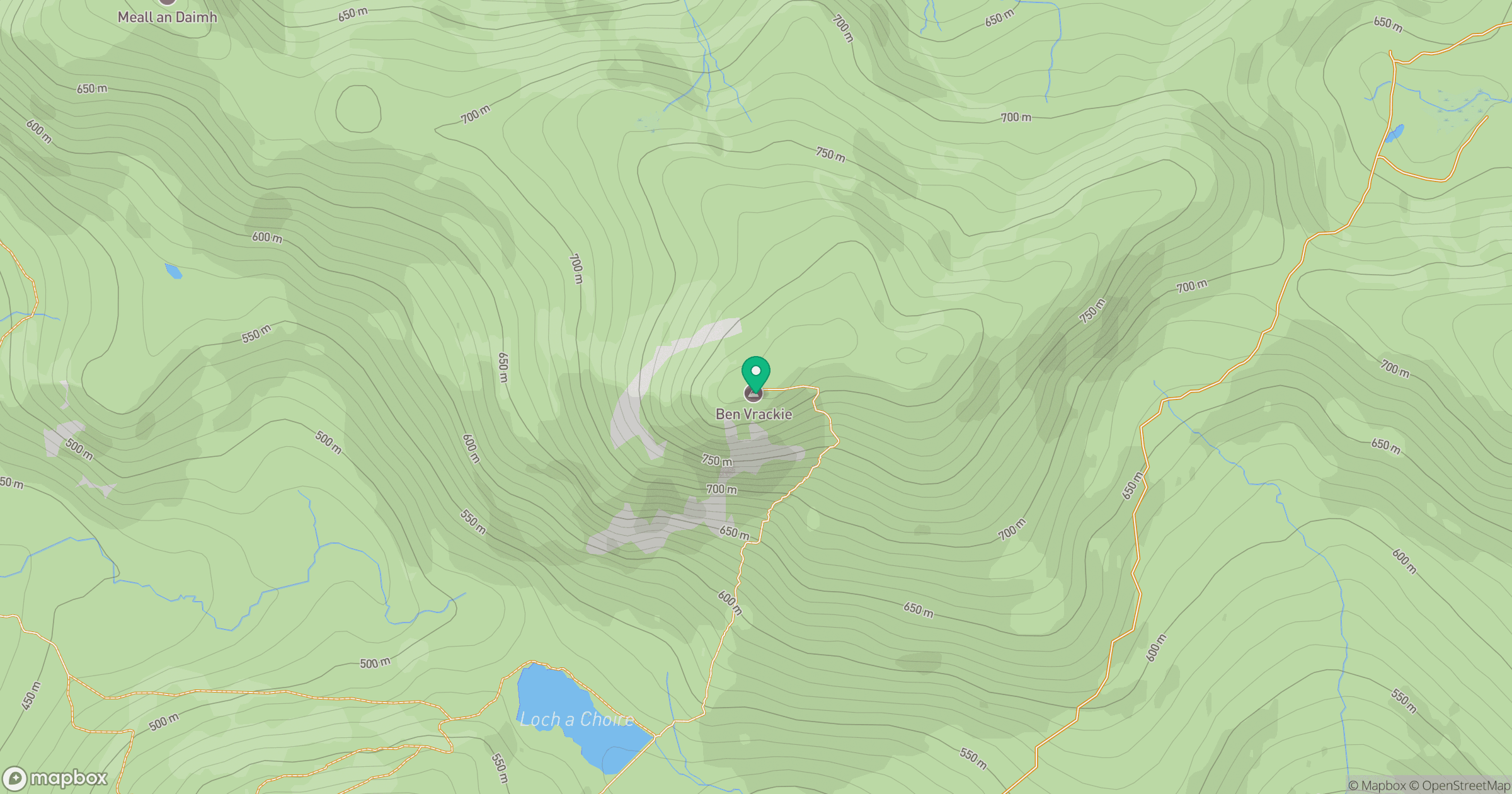
Grid reference: NN950632
View on OpenStreetMapOpens a map in a new tab, centred on the hill.
![Ben Macdui [Beinn Macduibh]](https://cdn.walkmates.com/gallery-images/e60cf32aeb394c3282fcdd14a63368f0.jpg)
No comments yet. Be the first.