

Craig Lochie
Good walks are even better shared.
Overview
Craig Lochie: A Hidden Gem in the Scottish Highlands
Nestled within the breathtaking Scottish Highlands, Craig Lochie stands as a marvellous 651 meters high Marilyn, offering spectacular views and a welcoming atmosphere for hikers of all levels.
Geology
Craig Lochie is primarily composed of ancient metamorphic schist. These resilient rocks tell tales of intense geological activity that have shaped the landscape over millions of years. While fossils may be rare, the stunning rock formations remind us of the planet’s dramatic history.
Routes
West Highland Way to Craig Lochie
This is a popular and moderate route, spanning 5 km, starting from the famous West Highland Way. Enjoy a gentle ascent while taking in scenic glens on your way to the summit.
Direct Ascent from Letterfinlay
For those craving a challenge, the direct ascent from Letterfinlay is perfect. At 3.5 km, it’s shorter but steeper, providing a proper workout!
Summit Features
The summit is characterised by a large rocky outcrop and a charming stone cairn, ideal for that classic 'I conquered Craig Lochie' photo. Don’t forget to capture the view—your friends might need convincing that you made it up!
Terrain
Expect a mix of rocky and grassy terrains, with a few boggy sections that can test your boot's waterproofing. Hills in this area can be slightly treacherous after rain, so keep your footing steady!
Views
The panoramic views from Craig Lochie include the stunning Loch Lochy and the surrounding peaks of the Great Glen. Spring and autumn are particularly great for admiring the scenery, boasting clear skies and vibrant landscapes.
Hazards
Be mindful of the unpredictable weather, as Highland conditions can change rapidly. Uneven terrain also poses a risk, so remain vigilant and enjoy.
Access
Accessing Craig Lochie is easy, with plenty of parking available at the Letterfinlay Hotel, just off the A82. You can also catch a bus from nearby towns like Fort William, which is about 17 km away.
Facilities
Fort William is nearby, offering a plethora of amenities such as cafes, restaurants, and public toilets. The Letterfinlay Hotel also provides food and drinks for tired hikers.
History
The name 'Craig Lochie' translates to 'rocky hill of Lochy', perfectly capturing its geographical charm. With a rich history and cultural significance, Craig Lochie is a must-visit for all outdoor enthusiasts.
So lace up your hiking boots, pack a sandwich (or two), and set off on an adventure that promises not just nature's beauty but a sprinkle of Highland charm!
Happy hiking!
Explore routes near Craig Lochie
Public walks starting within 80 km of this hill. Nearby does not mean a route reaches the summit; check its map and access before setting out.
Aberfeldy: Glassie Woodland and River Tay Circular
View route
Kenmore: Drummond Hill Black Rock Trail above Loch Tay
View route
Glen Banvie Trail with the Bruar viewpoint
View route
Unled club outing: Glenesk (coach departure)
View route
Route planning notes
These notes describe possible approaches, not verified navigable routes or permission to cross land. Check current paths, local access rules and conditions before setting out.
West Highland Way to Craig Lochie
Starting from the West Highland Way, this route winds through scenic glens and offers a gentle ascent up to the summit.
Direct Ascent from Letterfinlay
A more challenging route that directly approaches from Letterfinlay, perfect for the keen hiker seeking a bit of a workout.
Make a day of it, together
Find someone to share the walk with, or organise a day out along a route you like.
Photo Gallery
View all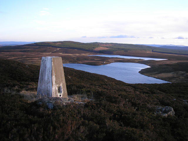 Photo could not load
NN9447 : The trig point on Craig Lochie
Sandy Gemmill
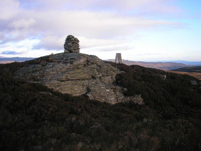 Photo could not load
NN9447 : Summit of Craig Lochie
Sandy Gemmill
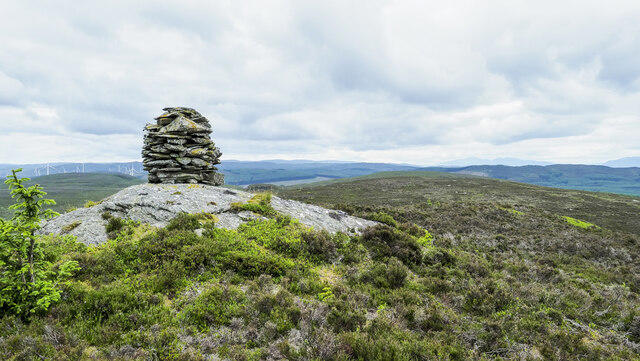 Photo could not load
NN9447 : Summit cairn of Craig Lochie
Trevor Littlewood
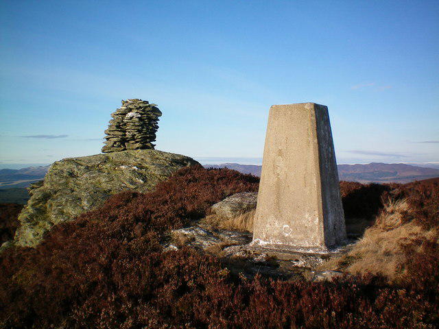 Photo could not load
NN9447 : Craig Lochie summit
Rob Woodall
Hill facts and local notes
Classifications
Elevation
520m
1,706 ft
Prominence
126m
Coordinates
56.6099, -3.7208
NN944477
OS Map
52 53
Explorer: 379W
At the Summit
The summit features a large rocky outcrop and a small stone cairn that offers a perfect backdrop for your 'I climbed Craig Lochie' photo.
Terrain & Geology
Craig Lochie is primarily composed of ancient metamorphic rocks, including schist which tells the tale of geological forces at work millions of years ago. Fossils are rare in these hard rocks, but an excellent place to ponder the Earth’s history!
Views & Scenery
From the summit, you can enjoy panoramic views of Loch Lochy and the surrounding hills, including distant peaks of the Great Glen.
History & Heritage
Name Origin
The name 'Craig Lochie' translates to 'rocky hill of Lochy', reflecting its geographical setting.
Historical Significance
The area is rich in both natural and cultural heritage, often attracting hikers and adventure seekers from all over the world.
Getting There & Facilities
Check current local access restrictions, parking rules and transport timetables before travelling. These notes do not confirm public access to the summit.
Parking
Parking is available at the Letterfinlay Hotel, located just off the A82. There are no parking fees, making it a pleasant spot to start your hike.
Public Transport
Buses run regularly along the A82 with stops at nearby villages like Invergarry and Fort William.
Nearby Facilities
The nearest facilities can be found in Fort William, including cafes, restaurants, and public toilets. The Letterfinlay Hotel also offers food and drink.
Safety Information
Known Hazards
- Watch out for sudden weather changes; the Highlands can turn on a dime! Terrain can also be uneven, so keep your wits about you.
General Safety Tips
- Check weather conditions before setting out
- Carry appropriate clothing and equipment
- Let someone know your planned route
- Take a map, compass, and GPS device
- Carry emergency supplies: food, water, first aid kit, torch
Hills
Some common questions about the hills answered
Are there group walks up Craig Lochie?
Many walkers use Walkmates to join or organise walks with others. You can check for group walks around Craig Lochie through the maps
Are there other walkers around Craig Lochie?
Activity varies by location and time, but Walkmates lets you see whether others have shared walks or shown interest in this area. Find other people through the walking friends search walking friends for Craig Lochie search or of course create your own walk for Craig Lochie
Can I organise a walk to Craig Lochie?
Yes. If there aren’t any walks listed already, you can create a walk and make it available for others to join.
If you're signed up to Walkmates, you can create a walk to Craig Lochie.
How do I find a walk up this hill?
There are often multiple ways to walk this hill, depending on experience and route preference. Walkmates helps you explore walks and routes that others have shared.
Can I suggest a new route up Craig Lochie?
Yes. You can suggest or create routes to share with others. Walkmates focuses on the social side of walking, so routes are used to help people organise walks and explore areas together, rather than as detailed navigation tools or route libraries.
Other uses really appreciate knowledgeable walkers sharing their routes. Share your favourite route to Craig Lochie here
The is an error or something incorrect about this hill. How do I let you know?
We always strive to keep the information on Walkmates as accurate as possible. If you find an error, please let us know through the contact form and we'll aim to correct it as quickly as possible
Community Discussion
Comments
Location
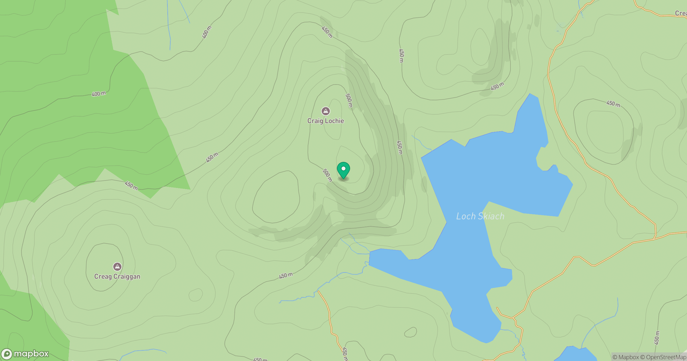
Grid reference: NN944477
View on OpenStreetMapOpens a map in a new tab, centred on the hill.
Hills within 30 km
Straight-line distance, not a walking route or confirmation of access.
Beinn a' Ghlo - Carn Liath
976m
Beinn a' Ghlo - Braigh Coire Chruinn-bhalgain
1,070m
Beinn a' Ghlo - Carn nan Gabhar
1,122m
Schiehallion
1,083m
Creag a' Mhadaidh
530m
No comments yet. Be the first.