

Meall na h-Aisre
Good walks are even better shared.
NN5199 : Descent into Coire Gorm
Chris Eilbeck Photo source
Overview
Introduction
Meall na h-Aisre is a stunning mountain in the heart of the Scottish Highlands, sitting at an elevation of 703 meters. A Marilyn in classification, it offers splendid views and a chance for a good old leg stretch in nature's bosom.
Geology
The mountain's composition of granite and schist provides not just a scenic backdrop but also a fascinating geology for enthusiasts. With weathered rocks peppering the landscape, one can easily mistake this beauty for an ancient castle’s ruins, if you squint hard enough!
Hiking Routes
The most popular route to the summit starts from the parking area in Invergarry. The Eastern Approach winds through pleasant heathers and grassy slopes before tackling the rocky ascent closer to the top. A round trip can take around 3.5 hours, depending on how willing you are to stop and smell the wildflowers.
Summit Features
Upon reaching the summit, hikers are greeted by a friendly cairn that always looks like it could use a little more stone. The summit provides breathtaking panoramas; it’s a great spot to whip out the picnic and marvel at the world below.
Terrain
Expect a mix of rocky, grassy, and boggy terrain. Investing in a good pair of hiking boots could save you from a surprise dunk into a bog — trust me, that’s not a fun experience!
Views
The summit rewards your efforts with magnificent vistas. Gaze upon the mighty Ben Nevis to the south, the picturesque Loch Lochy, and the vast Great Glen. For the best views, timing it for late spring through early autumn works wonders.
Hazards
While hiking in the Highlands is a joy, be wary of the weather. It can change faster than a cat on a hot tin roof. Rocky sections, if wet, can be slippery, so watch your footing and take care!
Access and Facilities
Invergarry serves as the closest town, where you can park before embarking on your trek. Limited public transport options are available but plan ahead. Don’t forget to fill your pockets with snacks, as there are minimal facilities nearby. A public toilet is available in the village hall, should nature call halfway up!
Conclusion
Meall na h-Aisre is a delightful adventure for hikers of all levels, promising unforgettable views and a good day out. Remember, your legs might ache but your heart will be full!
Happy hiking!
Explore routes near Meall na h-Aisre
Walks starting near this hill. Open a route to check its map, distance and full itinerary.
Fort Augustus to Kytra Lock: Caledonian Canal Towpath
View route
Glen Affric: Coire Loch Woodland Trail
View route
Aviemore: Loch an Eilein and the Croft Track from Rothiemurchus
View route
Rothiemurchus: Beaver Trail and Lochan Mor
View route
Route planning notes
These notes describe possible approaches. Check a route's map and access information when planning your walk.
Eastern Approach
A straightforward ascent starting from the small parking area at Invergarry. The path meanders through heather and grassy slopes, giving way to rocky sections near the summit.
Make a day of it, together
Find someone to share the walk with, or organise a day out along a route you like.
Photo Gallery
View all Photo could not load
NN5199 : Descent into Coire Gorm
Chris Eilbeck
 Photo could not load
NN5199 : Near the summit of Meall na h-Aisre
Steven Brown
 Photo could not load
NH5100 : Fence line on Meall na h-Aisre
Steven Brown
 Photo could not load
NH5100 : Peat Hag, Meall na h-Aisre
Chris Eilbeck
 Photo could not load
NH5100 : Trig point and fence lune on Meall na h-Aisre
Steven Brown
 Photo could not load
NH5100 : Meall na h-Aisre (trig point)
Raibeart MacAoidh
Hill facts and local notes
Classifications
Elevation
862m
2,828 ft
Prominence
155m
Coordinates
57.0676, -4.4501
NH515000
OS Map
35
Explorer: OL55 401
At the Summit
The summit is marked by a small cairn and offers a stunning panoramic view of the surrounding peaks and valleys.
Terrain & Geology
Meall na h-Aisre is predominantly composed of granite and schist, typical of the Highland landscape. The weathered rock creates a unique, rugged terrain that is both beautiful and challenging.
Views & Scenery
From the summit, enjoy views of Ben Nevis to the south, Loch Lochy, and the Great Glen.
History & Heritage
Name Origin
The name 'Meall na h-Aisre' translates from Gaelic as 'Hill of the Reedy Ground', indicative of the lush surroundings.
Historical Significance
This area is steeped in local Highland history, being part of the lands traditionally inhabited by clans in the region.
Getting There & Facilities
Parking
There is a small parking area at Invergarry, approximately 3 km from the trailhead.
Public Transport
Public transport via bus services to Invergarry, though may require planning as these services can be infrequent.
Nearby Facilities
Few facilities are available in Invergarry; be sure to bring your own refreshments and a packed lunch. There are public toilets at the village hall.
Safety Information
Known Hazards
- Be aware of sudden weather changes, especially in the Highlands. Fog can roll in quickly, reducing visibility. Rocky sections can be slippery, particularly after rain.
General Safety Tips
- Check weather conditions before setting out
- Carry appropriate clothing and equipment
- Let someone know your planned route
- Take a map, compass, and GPS device
- Carry emergency supplies: food, water, first aid kit, torch
Hills
Some common questions about the hills answered
Are there group walks up Meall na h-Aisre?
Many walkers use Walkmates to join or organise walks with others. You can check for group walks around Meall na h-Aisre through the maps
Are there other walkers around Meall na h-Aisre?
Activity varies by location and time, but Walkmates lets you see whether others have shared walks or shown interest in this area. Find other people through the walking friends search walking friends for Meall na h-Aisre search or of course create your own walk for Meall na h-Aisre
Can I organise a walk to Meall na h-Aisre?
Yes. If there aren’t any walks listed already, you can create a walk and make it available for others to join.
If you're signed up to Walkmates, you can create a walk to Meall na h-Aisre.
How do I find a walk up this hill?
There are often multiple ways to walk this hill, depending on experience and route preference. Walkmates helps you explore walks and routes that others have shared.
Can I suggest a new route up Meall na h-Aisre?
Yes. You can suggest or create routes to share with others. Walkmates focuses on the social side of walking, so routes are used to help people organise walks and explore areas together, rather than as detailed navigation tools or route libraries.
Other uses really appreciate knowledgeable walkers sharing their routes. Share your favourite route to Meall na h-Aisre here
The is an error or something incorrect about this hill. How do I let you know?
We always strive to keep the information on Walkmates as accurate as possible. If you find an error, please let us know through the contact form and we'll aim to correct it as quickly as possible
Community Discussion
Comments
Location
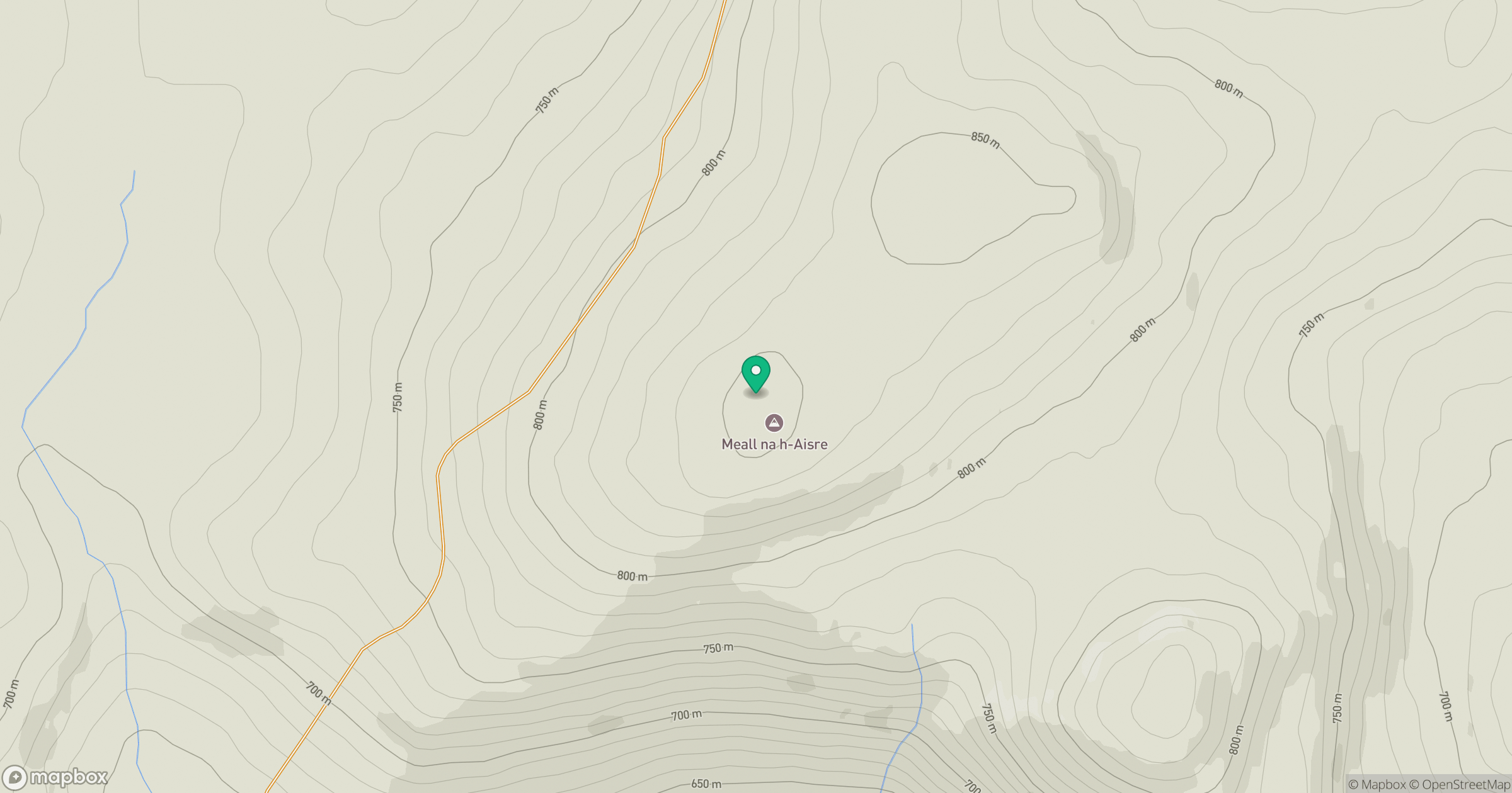
Grid reference: NH515000
View on OpenStreetMapOpens a map in a new tab, centred on the hill.
No comments yet. Be the first.