
Creag Mhor
Good walks are even better shared.
Overview
Creag Mhor
Overview
Creag Mhor, a prominent Munro in the Grampian Mountains, stands at 914 meters, inviting both seasoned climbers and casual walkers alike to bask in its impressive views and rugged terrain. Whether you're looking to conquer your first Munro or seeking to add another notch on your hiking belt, Creag Mhor promises a delightful day out.
Geology
Composed mainly of granite, Creag Mhor represents the classic Scottish Highland landscape, shaped by the relentless forces of glaciers that have polished its slopes over millennia. Those keen on geology will appreciate the fascinating features unique to this area, as you traverse its ancient rock formations.
Routes
From Glen Dochart
Starting from Glen Dochart, this route is particularly picturesque. It’s a moderate hike, about 10 km long, taking roughly 4 hours to complete. As you meander through the glen, don’t be surprised if a deer gives you a nod of approval.
From Crianlarich
For those looking for an added challenge, the route from Crianlarich offers steeper terrain and a few leg-burners along the way. Approximately 12 km in distance, it requires about 5 hours, but trust me, the views from the top are worth every drop of sweat.
Summit Features
At the summit, you will be greeted by a sizeable cairn marking your achievement, along with 360-degree views that will have you feeling on top of the world – quite literally!
Terrain Type
The terrain varies from grassy slopes to rocky outcrops and can be quite boggy in sections, especially after rain. A sturdy pair of boots is essential; you wouldn’t want to lose a shoe in the mud!
Views
On a clear day, the views from Creag Mhor are astounding. You can spot the jagged peaks of Ben More and Stob Binnein, along with the tranquil waters of Loch Voil. Spring and autumn are the best times to visit, boasting vibrant colours and clear skies.
Hazards
As always in the Highlands, be mindful of changing weather conditions and dress appropriately. The rocky sections can become slippery, especially after a downpour. Better safe than sorry!
Nearby Summits
Don’t forget to explore the nearby peaks of Ben More and Stob Binnein, both of which challenge you further with stunning vistas and invigorating climbs.
Access
Creag Mhor can be easily accessed from Crianlarich, where you can find a car park along the A85. Public transport options abound, making it an accessible destination for all.
Facilities
Located in Crianlarich, you can refuel at the local café and use the public toilets before or after your hike.
History
Creag Mhor’s name translates to ‘Big Crag’, reflecting its imposing presence. The mountain holds cultural significance, featuring in local legends that have been passed down through generations.
Conclusion
In summary, Creag Mhor is not just another hill; it's a splendid adventure waiting to unfold. Pack your gear, lace up those boots, and get ready to create lifelong memories in the embrace of the Scottish Highlands. Don’t forget to take your camera – the views deserve to be captured! Enjoy your hike!
Explore routes near Creag Mhor
Walks starting near this hill. Open a route to check its map, distance and full itinerary.
Fort Augustus to Kytra Lock: Caledonian Canal Towpath
View route
Glen Affric: Coire Loch Woodland Trail
View route
Banavie to Glen Loy Aqueduct: Neptune’s Staircase Canal Towpath
View route
Ben Nevis via Mountain Path
View route
Route planning notes
These notes describe possible approaches. Check a route's map and access information when planning your walk.
From Glen Dochart
A scenic and relatively straightforward route starting from Glen Dochart, offering hikers a gentle ascent with spectacular views of the surrounding valleys.
From Crianlarich
Starting from the village of Crianlarich, this route combines a steeper ascent with beautiful forestry trails. Ideal for those looking for a bit of a leg workout!
Make a day of it, together
Find someone to share the walk with, or organise a day out along a route you like.
Hill facts and local notes
Classifications
Elevation
766m
2,514 ft
Prominence
129m
Coordinates
57.0417, -4.4991
NN484972
OS Map
34
Explorer: OL55 401
At the Summit
The summit features a large cairn that marks the highest point of Creag Mhor, along with stunning panoramic views of the surrounding peaks.
Terrain & Geology
Creag Mhor is primarily composed of granite, characteristic of the Scottish Highlands. This rock formation has been shaped by glacial activity, giving the mountain its rugged yet inviting character.
Views & Scenery
From the summit, enjoy captivating views of Ben More, Stob Binnein, and the serene Loch Voil. A photographer's dream!
History & Heritage
Name Origin
Creag Mhor translates to 'Big Crag' in Gaelic, aptly named for its prominent rocky features.
Historical Significance
The mountain has long been revered by local hikers and climbers, and it plays a part in many folk stories and local traditions.
Getting There & Facilities
Parking
There is a car park at the end of the A85 near Crianlarich, a convenient starting point for your adventure.
Public Transport
Crianlarich has good public transport links with trains and buses stopping nearby.
Nearby Facilities
In Crianlarich, you will find a café for refreshments and public toilets, perfect for a pit stop before your hike.
Safety Information
Known Hazards
- Watch out for sudden weather changes, especially in winter. The rocky terrain can also be slippery when wet.
General Safety Tips
- Check weather conditions before setting out
- Carry appropriate clothing and equipment
- Let someone know your planned route
- Take a map, compass, and GPS device
- Carry emergency supplies: food, water, first aid kit, torch
Hills
Some common questions about the hills answered
Are there group walks up Creag Mhor?
Many walkers use Walkmates to join or organise walks with others. You can check for group walks around Creag Mhor through the maps
Are there other walkers around Creag Mhor?
Activity varies by location and time, but Walkmates lets you see whether others have shared walks or shown interest in this area. Find other people through the walking friends search walking friends for Creag Mhor search or of course create your own walk for Creag Mhor
Can I organise a walk to Creag Mhor?
Yes. If there aren’t any walks listed already, you can create a walk and make it available for others to join.
If you're signed up to Walkmates, you can create a walk to Creag Mhor.
How do I find a walk up this hill?
There are often multiple ways to walk this hill, depending on experience and route preference. Walkmates helps you explore walks and routes that others have shared.
Can I suggest a new route up Creag Mhor?
Yes. You can suggest or create routes to share with others. Walkmates focuses on the social side of walking, so routes are used to help people organise walks and explore areas together, rather than as detailed navigation tools or route libraries.
Other uses really appreciate knowledgeable walkers sharing their routes. Share your favourite route to Creag Mhor here
The is an error or something incorrect about this hill. How do I let you know?
We always strive to keep the information on Walkmates as accurate as possible. If you find an error, please let us know through the contact form and we'll aim to correct it as quickly as possible
Community Discussion
Comments
Location
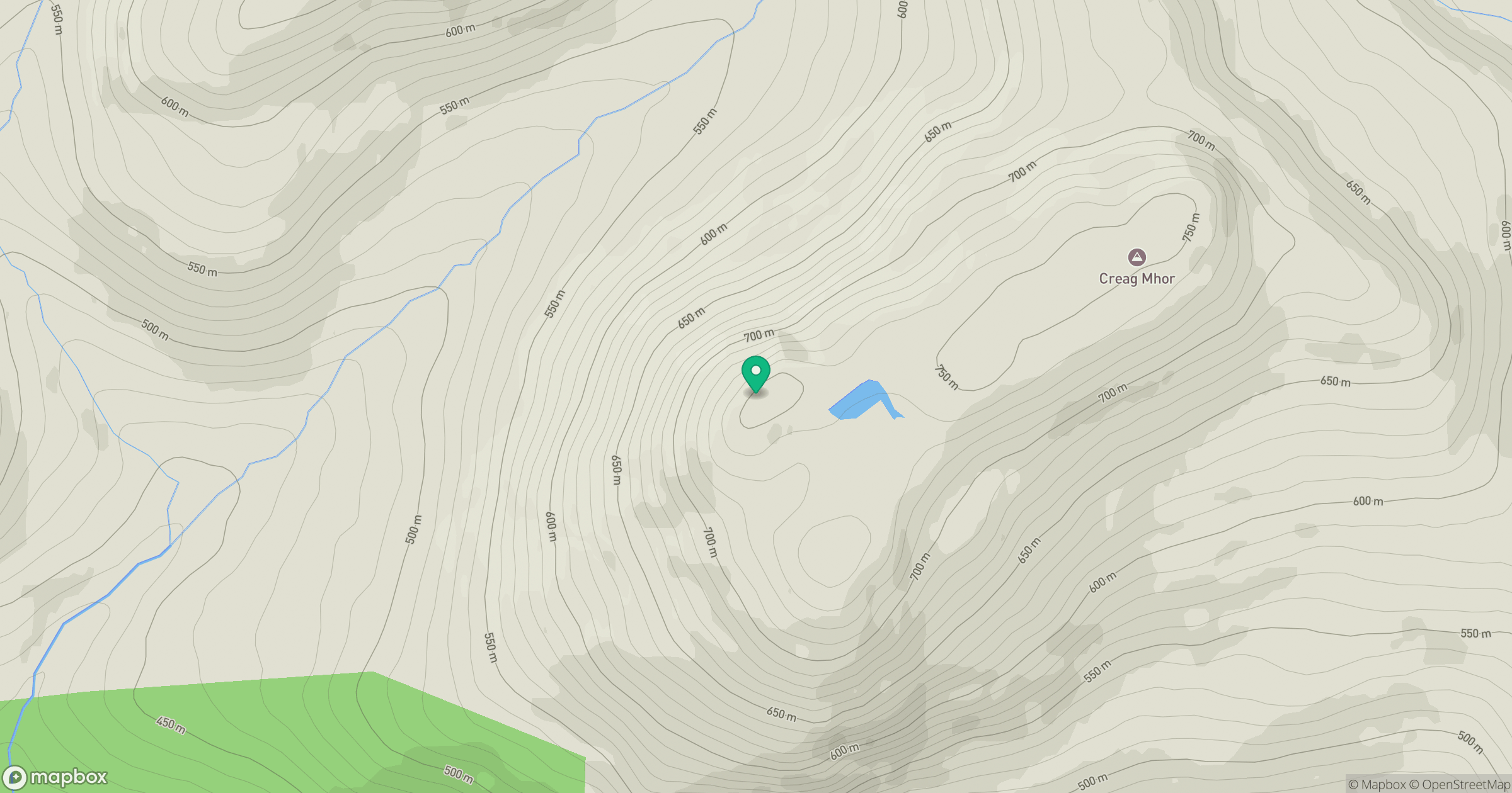
Grid reference: NN484972
View on OpenStreetMapOpens a map in a new tab, centred on the hill.
No comments yet. Be the first.