
Geal Charn
Good walks are even better shared.
Overview
Geal Charn: The White Cairn
Geal Charn, towering at 928 meters, is one of the prominent Munros in the Scottish Highlands. Nestled amidst breathtaking scenery, the mountain is a favourite among hikers and outdoor enthusiasts alike.
Geology
Composed mainly of granite and schist, Geal Charn showcases the rugged beauty typical of the Highlands. The solid rock provides a challenging, yet rewarding, terrain that adds a thrilling flavour to every step taken.
Routes
There are several routes to the summit, but the most popular ones include the North-West Ridge and the Hollow to the East. Each route has its own character and unique views, ensuring a splendid day out regardless of the choice.
- North-West Ridge Route: This 6.5 km route leads directly to the summit. It's moderately challenging and offers excellent views almost from the start.
- Hollow to the East Route: A bit more challenging, this 7 km trek winds through various landscapes before a final ascent. It’s worth the effort, especially in the quieter months.
Summit Features
Upon reaching the top, you'll be greeted by a large cairn and a trig point. These structures not only serve as navigational aids but also provide the ideal backdrop for your triumphal summit selfies!
Terrain Type
Expect a combination of rocky paths and grassy slopes, which can turn a wee bit boggy in certain areas. A sturdy pair of hiking boots is a must—unless you enjoy wet feet!
Views
The views from the summit are nothing short of spectacular. You'll be treated to sights of the Nevis Range and the Great Glen, with the distant Glencoe massif appearing like something out of a fantasy novel. The best time to visit for these views? Late spring through autumn, when the landscapes bloom with life.
Hazards
Always keep an eye on the weather. The Highlands are known for their unpredictable nature, and what starts as a sunny day can swiftly change into something more tumultuous. Stay safe and be prepared for anything!
Access
Parking is conveniently located at a lay-by on the A9 near Laggan. If you're not driving, you can catch a bus from Fort William or Inverness, but be mindful of the schedule. Laggan itself offers basic amenities, so stock up before heading off on your trek.
Nearby Summits
If you're feeling adventurous and looking for more hills to conquer, consider tackling nearby summits like Carn a' Mhaim or Creach Beinn for a truly epic Highland experience.
In summary, Geal Charn offers a delightful day out filled with stunning views, engaging terrain, and a rich tapestry of history and geology. Bring along your sense of adventure and a camera—you're bound to leave with unforgettable memories!
Good luck, and may the spirits of the Munros bless your journey!
Explore routes near Geal Charn
Walks starting near this hill. Open a route to check its map, distance and full itinerary.
Fort Augustus to Kytra Lock: Caledonian Canal Towpath
View route
Aviemore: Loch an Eilein and the Croft Track from Rothiemurchus
View route
Rothiemurchus: Beaver Trail and Lochan Mor
View route
Glen Affric: Coire Loch Woodland Trail
View route
Route planning notes
These notes describe possible approaches. Check a route's map and access information when planning your walk.
North-West Ridge Route
A direct ascent up the North-West Ridge, offering stunning views as you gain elevation. Ideal for those looking for a straightforward path to the summit.
Hollow to the East Route
Starting from the east, this route leads you through some breathtaking landscapes with a few ups and downs before a final push to the summit.
Make a day of it, together
Find someone to share the walk with, or organise a day out along a route you like.
Hill facts and local notes
Classifications
Elevation
926m
3,039 ft
Prominence
101m
Coordinates
57.0574, -4.3736
NN561987
OS Map
35
Explorer: OL55 401
At the Summit
The summit is marked by a large cairn and a trig point, making it a perfect photo op for those who reach the top. The views are equally stunning, so be sure to bring a camera!
Terrain & Geology
Geal Charn is primarily composed of granite and schist, which are characteristic of the Scottish Highlands, providing a solid and rugged terrain for those who seek to conquer its summit.
Views & Scenery
From the summit, you can see the stunning Nevis Range, the expanse of the Great Glen, and on a clear day, the distant Glencoe massif. Truly a sight for sore eyes!
History & Heritage
Name Origin
Geal Charn translates to 'White Cairn' in Scots Gaelic, referring to the large stone marker at the summit.
Historical Significance
The area has historical significance as part of the ancient land used for hunting and has been noted in various local legends.
Getting There & Facilities
Parking
The nearest parking can be found at the small lay-by off the A9, just south of the village of Laggan. It's a popular spot, so arrive early to secure a space.
Public Transport
Buses run from places like Fort William and Inverness to Laggan, but check local schedules as they can be infrequent.
Nearby Facilities
While Laggan has limited facilities, there is a small café and a shop where you can grab last-minute supplies before your adventure.
Safety Information
Known Hazards
- Be cautious of the boggy sections in humid conditions. Also, the weather can change rapidly; be prepared for all seasons in a day.
General Safety Tips
- Check weather conditions before setting out
- Carry appropriate clothing and equipment
- Let someone know your planned route
- Take a map, compass, and GPS device
- Carry emergency supplies: food, water, first aid kit, torch
Hills
Some common questions about the hills answered
Are there group walks up Geal Charn?
Many walkers use Walkmates to join or organise walks with others. You can check for group walks around Geal Charn through the maps
Are there other walkers around Geal Charn?
Activity varies by location and time, but Walkmates lets you see whether others have shared walks or shown interest in this area. Find other people through the walking friends search walking friends for Geal Charn search or of course create your own walk for Geal Charn
Can I organise a walk to Geal Charn?
Yes. If there aren’t any walks listed already, you can create a walk and make it available for others to join.
If you're signed up to Walkmates, you can create a walk to Geal Charn.
How do I find a walk up this hill?
There are often multiple ways to walk this hill, depending on experience and route preference. Walkmates helps you explore walks and routes that others have shared.
Can I suggest a new route up Geal Charn?
Yes. You can suggest or create routes to share with others. Walkmates focuses on the social side of walking, so routes are used to help people organise walks and explore areas together, rather than as detailed navigation tools or route libraries.
Other uses really appreciate knowledgeable walkers sharing their routes. Share your favourite route to Geal Charn here
The is an error or something incorrect about this hill. How do I let you know?
We always strive to keep the information on Walkmates as accurate as possible. If you find an error, please let us know through the contact form and we'll aim to correct it as quickly as possible
Community Discussion
Comments
Location
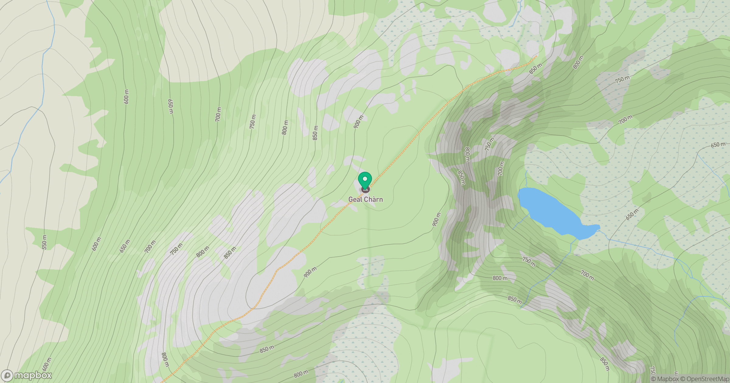
Grid reference: NN561987
View on OpenStreetMapOpens a map in a new tab, centred on the hill.
No comments yet. Be the first.