
Meall Mor
Good walks are even better shared.
Overview
Meall Mor: A Hiker's Delight
Nestled in the heart of the Scottish Highlands, Meall Mor stands tall at 750 meters, classified as a Marilyn due to its modest prominence. This round-shaped hill is not just a feast for the eyes but also a delight for those looking to stretch their legs in nature's embrace.
Geology
Meall Mor's rugged landscape is primarily made of schist, formed through the metamorphosis of sedimentary rock under pressure over millions of years. The surrounding valleys tell tales of glaciers that once carved through the soil, leaving behind a terrain that is as beautiful as it is historical.
Routes
The North Ridge Route is a popular choice among hikers. Starting from Kilchoan, this route covers approximately 6.5 km and can be tackled in around 2.5 hours, depending on your pace, and offers moderately challenging terrain as you ascend.
Summit Features
At the peak, adventurers are greeted by a stone cairn, a traditional pile of stones often found on summits. This not only serves as a landmark but also offers a fantastic photo opportunity—don't forget your camera!
Terrain Type
Expect a mix of grassy slopes interspersed with rocky patches. Ideal for sturdy walking boots but do leave the flip-flops at home; this is not the beach!
Views
Once you reach the summit, the views will blow your socks off (but leave your boots on!). You can survey the magnificent landscapes of Ben Nevis and the rugged beauty of the Ardnamurchan Peninsula, which is just a sight to behold. The late spring and autumn months provide the clearest skies, making them prime hiking times.
Hazards
As with any outdoor adventure, keep an ear out for weather changes; Highland weather can be as moody as a cat. Wet conditions can make the trails slippery, so tread carefully!
Nearby Summits
For the ambitious hiker, nearby peaks like Beinn Resipol and Meall nan Searrach offer additional challenges and stunning views.
Access
Kilchoan serves as the gateway to Meall Mor. There’s parking in the village, but it fills quickly, especially in summer. Bus services from Fort William can get you close, but don’t expect a bus every hour.
Facilities
After your trek, a visit to the local café in Kilchoan can be a lovely way to wind down. Toilets are available, making it a convenient base before or after your hike.
History
In Gaelic, Meall Mor means 'Big Round Hill', a name that perfectly encapsulates its presence in the landscape. The hill is steeped in cultural history, with various ancient sites scattered around the area.
So, gear up, lace your boots, and embark on an adventure to Meall Mor—where every step is worth the view!
Explore routes near Meall Mor
Public walks starting within 80 km of this hill. Nearby does not mean a route reaches the summit; check its map and access before setting out.
Banavie to Glen Loy Aqueduct: Neptune’s Staircase Canal Towpath
View route
Ben Nevis via Mountain Path
View route
Loch Affric full circuit from River Affric
View route
West Highland Way: Tyndrum to Bridge of Orchy
View route
Route planning notes
These notes describe possible approaches, not verified navigable routes or permission to cross land. Check current paths, local access rules and conditions before setting out.
North Ridge Route
A scenic ascent that begins from the village of Kilchoan, leading up a grassy ridge with occasional rocky outcrops.
Make a day of it, together
Find someone to share the walk with, or organise a day out along a route you like.
Hill facts and local notes
Classifications
Elevation
763m
2,503 ft
Prominence
107m
Coordinates
56.7983, -5.4620
NM886727
OS Map
40
Explorer: 391
At the Summit
The summit of Meall Mor features a stone cairn, which provides an excellent vantage point for photography and contemplation. High winds make it a challenging place for picnics!
Terrain & Geology
Meall Mor is primarily composed of schist, a metamorphic rock that showcases the dramatic geological history of the Highlands, shaped by ancient mountain building processes. The surrounding glacial valleys provide a glimpse into the area's past.
Views & Scenery
From the summit, hikers can enjoy breathtaking views over the surrounding peaks, including the distant Ben Nevis and the rugged coastline of the Ardnamurchan Peninsula.
History & Heritage
Name Origin
The name Meall Mor translates to 'Big Round Hill' in Gaelic, a fitting description for this prominent landscape feature.
Historical Significance
The mountain is part of the rich cultural tapestry of the Highlands, and the area has historical significance with ancient hill forts nearby.
Getting There & Facilities
Check current local access restrictions, parking rules and transport timetables before travelling. These notes do not confirm public access to the summit.
Parking
Parking is available at Kilchoan village, with ample spaces for cars. Arrive early as it can fill up during the summer months.
Public Transport
Buses from Fort William connect to Kilchoan, though they can be sparse. Check local timetables before planning your trip.
Nearby Facilities
Kilchoan has a modest café and a general store, where hikers can grab a snack before or after their hike. Toilets are available at the village.
Safety Information
Known Hazards
- Be aware of sudden weather changes common in the Highlands, which can affect visibility. Steep slopes may pose a risk during wet conditions.
General Safety Tips
- Check weather conditions before setting out
- Carry appropriate clothing and equipment
- Let someone know your planned route
- Take a map, compass, and GPS device
- Carry emergency supplies: food, water, first aid kit, torch
Hills
Some common questions about the hills answered
Are there group walks up Meall Mor?
Many walkers use Walkmates to join or organise walks with others. You can check for group walks around Meall Mor through the maps
Are there other walkers around Meall Mor?
Activity varies by location and time, but Walkmates lets you see whether others have shared walks or shown interest in this area. Find other people through the walking friends search walking friends for Meall Mor search or of course create your own walk for Meall Mor
Can I organise a walk to Meall Mor?
Yes. If there aren’t any walks listed already, you can create a walk and make it available for others to join.
If you're signed up to Walkmates, you can create a walk to Meall Mor.
How do I find a walk up this hill?
There are often multiple ways to walk this hill, depending on experience and route preference. Walkmates helps you explore walks and routes that others have shared.
Can I suggest a new route up Meall Mor?
Yes. You can suggest or create routes to share with others. Walkmates focuses on the social side of walking, so routes are used to help people organise walks and explore areas together, rather than as detailed navigation tools or route libraries.
Other uses really appreciate knowledgeable walkers sharing their routes. Share your favourite route to Meall Mor here
The is an error or something incorrect about this hill. How do I let you know?
We always strive to keep the information on Walkmates as accurate as possible. If you find an error, please let us know through the contact form and we'll aim to correct it as quickly as possible
Community Discussion
Comments
Location
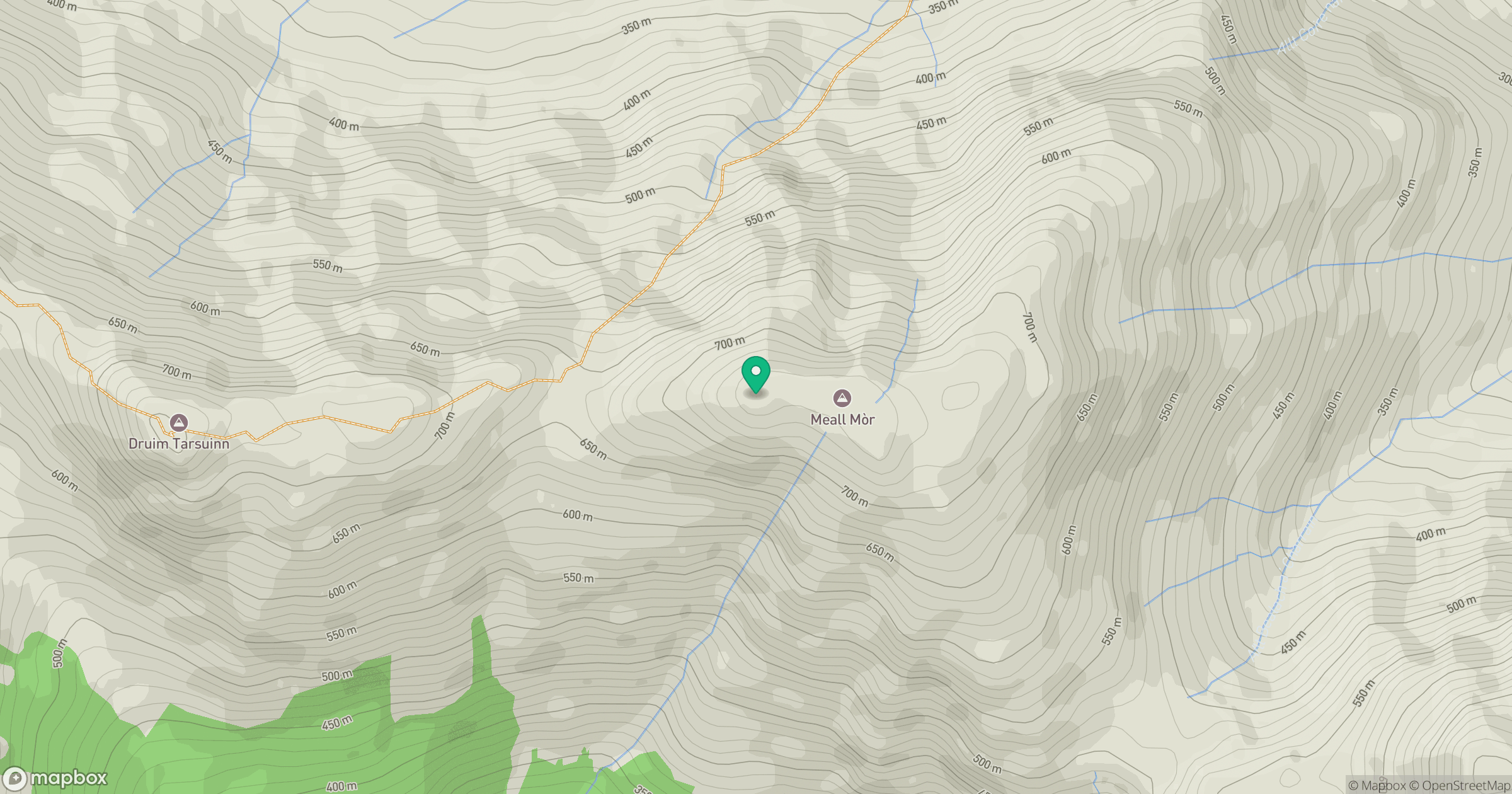
Grid reference: NM886727
View on OpenStreetMapOpens a map in a new tab, centred on the hill.
Hills within 30 km
Straight-line distance, not a walking route or confirmation of access.
No comments yet. Be the first.