

Meall Damh
Good walks are even better shared.
Overview
Meall Damh
Nestled in the scenic Scottish Highlands, Meall Damh offers an incredible experience for hikers seeking a relatively accessible summit with stunning views. Standing at an elevation of 319 meters, it may not be the tallest mountain in the range, but what it lacks in height, it more than makes up for in natural beauty.
Geology
Meall Damh is primarily composed of ancient metamorphic rocks, revealing a complex geological history. The rugged landscape and impressive rock formations will fascinate geology enthusiasts as they explore the area.
Routes
There are several recommended routes to the summit of Meall Damh:
- Corran Ferry Route: This scenic trail, approximately 6.5 km long, offers a delightful trek through lush woodlands. Expect a moderate challenge that can be completed in around 2.5 hours.
- The Inversanda Circuit: For those looking for a bit more adventure, this challenging circular route spans 8 km and takes 3.5 hours. It offers splendid views as it weaves through forests and alongside the coast.
Summit Features
At the summit, hikers will find a large cairn, an ideal spot for resting and marveling at the breathtaking surroundings. Make sure to bring your camera!
Terrain
The terrain at Meall Damh is a mix of grassy slopes and rocky outcrops, with a few boggy patches to watch out for, especially after a bit of rain. Good footwear is a must.
Views
From the top, you can soak in panoramic vistas that include Loch Linnhe and the distant Isle of Mull. To catch the best views, plan your hike during spring or autumn when the skies are clearer and the colours more vibrant.
Hazards
While hiking Meall Damh, it's essential to stay mindful of the terrain. Slippery rocks after rain can be tricky, and gusty winds can surprise you on the summit. Always keep your wits about you!
Nearby Summits
If you're feeling adventurous, nearby summits worth exploring include Ben Nevis, the UK's highest peak, and Sgurr na Ciche, both providing their own unique challenges and views.
Access
The nearest parking is at the Corran Ferry terminal, which accommodates about a dozen vehicles. Regular buses operate from Fort William to the ferry terminal, making access straightforward for those relying on public transport.
Facilities
Basic facilities such as toilets and a small café for refreshments can be found at the terminal, ensuring you can fuel up before or after your hike.
History
The name 'Meall Damh' translates to 'Hill of the Stag' in Gaelic. The mountain holds cultural significance as a traditional hunting ground and is rich in wildlife, adding to the allure of this magnificent Scottish landscape.
In conclusion, Meall Damh isn't just another hill—it's a delightful adventure waiting to be explored! Whether you're a seasoned hiker or a casual walker, this hill is well worth the excursion.
Happy hiking!
Explore routes near Meall Damh
Public walks starting within 80 km of this hill. Nearby does not mean a route reaches the summit; check its map and access before setting out.
Ben Nevis via Mountain Path
View route
Banavie to Glen Loy Aqueduct: Neptune’s Staircase Canal Towpath
View route
Crinan Canal: Bellanoch and Dunardry towpath return
View route
West Highland Way: Tyndrum to Bridge of Orchy
View route
Route planning notes
These notes describe possible approaches, not verified navigable routes or permission to cross land. Check current paths, local access rules and conditions before setting out.
Corran Ferry Route
Starting from the Corran Ferry, this scenic route meanders through lush woodlands and ascends the gentle slopes of Meall Damh.
The Inversanda Circuit
A circular route that includes a portion of the coastal path, offering diverse scenery from forests to hills.
Make a day of it, together
Find someone to share the walk with, or organise a day out along a route you like.
Photo Gallery
View all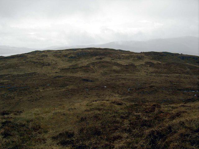 Photo could not load
NM7348 : Meall Damh summit area
Colin Kinnear
Hill facts and local notes
Classifications
Elevation
339m
1,112 ft
Prominence
132m
Coordinates
56.5740, -5.6811
NM739485
OS Map
49
Explorer: 383E 383W
At the Summit
The summit features a large cairn, providing a perfect spot for taking in the views and enjoying a well-earned snack.
Terrain & Geology
Meall Damh primarily comprises ancient metamorphic rocks, which form striking landscapes and provide a rich geological history.
Views & Scenery
From the summit, enjoy panoramic views of the surrounding hills, Loch Linnhe, and the distant Isle of Mull on a clear day.
History & Heritage
Name Origin
The name 'Meall Damh' translates to 'Hill of the Stag' in Gaelic, reflecting the wildlife in the area.
Historical Significance
The mountain is significant for its vibrant ecology and as a traditional hunting ground in the Highlands.
Getting There & Facilities
Check current local access restrictions, parking rules and transport timetables before travelling. These notes do not confirm public access to the summit.
Parking
There is limited parking near the Corran Ferry terminal, suitable for around a dozen vehicles.
Public Transport
Buses from Fort William to the ferry terminal run regularly.
Nearby Facilities
Basic facilities are available at the Corran Ferry terminal, including toilets and a small café for refreshments.
Safety Information
Known Hazards
- Beware of slippery rocks, particularly after rain; also keep an eye out for the occasional gusty winds.
General Safety Tips
- Check weather conditions before setting out
- Carry appropriate clothing and equipment
- Let someone know your planned route
- Take a map, compass, and GPS device
- Carry emergency supplies: food, water, first aid kit, torch
Hills
Some common questions about the hills answered
Are there group walks up Meall Damh?
Many walkers use Walkmates to join or organise walks with others. You can check for group walks around Meall Damh through the maps
Are there other walkers around Meall Damh?
Activity varies by location and time, but Walkmates lets you see whether others have shared walks or shown interest in this area. Find other people through the walking friends search walking friends for Meall Damh search or of course create your own walk for Meall Damh
Can I organise a walk to Meall Damh?
Yes. If there aren’t any walks listed already, you can create a walk and make it available for others to join.
If you're signed up to Walkmates, you can create a walk to Meall Damh.
How do I find a walk up this hill?
There are often multiple ways to walk this hill, depending on experience and route preference. Walkmates helps you explore walks and routes that others have shared.
Can I suggest a new route up Meall Damh?
Yes. You can suggest or create routes to share with others. Walkmates focuses on the social side of walking, so routes are used to help people organise walks and explore areas together, rather than as detailed navigation tools or route libraries.
Other uses really appreciate knowledgeable walkers sharing their routes. Share your favourite route to Meall Damh here
The is an error or something incorrect about this hill. How do I let you know?
We always strive to keep the information on Walkmates as accurate as possible. If you find an error, please let us know through the contact form and we'll aim to correct it as quickly as possible
Community Discussion
Comments
Location
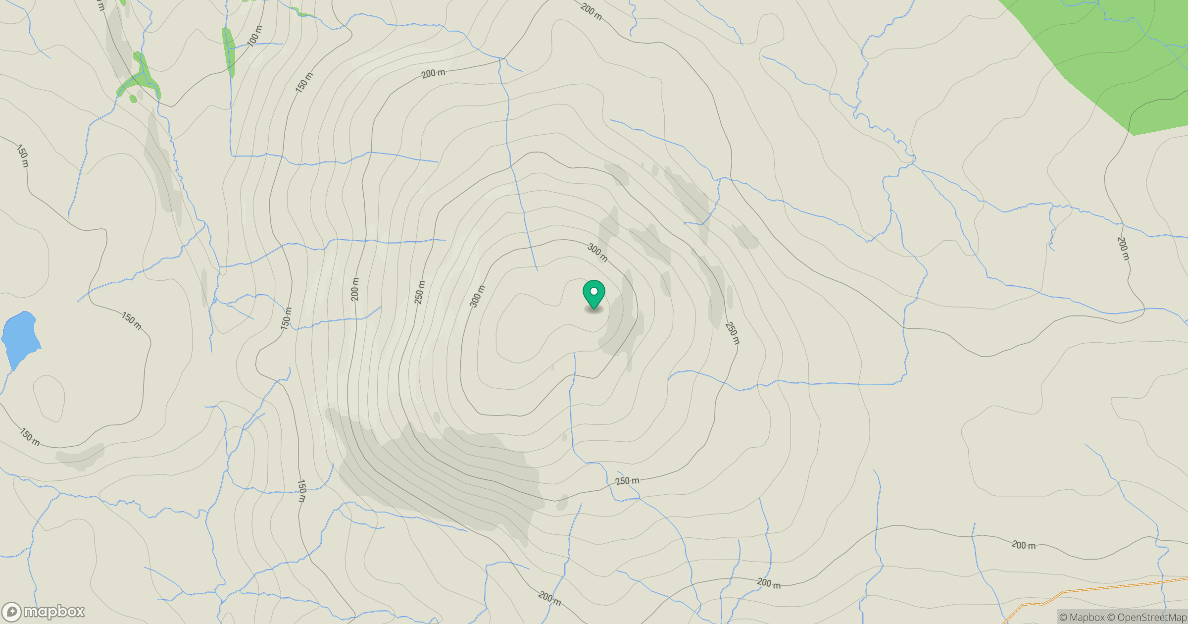
Grid reference: NM739485
View on OpenStreetMapOpens a map in a new tab, centred on the hill.
Hills within 30 km
Straight-line distance, not a walking route or confirmation of access.
No comments yet. Be the first.