

Glais Bheinn
Good walks are even better shared.
Overview
Glais Bheinn: A Gem of the Scottish Highlands
Glais Bheinn, standing proudly at 743 meters, is a must-visit for hiking enthusiasts looking to explore the enchanting landscapes of the Scottish Highlands.
Geology
The mountain's intriguing geology features granitic and gneissic rock formations. These ancient rocks tell tales of tumultuous geological processes that have shaped this breathtaking landscape over millions of years.
Access
To reach this Highland marvel, you’ll want to start your journey in Inverie, where you’ll find a small car park. Public transport is a bit limited, but don’t let that put you off; ferries from Mallaig get you to this charming village. Just remember to pack your sea legs!
Routes
The most popular route is the Glais Bheinn Approach from Inverie, spanning approximately 12.5 km. It’s a lovely trek that takes around 5 hours, suitable for those who have a fair bit of puff but don’t mind getting their boots muddy!
Summit Features
As you conquer the summit, you’ll be greeted by a well-stacked cairn marking your achievement and plenty of space for some photo ops. The sense of accomplishment is palpable, not to mention the view that awaits you.
Views
The summit rewards your effort with stunning vistas of the Knoydart Range, Loch Nevis, and, on particularly clear days, even the distant islands of Skye and Eigg.
Terrain
Prepare for a mix of rocky and grassy trails, along with the odd bog patch that could put your footwear to the test. Waterproof boots are highly recommended—unless you fancy a foot bath!
Hazards
As with all Highland hikes, be wary of sudden weather shifts, and watch your step on slippery rocks and boggy patches. Stick to marked paths to avoid getting lost in the tall heather!
Nearby Summits
If you’re feeling adventurous, why not tackle nearby peaks like Sgurr na Ciche or Ladhar Bheinn? They’re all part of the breathtaking Highland experience.
Facilities
Inverie has basic facilities such as a village shop and a quaint pub, perfect for fuelling up after your ascent.
History
The name Glais Bheinn literally means Rocky Mountain in Gaelic, and let's be honest, it’s a rather fitting moniker! The area is rich in Highland folklore and history, adding a fascinating layer to your visit.
So dust off those hiking boots, pack a sandwich or two, and get ready to explore this heavenly part of Scotland!
Remember, the Highlands are wild and beautiful, so respect the landscape, take your rubbish home, and leave no trace!
Explore routes near Glais Bheinn
Public walks starting within 80 km of this hill. Nearby does not mean a route reaches the summit; check its map and access before setting out.
Ben Nevis via Mountain Path
View route
Crinan Canal: Bellanoch and Dunardry towpath return
View route
Banavie to Glen Loy Aqueduct: Neptune’s Staircase Canal Towpath
View route
West Highland Way: Tyndrum to Bridge of Orchy
View route
Route planning notes
These notes describe possible approaches, not verified navigable routes or permission to cross land. Check current paths, local access rules and conditions before setting out.
Glais Bheinn Approach from Inverie
This route starts from the picturesque village of Inverie, following a well-trodden path through lush glens and rugged landscapes, leading to the summit of Glais Bheinn. Perfect for those who love a bit of a zest in their step!
Make a day of it, together
Find someone to share the walk with, or organise a day out along a route you like.
Photo Gallery
View all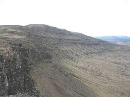 Photo could not load
NM7243 : Glais Bheinn
Peter Kenny
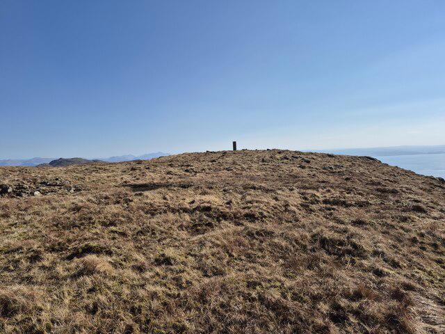 Photo could not load
NM7243 : Trig point on Glais Bheinn
Steven Brown
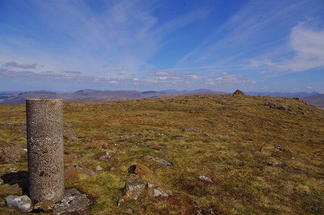 Photo could not load
NM7243 : The summit of Glais Bheinn
Pat Macleod
Hill facts and local notes
Classifications
Elevation
480m
1,575 ft
Prominence
100m
Coordinates
56.5308, -5.7076
NM721438
OS Map
49
Explorer: 383E 383W
At the Summit
The summit features a prominent cairn that offers a perfect photo opportunity. The panoramic views stretch into the distance, with the rugged hills and glens of Knoydart providing a stunning backdrop.
Terrain & Geology
Glais Bheinn is primarily composed of granitic and gneissic rock, typical of the rugged Highland terrain. The geological history showcases a fascinating mix of ancient metamorphic processes, giving rise to striking rock formations and distinctive landscape features.
Views & Scenery
From the summit, you can see the majestic peaks of the Knoydart Range, Loch Nevis, and the distant islands of Skye and Eigg on a clear day.
History & Heritage
Name Origin
Glais Bheinn translates to 'Rocky Mountain' in Gaelic, which is quite fitting given its rugged terrain.
Historical Significance
This mountain is part of the culturally rich Knoydart Peninsula, an area steeped in Highland history and legend.
Getting There & Facilities
Check current local access restrictions, parking rules and transport timetables before travelling. These notes do not confirm public access to the summit.
Parking
Inverie has a small car park near the path leading to Glais Bheinn. Be prepared for limited spaces!
Public Transport
The nearest public transport options are ferries from Mallaig to Inverie on the Knoydart Peninsula.
Nearby Facilities
Inverie itself offers some basic amenities like a village shop and a pub, perfect for a pint after your trek.
Safety Information
Known Hazards
- Typical highland hazards include sudden weather changes, slippery rocks, and the occasional bog. Ensure that you stay on marked paths to avoid getting lost in the heather!
General Safety Tips
- Check weather conditions before setting out
- Carry appropriate clothing and equipment
- Let someone know your planned route
- Take a map, compass, and GPS device
- Carry emergency supplies: food, water, first aid kit, torch
Hills
Some common questions about the hills answered
Are there group walks up Glais Bheinn?
Many walkers use Walkmates to join or organise walks with others. You can check for group walks around Glais Bheinn through the maps
Are there other walkers around Glais Bheinn?
Activity varies by location and time, but Walkmates lets you see whether others have shared walks or shown interest in this area. Find other people through the walking friends search walking friends for Glais Bheinn search or of course create your own walk for Glais Bheinn
Can I organise a walk to Glais Bheinn?
Yes. If there aren’t any walks listed already, you can create a walk and make it available for others to join.
If you're signed up to Walkmates, you can create a walk to Glais Bheinn.
How do I find a walk up this hill?
There are often multiple ways to walk this hill, depending on experience and route preference. Walkmates helps you explore walks and routes that others have shared.
Can I suggest a new route up Glais Bheinn?
Yes. You can suggest or create routes to share with others. Walkmates focuses on the social side of walking, so routes are used to help people organise walks and explore areas together, rather than as detailed navigation tools or route libraries.
Other uses really appreciate knowledgeable walkers sharing their routes. Share your favourite route to Glais Bheinn here
The is an error or something incorrect about this hill. How do I let you know?
We always strive to keep the information on Walkmates as accurate as possible. If you find an error, please let us know through the contact form and we'll aim to correct it as quickly as possible
Community Discussion
Comments
Location
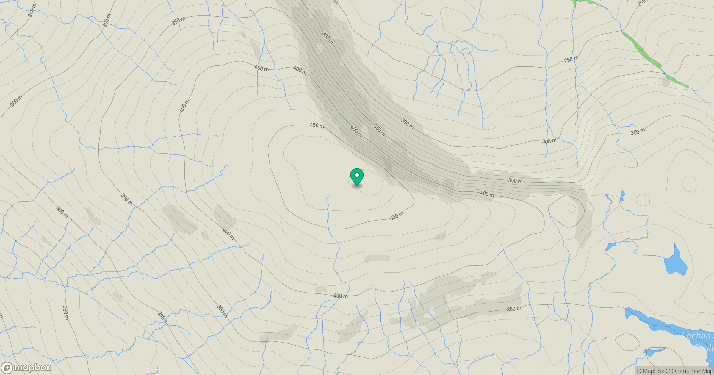
Grid reference: NM721438
View on OpenStreetMapOpens a map in a new tab, centred on the hill.
Hills within 30 km
Straight-line distance, not a walking route or confirmation of access.
No comments yet. Be the first.