

Ben More
Good walks are even better shared.
NM5232 : South ridge, Ben More
Richard Webb Photo source
Overview
Ben More is Mull’s highest mountain and only Munro, at 966 m above Loch na Keal. The usual Dhiseig route is a strenuous hillwalk returning the same way. A’ Chioch offers a separate exposed scrambling approach; adding Beinn Fhada makes a longer circuit. Magnetic rocks can affect compass readings near the summit.
Ben More on Mull
Ben More is the 966 m high point of Mull and its only Munro. This is the island mountain at NM525330, distinct from Ben More near Crianlarich. DoBIH records 966 m prominence and an OS rivet inside the summit’s large stone shelter.
Choose an itinerary
- Dhiseig, out and back: 9.25 km and 5–6.5 hours, returning by the ascent path.
- Gleann na Beinne Fada and A’ Chioch: a scrambling approach with Beinn Fhada omitted. The published start and Dhiseig finish differ; include the road connection when planning a round trip.
- Beinn Fhada and A’ Chioch circuit: 14.5 km and 8–9 hours, including the road return.
- An Gearna circuit: the author gives 9 km and about 6 hours from a 2017 walk, ascending the rough ridge and descending the usual path.
Safety and access
The local visitor guide warns about magnetic rock. Compass readings may be distorted near the summit; use independent checks of position and direction. The Dhiseig route has a stream crossing that may be unsafe in spate. The A’ Chioch approach includes exposure and loose steep rock: do not turn it into an unplanned descent.
Check mountain weather, allow for slow progress and carry backup navigation. Snow or ice changes the outing: Mountaineering Scotland explains winter skills, equipment and daylight planning.
Consult the Mull Deer Management Group’s estate contacts before setting out. Follow local signs, keep clear of stalking parties and accept reasonable alternative routes. Benmore Estate advertises hind stalking into winter; an October cutoff or Sunday should not be treated as a guarantee.
The normal start is the B8035 opposite Dhiseig. Leave gates and passing places clear. Arrange travel to and from the rural trailhead, checking CalMac and West Coast Motors where relevant. Salen on Mull has shops and refreshments.
Landscape and name
Ben More means “big” or “great mountain”. Clear weather brings island and mainland views, described in Countryfile’s walk guide. The summit-area lava succession includes benmoreite, named from its type locality here; see the British Geological Survey’s account.
Editorial sources checked 16 October 2026, 10:18–10:22 UTC. The retained database revision of 28 October 2001 is a separate source-record date, not a new summit survey.
Explore routes near Ben More
Walks starting near this hill. Open a route to check its map, distance and full itinerary.
Crinan Canal: Bellanoch and Dunardry towpath return
View route
Ben Nevis via Mountain Path
View route
Banavie to Glen Loy Aqueduct: Neptune’s Staircase Canal Towpath
View route
Route planning notes
These notes describe possible approaches. Check a route's map and access information when planning your walk.
Ben More from Dhiseig, out and back
From the shore-side B8035 parking opposite Dhiseig (NM494359), follow the mountain path beside the Abhainn Dhiseig, cross the burn and climb the stony upper slopes to the summit shelter. Retrace the same route. Walkhighlands gives 9.25 km, 945 m ascent and 5–6.5 hours for the whole outing. This avoids the A’ Chioch scramble; the burn crossing can be unsafe in spate.
A’ Chioch via Gleann na Beinne Fada
Start beside the Abhainn na h-Uamha bridge on the B8035 (NM505365). Follow the glen to the col below A’ Chioch, climb its ridge, then tackle Ben More’s steep eastern ridge. Descend the Dhiseig path to NM494360 and allow for the separate road walk back to the start. This variant omits Beinn Fhada. Expect exposed scrambling, loose rock and difficult route-finding.
Beinn Fhada, A’ Chioch and Ben More circuit
From B8035 parking at NM510371, approach Beinn Fhada via its northwest ridge, then descend to the col and cross A’ Chioch to Ben More. Descend by the Dhiseig path and walk about 2 km along the road back to the start. Walkhighlands gives 14.5 km, 1255 m ascent and 8–9 hours for this full circuit. Exposed scrambling and the steep, loose final climb require care.
Ben More via An Gearna from Dhiseig
From Dhiseig (NM494359), leave the usual approach for the less-defined An Gearna ridge. Climb rough ground and steep scree to join the summit crest, then return by the standard Dhiseig path. Get Lost Mountaineering gives 9 km and about 6 hours for this circuit, based on a walk on 8 October 2017. The upper ridge and stream crossing need care; this is distinct from A’ Chioch.
Make a day of it, together
Find someone to share the walk with, or organise a day out along a route you like.
Photo Gallery
View all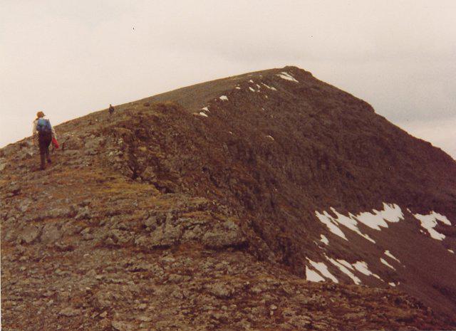 Photo could not load
NM5232 : South ridge, Ben More
Richard Webb
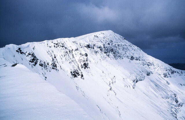 Photo could not load
NM5232 : Ridge rising to summit of Ben More
Trevor Littlewood
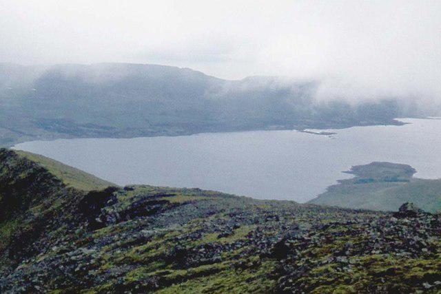 Photo could not load
NM5232 : South ridge of Ben More
Alan Reid
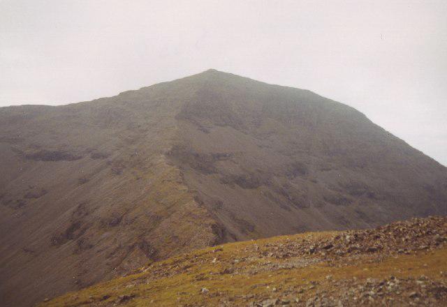 Photo could not load
NM5233 : Ben More Mull
Michael Graham
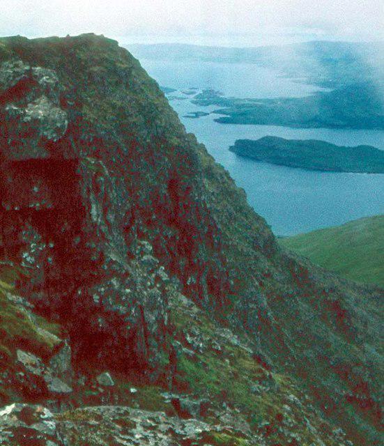 Photo could not load
NM5233 : Ben More, Mull
Alan Reid
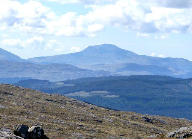 Photo could not load
NM5233 : Ben More from Beinn Chlaonleud in Morvern, some 25km away
Phillip Williams
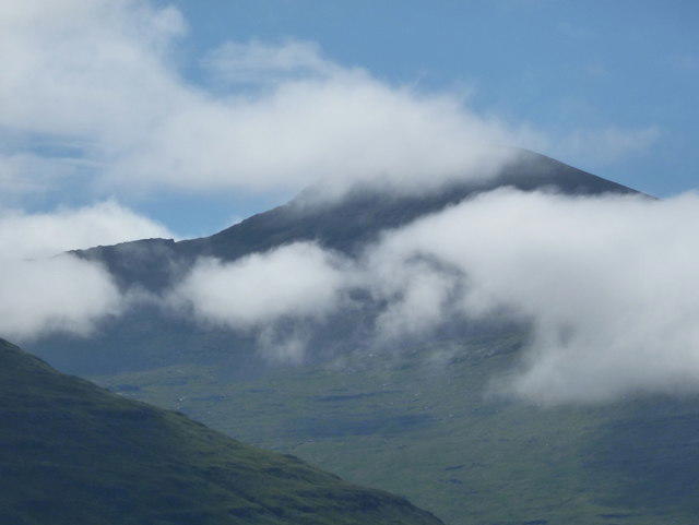 Photo could not load
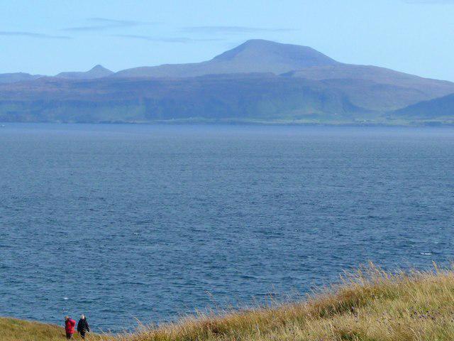
NM5233 : Mull: Ben More from across Loch na Keal
Chris Downer
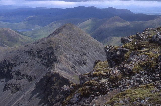 Photo could not load
NM5233 : Ben More's east ridge
Tom Richardson
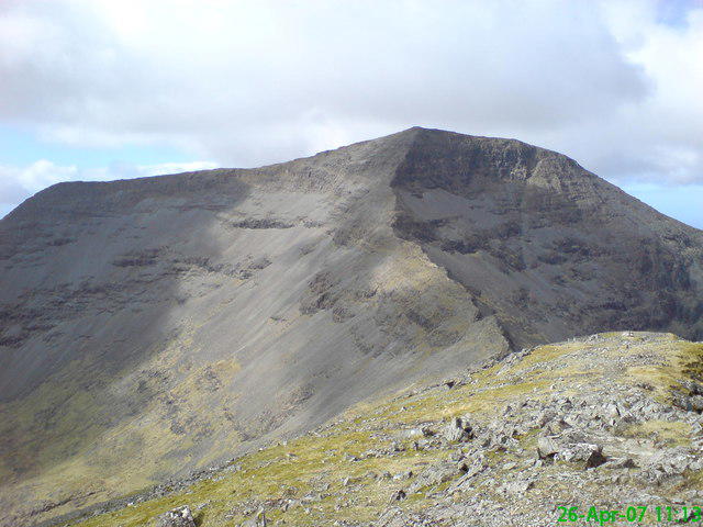 Photo could not load
NM5233 : Ben More Mull
Stephen clark
NM5232 : Ben More
ronnie leask
Hill facts and local notes
Classifications
Elevation
966m
3,169 ft
Prominence
966m
Coordinates
56.4248, -6.0140
NM525330
OS Map
47 48
Explorer: 375W
At the Summit
A large circular stone shelter marks the summit. DoBIH records an OS rivet in its centre. Published guides describe remains of the former trig point rather than an intact pillar; a smaller cairn on the approach is not the summit.
Terrain & Geology
Ben More exposes Palaeogene lava flows of the Mull Plateau Lava Formation. The Ben More Main Member is overlain by the Pale Member around the summit, including mugearite, benmoreite and trachyte as well as basalt. The summit-area rocks have undergone hydrothermal alteration.
Views & Scenery
In clear weather the outlook spans Loch na Keal, Ulva and surrounding islands, much of Mull and mainland mountains. A’ Chioch is prominent nearby; Ben Cruachan and Ben Nevis may be visible in good conditions.
History & Heritage
Name Origin
Ben More comes from Gaelic Beinn Mhòr, meaning “big” or “great mountain”.
Historical Significance
Ben More is the type locality of benmoreite, a volcanic rock identified by Tilley and Muir in 1964. Its lava succession is an important part of the geological record of Mull’s ancient volcanic activity.
Getting There & Facilities
Parking
Grass parking on the shore side of the B8035 opposite the Dhiseig turn, at the usual route start NM494359. Ridge circuits have separate roadside starts farther northeast. Keep gates and passing places clear, obey local signs and assess soft ground before parking. Check current access advice through the Mull Deer Management Group and follow reasonable alternative routes around stalking.
Public Transport
Reach Mull by ferry, including Oban–Craignure, Lochaline–Fishnish or Kilchoan–Tobermory. Walkhighlands lists no public transport to the Dhiseig trailhead. Arrange onward and return travel and check current CalMac and West Coast Motors timetables; a mainland train to Crianlarich does not reach this hill.
Nearby Facilities
Plan food, water and toilet stops before reaching the rural Dhiseig start. Salen on Mull has shops and refreshments; Craignure is a ferry and service hub. Check current opening times before relying on village businesses.
Safety Information
Known Hazards
- Magnetic rocks can distort compass readings near the summit. Cross-check position and direction using terrain, a map and independent navigation; do not rely on one device.
- Loose scree, wet rock and steep drops demand care. A’ Chioch has exposed scrambling and a very steep, loose final ascent with complex route-finding; it is better tackled uphill than as an improvised descent.
- The Abhainn Dhiseig crossing can be difficult after heavy rain. Check water levels and turn back if unsafe. Low cloud can hide the summit approach and the correct descent.
- Strong wind increases the risk on exposed ridges. Check current mountain weather and leave enough time for the return, including road walking on ridge circuits.
Seasonal Hazards
Snow and ice can require winter mountaineering skills, suitable boots, an ice axe and crampons with the ability to use them. Paths may disappear and short daylight limits progress. Deer management also takes place beyond the traditional late-summer stag period: check current estate advice rather than assuming a particular season or Sunday is free of stalking.
General Safety Tips
- Check weather conditions before setting out
- Carry appropriate clothing and equipment
- Let someone know your planned route
- Take a map, compass, and GPS device
- Carry emergency supplies: food, water, first aid kit, torch
Hills
Some common questions about the hills answered
Are there group walks up Ben More?
Many walkers use Walkmates to join or organise walks with others. You can check for group walks around Ben More through the maps
Are there other walkers around Ben More?
Activity varies by location and time, but Walkmates lets you see whether others have shared walks or shown interest in this area. Find other people through the walking friends search walking friends for Ben More search or of course create your own walk for Ben More
Can I organise a walk to Ben More?
Yes. If there aren’t any walks listed already, you can create a walk and make it available for others to join.
If you're signed up to Walkmates, you can create a walk to Ben More.
How do I find a walk up this hill?
There are often multiple ways to walk this hill, depending on experience and route preference. Walkmates helps you explore walks and routes that others have shared.
Can I suggest a new route up Ben More?
Yes. You can suggest or create routes to share with others. Walkmates focuses on the social side of walking, so routes are used to help people organise walks and explore areas together, rather than as detailed navigation tools or route libraries.
Other uses really appreciate knowledgeable walkers sharing their routes. Share your favourite route to Ben More here
The is an error or something incorrect about this hill. How do I let you know?
We always strive to keep the information on Walkmates as accurate as possible. If you find an error, please let us know through the contact form and we'll aim to correct it as quickly as possible
Community Discussion
Comments
Location
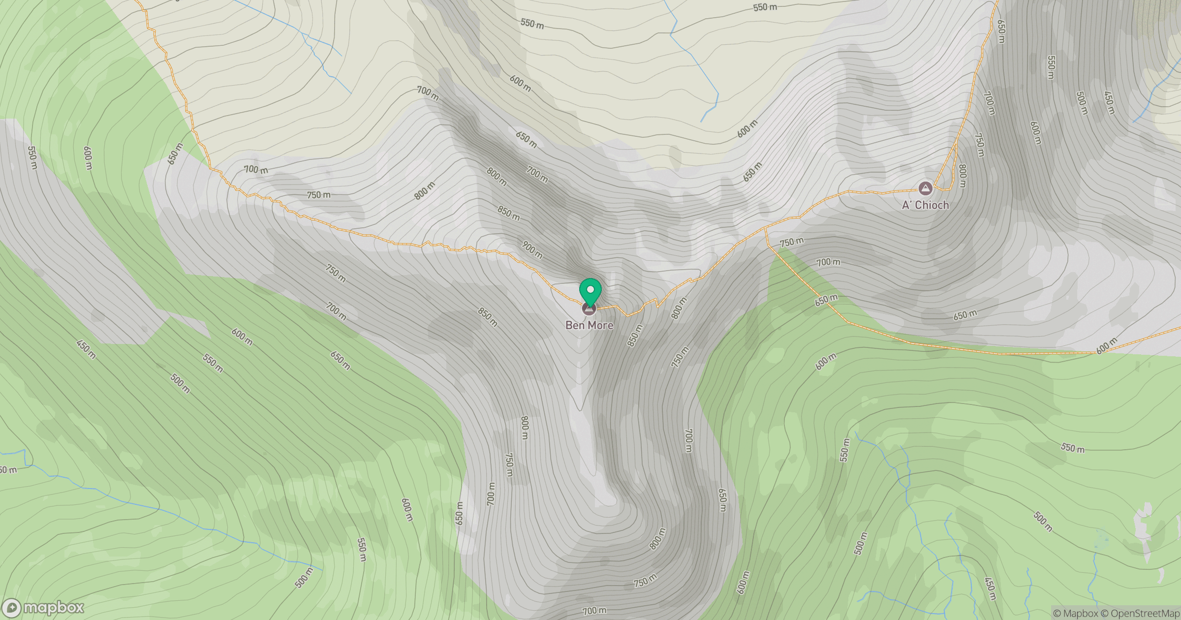
Grid reference: NM525330
View on OpenStreetMapOpens a map in a new tab, centred on the hill.
No comments yet. Be the first.