

Meall a' Choire Odhair
Good walks are even better shared.
Overview
Meall a' Choire Odhair
Nestled in the heart of the Scottish Highlands, Meall a' Choire Odhair stands at an impressive 930 meters, making it a noteworthy Munro for any passionate hillwalker. Known for its distinctive red sandstone, the mountain offers a feast for the eyes, especially when the sun gleams down on its rugged surface.
Geography and Geology
The geological composition of Meall a' Choire Odhair is predominantly Old Red Sandstone, resulting in beautiful earthy tones that contrast with the vibrant greens of the surrounding hills. Erosion has sculpted dramatic cliffs and valleys around the mountain, further enhancing its breathtaking scenery.
Routes
Two well-trodden paths lead up to the crowning glory of this mountain. The Aberfeldy to Meall a' Choire Odhair route is a moderate 14 km trek, taking about 6 hours. This path has gained popularity among climbers for its accessibility and views. For those looking for a challenge, the Rannoch Moor Route provides a more demanding ascent with its 13.5 km distance and potential for ever-changing weather conditions, typically taking around 5.5 hours.
Summit Features
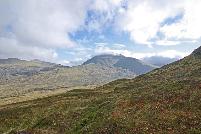
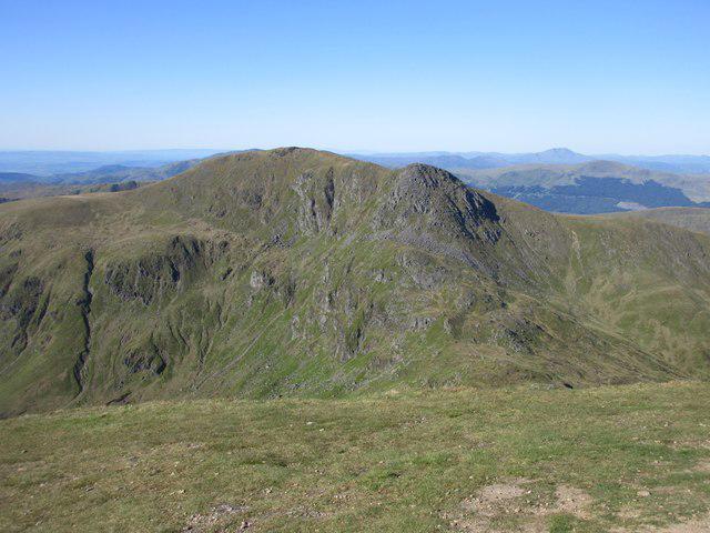
At the summit, hikers will find a substantial cairn, perfect for a celebratory photo as you take in the astounding views. Bring a camera, because the panorama of Schiehallion and the undulating green hills of the Highlands is nothing short of spectacular!
Terrain
The terrain ranges from rocky paths at lower elevations to grassy slopes higher up, with a few squishy bogs to test your boot's waterproofing. Dress appropriately!
Views
The summit rewards those who make the climb with views that are simply breathtaking. Expect to see landscapes stretching towards Schiehallion and the wild expanse of Rannoch Moor. The best time to catch these vistas is during spring or autumn, so pack your bags for that ideal hiking season!
Hazards
Be mindful that weather can change faster than you can say 'Scottish rain', with unexpected showers or thick fog appearing in a blink. And don't overlook those boggy patches—they can be sneakily deep!
Access
Accessing Meall a' Choire Odhair is straightforward, with a small car park near Aberfeldy, which offers essentials like cafes and shops. A decent bus service runs from Aberfeldy to nearby villages, but do check the schedule.
Facilities
Post-hike, make sure to patronise one of Aberfeldy's lovely cafes to refuel! They'll have you sorted with hot coffee or a slice of cake—or both!
History
The name itself, translating to 'Hill of the Maw of the Grey Hollow', provides a glimpse into the area's rich cultural history. This mountain holds a cherished spot in the hearts of many who have taken to its slopes, making it a beloved destination on the Munro list.
To sum up, Meall a' Choire Odhair is a gem in the Scottish Highlands that offers beauty, challenge, and an escape into the wild. Remember to pack your sense of adventure (and snacks!).
Explore routes near Meall a' Choire Odhair
Public walks starting within 80 km of this hill. Nearby does not mean a route reaches the summit; check its map and access before setting out.
Crieff: Lady Mary's Walk and the River Earn
View route
RSVP Forth Valley: Dunblane to Kilbryde walk
View route
RSVP Forth Valley: Cocksburn Reservoir walk
View route
RSVP Forth Valley: walk around Alva
View route
Route planning notes
These notes describe possible approaches, not verified navigable routes or permission to cross land. Check current paths, local access rules and conditions before setting out.
Aberfeldy to Meall a' Choire Odhair
A popular route beginning from Aberfeldy, offering stunning scenery and a steady incline.
Rannoch Moor Route
Starting from the north, this route allows hikers to experience the wild beauty of Rannoch Moor before ascending the slopes of the mountain.
Make a day of it, together
Find someone to share the walk with, or organise a day out along a route you like.
Photo Gallery
View all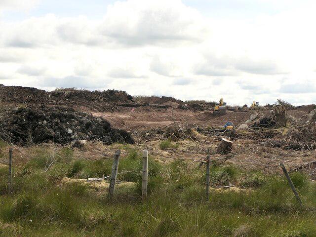 Photo could not load
NN8013 : Wind farm construction, Meall a' Choire Odhair
Richard Webb
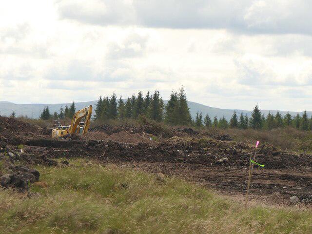 Photo could not load
NN8013 : Turbine site, Meall a' Choire Odhair
Richard Webb
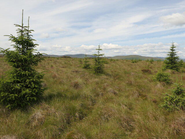 Photo could not load
NN8013 : Summit, Meall a' Choire Odhair
Richard Webb
Hill facts and local notes
Classifications
Elevation
357m
1,171 ft
Prominence
126m
Coordinates
56.3034, -3.9302
NN806140
OS Map
57
Explorer: OL47W 368W
At the Summit
The summit features a prominent cairn, making it a perfect spot for a well-deserved rest after the ascent. On a clear day, fantastic views stretch as far as the eye can see.
Terrain & Geology
Meall a' Choire Odhair is primarily composed of Old Red Sandstone, which gives the mountain its characteristic reddish hue. The erosion and weathering have created impressive cliffs, adding to the scenic beauty.
Views & Scenery
From the summit, you can feast your eyes on the stunning vistas of Schiehallion, the vastness of Rannoch Moor, and the rolling hills surrounding the Highland area.
History & Heritage
Name Origin
The name 'Meall a' Choire Odhair' translates to 'Hill of the Maw of the Grey Hollow', hinting at the topography and its appearance.
Historical Significance
This mountain is significant not only for its natural beauty but also for its place in Scottish hiking culture, being a celebrated Munro among hillwalkers.
Getting There & Facilities
Check current local access restrictions, parking rules and transport timetables before travelling. These notes do not confirm public access to the summit.
Parking
There is a small car park at the start of the Aberfeldy route, suitable for a dozen cars.
Public Transport
The nearest bus service operates from Aberfeldy to nearby villages, but check the schedule as it may be limited.
Nearby Facilities
Aberfeldy offers a range of facilities including cafes, shops, and public toilets, perfect for a pre-hike caffeine fix or a post-hike snack!
Safety Information
Known Hazards
- Watch out for sudden weather changes, which can bring rain, fog, or strong winds. Also, be cautious of muddy and uneven ground, especially in the boggy sections.
General Safety Tips
- Check weather conditions before setting out
- Carry appropriate clothing and equipment
- Let someone know your planned route
- Take a map, compass, and GPS device
- Carry emergency supplies: food, water, first aid kit, torch
Hills
Some common questions about the hills answered
Are there group walks up Meall a' Choire Odhair?
Many walkers use Walkmates to join or organise walks with others. You can check for group walks around Meall a' Choire Odhair through the maps
Are there other walkers around Meall a' Choire Odhair?
Activity varies by location and time, but Walkmates lets you see whether others have shared walks or shown interest in this area. Find other people through the walking friends search walking friends for Meall a' Choire Odhair search or of course create your own walk for Meall a' Choire Odhair
Can I organise a walk to Meall a' Choire Odhair?
Yes. If there aren’t any walks listed already, you can create a walk and make it available for others to join.
If you're signed up to Walkmates, you can create a walk to Meall a' Choire Odhair.
How do I find a walk up this hill?
There are often multiple ways to walk this hill, depending on experience and route preference. Walkmates helps you explore walks and routes that others have shared.
Can I suggest a new route up Meall a' Choire Odhair?
Yes. You can suggest or create routes to share with others. Walkmates focuses on the social side of walking, so routes are used to help people organise walks and explore areas together, rather than as detailed navigation tools or route libraries.
Other uses really appreciate knowledgeable walkers sharing their routes. Share your favourite route to Meall a' Choire Odhair here
The is an error or something incorrect about this hill. How do I let you know?
We always strive to keep the information on Walkmates as accurate as possible. If you find an error, please let us know through the contact form and we'll aim to correct it as quickly as possible
Community Discussion
Comments
Location
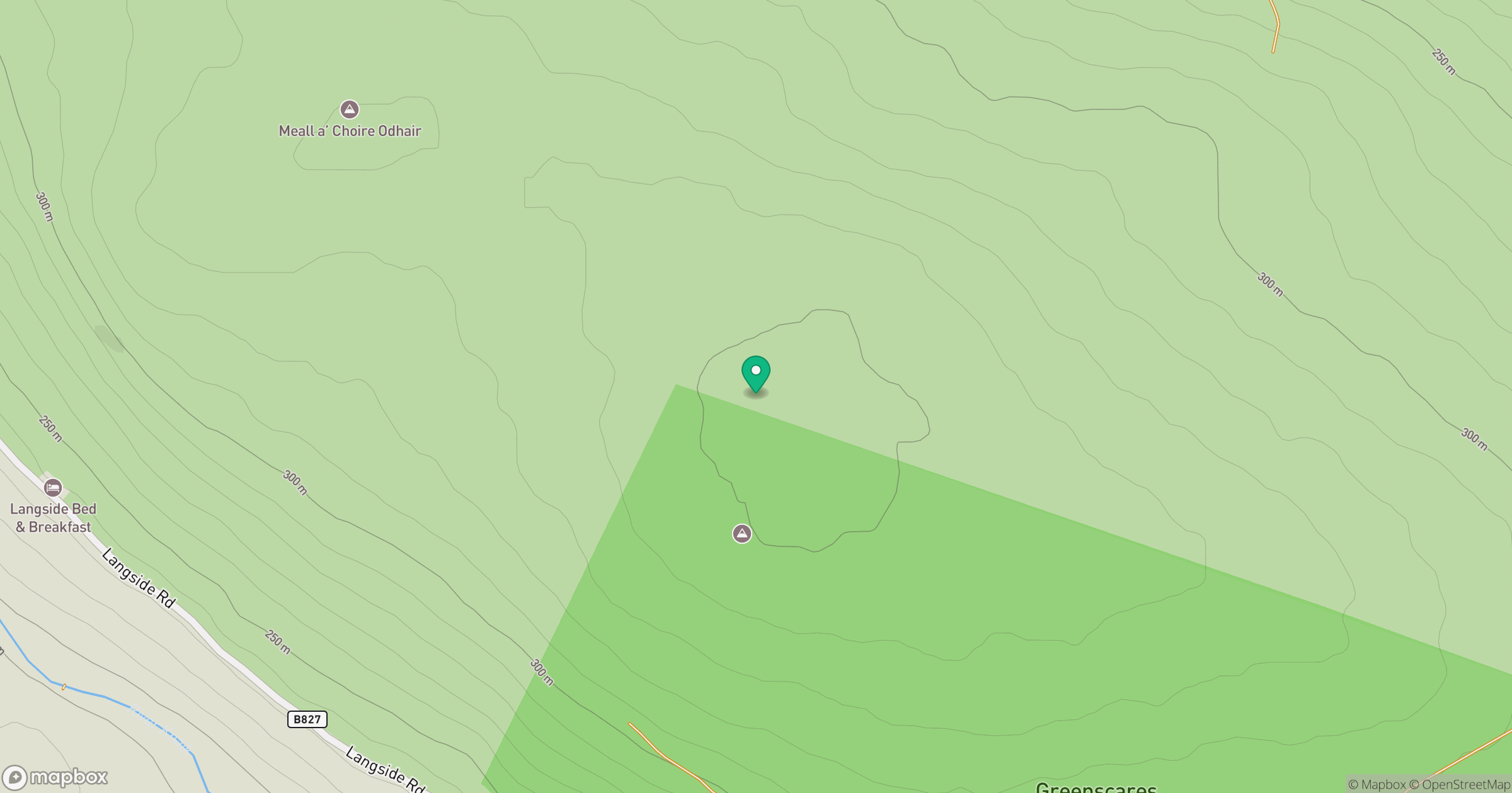
Grid reference: NN806140
View on OpenStreetMapOpens a map in a new tab, centred on the hill.
Hills within 30 km
Straight-line distance, not a walking route or confirmation of access.
No comments yet. Be the first.