

Ben Cleuch
Good walks are even better shared.
NN9000 : Ben Cleuch trig point S1605
Chris Wimbush Photo source
Overview
Ben Cleuch is the 721 m high point of the Ochil Hills in Clackmannanshire, with grassy uplands above steep southern glens. Routes from Tillicoultry and Alva reach a trig point and stone windshelter. Mill Glen is closed from the first bridge; use the east-side alternative or another approach and check current access notices.
Ben Cleuch: the highest hill in the Ochils
Ben Cleuch rises to 721 m in Clackmannanshire, in central Scotland. It is a Graham, Donald and Marilyn. The summit has a trig point within a stone windshelter; the database notes that ground about 20 m east may be equally high. Hill data.
Important access warning
Clackmannanshire Council's November 2024 notice remains published at the check on 16 October 2026: Mill Glen, also called Tillicoultry Glen, is closed from the first bridge. Flood damage has left missing and undercut path, with additional erosion between the first gate and first bridge. Follow barriers and signs. This affects the glen path, not every approach to Ben Cleuch. Council notice.
Choosing a route
- From Tillicoultry, use the east-side alternative to reach The Law and retrace that approach. Route warning and guidance.
- Alva approaches include Silver Glen with Ben Ever, Wood Hill with Ben Ever, or Silver Glen towards Ben Buck. The route cards distinguish these; use the linked guide and a map to plan the return. Alva routes.
- The defined Dollar round starts at the upper car park near Castle Campbell and includes King's Seat Hill, Andrew Gannel Hill, Ben Cleuch, Tarmangie Hill and Whitewisp Hill. UKHillwalking publishes 15.56 km, 914 m ascent and 4–6 hours. Its Saddle Hill descent is steep and partly pathless. Full Dollar itinerary.
Terrain and preparation
These are substantial hillwalks, with grassy uplands, boggy ground and steep southern approaches. Carry navigation equipment and know how to use it; low cloud can obscure the route. Snow and ice require additional skills and equipment, and shorter winter days reduce the time available. Navigation and winter guidance.
Landscape and history
The Ochils are built largely from ancient volcanic lavas and associated volcanic deposits. Clear conditions give views across the surrounding hills and Forth lowlands, with Highland mountains beyond. Geology and summit overview.
The steep burns below the hill helped power the Hillfoots textile industry. Tillicoultry Burn once supplied eight mills through dams and water channels. Local history.
Access and facilities
Tillicoultry and Alva are the main southern starting towns. Choose parking for the actual route rather than assuming Dollar or Menstrie is the nearest start. For the Dollar circuit, Brewlands is reached by a steep single-track road and is unsuitable for larger vehicles; use the Quarry car park instead, allowing for the extra walking. Dollar Glen has no on-site toilets. Castle Campbell is seasonally closed from October through March. Dollar Glen visitor information and Castle Campbell access.
Explore routes near Ben Cleuch
Walks starting near this hill. Open a route to check its map, distance and full itinerary.
Strathallan Court Strollers and Stragglers
View route
Fallin Bing Wednesday Walk
View route
King's Park and the Golf Course
View route
King's Park to Cambusbarron
View route
Route planning notes
These notes describe possible approaches. Check a route's map and access information when planning your walk.
Ben Cleuch via The Law and east-side bypass
From Upper Mill Street, Tillicoultry, use the path above the east side of Mill Glen to reach the footbridge below The Law. A steep, rough section and short scramble lead to the grassy ascent. Continue to Ben Cleuch and return the same way. Do not use the closed gorge path or the old Mill Glen descent.
Ben Cleuch via Silver Glen and Ben Ever from Alva
From Alva Glen car park, reach the Silver Glen track and climb its zigzags. Beyond the second gate, take the steep grassy path onto Ben Ever, then continue to Ben Cleuch. Return by the same route. The lower glen has uneven paths and steep drops.
Ben Cleuch via Wood Hill and Ben Ever from Alva
From Alva Glen car park, reach Woodland Park and climb Wood Hill. Continue past the steep-sided gully north of its summit to Ben Ever and Ben Cleuch; return the same way. Expect steep grass and a faint bypass around the gully. This route does not use The Law or Mill Glen.
Ben Cleuch, King's Seat and Tarmangie from Dollar Glen
Start at Brewlands upper car park near Castle Campbell. Cross King's Seat Hill and Andrew Gannel Hill to Ben Cleuch; retrace to Andrew Gannel, then continue via Maddy Moss, Tarmangie and Whitewisp, descending Saddle Hill. UKHillwalking gives 4–6 hours and 914 m ascent. Boggy ground and a steep, partly pathless descent require navigation.
Ben Cleuch via Silver Glen and Ben Buck from Alva
From Alva Glen car park, follow the Silver Glen track to Alva Moss, then climb towards Ben Buck. The path turns towards Ben Cleuch before Ben Buck’s summit; visiting that top is optional. Continue to Ben Cleuch and retrace the route. Expect grassy paths and wet ground beyond the track.
Make a day of it, together
Find someone to share the walk with, or organise a day out along a route you like.
Photo Gallery
View all Photo could not load
NN9000 : Ben Cleuch trig point S1605
Chris Wimbush
 Photo could not load
NN9000 : Tower on Ben Cleuch 1979
Jim Barton
 Photo could not load
NN9000 : Path, Ben Cleuch
Richard Webb
 Photo could not load
NN9000 : View from Ben Cleuch
William Starkey
 Photo could not load
NN9000 : Small Cairn on Ben Cleuch
Alan Pitkethley
 Photo could not load
NN9000 : Ben Cleuch View Indicator
Scott Cormie
 Photo could not load
NN9000 : View from the summit of Ben Cleuch
Richard Webb
 Photo could not load
NN9000 : Trig point and summit shelter, Ben Cleuch
Alan O'Dowd
 Photo could not load
NN9000 : Summit of Ben Cleuch
Gordon Brown

NN9000 : Ben Cleuch - summit viewpoint
John Chroston
Hill facts and local notes
Classifications
Elevation
721m
2,365 ft
Prominence
595m
Coordinates
56.1857, -3.7695
NN902006
OS Map
58
Explorer: 366E
At the Summit
A trig point stands within a stone windshelter. DoBIH notes that ground 20 m east at NN 90299 00627 may be equally high.
Terrain & Geology
The Ochil Hills consist largely of volcanic lavas with interbedded tuffs and other volcanic deposits. The British Geological Survey describes basaltic and andesitic rocks among the principal lava types.
Views & Scenery
In clear weather, views extend across the Ochils and Forth lowlands towards the Southern Highlands.
History & Heritage
Name Origin
Scots cleuch, also spelled cleugh, means a gorge or ravine. The dictionary meaning alone does not establish the precise origin of this hill’s name.
Historical Significance
The burns below the Ochils powered the Hillfoots textile industry. Tillicoultry Burn once supplied eight mills through a system of dams and water channels; surviving sluices and dam remains record that history.
Getting There & Facilities
Parking
Tillicoultry: Upper Mill Street for The Law approach. Alva: Alva Glen car park at the top of Brook Street or Ochil Hills Woodland Park. Dollar circuit: Brewlands upper car park near Castle Campbell; larger vehicles should use Quarry car park and allow for extra walking. Do not assume spaces are available.
Public Transport
Buses serve Tillicoultry and Alva. Check current timetables, last return services and disruption notices before travelling; there is still a walk from the town to each hill route.
Nearby Facilities
Use the Hillfoots towns for shops and refreshments. Dollar Glen has no on-site toilets. Castle Campbell is seasonally closed from October to March, so do not rely on its visitor facilities for a winter hillwalk.
Safety Information
Known Hazards
- Mill Glen (Tillicoultry Glen) is closed from the first bridge: flood damage has washed away and undercut the path. Further erosion affects the section between the first gate and first bridge. Follow council signs and barriers; use the east-side alternative rather than the closed gorge.
- The Law approach includes steep rough ground and a short rocky scramble. Wood Hill has steep grassy slopes and a gully north of its summit.
- Alva Glen paths can be uneven, slippery and unfenced above steep drops. Open hills require reliable navigation in poor visibility.
Seasonal Hazards
Snow and ice can make steep ground hazardous and obscure paths. Winter travel needs suitable skills and equipment, with allowance for short daylight. Check the weather and current access notices before setting out.
General Safety Tips
- Check weather conditions before setting out
- Carry appropriate clothing and equipment
- Let someone know your planned route
- Take a map, compass, and GPS device
- Carry emergency supplies: food, water, first aid kit, torch
Hills
Some common questions about the hills answered
Are there group walks up Ben Cleuch?
Many walkers use Walkmates to join or organise walks with others. You can check for group walks around Ben Cleuch through the maps
Are there other walkers around Ben Cleuch?
Activity varies by location and time, but Walkmates lets you see whether others have shared walks or shown interest in this area. Find other people through the walking friends search walking friends for Ben Cleuch search or of course create your own walk for Ben Cleuch
Can I organise a walk to Ben Cleuch?
Yes. If there aren’t any walks listed already, you can create a walk and make it available for others to join.
If you're signed up to Walkmates, you can create a walk to Ben Cleuch.
How do I find a walk up this hill?
There are often multiple ways to walk this hill, depending on experience and route preference. Walkmates helps you explore walks and routes that others have shared.
Can I suggest a new route up Ben Cleuch?
Yes. You can suggest or create routes to share with others. Walkmates focuses on the social side of walking, so routes are used to help people organise walks and explore areas together, rather than as detailed navigation tools or route libraries.
Other uses really appreciate knowledgeable walkers sharing their routes. Share your favourite route to Ben Cleuch here
The is an error or something incorrect about this hill. How do I let you know?
We always strive to keep the information on Walkmates as accurate as possible. If you find an error, please let us know through the contact form and we'll aim to correct it as quickly as possible
Community Discussion
Comments
Location
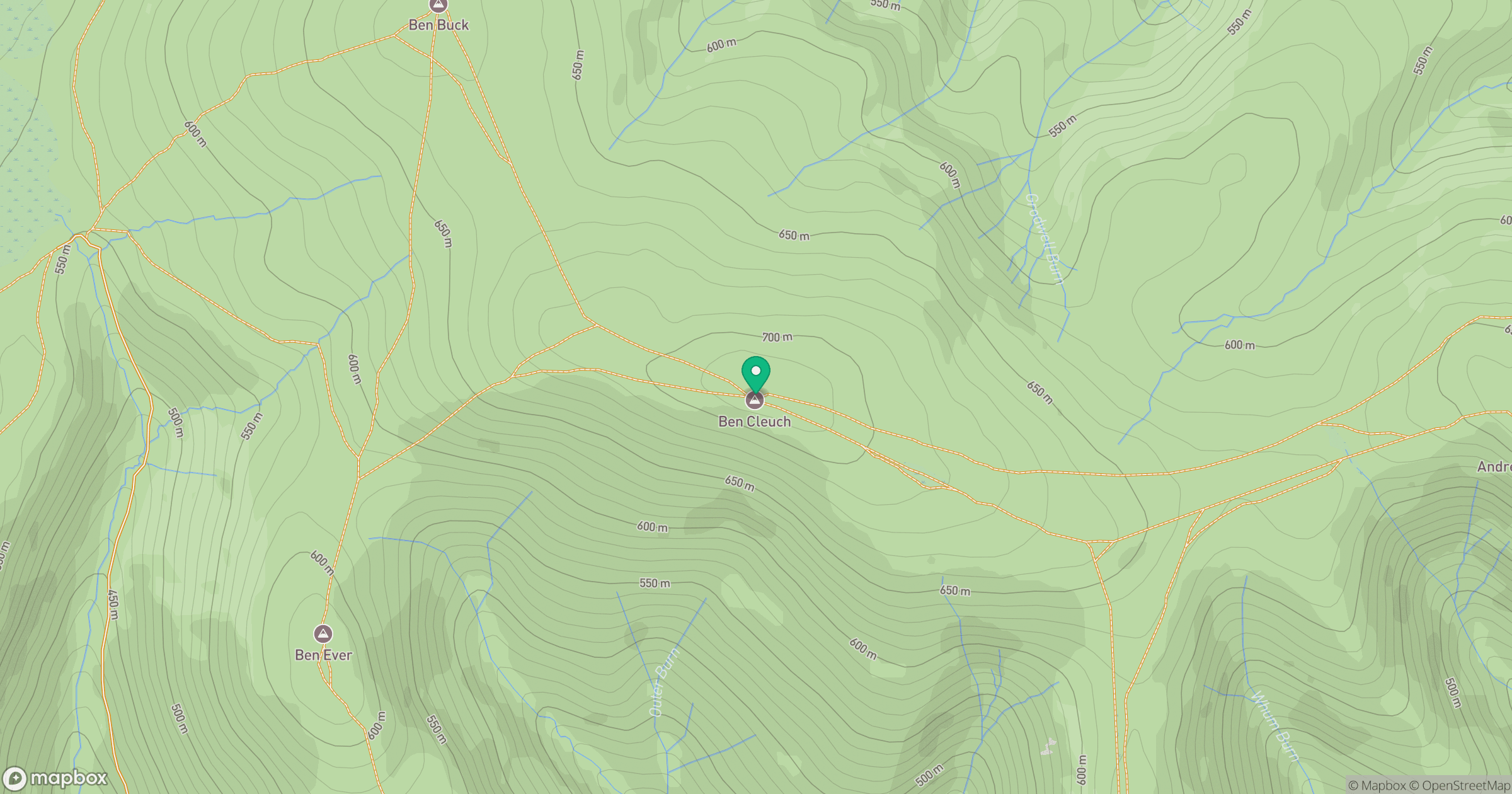
Grid reference: NN902006
View on OpenStreetMapOpens a map in a new tab, centred on the hill.
No comments yet. Be the first.