

Dumyat
Good walks are even better shared.
NS8397 : Dumyat and Lossburn reservoir from the north
AlastairG Photo source
Overview
Dumyat rises to 419 m at the western end of the Ochil Hills, above Blairlogie and Menstrie. Its rocky summit overlooks the Forth Valley, with the Wallace Monument and Stirling Castle below. The western hill path offers a gentler approach than the steep southern slopes; nearby Castle Law holds the remains of an ancient fort.
Dumyat
Dumyat’s 419 m summit stands apart from the higher Ochils, looking over the Forth Valley towards Stirling. A trig pillar, beacon and regimental memorial make the summit easy to recognise, but the highest rock is about 40 m north-west of the trig.
Choosing an approach
The western hill path begins at Pendreich Forest car park. A woodland link reaches Sheriffmuir Road and the open hill path; the return follows the same way. Walkhighlands lists 7 km and 2–2.5 hours, including a short visit to Castle Law.
For a steeper circuit, start at Blairlogie Meadows beside the A91, climb through Blairlogie Glen and join the western path. Descend east from Dumyat to the farm track, then return west by the footpath and bridge to the car park. Walking Britain lists 6.5 km and 3 hours 10 minutes.
Rock and history
The hill’s lava flows and volcanic debris belong to the Lower Devonian Ochil Volcanic Formation. Pink-weathering intrusive rock forms crags west of the summit. Castle Law, the lower south-west top, holds the remains of a prehistoric fort. Dumyat’s name is commonly interpreted as the fort of the Maeatae.
Planning the walk
Southern crags and the steep eastern descent demand care, particularly on wet ground. New woodland planting and deer fences have changed parts of the northern approaches; follow gates and current signs. There is no bus to Pendreich itself. Bridge of Allan and Menstrie offer lower-level bus access, and Bridge of Allan and Stirling have toilets and refreshments.
Explore routes near Dumyat
Walks starting near this hill. Open a route to check its map, distance and full itinerary.
Strathallan Court Strollers and Stragglers
View route
Bridge of Allan Strollers and Stragglers
View route
Fallin Bing Wednesday Walk
View route
King's Park and the Golf Course
View route
Route planning notes
These notes describe possible approaches. Check a route's map and access information when planning your walk.
Dumyat from Pendreich Forest car park
From Pendreich Forest car park, follow the woodland link beside Sheriffmuir Road, then the western hill path to Dumyat. The published route includes a short Castle Law detour. Retrace the hill path and woodland link to the same car park. Walkhighlands gives 2–2.5 hours for the full return walk.
Dumyat circuit from Blairlogie Meadows
Start at Blairlogie Meadows car park beside the A91. Climb through Blairlogie Glen to the western hill path and Dumyat. Descend the steep east side to the stony track, follow it west past the cottages, then take the footpath before the cattle grid and cross the bridge back to the same car park. Walking Britain gives 3 hours 10 minutes.
Make a day of it, together
Find someone to share the walk with, or organise a day out along a route you like.
Photo Gallery
View all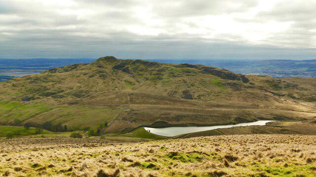 Photo could not load
NS8397 : Dumyat and Lossburn reservoir from the north
AlastairG
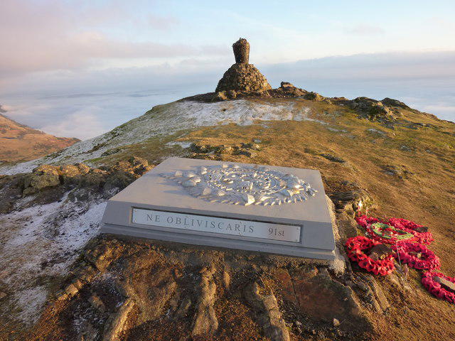 Photo could not load
NS8397 : Dumyat Summit - New Memorial
I A Smellie
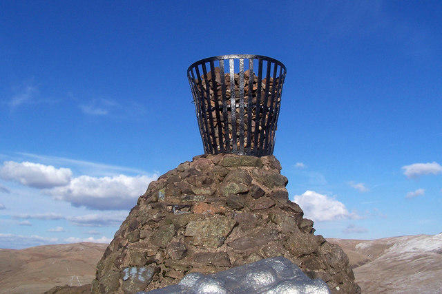 Photo could not load
NS8397 : Dumyat beacon
Frank Garvock
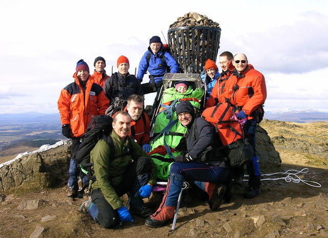 Photo could not load
NS8397 : Sponsored Stretcher Carry up Dumyat
John Chroston
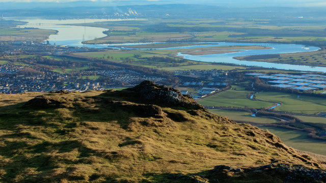 Photo could not load
NS8397 : From Dumyat looking towards Grangemouth
Doug Lee
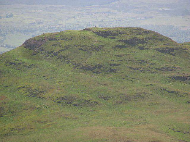 Photo could not load
NS8397 : Dumyat
Richard Webb
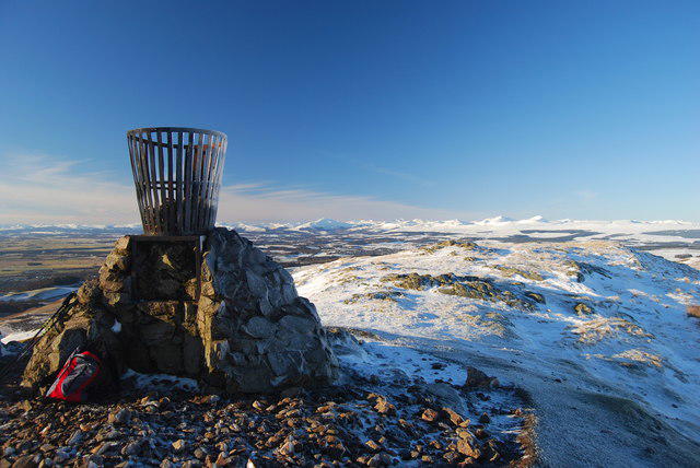 Photo could not load
NS8397 : Dumyat summit
John Chroston
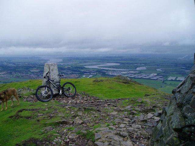 Photo could not load
NS8397 : Dumyat Trig Point
Alan Pitkethley
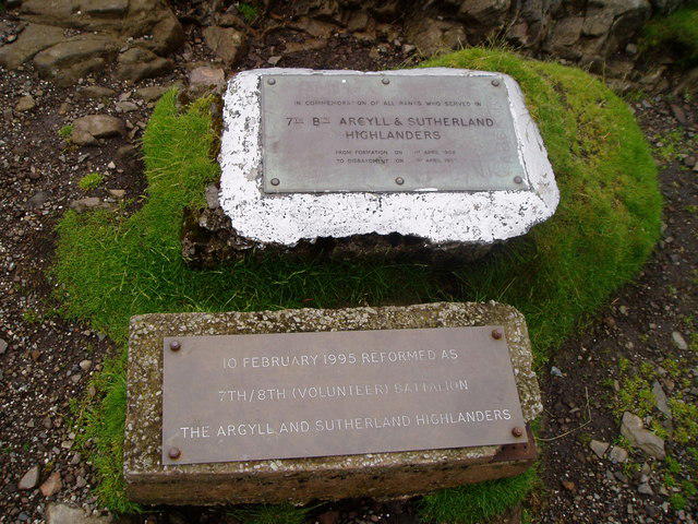 Photo could not load
NS8397 : Dumyat Memorial Plaques
Alan Pitkethley
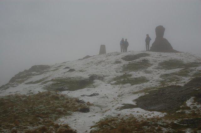
NS8397 : Dumyat Summit
trevor peach
Hill facts and local notes
Classifications
Elevation
419m
1,375 ft
Prominence
192m
Coordinates
56.1577, -3.8766
NS835976
OS Map
57
Explorer: 366E
At the Summit
The highest point is a rock about 40 m north-west of the trig pillar. The summit area also has a metal beacon on a cairn and a memorial to the Argyll and Sutherland Highlanders.
Terrain & Geology
Dumyat exposes Lower Devonian rocks of the Ochil Volcanic Formation: lava flows, including basalt near the summit, interbedded with volcanic conglomerate and breccia. The western approach crosses andesite and a pink-weathering microgranodiorite intrusion, with crags and scree beside the path.
Views & Scenery
From the summit, you can see landmarks such as the Wallace Monument, Stirling Castle, and the expansive Forth Valley. On a clear day, the vista extends to the Southern Highlands.
History & Heritage
Name Origin
Dumyat is thought to mean 'fort of the Maeatae', combining Gaelic dùn (fort) with the name of an ancient people. This interpretation may originally have referred to the fort on Castle Law, the lower south-west top.
Historical Significance
Castle Law, about 400 m south-west of Dumyat’s summit, preserves a later prehistoric fort and a smaller dun-like enclosure that may represent a later phase. The site is a scheduled monument. A separate memorial on Dumyat’s main summit commemorates the Argyll and Sutherland Highlanders.
Getting There & Facilities
Parking
Pendreich Forest car park on Sheriffmuir Road (NS810975) is the start of the western hill-path walk. The access road is steep and single-track; avoid obstructing gates and passing places. Blairlogie Meadows car park beside the A91 serves the longer circuit from the south.
Public Transport
No bus runs to the Pendreich route start. Buses serve Bridge of Allan near the A9/Kenilworth Road junction, leaving an uphill approach on foot. Menstrie offers a bus-served alternative start for eastern routes. Check current journeys with Traveline Scotland.
Nearby Facilities
Pendreich has parking and picnic benches. Use Bridge of Allan or Stirling for public toilets and places to eat; bring food and water for the hill.
Safety Information
Known Hazards
- Very steep slopes and crags on the southern side, including below Castle Law; avoid shortcuts towards the cliff edge.
- Rocky, eroded paths can be slippery after rain; the eastern descent is steep.
- The open hill is exposed to wind and poor visibility; carry suitable clothing and a map.
Seasonal Hazards
Bracken can obscure the less-used southern paths later in the growing season. Ticks are most active from March to October; keep to clear paths and check for ticks after the walk.
General Safety Tips
- Check weather conditions before setting out
- Carry appropriate clothing and equipment
- Let someone know your planned route
- Take a map, compass, and GPS device
- Carry emergency supplies: food, water, first aid kit, torch
Hills
Some common questions about the hills answered
Are there group walks up Dumyat?
Many walkers use Walkmates to join or organise walks with others. You can check for group walks around Dumyat through the maps
Are there other walkers around Dumyat?
Activity varies by location and time, but Walkmates lets you see whether others have shared walks or shown interest in this area. Find other people through the walking friends search walking friends for Dumyat search or of course create your own walk for Dumyat
Can I organise a walk to Dumyat?
Yes. If there aren’t any walks listed already, you can create a walk and make it available for others to join.
If you're signed up to Walkmates, you can create a walk to Dumyat.
How do I find a walk up this hill?
There are often multiple ways to walk this hill, depending on experience and route preference. Walkmates helps you explore walks and routes that others have shared.
Can I suggest a new route up Dumyat?
Yes. You can suggest or create routes to share with others. Walkmates focuses on the social side of walking, so routes are used to help people organise walks and explore areas together, rather than as detailed navigation tools or route libraries.
Other uses really appreciate knowledgeable walkers sharing their routes. Share your favourite route to Dumyat here
The is an error or something incorrect about this hill. How do I let you know?
We always strive to keep the information on Walkmates as accurate as possible. If you find an error, please let us know through the contact form and we'll aim to correct it as quickly as possible
Community Discussion
Comments
Location
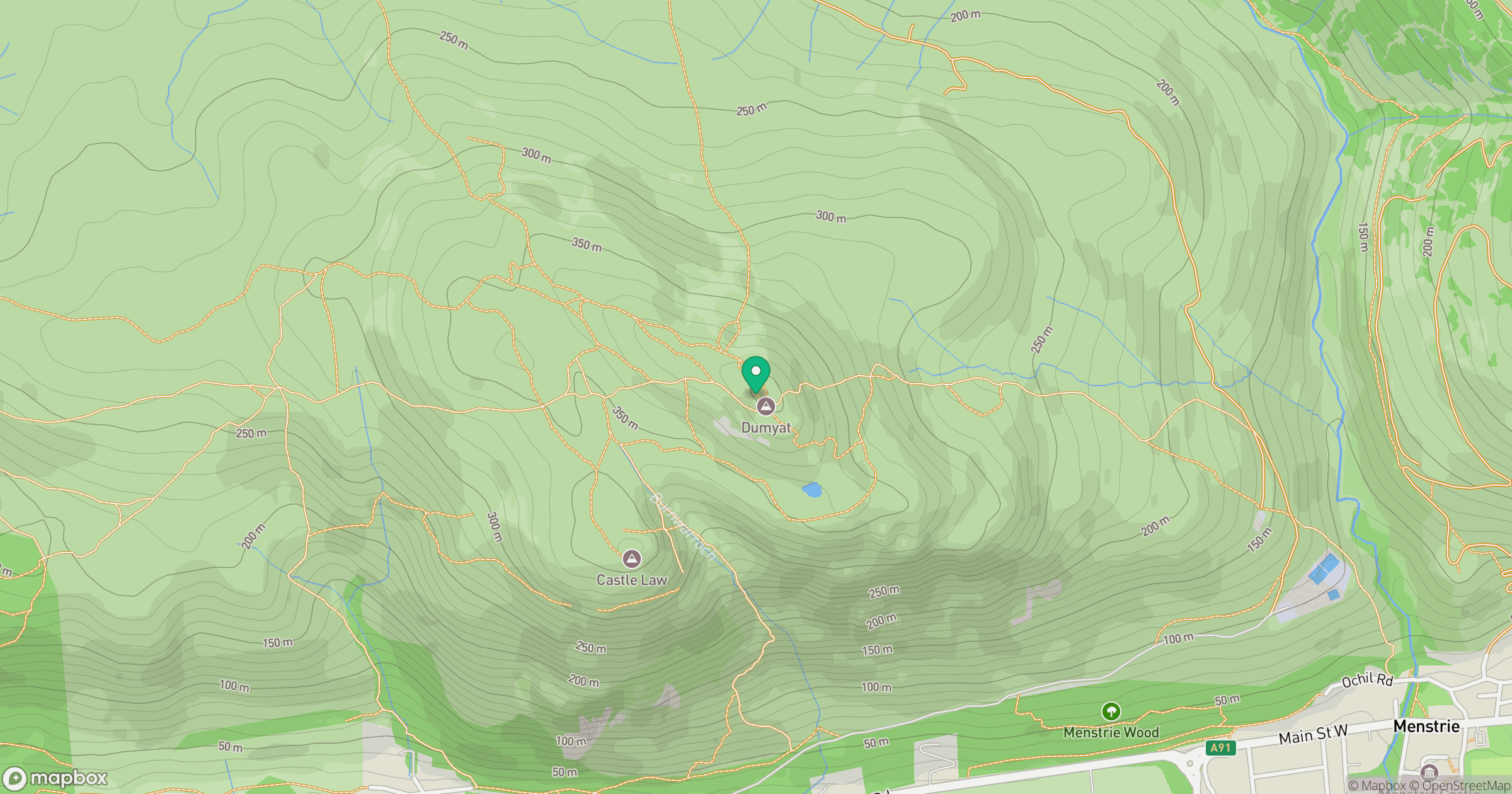
Grid reference: NS835976
View on OpenStreetMapOpens a map in a new tab, centred on the hill.


No comments yet. Be the first.