
Beinn nan Eun
Good walks are even better shared.
Overview
Beinn nan Eun: The Bird's Hill
Beinn nan Eun, translating to 'Hill of the Birds', stands tall at 946 meters, making it a prominent Munro in the heart of the Scottish Highlands. Its towering presence and striking geology composed mainly of gleaming schist make it not only a physical challenge but also a delight for the eyes.
Geology
As you trek up Beinn nan Eun, you’ll notice the shimmering schist under your feet. This metamorphic rock glistens in the sunlight and has been shaped by the powerful forces of nature over millennia. Don’t be surprised if another hiker starts talking about geology; Beinn nan Eun is a true geological treasure.
Routes
There are several routes to the summit, with the most popular starting from the A82 near Crianlarich. This 16km journey will take approximately 5 hours and is rated as moderate.
Alternatively, the Crianlarich to Beinn nan Eun loop provides a shorter 14.5km option, taking around 4.5 hours. Either way, you’re in for beautiful sceneries and a chance to stretch your legs!
Summit Features
At the summit, you’ll find a sturdy stone cairn—perfect for a photo op—and a trig point that makes for an excellent backdrop for your hiking selfies. Don’t forget to revel in your accomplishment with a humble sandwich; after all, calories burned need to be replaced!
Terrain and Views
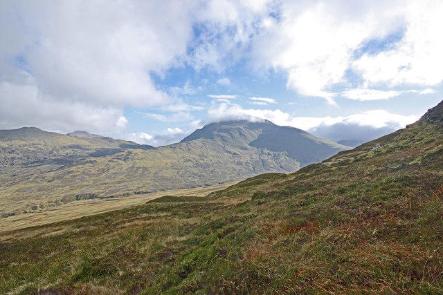
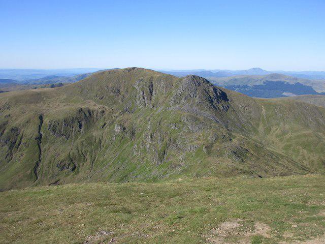
The terrain varies from grassy slopes to rocky outcrops, but keep an eye out for those hidden boggy spots that like to ambush unwary hikers. From the top, the views are nothing short of spectacular. You’ll gaze over the Strath Fillan valley and peer into the rugged outlines of Ben More and Stob Binnein, a feast for sore eyes.
Hazards
As with any Scottish Munro, the weather can be unpredictable. Better pack a waterproof jacket unless you fancy playing a game of soggy bingo. Also, slippery paths can test your balance, so make sure to wear sturdy footwear.
Access
Parking is conveniently located in a layby along the A82, about 4 km south of Crianlarich. The village itself is well-connected via public transport, offering train and bus services for those who prefer not to drive.
Facilities
In Crianlarich, you will find a handful of cafes and a shop to refuel and plan your adventure. There are also toilets available, ensuring you’re well-prepared before hitting those trails.
History
The mountain’s name reflects its biodiversity and history. 'Hill of the Birds' indeed embodies not only the wildlife that inhabits the area but also the cultural significance embedded in the landscape.
To sum it up, Beinn nan Eun provides an excellent hiking opportunity, whether you’re seeking adventure, scenic beauty, or just a good reason to pack a picnic! Embrace the experience, but remember—it’s not just about the summit, it’s about the journey!
Explore routes near Beinn nan Eun
Public walks starting within 80 km of this hill. Nearby does not mean a route reaches the summit; check its map and access before setting out.
RSVP Forth Valley: Dunblane to Kilbryde walk
View route
Loch Lubnaig: West Shore Railway Path from Ben Ledi Car Park
View route
Crieff: Lady Mary's Walk and the River Earn
View route
RSVP Forth Valley: Cocksburn Reservoir walk
View route
Route planning notes
These notes describe possible approaches, not verified navigable routes or permission to cross land. Check current paths, local access rules and conditions before setting out.
From the A82 near Crianlarich
A popular and straightforward ascent starting from the main road, with a well-defined path leading to the summit.
Crianlarich to Beinn nan Eun loop
An exhilarating loop that offers a mix of paths and open hillside, with scenic views throughout the route.
Make a day of it, together
Find someone to share the walk with, or organise a day out along a route you like.
Hill facts and local notes
Classifications
Elevation
631m
2,070 ft
Prominence
142m
Coordinates
56.2932, -4.0639
NN723131
OS Map
57
Explorer: OL47W 368W
At the Summit
The summit is marked by a stone cairn, providing a great spot for a well-deserved sandwich (or two) while soaking in the views. A trig point can also be found nearby, making it a perfect photo opportunity.
Terrain & Geology
Beinn nan Eun is primarily composed of schist, which is a metamorphic rock rich in mica. This gives the mountain its distinctive sparkling appearance, especially under the sunlight. The geology is also characterised by glacial deposits that are a reminder of the last Ice Age.
Views & Scenery
From the summit, one can enjoy panoramic views of the surrounding peaks, including Ben More and the expansive landscape of the Strath Fillan valley.
History & Heritage
Name Origin
The name 'Beinn nan Eun' translates to 'Hill of the Birds', indicating the area’s vibrant avian life and perhaps its history of birdwatching.
Historical Significance
This Munro was first ascended in the 19th century and has since become a favourite among local hikers and those daring enough to tackle the entire Crianlarich ridge.
Getting There & Facilities
Check current local access restrictions, parking rules and transport timetables before travelling. These notes do not confirm public access to the summit.
Parking
There is a layby along the A82, approximately 4 km south of Crianlarich, providing a convenient place to park your car and start your adventure.
Public Transport
Crianlarich is served by both trains and buses, making it accessible for those who prefer not to drive. It's a short walk from the village centre to the start of the routes.
Nearby Facilities
Crianlarich offers a few options for refreshments and facilities, including a small shop and a few cafes. Toilets are available in the village, making it a practical stop before or after your hike.
Safety Information
Known Hazards
- Be aware of rapidly changing weather conditions, which can turn a clear day into a cloudy affair in no time. Slippery rocks and muddy paths can also be a challenge, so good footwear is recommended.
General Safety Tips
- Check weather conditions before setting out
- Carry appropriate clothing and equipment
- Let someone know your planned route
- Take a map, compass, and GPS device
- Carry emergency supplies: food, water, first aid kit, torch
Hills
Some common questions about the hills answered
Are there group walks up Beinn nan Eun?
Many walkers use Walkmates to join or organise walks with others. You can check for group walks around Beinn nan Eun through the maps
Are there other walkers around Beinn nan Eun?
Activity varies by location and time, but Walkmates lets you see whether others have shared walks or shown interest in this area. Find other people through the walking friends search walking friends for Beinn nan Eun search or of course create your own walk for Beinn nan Eun
Can I organise a walk to Beinn nan Eun?
Yes. If there aren’t any walks listed already, you can create a walk and make it available for others to join.
If you're signed up to Walkmates, you can create a walk to Beinn nan Eun.
How do I find a walk up this hill?
There are often multiple ways to walk this hill, depending on experience and route preference. Walkmates helps you explore walks and routes that others have shared.
Can I suggest a new route up Beinn nan Eun?
Yes. You can suggest or create routes to share with others. Walkmates focuses on the social side of walking, so routes are used to help people organise walks and explore areas together, rather than as detailed navigation tools or route libraries.
Other uses really appreciate knowledgeable walkers sharing their routes. Share your favourite route to Beinn nan Eun here
The is an error or something incorrect about this hill. How do I let you know?
We always strive to keep the information on Walkmates as accurate as possible. If you find an error, please let us know through the contact form and we'll aim to correct it as quickly as possible
Community Discussion
Comments
Location
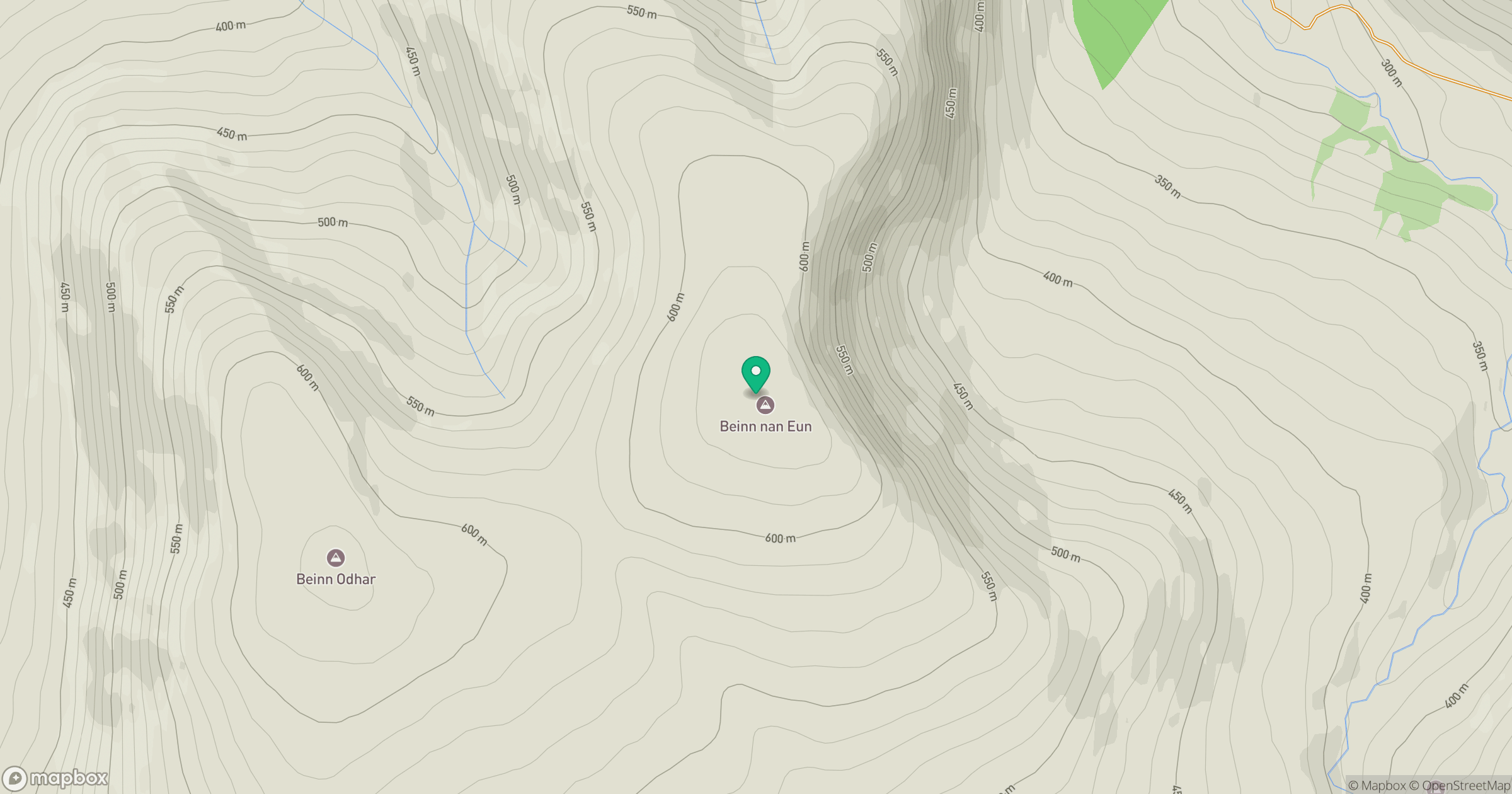
Grid reference: NN723131
View on OpenStreetMapOpens a map in a new tab, centred on the hill.
Hills within 30 km
Straight-line distance, not a walking route or confirmation of access.
No comments yet. Be the first.