

Meall a' Chathaidh
Good walks are even better shared.
Overview
Meall a' Chathaidh
Introduction
Nestled in the stunning Scottish Highlands, Meall a' Chathaidh rises gracefully to an elevation of 927 meters, earning its place as a proud Munro. This peak draws in hikers with its promise of sweeping views and a touch of Highland charm.
Geology
Meall a' Chathaidh is predominantly made up of schists and granites, revealing the ancient geological processes that have sculpted the Scottish landscape over millennia. The rugged rock formations and varied terrain tell a story of earth having a wild party.
Routes
There are several routes to the summit, each with its own unique charm. The Aberfeldy Route is particularly popular, offering a gradual ascent, while the Dull Route takes you through verdant forests before presenting you with the mountain's craggy crown. Enjoy the beauty of the Highlands — but remember, it isn't a walk in the park!
Summit Features
Upon reaching the summit, you’ll be greeted by a well-constructed cairn, often surrounded by resting hikers enjoying their well-deserved snack. The views? Absolutely remarkable! You'll have a panoramic sight of neighbourly giants like Ben Lawers.
Terrain
Expect the terrain to be a cocktail of grassy hills with some rocky outcrops. Just a heads up: after a good rain, certain spots might try to encourage you to engage in a friendly mud wrestling match.
Views
The highlights from the peak include not only the majestic Ben Lawers but also the serene Loch Tay. For the best viewing experience, aim for late spring or early autumn when the weather blesses you with clarity.
Hazards
Hiking in the Highlands can be unpredictable. Sudden changes in weather can reduce visibility—be prepared, and don’t forget to bring your compass. Also, keep an eye out for those cheeky bogs eager to claim an unsuspecting boot!
Nearby Summits
For those with a bit of extra energy (and spare snacks!), nearby Ben Lawers and Beinn Ghlas offer more tantalising summits to conquer.
Access
You’ll find convenient parking near Aberfeldy, with public transport options available from larger towns. The town itself is charming and has all the facilities one might need before or after a hike.
Facilities
While the summit is devoid of shops, the delightful town of Aberfeldy will cater to your caffeine cravings and provide access to public toilets — because nobody wants to tackle the final ascent with a full bladder!
History
The name 'Meall a' Chathaidh' speaks volumes — literally! Meaning 'hill of the old man,' it resonates with local legends. Its significance in the hiking community has made it a treasured destination for many.
Now get your boots on, and remember: the mountains are calling, and you must go!
Explore routes near Meall a' Chathaidh
Public walks starting within 80 km of this hill. Nearby does not mean a route reaches the summit; check its map and access before setting out.
Glen Banvie Trail with the Bruar viewpoint
View route
Aberfeldy: Glassie Woodland and River Tay Circular
View route
Kenmore: Drummond Hill Black Rock Trail above Loch Tay
View route
Coire Ardair lochan from Aberarder and back
View route
Route planning notes
These notes describe possible approaches, not verified navigable routes or permission to cross land. Check current paths, local access rules and conditions before setting out.
Aberfeldy Route
A popular ascent starting from Aberfeldy, offering a gradual climb and breathtaking surrounding scenery.
Dull Route
Starting from the village of Dull, this route provides a charming walk through lush forests before tackling the final ascent.
Make a day of it, together
Find someone to share the walk with, or organise a day out along a route you like.
Photo Gallery
View all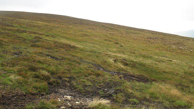 Photo could not load
NN7468 : North side of Meall a' Chathaidh
Richard Webb
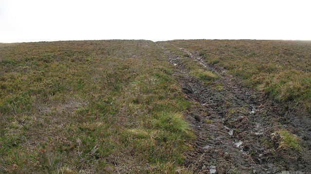 Photo could not load
NN7467 : Mobile phone engineering erosion, Meall a' Chathaidh
Richard Webb
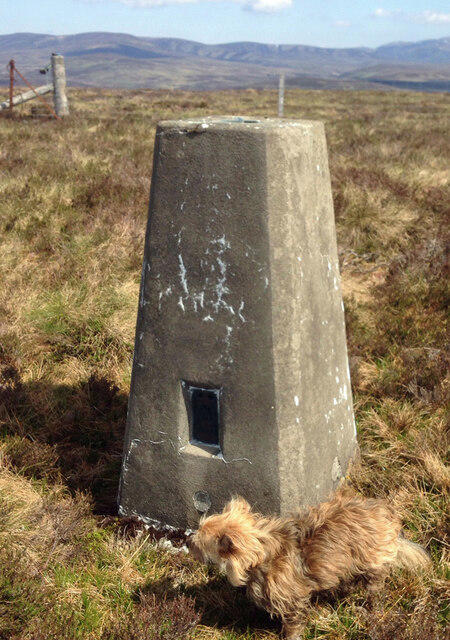 Photo could not load
NN7467 : Meall A' Chathaidh Trig Point Flush Bracket S9394
thejackrustles
Hill facts and local notes
Classifications
Elevation
521m
1,709 ft
Prominence
104m
Coordinates
56.7859, -4.0556
NN745679
OS Map
42
Explorer: OL49W OL51W 386W 394W
At the Summit
The summit boasts a sizable cairn, well-worn by many a hiker's visit, and offers sweeping vistas over the surrounding mountains and glens.
Terrain & Geology
The mountain is composed primarily of schists and granites, a testament to the ancient geological forces that shaped this rugged landscape, showcasing both beauty and raw power.
Views & Scenery
From the summit, you can see the mighty Ben Lawers and the vast expanse of Loch Tay shimmering in the distance.
History & Heritage
Name Origin
The name 'Meall a' Chathaidh' can be translated to 'hill of the old man' in Scots Gaelic, a nod to the local folklore.
Historical Significance
This mountain has been a long-standing favourite for local and visiting climbers, gaining a place in the heart of many outdoor enthusiasts.
Getting There & Facilities
Check current local access restrictions, parking rules and transport timetables before travelling. These notes do not confirm public access to the summit.
Parking
Parking is available at the designated car park near Aberfeldy, with easy access to the trailhead.
Public Transport
Buses run from major towns to Aberfeldy, making it a convenient starting point for your adventure.
Nearby Facilities
While there's no café at the summit, the town of Aberfeldy has several lovely spots for coffee and cake, as well as public toilets.
Safety Information
Known Hazards
- Unpredictable weather can lead to sudden visibility drops; also, be cautious of boggy patches that could turn a hike into an unexpected mud bath.
General Safety Tips
- Check weather conditions before setting out
- Carry appropriate clothing and equipment
- Let someone know your planned route
- Take a map, compass, and GPS device
- Carry emergency supplies: food, water, first aid kit, torch
Hills
Some common questions about the hills answered
Are there group walks up Meall a' Chathaidh?
Many walkers use Walkmates to join or organise walks with others. You can check for group walks around Meall a' Chathaidh through the maps
Are there other walkers around Meall a' Chathaidh?
Activity varies by location and time, but Walkmates lets you see whether others have shared walks or shown interest in this area. Find other people through the walking friends search walking friends for Meall a' Chathaidh search or of course create your own walk for Meall a' Chathaidh
Can I organise a walk to Meall a' Chathaidh?
Yes. If there aren’t any walks listed already, you can create a walk and make it available for others to join.
If you're signed up to Walkmates, you can create a walk to Meall a' Chathaidh.
How do I find a walk up this hill?
There are often multiple ways to walk this hill, depending on experience and route preference. Walkmates helps you explore walks and routes that others have shared.
Can I suggest a new route up Meall a' Chathaidh?
Yes. You can suggest or create routes to share with others. Walkmates focuses on the social side of walking, so routes are used to help people organise walks and explore areas together, rather than as detailed navigation tools or route libraries.
Other uses really appreciate knowledgeable walkers sharing their routes. Share your favourite route to Meall a' Chathaidh here
The is an error or something incorrect about this hill. How do I let you know?
We always strive to keep the information on Walkmates as accurate as possible. If you find an error, please let us know through the contact form and we'll aim to correct it as quickly as possible
Community Discussion
Comments
Location
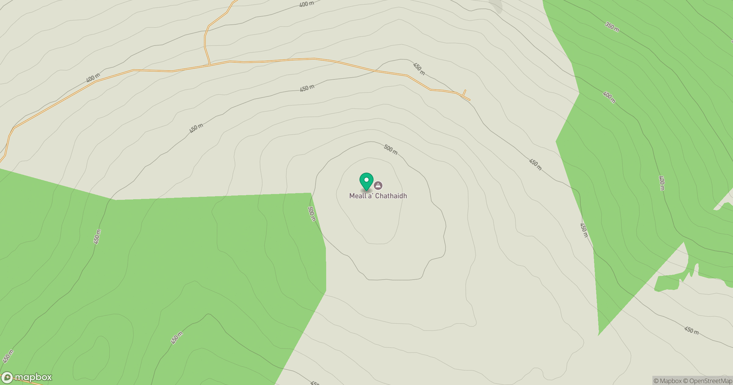
Grid reference: NN745679
View on OpenStreetMapOpens a map in a new tab, centred on the hill.
Hills within 30 km
Straight-line distance, not a walking route or confirmation of access.
Schiehallion
1,083m
An Stuc
1,117m
Ben Lawers
1,214m
Beinn a' Ghlo - Carn Liath
976m
Beinn a' Ghlo - Braigh Coire Chruinn-bhalgain
1,070m
No comments yet. Be the first.